Jeff Piotrowski(@Jeff_Piotrowski) 's Twitter Profileg
Jeff Piotrowski

@Jeff_Piotrowski

Emmy Award-Winning Storm Chaser over 40 years.4K Extreme Weather Stock. Tesla-Cybertruck, Sales-Radar & Weather Displays & TEDx Speaker

ID:212071519

linkhttp://TwisterChasers.Com calendar_today05-11-2010 01:48:16

22,8K Tweets

87,1K Followers

2,7K Following

NWS Wichita(@NWSWichita) 's Twitter Profile Photo

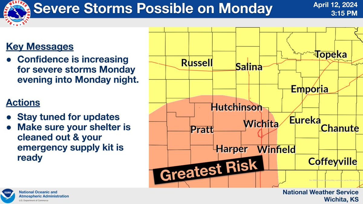
Confidence is increasing for severe storms Monday evening and Monday night. The greatest risk appears to be across areas shaded in orange. It's too early for specifics at this point but we encourage you to continue to check back throughout the weekend for updates.

Confidence is increasing for severe storms Monday evening and Monday night. The greatest risk appears to be across areas shaded in orange. It's too early for specifics at this point but we encourage you to continue to check back throughout the weekend for updates. #kswx
account_circle
NWS Norman(@NWSNorman) 's Twitter Profile Photo

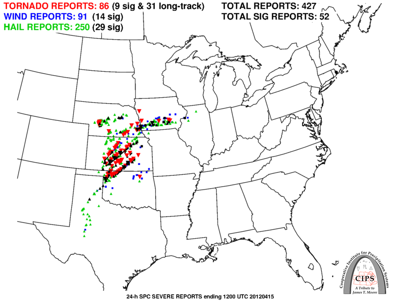
No changes were made to the risk area for severe weather this upcoming Monday. All hazards will be possible with any storm that forms. Now is the time to make sure you have a plan in place for when a warning is issued!

No changes were made to the risk area for severe weather this upcoming Monday. All hazards will be possible with any storm that forms. Now is the time to make sure you have a plan in place for when a warning is issued! #okwx #txwx
account_circle
Jeff Piotrowski(@Jeff_Piotrowski) 's Twitter Profile Photo

We are designing the wrap for and we want to know what you think looks best #1 or #2 for the TwisterChasers logo type. Any other thoughts appreciated!

We are designing the wrap for #TwisterChasers #Cybertruck and we want to know what you think looks best #1 or #2 for the TwisterChasers logo type. Any other thoughts appreciated!
account_circle
Intel Point Alert(@IntelPointAlert) 's Twitter Profile Photo

BREAKING: β€˜Flash Flood Emergency’ declared in areas west of Pittsburgh, Pennsylvania; several buildings underwater

account_circle
NWS Amarillo(@NWSAmarillo) 's Twitter Profile Photo

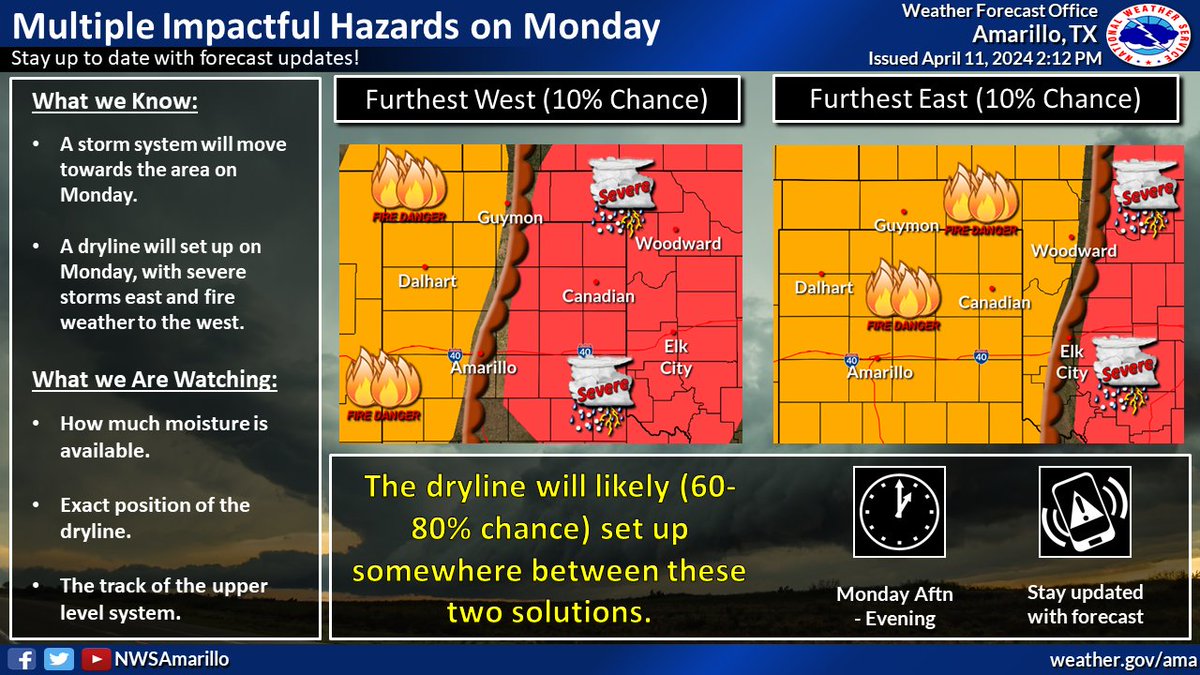
A dryline will set up across portions of the area on Monday. To the west, fire weather conditions are expected. To the east, severe weather is forecast with all hazards possible. The positioning of the dryline will be key, so be sure to check back for updates!

A dryline will set up across portions of the area on Monday. To the west, fire weather conditions are expected. To the east, severe weather is forecast with all hazards possible. The positioning of the dryline will be key, so be sure to check back for updates! #phwx #TXwx #OKwx
account_circle
NWS Norman(@NWSNorman) 's Twitter Profile Photo

Our next risk of severe weather is Monday (April 15th). Large hail, damaging winds, and tornadoes are possible.

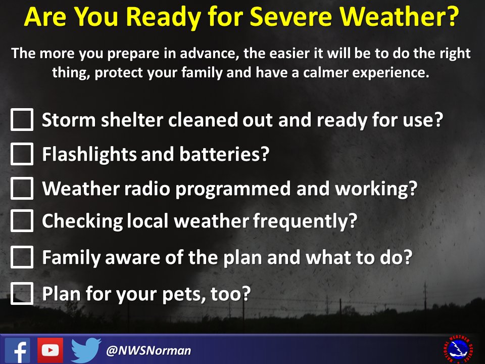
With the risk of storms, it's good to be prepared. There'll always be another risk of severe weather even if you don't use these tips on Monday!

Our next risk of severe weather is Monday (April 15th). Large hail, damaging winds, and tornadoes are possible. With the risk of storms, it's good to be prepared. There'll always be another risk of severe weather even if you don't use these tips on Monday! #okwx #texomawx
account_circle
Vortix(@VortixWx) 's Twitter Profile Photo

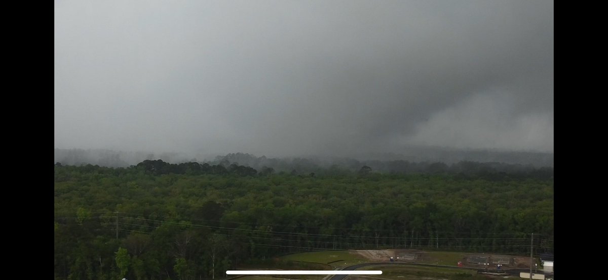
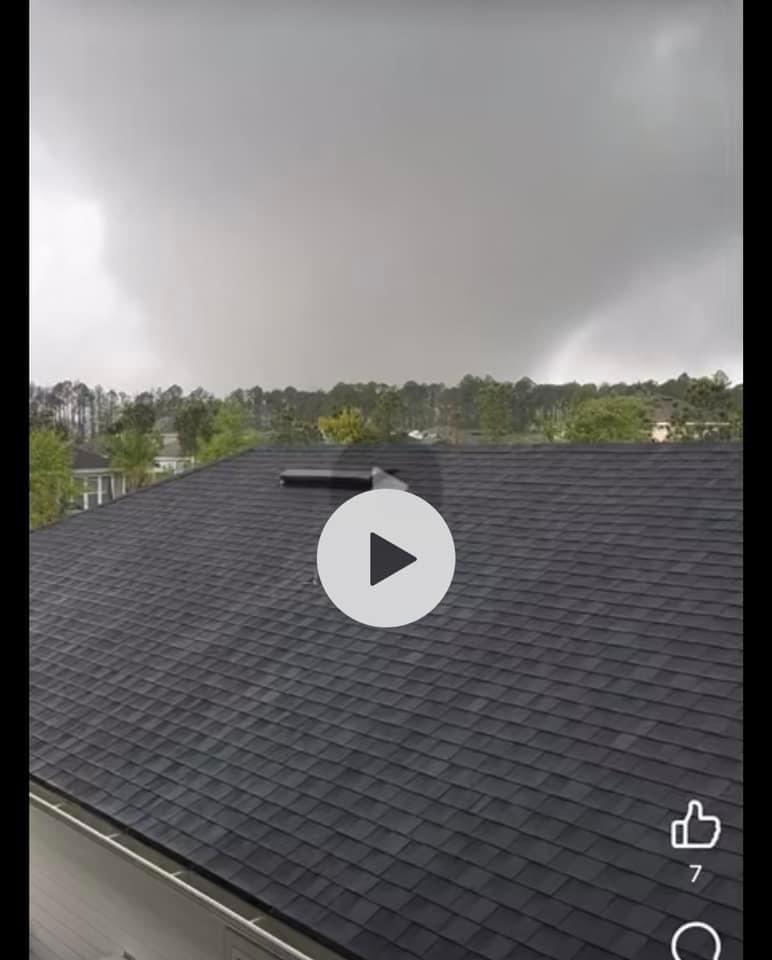
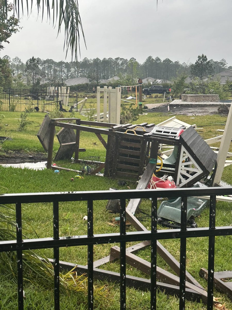
Some images of the damage done to a yard in St. Augustine, . A playground set is messed up with a lot of the fencing damaged.

πŸ“·: St. Johns County Fire Recuse
facebook.com/photo?fbid=892…

Some images of the damage done to a yard in St. Augustine, #Florida. A playground set is messed up with a lot of the fencing damaged. #FLwx #severewx πŸ“·: St. Johns County Fire Recuse facebook.com/photo?fbid=892…
account_circle
Evan Bentley(@evan_bentley) 's Twitter Profile Photo

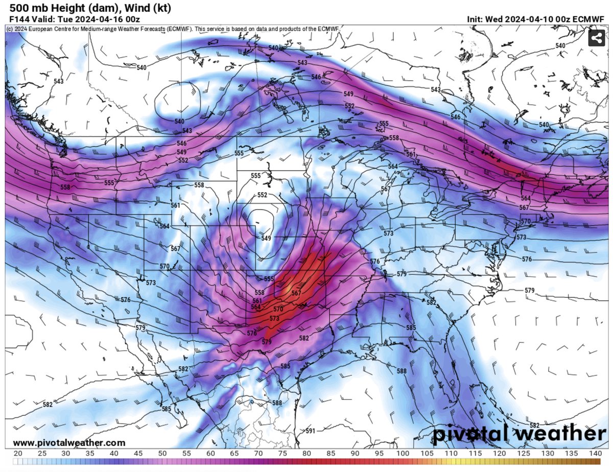
Despite the significant differences in the operational runs, the ensemble mean from the ECS and GEFS are aligned quite well for day 6.

Despite the significant differences in the operational runs, the ensemble mean from the ECS and GEFS are aligned quite well for day 6.
account_circle
AZ Intel(@AZ_Intel_) 's Twitter Profile Photo

BREAKING: New footage from Slidell, Louisiana police show damage from a suspected tornado.

The police officer on scene reports β€˜catastrophic damage,' urges people to stay indoors and seek shelter.

account_circle
NWS Norman(@NWSNorman) 's Twitter Profile Photo

Monday continues to look like it will be a severe weather day across much of Oklahoma and northern Texas. A strong upper-level storm, plentiful moisture, and a dry line are expected to be in place for all severe hazards.

Monday continues to look like it will be a severe weather day across much of Oklahoma and northern Texas. A strong upper-level storm, plentiful moisture, and a dry line are expected to be in place for all severe hazards.
account_circle