MetWatch ☈(@MetWatchUK) 's Twitter Profileg
MetWatch ☈

@MetWatchUK

A weather enthusiast providing the latest UK weather updates, and reliable forecasts.

Occasional landscape photography postsπŸ“Έ & worldwide severe weather news.

ID:1232246369177473024

calendar_today25-02-2020 10:10:11

12,4K Tweets

6,7K Followers

351 Following

Follow People
MetWatch ☈(@MetWatchUK) 's Twitter Profile Photo

It's just over a year ago now since I captured the most incredible close lightning strike in rural Warwickshire as a thunderstorm was moving away.

A day I will remember for the rest of my life.

account_circle
MetWatch ☈(@MetWatchUK) 's Twitter Profile Photo

A good chance of the aurora being seen tonight down to even southern UK as the strongest Geomagnetic Storm in nearly 20 years will likely impact Earth.

Head to the countryside away from the light pollution to get the best chances of seeing it!

account_circle
MetWatch ☈(@MetWatchUK) 's Twitter Profile Photo

Warmest day of the year so far here reaching about 22Β°C with plenty of sunshine following some morning cloud. More to come rest of this week!

account_circle
MetWatch ☈(@MetWatchUK) 's Twitter Profile Photo

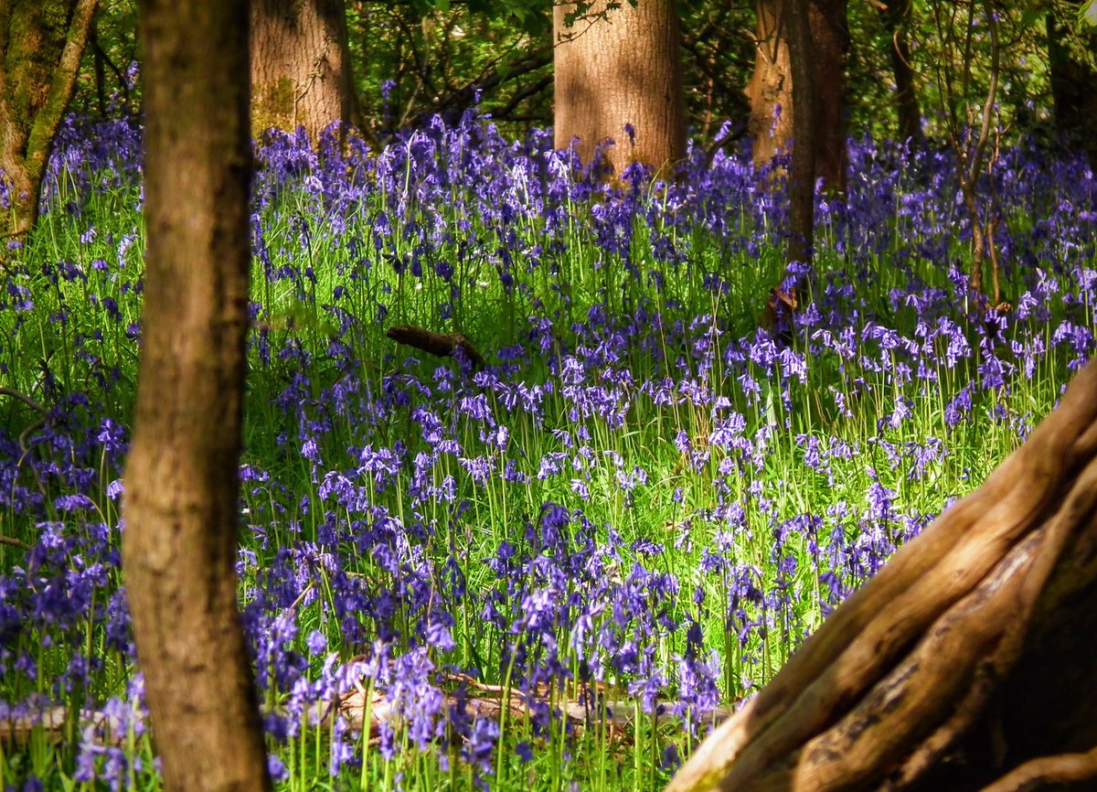
Some more last week in Brandon woods, Warwickshire.

The display has lasted quite long this spring, likely as a result of the chiller second half to April.

Warwickshire Wildlife Trust

Some more #bluebells last week in Brandon woods, Warwickshire. The display has lasted quite long this spring, likely as a result of the chiller second half to April. #ThePhotoHour #flowers #photography @WKWT
account_circle
MetWatch ☈(@MetWatchUK) 's Twitter Profile Photo

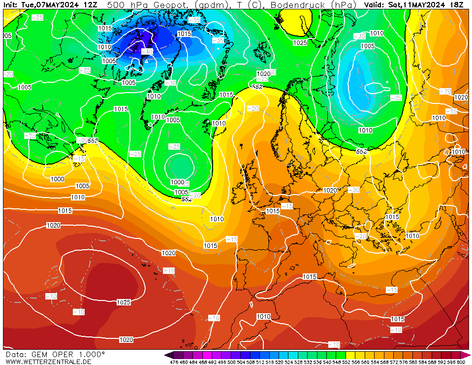
Continuing to warm up this week.

By the weekend there is certainly the chance of the first 25C of the year as high pressure drifts slightly east & brings in an even warmer airmass from the south before perhaps something thundery early next week.

Continuing to warm up this week. By the weekend there is certainly the chance of the first 25C of the year as high pressure drifts slightly east & brings in an even warmer airmass from the south before perhaps something thundery early next week. #ukweather
account_circle
MetWatch ☈(@MetWatchUK) 's Twitter Profile Photo

Likely to be a high end day for severe thunderstorms, producing multiple destructive EF3+ tornadoes across central southern parts of the lower 48.

account_circle
MetWatch ☈(@MetWatchUK) 's Twitter Profile Photo

Likely to be a high end day for severe thunderstorms, producing multiple destructive EF3+ tornadoes across central southern parts of the lower 48.

account_circle
MetWatch ☈(@MetWatchUK) 's Twitter Profile Photo

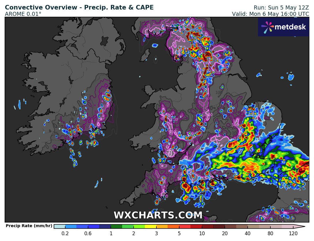
Heavy showers developing across central and northern areas over any converging winds this afternoon. A few could become thundery in nature though nothing severe is expected.

Wet one for the south east but an improving picture from tomorrow forward.

Heavy showers developing across central and northern areas over any converging winds this afternoon. A few could become thundery in nature though nothing severe is expected. Wet one for the south east but an improving picture from tomorrow forward. #ukweather
account_circle