NWS Jackson MS(@NWSJacksonMS) 's Twitter Profile Photo

⛈️ Severe storms will be possible across portions of the area Tuesday afternoon into night. Please stay tuned for any updates to timing and impacts. 👀🤳

💨 Additionally, Winds will become breezy on Tuesday with sustained speeds of 20 to 25 mph and gusts of 30 to 40 mph.

⛈️ Severe storms will be possible across portions of the area Tuesday afternoon into night.  Please stay tuned for any updates to timing and impacts. 👀🤳

💨 Additionally, Winds will become breezy on Tuesday with sustained speeds of 20 to 25 mph and gusts of 30 to 40 mph.
account_circle
NWS Jackson MS(@NWSJacksonMS) 's Twitter Profile Photo

Come join us and
NWS Memphis
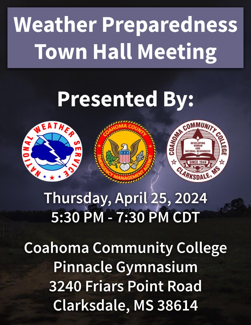
on April 23rd and 25th for a Weather Preparedness Town Hall in Bolivar and Coahoma counties. Being prepared and knowing how to react when severe weather threatens is very important. Everyone is welcome to come and learn!
Come join us and
@NWSMemphis
on April 23rd and 25th for a Weather Preparedness Town Hall in Bolivar and Coahoma counties. Being prepared and knowing how to react when severe weather threatens is very important. Everyone is welcome to come and learn!
account_circle
NWS Jackson MS(@NWSJacksonMS) 's Twitter Profile Photo

Come join us and NWS Memphis
on April 23rd and 25th for a Weather Preparedness Town Hall in Bolivar and Coahoma counties. Being prepared and knowing how to react when severe weather threatens is very important. Everyone is welcome to come and learn!

Come join us and @NWSMemphis
on April 23rd and 25th for a Weather Preparedness Town Hall in Bolivar and Coahoma counties. Being prepared and knowing how to react when severe weather threatens is very important. Everyone is welcome to come and learn!
account_circle
NWS Jackson MS(@NWSJacksonMS) 's Twitter Profile Photo

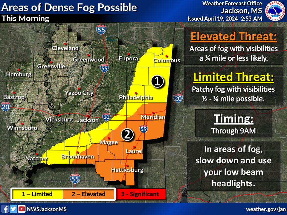
Good morning! Isolated showers and storms will be possible along and north of Interstate 20. Elsewhere, expect mostly to partly cloudy skies. Highs will range from the lower 70s to middle 80s. Areas of dense fog will be possible through 9am.

Good morning! Isolated showers and storms will be possible along and north of Interstate 20. Elsewhere, expect mostly to partly cloudy skies. Highs will range from the lower 70s to middle 80s. Areas of dense fog will be possible through 9am.
account_circle
Nick Krasznavolgyi(@NickKrasz_Wx) 's Twitter Profile Photo

Good morning, NWS Jackson MS. I have a question regarding the 3/24/23 tornado event, concerning the Winona, MS EF3 tornado. To my understanding, a wind speed of 155 mph was applied to the tornado. I noticed recently that the path was “upgraded” to EF3 (165 mph). Is this an error?
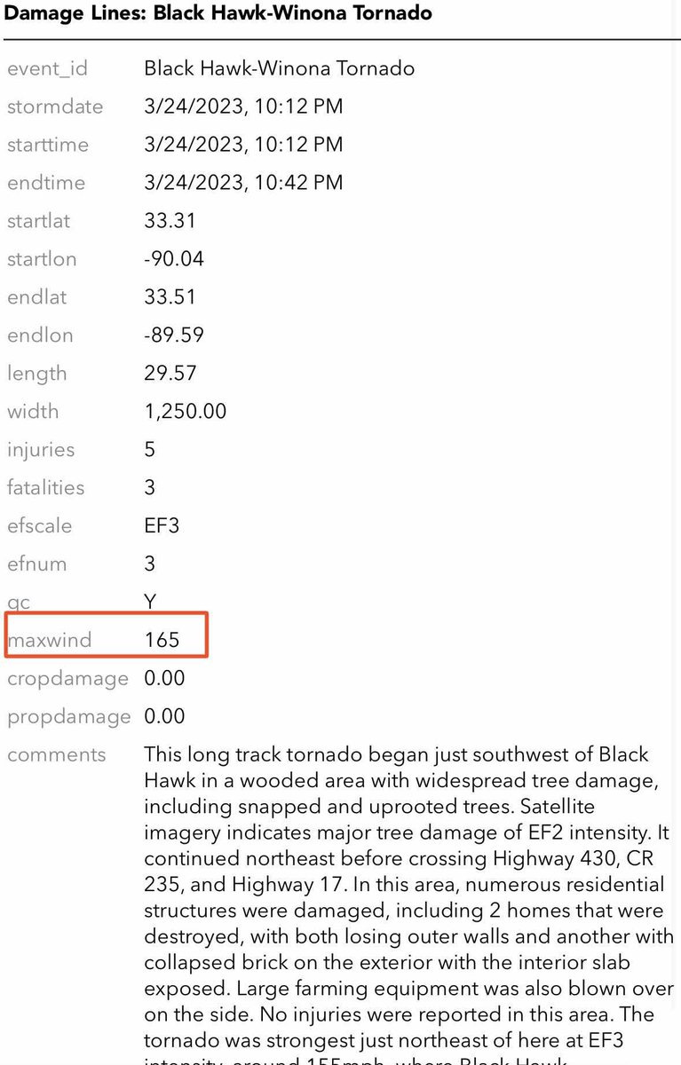
Good morning, @NWSJacksonMS. I have a question regarding the 3/24/23 tornado event, concerning the Winona, MS EF3 tornado. To my understanding, a wind speed of 155 mph was applied to the tornado. I noticed recently that the path was “upgraded” to EF3 (165 mph). Is this an error?
account_circle
NewfoundWeatherNerd(@ChilledOutStorm) 's Twitter Profile Photo

NWS Jackson MS Nick Krasznavolgyi Y’all are genuinely putting so much effort into fully rating the 3/24/23 tornado outbreak, and that is really amazing. Thank you for the work that you do

account_circle
NWS Jackson MS(@NWSJacksonMS) 's Twitter Profile Photo

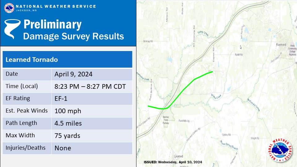
🌪️ NWS Jackson damage survey teams have confirmed two tornadoes from last night and this morning's storms. An EF1 near Learned in Hinds County and an EF0 near Lake Camden in Madison County. Additional surveys are planned for tomorrow!

🌪️ NWS Jackson damage survey teams have confirmed two tornadoes from last night and this morning's storms. An EF1 near Learned in Hinds County and an EF0 near Lake Camden in Madison County. Additional surveys are planned for tomorrow!
account_circle
NWS Jackson MS(@NWSJacksonMS) 's Twitter Profile Photo

Great news! The NOAA weather radio transmitter in Ackerman, MS has been restored and the broadcast is once again on the air.📻

Great news! The NOAA weather radio transmitter in Ackerman, MS has been restored and the broadcast is once again on the air.📻
account_circle