Nick Krasznavolgyi(@NickKrasz_Wx) 's Twitter Profileg
Nick Krasznavolgyi

@NickKrasz_Wx

Weather Nerd - Forensic Meteorology - “Tornado Historian” - Sushi Connoisseur - Avid Phillies Fan - #RingTheBell

ID:1270111423344017408

linkhttps://linktr.ee/nickkrasz_wx calendar_today08-06-2020 21:54:10

20,6K Tweets

6,0K Followers

798 Following

Nick Krasznavolgyi(@NickKrasz_Wx) 's Twitter Profile Photo

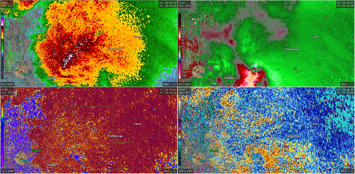
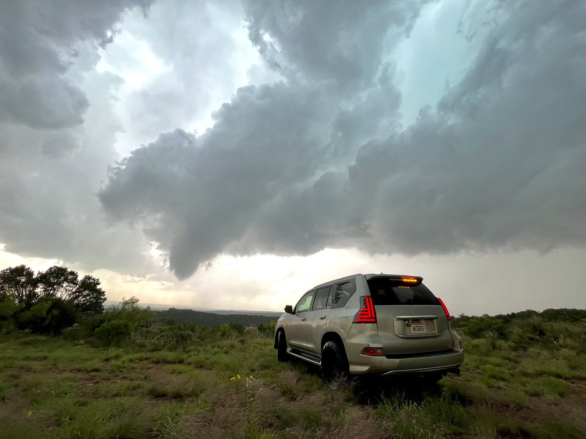
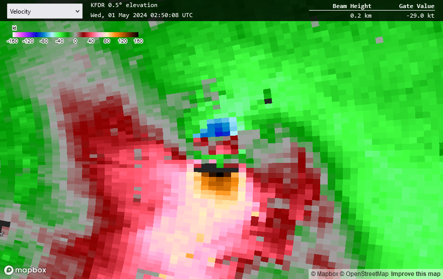
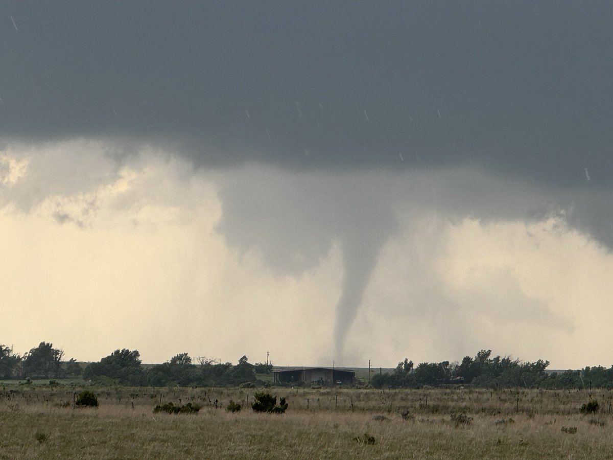
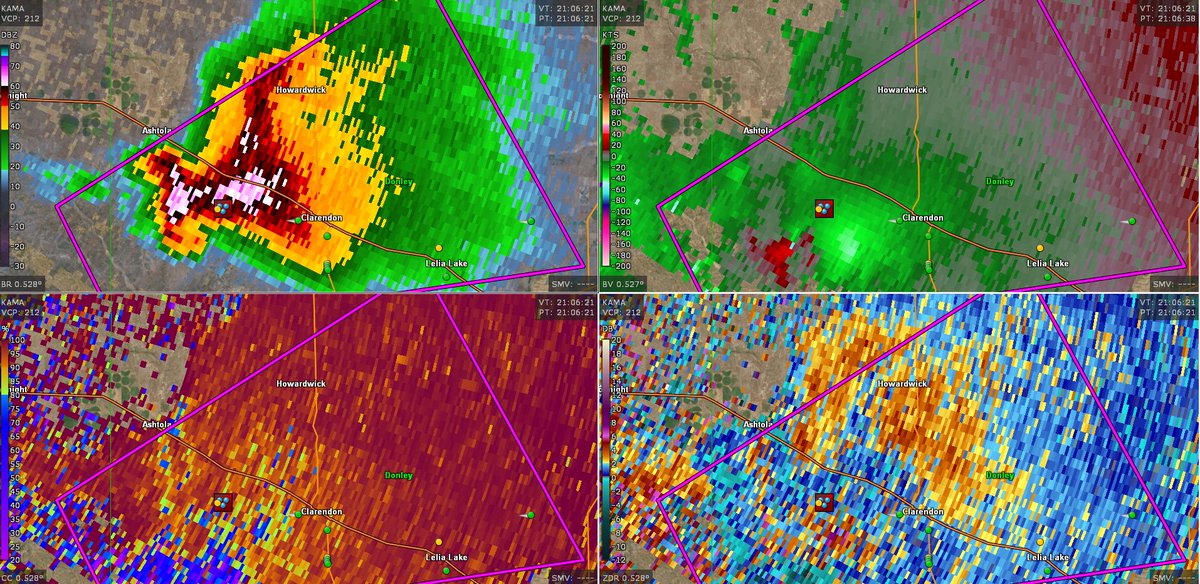
From Yesterday (April 30):

Radar Image #1: EF3 (140 mph)
Radar Image #2: EF1 (110 mph)

Weak couplets don't mean weak tornadoes, and intense couplets don't mean intense tornadoes. It completely depends on the storm environment and location of tornado (populated or rural area)!

From Yesterday (April 30): Radar Image #1: EF3 (140 mph) Radar Image #2: EF1 (110 mph) Weak couplets don't mean weak tornadoes, and intense couplets don't mean intense tornadoes. It completely depends on the storm environment and location of tornado (populated or rural area)!
account_circle
Nick Krasznavolgyi(@NickKrasz_Wx) 's Twitter Profile Photo

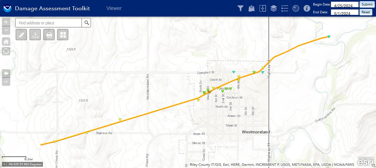
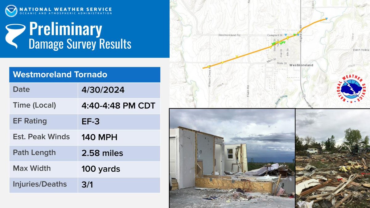
Details Regarding the Westmoreland, KS Tornado:

- Rating: EF3 (140 mph)
- Path Length: 2.6 mi
- Path Width: 100 yds
- Injuries/Fatalities: 3/1
- First EF3+ tornado in Pottawatomie County since 2008 (Manhattan EF4)
- First E(F3) tornado in Pottawatomie County since 1978

Details Regarding the Westmoreland, KS Tornado: - Rating: EF3 (140 mph) - Path Length: 2.6 mi - Path Width: 100 yds - Injuries/Fatalities: 3/1 - First EF3+ tornado in Pottawatomie County since 2008 (Manhattan EF4) - First E(F3) tornado in Pottawatomie County since 1978
account_circle
Nick Krasznavolgyi(@NickKrasz_Wx) 's Twitter Profile Photo

Updated 'Top 10 VROTS of 2024' sheet:

Yesterday, April 30th, a powerful supercell spawned an EF1* tornado east of Hollister, Oklahoma. With consultation with a radar expert, who manually dealiased the originally over-valued couplet, this tornado had a VROT of 124.5 kts! New #1.

Updated 'Top 10 VROTS of 2024' sheet: Yesterday, April 30th, a powerful supercell spawned an EF1* tornado east of Hollister, Oklahoma. With consultation with a radar expert, who manually dealiased the originally over-valued couplet, this tornado had a VROT of 124.5 kts! New #1.
account_circle
NWS Topeka(@NWSTopeka) 's Twitter Profile Photo

An EF3 Tornado struck Westmoreland Tuesday night with winds of 140 mph. This tornado injured 3 and killed one person.

An EF3 Tornado struck Westmoreland Tuesday night with winds of 140 mph. This tornado injured 3 and killed one person. #kswx
account_circle
NWS Norman(@NWSNorman) 's Twitter Profile Photo

Apr 30 tornado update:
The survey team says high end EF1 is the worst damage they can find for the tornado NE of Hollister in Tillman County.

account_circle
Giovanni Rizzotti(@Gio_wx) 's Twitter Profile Photo

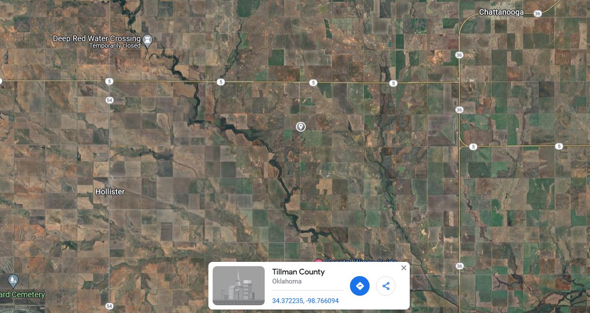
Are there any chasers who could get out and check on the well-being of this farmstead off N2360 Road north of Loveland, Oklahoma? Located at 34.372217, -98.766221. The fact that the couplet constricted and stalled over this location has me considerably worried.

Are there any chasers who could get out and check on the well-being of this farmstead off N2360 Road north of Loveland, Oklahoma? Located at 34.372217, -98.766221. The fact that the couplet constricted and stalled over this location has me considerably worried. #OKwx #WxTwitter
account_circle
Ethan Moriarty(@EMoriartyWX) 's Twitter Profile Photo

Reran my calcs with better geometry assumptions (smaller diameter, thicker, calculated out weight of cover via cast iron density, etc.)

New result is 171 mph using Bernoulli’s.

Reran my calcs with better geometry assumptions (smaller diameter, thicker, calculated out weight of cover via cast iron density, etc.) New result is 171 mph using Bernoulli’s.
account_circle
Nick Krasznavolgyi(@NickKrasz_Wx) 's Twitter Profile Photo

A recap from last night:

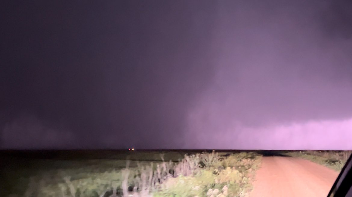
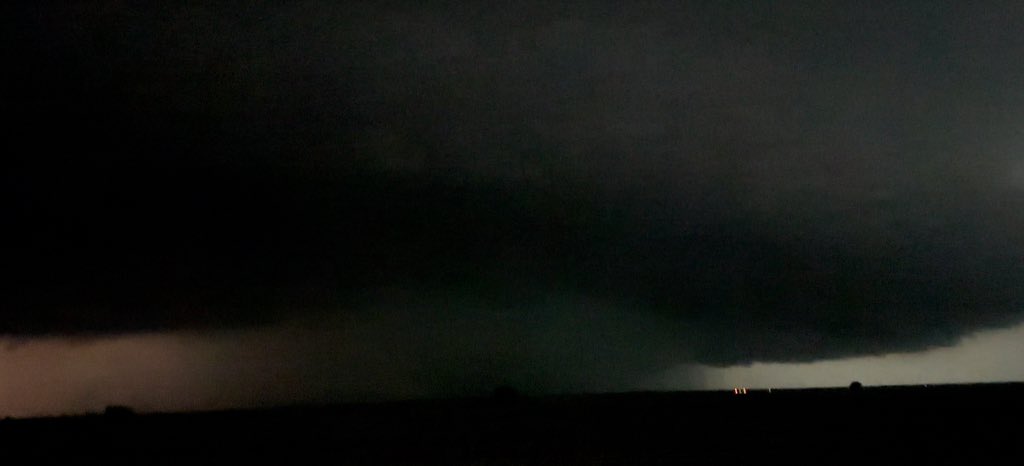
A powerful supercell east of Frederick, OK produced a likely intense/violent (EF3+), wedge tornado east of Hollister, with a preliminary VROT possibly in the top 5 highest recorded. Aside from this, likely the strongest anticyclonic tornado in decades!

A recap from last night: A powerful supercell east of Frederick, OK produced a likely intense/violent (EF3+), wedge tornado east of Hollister, with a preliminary VROT possibly in the top 5 highest recorded. Aside from this, likely the strongest anticyclonic tornado in decades!
account_circle
Nick Krasznavolgyi(@NickKrasz_Wx) 's Twitter Profile Photo

Anyone heading to SW OK today to get photos/videos of the damage? I’m curious what that monster did last night. Seemed to have passed over trees and possibly two farmsteads.

account_circle
Evan Bentley(@evan_bentley) 's Twitter Profile Photo

Please stop using Gate to Gate or delta-v to represent the intensity of tornado circulations.

1. This is outdated. Nearly all peer reviewed research in the past 10+ years uses vRot.

2. It does not have to be gate-to-gate.

3. You are perpetuating the tornado rating questioning

account_circle
Jared Trupp(@JaredTrupp) 's Twitter Profile Photo

Here are my photo from my impromptu storm chase tonight in SW OK the 1st 2 photos were taken at 9:32pm and the 2nd 2 were at 9:53pm. I was between Hollister and Loveland Looking north at the rotation. NWS Norman Reed Timmer, PhD

#okwx Here are my photo from my impromptu storm chase tonight in SW OK the 1st 2 photos were taken at 9:32pm and the 2nd 2 were at 9:53pm. I was between Hollister and Loveland Looking north at the rotation. @NWSNorman @ReedTimmerUSA #tornado
account_circle