RadarOmega(@RadarOmega) 's Twitter Profileg
RadarOmega

@RadarOmega

iOS: https://t.co/kl3NcXbqEi
Android: https://t.co/BMHfTHV8mi

RadarOmega Support: https://t.co/9Ik5Kut01H

Merch: https://t.co/cVgDNdBNML

ID:1016409968642330626

linkhttps://www.radaromega.com calendar_today09-07-2018 19:53:15

20,3K Tweets

67,9K Followers

127 Following

RadarOmega(@RadarOmega) 's Twitter Profile Photo

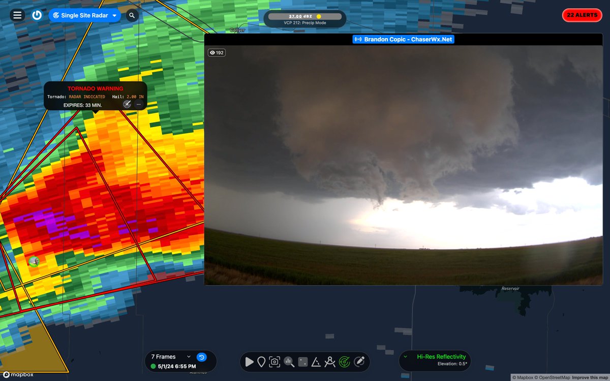
Watch as this thunderstorm in Kansas evolved into a softball-size-hail-producing supercell this evening, captured by storm chaser Brandon Copic!

account_circle
RadarOmega(@RadarOmega) 's Twitter Profile Photo

Severe Thunderstorm Warning including Gove County, KS until 9:00 PM CDT.

⚠️This destructive storm will contain softball sized (4') hail!

📸 Brandon Copic | cyclonePORT
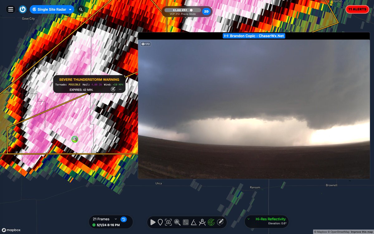
Severe Thunderstorm Warning including Gove County, KS until 9:00 PM CDT. #KSwx ⚠️This destructive storm will contain softball sized (4') hail! 📸 @BrandonCopicWx | @cyclonePORT
account_circle
RadarOmega(@RadarOmega) 's Twitter Profile Photo

🌪️‼️ Observed Tornado Warning including Turkey TX and Quitaque TX until 8:30 PM CDT

Source: Public confirmed tornado

🌪️‼️ Observed Tornado Warning including Turkey TX and Quitaque TX until 8:30 PM CDT #TXwx Source: Public confirmed tornado
account_circle
RadarOmega(@RadarOmega) 's Twitter Profile Photo

Storm chaser Vince Waelti 🌪 has maintained a great view of a tornado-warned supercell in the Texas Panhandle over the past half hour! Although the storm has struggled to produce, there has been no shortage of eerie sights captured on his cyclonePORT stream. Take a look!

account_circle
RadarOmega(@RadarOmega) 's Twitter Profile Photo

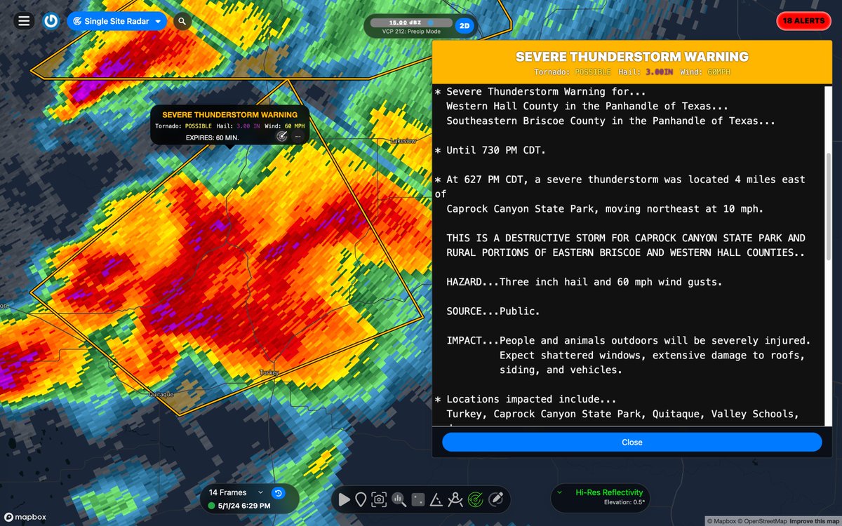
Severe Thunderstorm Warning including Turkey TX, Quitaque TX and Brice TX until 7:30 PM CDT.

⚠️This destructive storm will contain large apple sized hail!

Severe Thunderstorm Warning including Turkey TX, Quitaque TX and Brice TX until 7:30 PM CDT. #TXwx ⚠️This destructive storm will contain large apple sized hail!
account_circle
RadarOmega(@RadarOmega) 's Twitter Profile Photo

Moments go, storm chaser Vince Waelti 🌪 captured this view of a tornado-warned storm a few miles south of Perryton in the Texas Panhandle!

account_circle
RadarOmega(@RadarOmega) 's Twitter Profile Photo

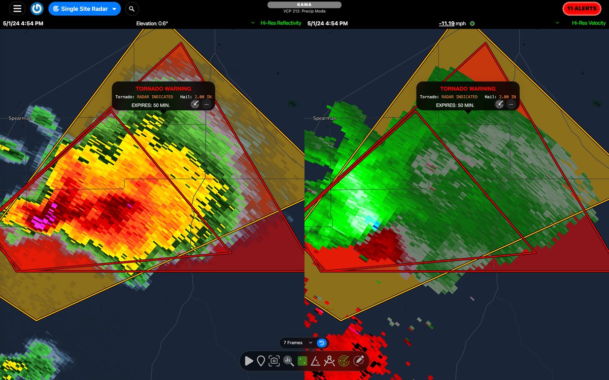
Observed Tornado Warning continues for Hansford County, TX, Hutchinson County, TX, Ochiltree County, TX, Roberts County, TX until 5:45 PM CDT

Storm chaser Vince Waelti 🌪 has a view of this storm! Tune into his cyclonePORT stream in the RadarOmega app!
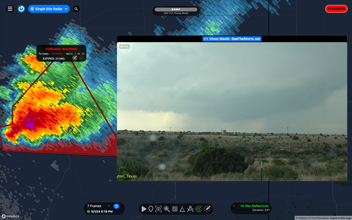
Observed Tornado Warning continues for Hansford County, TX, Hutchinson County, TX, Ochiltree County, TX, Roberts County, TX until 5:45 PM CDT #TXwx Storm chaser @VinceWaelti has a view of this storm! Tune into his @cyclonePORT stream in the RadarOmega app!
account_circle
RadarOmega(@RadarOmega) 's Twitter Profile Photo

A new tornado watch has been issued for parts of Kansas valid until midnight tonight! Along with a couple tornadoes, scattered hail up to softball size is likely and scattered wind gusts up to 70 mph are possible.

account_circle
RadarOmega(@RadarOmega) 's Twitter Profile Photo

🌪️‼️Tornado Warning including Hansford County, TX, Hutchinson County, TX, Ochiltree County, TX, Roberts County, TX until 5:45 PM CDT

🌪️‼️Tornado Warning including Hansford County, TX, Hutchinson County, TX, Ochiltree County, TX, Roberts County, TX until 5:45 PM CDT #TXwx
account_circle
RadarOmega(@RadarOmega) 's Twitter Profile Photo

⛈️The dryline in action in the Texas Panhandle this afternoon. It must be May!

High resolution satellite imagery like this is available to all RadarOmega subscribers.

account_circle
RadarOmega(@RadarOmega) 's Twitter Profile Photo

Check out this 3D volumetric radar presentation of a supercell in the Texas Panhandle producing very large hail!

Tornado Warning including Clarendon TX, Howardwick TX and Lelia Lake TX until 4:30 PM CDT. This storm will also contain tennis ball size (2.50') hail!

account_circle
RadarOmega(@RadarOmega) 's Twitter Profile Photo

A tornado watch has been issued for portions of Texas and Oklahoma valid until 11pm this evening! A few tornadoes are possible, while widespread hail up to softball size (4') and scattered wind gusts up to 75 mph are both likely.

account_circle
RadarOmega(@RadarOmega) 's Twitter Profile Photo

🔥 Dry and breezy conditions are expected across the southern High Plains today! Critical fire weather conditions are most likely from eastern New Mexico into far western Texas, where dry conditions will overlap receptive fuels for the longest duration this afternoon.

account_circle
RadarOmega(@RadarOmega) 's Twitter Profile Photo

A severe thunderstorm watch has been issued for parts of West Texas until 9 PM CDT!

PRIMARY THREATS:
- Large hail up to 3' in diameter
- Damaging winds up to 80 mph
- A tornado or two possible

account_circle
RadarOmega(@RadarOmega) 's Twitter Profile Photo

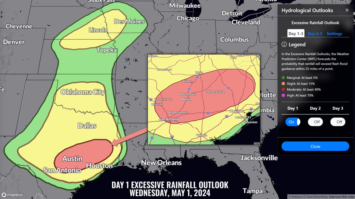
There is a moderate risk (level 3/4) of excessive rainfall today across parts of central and eastern Texas! Multiple rounds of heavy rainfall over already saturated soils will lead to flash, urban, and river flooding.

There is a moderate risk (level 3/4) of excessive rainfall today across parts of central and eastern Texas! Multiple rounds of heavy rainfall over already saturated soils will lead to flash, urban, and river flooding. #TXwx
account_circle
RadarOmega(@RadarOmega) 's Twitter Profile Photo

Infrared satellite imagery shows the evolution of widespread severe storms yesterday afternoon across the Plains! Severe storms are expected again today in the southern Plains. Satellite is available to all subscribers!

account_circle