John Ristau πŸ‡¨πŸ‡¦ πŸ‡³πŸ‡Ώ(@SinistralSeismo) 's Twitter Profileg
John Ristau πŸ‡¨πŸ‡¦ πŸ‡³πŸ‡Ώ

@SinistralSeismo

New Zealand-based Canadian earthquake seismologist. Tweets and opinions are my own.

ID:2278468723

calendar_today06-01-2014 03:54:24

1,4K Tweets

722 Followers

499 Following

GeoNet(@geonet) 's Twitter Profile Photo

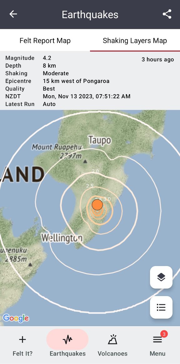
Breaking news! πŸ“£ Shaking Layers is now on our app πŸ™Œ
Open or download the GeoNet app and tap on any earthquake of M3.5 or greater to get a measure of ground shaking intensity in different parts of the country. Read more about it here πŸ‘‡
geonet.org.nz/news/76UwEoN58…

Breaking news! πŸ“£ Shaking Layers is now on our app πŸ™Œ Open or download the GeoNet app and tap on any earthquake of M3.5 or greater to get a measure of ground shaking intensity in different parts of the country. Read more about it here πŸ‘‡ geonet.org.nz/news/76UwEoN58…
account_circle
GeoNet(@geonet) 's Twitter Profile Photo

Today in history: Monday 14 November 2016 at 12.02am, a magnitude 7.8 earthquake struck 15km north-east of Culverden, North Canterbury, starting near the town of Waiau. It was New Zealand’s most complex earthquake ever recorded, with more than 20 faults rupturing. 1/3

Today in history: Monday 14 November 2016 at 12.02am, a magnitude 7.8 earthquake struck 15km north-east of Culverden, North Canterbury, starting near the town of Waiau. It was New Zealand’s most complex earthquake ever recorded, with more than 20 faults rupturing. 1/3
account_circle
Jamie Morton(@Jamienzherald) 's Twitter Profile Photo

Scientists have discovered two faults north of Wellington to be more active than they first thought – the latest finding in a long-running, painstaking effort to map the region’s incredibly complex seismic environment nzherald.co.nz/nz/faults-near…

account_circle
GeoNet(@geonet) 's Twitter Profile Photo

175 years ago, today an M7.4 earthquake struck Marlborough destroying houses in the nearby valleys. Wellington & Nelson also suffered significant damage to brick and stone buildings, and many houses in the Wairarapa suffered chimney damage. 1/3

175 years ago, today an M7.4 earthquake struck Marlborough destroying houses in the nearby valleys. Wellington & Nelson also suffered significant damage to brick and stone buildings, and many houses in the Wairarapa suffered chimney damage. 1/3
account_circle
GeoNet(@geonet) 's Twitter Profile Photo

A magnitude 6.0 earthquake with strong shaking has occurred at 9:14am on Wednesday 20 Sept. The earthquake was 11km deep and located within 45km north of Geraldine and felt widely throughout the Canterbury region. Read all about the quake here πŸ‘‡ mtr.cool/nymgutuzdt

account_circle
GeoNet(@geonet) 's Twitter Profile Photo

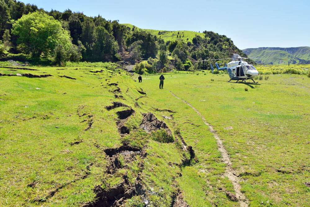
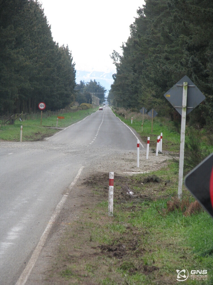
Today in history: the M7.2 Darfield earthquake struck Canterbury in 2010. Buildings were damaged, some partially collapsed and masonry fell from historic churches. Roads cracked open and paddock fences and shelter belts were displaced horizontally by up to 5m. 1/3

Today in history: the M7.2 Darfield earthquake struck Canterbury in 2010. Buildings were damaged, some partially collapsed and masonry fell from historic churches. Roads cracked open and paddock fences and shelter belts were displaced horizontally by up to 5m. 1/3
account_circle
GeoNet(@geonet) 's Twitter Profile Photo

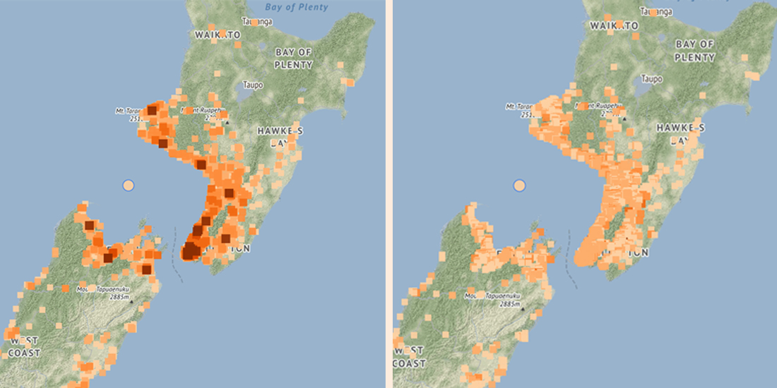
We map felt reports to identify how widely and how strongly people experienced earthquake ground shaking. πŸ—Ί From tomorrow you will notice changes to the felt report maps that we provide on our website. Read all about the changes here πŸ‘‡
geonet.org.nz/news/7AZhBTG25…

We map felt reports to identify how widely and how strongly people experienced earthquake ground shaking. πŸ—Ί From tomorrow you will notice changes to the felt report maps that we provide on our website. Read all about the changes here πŸ‘‡ geonet.org.nz/news/7AZhBTG25…
account_circle
GeoNet(@geonet) 's Twitter Profile Photo

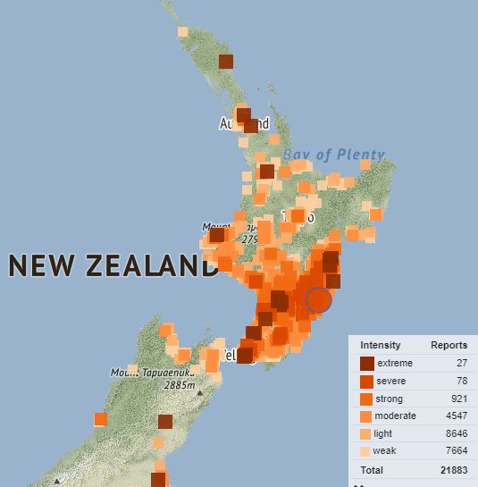
A deep M5.6 earthquake south-west of Whanganui has caused shaking across parts of the North Island and the upper South Island. We have received more than 20,000 felt reports. For more details on the quake see: geonet.org.nz/earthquake/202…

A deep M5.6 earthquake south-west of Whanganui has caused shaking across parts of the North Island and the upper South Island. We have received more than 20,000 felt reports. For more details on the quake see: geonet.org.nz/earthquake/202…
account_circle
National Emergency Management Agency(@NZcivildefence) 's Twitter Profile Photo

We have issued a NATIONAL ADVISORY: TSUNAMI ACTIVITY following the magnitude 7.7 earthquake near the Loyalty Islands. We expect New Zealand coastal areas to experience strong and unusual currents and unpredictable surges at the shore.

account_circle
GeoNet(@geonet) 's Twitter Profile Photo

There has been severe shaking in Porangahau this morning with a M5.7 followed closely by a M5.3. Our team are still looking at this so the size/locations are currently preliminary. We will have updated information ASAP.

There has been severe shaking in Porangahau this morning with a M5.7 followed closely by a M5.3. Our team are still looking at this so the size/locations are currently preliminary. We will have updated information ASAP. #eqnz
account_circle
John Ristau πŸ‡¨πŸ‡¦ πŸ‡³πŸ‡Ώ(@SinistralSeismo) 's Twitter Profile Photo

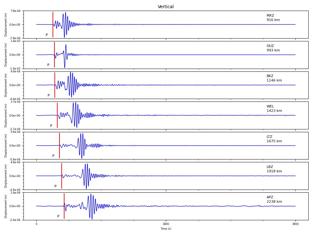
Mw 7.1 earthquake near Raoul Island today. Reverse faulting at 50 km depth. Small tsunami (~20 cm peak-to-trough) recorded at Raoul Island. The earthquake was well recorded across the New Zealand seismic network.

Mw 7.1 earthquake near Raoul Island today. Reverse faulting at 50 km depth. Small tsunami (~20 cm peak-to-trough) recorded at Raoul Island. The earthquake was well recorded across the New Zealand seismic network.
account_circle
GeoNet(@geonet) 's Twitter Profile Photo

Love GeoNet Data? Did you know we have
regular Data Blogs? Check out our latest today comparing the Kawerau earthquake swarm with other
swarms: geonet.org.nz/news/4JzNrNwt6… You can find our earlier blogs in the News on our website by selecting the Data Blog search filter.

Love GeoNet Data? Did you know we have regular Data Blogs? Check out our latest today comparing the Kawerau earthquake swarm with other swarms: geonet.org.nz/news/4JzNrNwt6… You can find our earlier blogs in the News on our website by selecting the Data Blog search filter.
account_circle
GeoNet(@geonet) 's Twitter Profile Photo

A swarm of earthquakes has been occurring tonight south west of Kawerau, felt across the Bay of Plenty. We have recorded more than 40 earthquakes so far, the largest of which have been a M4.8 and M4.6. This swarm is in a similar area to swarms that occurred in 2018 and 2019. 1/2

account_circle
GeoNet(@geonet) 's Twitter Profile Photo

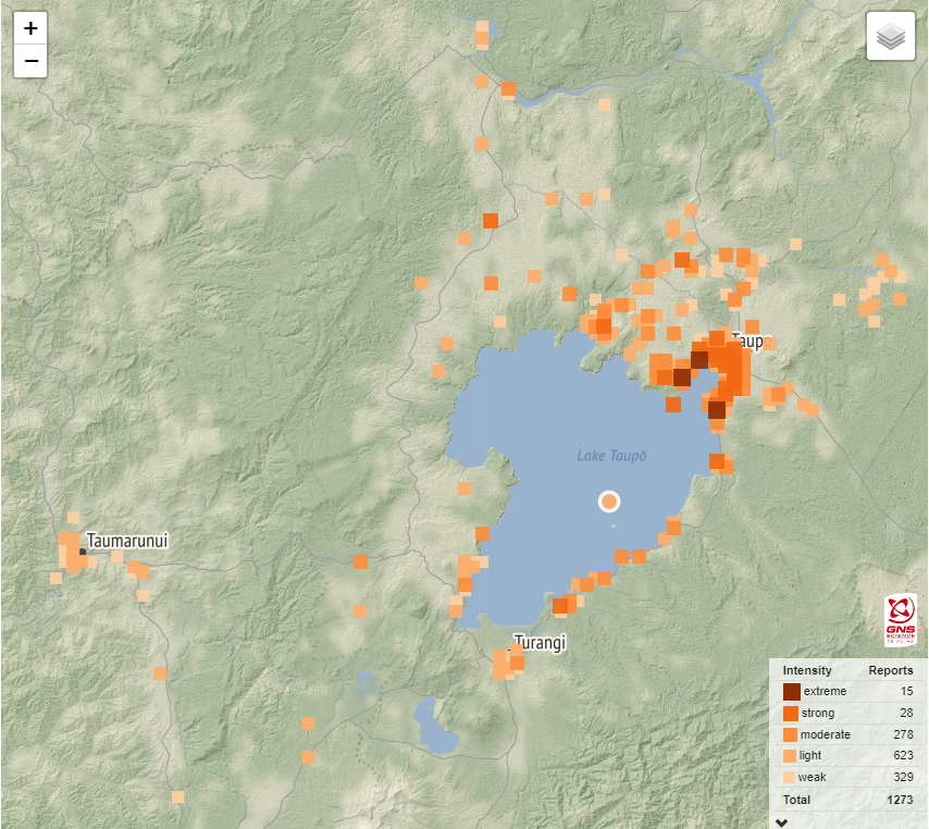
A M4.4 earthquake at Lake Taupō triggered around 1200 felt reports this afternoon. Light shaking was reported. We expect aftershocks in the coming days. For more detail, see geonet.org.nz/earthquake/202….

A M4.4 earthquake at Lake Taupō triggered around 1200 felt reports this afternoon. Light shaking was reported. We expect aftershocks in the coming days. For more detail, see geonet.org.nz/earthquake/202….
account_circle
John Ristau πŸ‡¨πŸ‡¦ πŸ‡³πŸ‡Ώ(@SinistralSeismo) 's Twitter Profile Photo

Mw 5.5 (ML 6.0) earthquake 46 km deep off the southwest coast of the North Island. Hard to tell at a quick glance where it sits relative to the plate boundary - have to have a closer look tomorrow.

Mw 5.5 (ML 6.0) earthquake 46 km deep off the southwest coast of the North Island. Hard to tell at a quick glance where it sits relative to the plate boundary - have to have a closer look tomorrow.
account_circle
Dr. Dee Ninis(@DeeNinis) 's Twitter Profile Photo

We can’t predict the exact time, place and magnitude of future earthquakes. But we can estimate the chance of future seismic activity. Me and @mcgerstenberger explain the hows of earthquake forecastingπŸ‘‡
Seismology Research Centre GNS Science Te PΕ« Ao Monash Earth, Atmosphere and Environment 🌏πŸŒͺοΈπŸƒ AF8
theconversation.com/nobody-can-pre…
account_circle