Kentucky Mesonet(@kymesonet) 's Twitter Profileg
Kentucky Mesonet

@kymesonet

The Commonwealth's Official Source for Weather and Climate Data, with 79 automated weather stations across 74 counties in Kentucky.

ID:237454089

linkhttp://www.kymesonet.org calendar_today12-01-2011 21:53:15

5,7K Tweet

2,3K Takipçi

407 Takip Edilen

Kentucky Mesonet(@kymesonet) 's Twitter Profile Photo

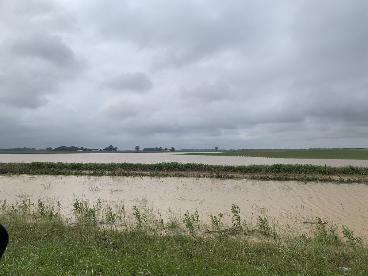
Torrential rains from locally heavy t-storms have resulted in > 4' of rainfall at our site 5 mi E of Henderson. This has led to flooding of low-lying areas & plenty of standing water in Henderson County, as seen by both our webcam and on either side of the Audubon Parkway.

Torrential rains from locally heavy t-storms have resulted in > 4' of rainfall at our site 5 mi E of Henderson. This has led to flooding of low-lying areas & plenty of standing water in Henderson County, as seen by both our webcam and on either side of the Audubon Parkway. #kywx
account_circle
Kentucky Mesonet(@kymesonet) 's Twitter Profile Photo

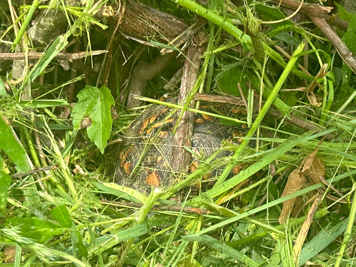
Almost camouflaged beneath the grass at our Lawrence County site yesterday was this turtle 🐢, although he was discovered by our field technician, Cooper Jackson!

Almost camouflaged beneath the grass at our Lawrence County site yesterday was this turtle 🐢, although he was discovered by our field technician, Cooper Jackson! #kywx
account_circle
Kentucky Mesonet(@kymesonet) 's Twitter Profile Photo

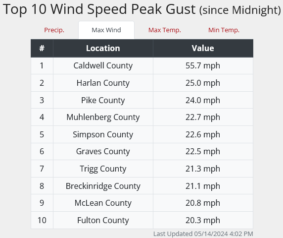
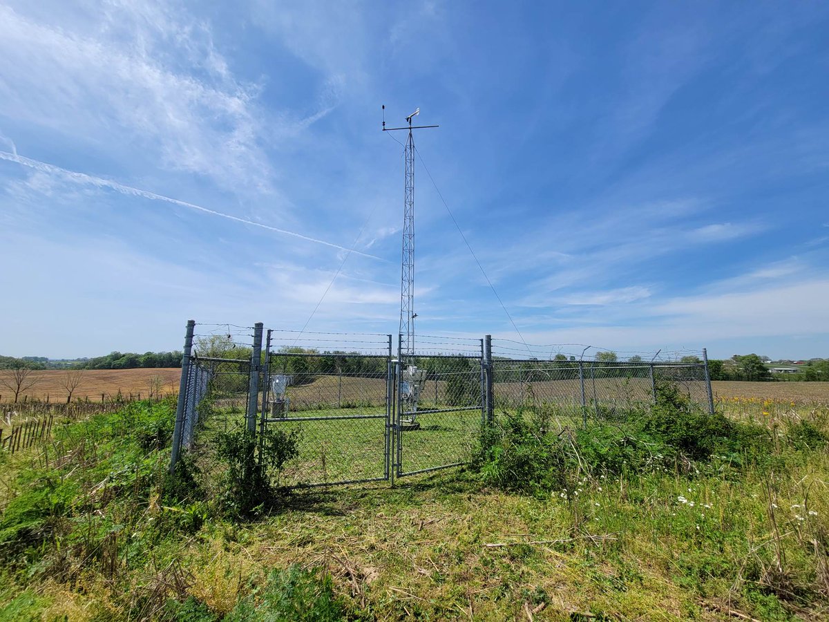
Moments ago, our site in Caldwell County near Princeton clocked a wind gust to near 56 mph.

Scattered strong storms with gusty winds and hail are possible across portions of the state into the evening.

Moments ago, our site in Caldwell County near Princeton clocked a wind gust to near 56 mph. Scattered strong storms with gusty winds and hail are possible across portions of the state into the evening. #kywx
account_circle
Kentucky Mesonet(@kymesonet) 's Twitter Profile Photo

Site of the Week: Adair County (3 mi N of Columbia)
First online data: 5/14/2008
Max temp that day: 67.3
Min temp that day: 55.1
All-time Max temp: 104.3 (6/29/2012)
All-time Min temp: -15.4 (2/20/2015)
All-time wettest: 7.33' (5/2/2010)
Driest month: Sept. 2019 (0.10')

Site of the Week: Adair County (3 mi N of Columbia) First online data: 5/14/2008 Max temp that day: 67.3 Min temp that day: 55.1 All-time Max temp: 104.3 (6/29/2012) All-time Min temp: -15.4 (2/20/2015) All-time wettest: 7.33' (5/2/2010) Driest month: Sept. 2019 (0.10') #kywx
account_circle
Kentucky Mesonet(@kymesonet) 's Twitter Profile Photo

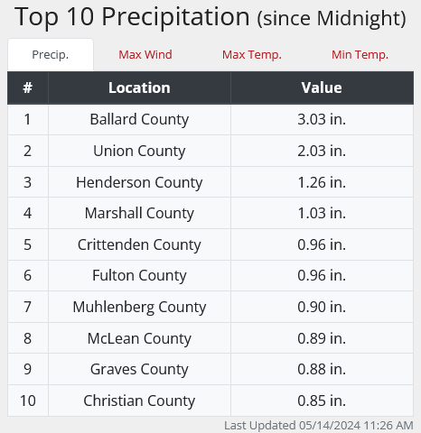
Bands of rain with rumbles of thunder are advancing E across the Commonwealth today. So far, amounts have been light generally E of I-65. In the W, however, soaking rains have occurred. The site with the highest total: Ballard County with > 3' since midnight!

Bands of rain with rumbles of thunder are advancing E across the Commonwealth today. So far, amounts have been light generally E of I-65. In the W, however, soaking rains have occurred. The site with the highest total: Ballard County with > 3' since midnight! #kywx
account_circle
Kentucky Mesonet(@kymesonet) 's Twitter Profile Photo

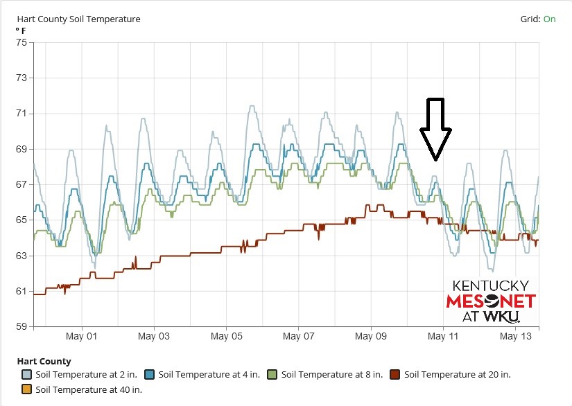
Did you know that many of our sites measure conditions both above AND below ground? Here are graphs from one of those sites (Hart Co. E of Munfordville) showing soil temperature and moisture trends over the past two weeks. More info anytime at kymesonet.org.

Did you know that many of our sites measure conditions both above AND below ground? Here are graphs from one of those sites (Hart Co. E of Munfordville) showing soil temperature and moisture trends over the past two weeks. More info anytime at kymesonet.org. #kywx
account_circle
Kentucky Mesonet(@kymesonet) 's Twitter Profile Photo

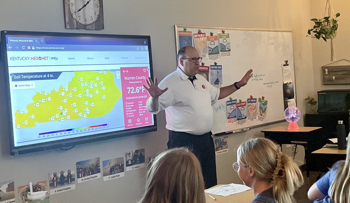
And that's a wrap! Our final classroom visit for the 2023-'24 school year came earlier this week at Foundation Christian Academy in Bowling Green! Our thanks to Ms. Cummins for inviting us to speak to the 4th graders!

And that's a wrap! Our final classroom visit for the 2023-'24 school year came earlier this week at Foundation Christian Academy in Bowling Green! Our thanks to Ms. Cummins for inviting us to speak to the 4th graders! #outreach #kywx
account_circle
Kentucky Mesonet(@kymesonet) 's Twitter Profile Photo

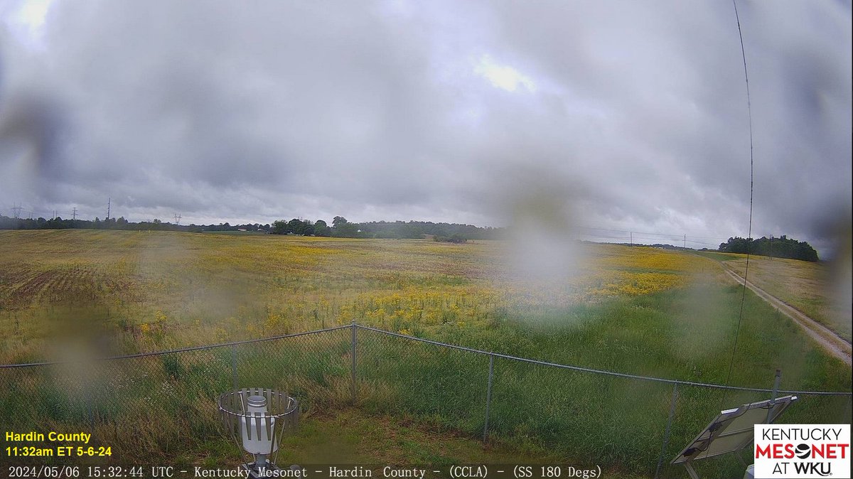
NEW: Our technicians have just installed a new webcam on our tower in Meade Co. near Brandenburg (view faces SW). In addition, our older webcam one county over in Hardin (near E'town) has been replaced by a new, real-time camera.
We now have 67 webcams active in the field!

NEW: Our technicians have just installed a new webcam on our tower in Meade Co. near Brandenburg (view faces SW). In addition, our older webcam one county over in Hardin (near E'town) has been replaced by a new, real-time camera. We now have 67 webcams active in the field! #kywx
account_circle
Kentucky Mesonet(@kymesonet) 's Twitter Profile Photo

A stormy week is well underway. Multiple rounds of embedded rain/thunder are sliding NE across the state this morning as low pressure does the same.
Remember, you can overlay our radar imagery over maps with various parameters on kymesonet.org!

A stormy week is well underway. Multiple rounds of embedded rain/thunder are sliding NE across the state this morning as low pressure does the same. Remember, you can overlay our radar imagery over maps with various parameters on kymesonet.org! #kywx
account_circle
KY Climate Center(@KYClimate) 's Twitter Profile Photo

THU morning update shows more of SE KY in D0 (abnormally dry). Further discussion TODAY with Dr. Jerry Brotzge in our Drought Early Warning webinar at 2pm ET/1pm CT. Please join us! Zoom link: 📷wku.zoom.us/j/99406376503
YouTube Channel: 📷youtube.com/channel/UCDg3h… UK Ag Weather Center

account_circle
Kentucky Mesonet(@kymesonet) 's Twitter Profile Photo

No 'jive turkey' 🦃here! This bird was spotted roaming the grounds outside our offices at WKU Innovation Campus this morning. We believe it's lost; this bird should be out in the open land wandering around near one of our sites! 😁
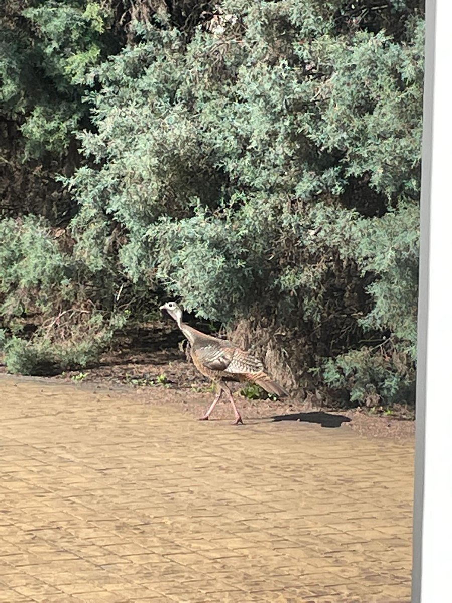
No 'jive turkey' 🦃here! This bird was spotted roaming the grounds outside our offices at @WKUInnovation this morning. We believe it's lost; this bird should be out in the open land wandering around near one of our sites! 😁
account_circle
KY Climate Center(@KYClimate) 's Twitter Profile Photo

Zoom link: wku.zoom.us/j/99406376503
YouTube Channel: youtube.com/channel/UCDg3h…

Please let me know if you have any questions, and we look forward to seeing you this Thursday at 2pm ET / 1pm CT!
-KY Climate Center Team NIDIS Drought.gov UK Ag Weather Center

account_circle
KY Climate Center(@KYClimate) 's Twitter Profile Photo

Just click on the Zoom link below (no registration required). There is also the option to view live on the YouTube channel. Webinars are regularly scheduled for the first Thursday of the month, with the opportunity of additional webinars in the case of drought episodes.

account_circle
KY Climate Center(@KYClimate) 's Twitter Profile Photo

We'll take a look at where we stand drought-wise & what the outlooks portend going forward. This webinar is hosted by KY Climate Center in partnership with the National Integrated Drought Information System (NIDIS) and in coordination with the Midwest Drought Early Warning System.

account_circle
KY Climate Center(@KYClimate) 's Twitter Profile Photo

🧵Happy week everyone! A reminder to join us this THU (May 2nd) at 2pm ET / 1pm CT - as state climatologist & WKU Ogden College professor Dr. Jerry Brotzge takes us through a look back at April, current conditions, ag impacts, & outlooks, followed by a time for Q & A.

🧵Happy #KentuckyDerby150 week everyone! A reminder to join us this THU (May 2nd) at 2pm ET / 1pm CT - as state climatologist & @wkuogden professor Dr. Jerry Brotzge takes us through a look back at April, current conditions, ag impacts, & outlooks, followed by a time for Q & A.
account_circle
Kentucky Mesonet(@kymesonet) 's Twitter Profile Photo

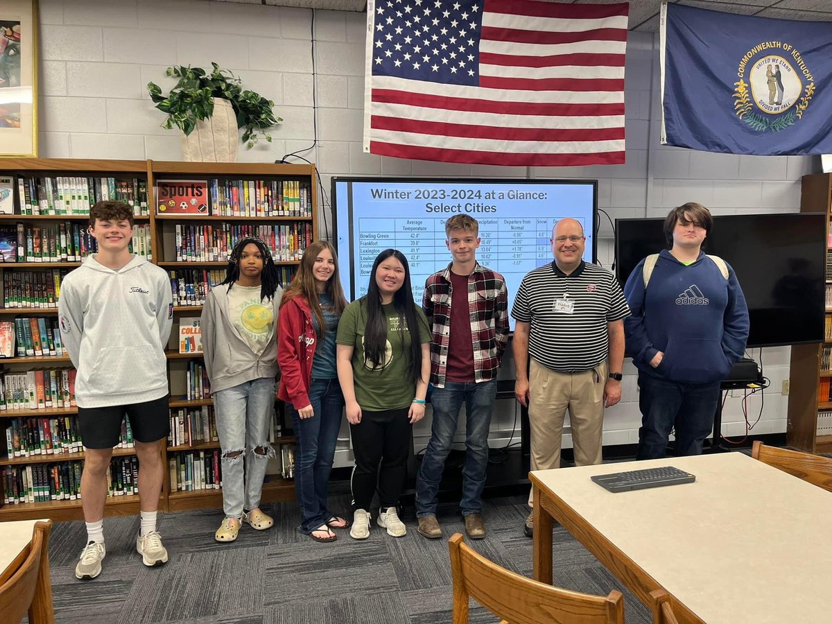
On Friday, we paid a visit to Butler County High School in Morgantown, KY, where we spoke to environmental science students along with the STEM Club on Mesonet, climate, along with careers in meteorology. Or thanks to Ms. Madison Staton for having us!

On Friday, we paid a visit to Butler County High School in Morgantown, KY, where we spoke to environmental science students along with the STEM Club on Mesonet, climate, along with careers in meteorology. Or thanks to Ms. Madison Staton for having us! #outreach #kywx
account_circle
Kentucky Mesonet(@kymesonet) 's Twitter Profile Photo

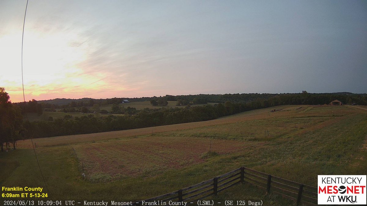
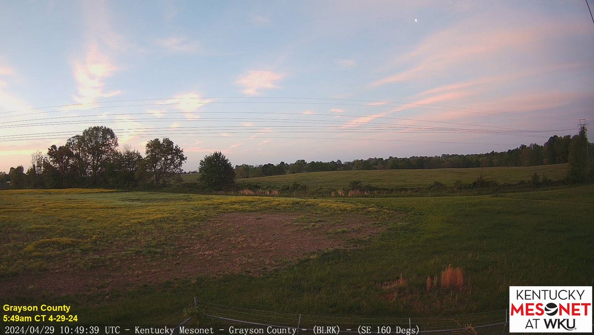
High clouds appeared like cotton candy in the skies over the Commonwealth on what is the start of week! 👀at the waning gibbous moon 🌖from our shot facing SE in Grayson Co. near Leitchfield! Expect clouds to thicken today with rain on the approach.

High clouds appeared like cotton candy in the skies over the Commonwealth on what is the start of #KentuckyDerby150 week! 👀at the waning gibbous moon 🌖from our shot facing SE in Grayson Co. near Leitchfield! Expect clouds to thicken today with rain on the approach. #kywx
account_circle