Metro Los Angeles(@metrolosangeles) 's Twitter Profile Photo

Final Environmental Impact Report is out for E Line extension to Whittier

•FEIR: mtro.la/oim650Rue5I

•StoryMap: mtro.la/fqXf50Rue5H

•Project to be built in phases, first to Montebello

•Metro Board will consider FEIR at future meeting

Final Environmental Impact Report is out for E Line extension to Whittier

•FEIR: mtro.la/oim650Rue5I

•StoryMap: mtro.la/fqXf50Rue5H

•Project to be built in phases, first to Montebello 

•Metro Board will consider FEIR at future meeting
account_circle
NOAA Coastal Ocean Science(@noaacoastalsci) 's Twitter Profile Photo

New release (collaboration w/ Bureau of Ocean Energy Management): an interactive StoryMap exploring offshore siting in the . Learn about the evolution from the original Call Area to Final Wind Energy Area and how conflicts w/ other ocean uses were minimized. storymaps.arcgis.com/stories/771b8c…
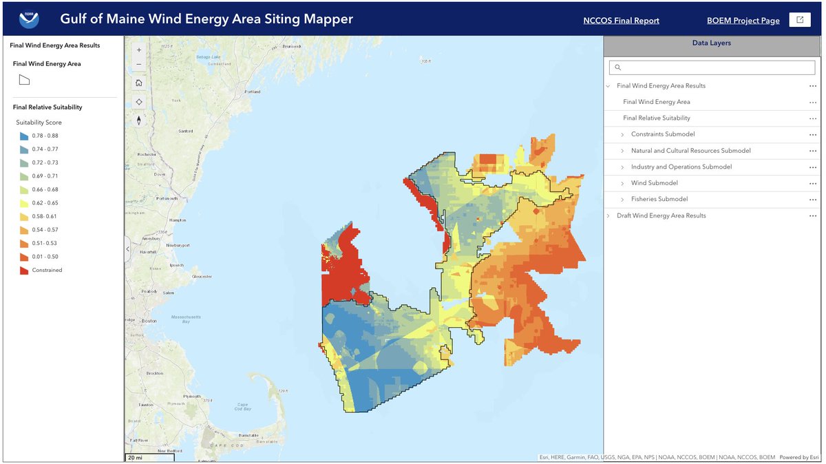
New release (collaboration w/ @BOEM): an interactive StoryMap exploring offshore #WindEnergy siting in the #GulfofMaine. Learn about the evolution from the original Call Area to Final Wind Energy Area and how conflicts w/ other ocean uses were minimized. storymaps.arcgis.com/stories/771b8c…
account_circle
Audubon Southwest(@audubonsw) 's Twitter Profile Photo

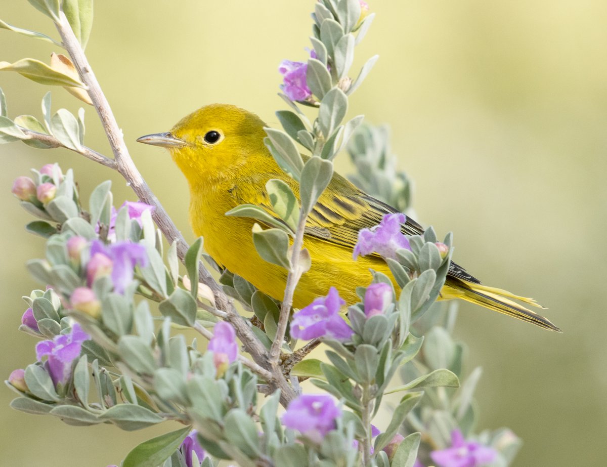
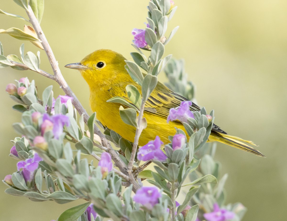
What's at stake for birds and people if we don't manage groundwater throughout more of Arizona? Explore our updated StoryMap highlighting the importance of sustaining healthy groundwater supplies. audubon.org/news/understan… 📸 Yellow Warbler. Joe Aliperti/Audubon Photography Awards

What's at stake for birds and people if we don't manage groundwater throughout more of Arizona? Explore our updated StoryMap highlighting the importance of sustaining healthy groundwater supplies. audubon.org/news/understan… 📸 Yellow Warbler. Joe Aliperti/Audubon Photography Awards
account_circle
Aying 🌈(@ayingdome) 's Twitter Profile Photo

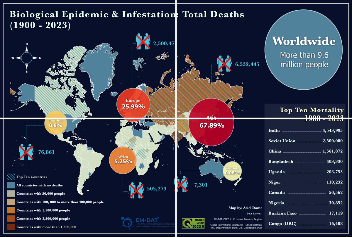
BIOLOGICAL EPIDEMIC & INFESTATION MAP: TOTAL DEATHS (1900-2023)

My winning piece in the 7th Annual International Humanitarian Mapathon: Crisis StoryMap Challenge

🏆 First Place (Overall)
🏆 People's Choice Award

Data provided by the United Nations (UN) SmartMaps.

Map in QGIS.

BIOLOGICAL EPIDEMIC & INFESTATION MAP: TOTAL DEATHS (1900-2023)

My winning piece in the 7th Annual International Humanitarian Mapathon: Crisis StoryMap Challenge

🏆 First Place (Overall)
🏆 People's Choice Award

Data provided by the United Nations (UN) SmartMaps.

Map in QGIS.
account_circle
Melissa_DataSG(@Melissa_DataSG) 's Twitter Profile Photo

Check out Melissa's team's StoryMap on the recent 4.8 magnitude earthquake in New Jersey on April 5th. Discover the impact on states, counties, zip codes, land parcels, and addresses near the epicenter. Powered by Esri- view here: i.melissa.com/4bcI2T3

account_circle
glenn(@gletham) 's Twitter Profile Photo

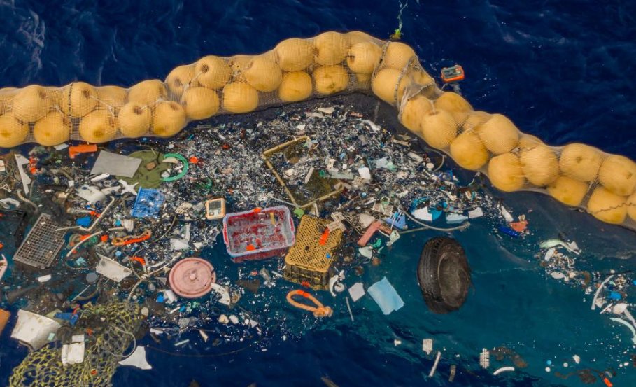
Exploring The Great Pacific Garbage Patch StoryMap - The Largest Accumulation of Ocean Plastic in the World ow.ly/R1QM50RsGoV

Exploring The Great Pacific Garbage Patch StoryMap - The Largest Accumulation of Ocean Plastic in the World  ow.ly/R1QM50RsGoV
account_circle
John Steffenson(@jsteffenson) 's Twitter Profile Photo

Happy Arbor Day! 🌳💚

Another beautiful StoryMap by the StoryMap team, Thanks Ross and team! - Celebrate the contribution of trees to our health and planet — with .
ow.ly/REPk50Rp6yB

account_circle
FAO Ecuador(@FAOEcuador) 's Twitter Profile Photo

El DIEM de la Food and Agriculture Organization ha identificado áreas clave afectadas por los incendios en Colombia, apuntando a una urgente necesidad de fortalecer la resiliencia en los territorios.


🗺️Accede al StoryMap: bit.ly/3U3aErZ

El DIEM de la @FAO ha identificado áreas clave afectadas por los incendios en Colombia, apuntando a una urgente necesidad de fortalecer la resiliencia en los territorios.

#DataInEmergencies

🗺️Accede al StoryMap: bit.ly/3U3aErZ
account_circle
Scott Meinhardt(@scottmeinhardt) 's Twitter Profile Photo

Supercharge your ArcGIS StoryMap stories with media actions that help enrich your stories with optional media behavior and map interactions in sidecar slides. ow.ly/gS6O50R6b9J

Supercharge your ArcGIS StoryMap stories with media actions that help enrich your stories with optional media behavior and map interactions in sidecar slides. ow.ly/gS6O50R6b9J
account_circle
Scott Safechuck(@SBCFireInfo) 's Twitter Profile Photo

Seeking Public Input! Santa Barbara County Fire Department is preparing a new Community Wildfire Protection Plan (CWPP) for the Santa Barbara Foothill Communities. For more information & survey, go to Storymap: storymaps.arcgis.com/stories/70505d…

account_circle
Melissa Edu(@MelissaEducate) 's Twitter Profile Photo

Check out Melissa's team's StoryMap on the recent 4.8 magnitude earthquake in New Jersey on April 5th. Discover the impact on states, counties, zip codes, land parcels, and addresses near the epicenter. Powered by Esri - view here: i.melissa.com/3WtpMkj

account_circle
Melissa Direct(@MelissaDirect) 's Twitter Profile Photo

Check out Melissa's team's StoryMap on the recent 4.8 magnitude earthquake in New Jersey on April 5th. Discover the impact on states, counties, zip codes, land parcels, and addresses near the epicenter. Powered by Esri - view here: i.melissa.com/3vVF1rk

account_circle
Melissa Informatics(@MelissaInfmatcs) 's Twitter Profile Photo

Check out Melissa's team's StoryMap on the recent 4.8 magnitude earthquake in New Jersey on April 5th. Discover the impact on states, counties, zip codes, land parcels, and addresses near the epicenter. Powered by Esri - view here: i.melissa.com/3Qgpf17

account_circle
Scott Meinhardt(@scottmeinhardt) 's Twitter Profile Photo

Roof reflectivity and topology can help with heat . The City of Cambridge, MA, USA used in general—and in particular—to understand the scope and distribution of community roof types and inform their citizens using a . ow.ly/LTHX30sBbXS

Roof reflectivity and topology can help with heat #adaptation. The City of Cambridge, MA, USA used #GIS in general—and #ArcGIS in particular—to understand the scope and distribution of community roof types and inform their citizens using a #Storymap. ow.ly/LTHX30sBbXS
account_circle
Noam Raydan(@NoamRaydan) 's Twitter Profile Photo

4/4 INSIGHT went online last week. The first post was on a Saudi company that launched a North Red Sea shipping service amid the Red Sea crisis: storymaps.arcgis.com/stories/756ca7…

INSIGHT is part of a growing ArcGIS StoryMap I co-founded with my colleague Farzin Nadimi, PhD فرزین ندیمی that tracks…

4/4 INSIGHT went online last week. The first post was on a Saudi company that launched a North Red Sea shipping service amid the Red Sea crisis: storymaps.arcgis.com/stories/756ca7…

INSIGHT is part of a growing ArcGIS StoryMap I co-founded with my colleague @FarzinNadimi  that tracks…
account_circle
WorldOrlando(@IntlOrlando) 's Twitter Profile Photo

Congrats 🥳 to the winning project teams of the 2023 Citizen Diplomacy Action Fund competition! Check out this to see their impact on communities across the U.S. 🇺🇸 and around the world 🌎.

bit.ly/2023CDAF

Global Ties U.S.

account_circle
Scott Meinhardt(@scottmeinhardt) 's Twitter Profile Photo

Esri UK shows how the ArcGIS system can translate problems into spatial answers through seven different categories. In this StoryMap, learn more about data science and GIS through suggested demos, lessons, and visualizations. ow.ly/byb550R8ePe

Esri UK shows how the ArcGIS system can translate problems into spatial answers through seven different categories. In this StoryMap, learn more about data science and GIS through suggested demos, lessons, and visualizations. ow.ly/byb550R8ePe
account_circle
Audubon Southwest(@audubonsw) 's Twitter Profile Photo

Explore nuestro StoryMap actualizado que destaca la importancia de mantener un suministro saludable de agua subterránea. audubon.org/es/noticias/en…📸Yellow Warbler. Joe Aliperti/Audubon Photography Awards

Explore nuestro StoryMap actualizado que destaca la importancia de mantener un suministro saludable de agua subterránea. audubon.org/es/noticias/en…📸Yellow Warbler. Joe Aliperti/Audubon Photography Awards
account_circle
Scott Meinhardt(@scottmeinhardt) 's Twitter Profile Photo

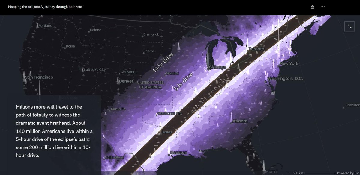
Excellent blog by Cooper Thomas from the Esri StoryMaps team on using Map Viewer-based workflows for the story, Mapping the eclipse: A journey through darkness. Follow along to see how you can use these workflows. ow.ly/uYy850R5GvS

StoryMap: ow.ly/xeqj30sBeZR

Excellent blog by Cooper Thomas from the @Esri StoryMaps team on using Map Viewer-based workflows for the story, Mapping the eclipse: A journey through darkness. Follow along to see how you can use these workflows. ow.ly/uYy850R5GvS

StoryMap: ow.ly/xeqj30sBeZR
account_circle
Copernicus ECMWF(@CopernicusECMWF) 's Twitter Profile Photo

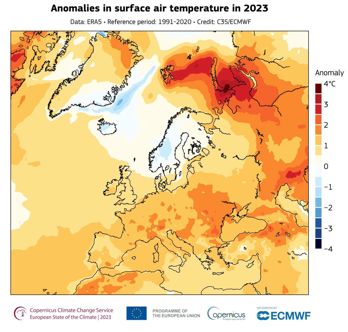
The first report produced jointly with World Meteorological Organization provides data and insights about WMO’s Regional Association VI members and a focus on Policy & Action.

See WMO’s storymap summary of the report: storymaps.arcgis.com/stories/58d385…

The first #ESOTC report produced jointly with @WMO provides data and insights about WMO’s Regional Association VI members and a focus on Policy & Action.

See WMO’s storymap summary of the report: storymaps.arcgis.com/stories/58d385…
account_circle