Utah Geological(@utahgeological) 's Twitter Profileg
Utah Geological

@utahgeological

The Utah Geological Survey (UGS) provides timely scientific information about Utah’s geologic environment, resources, and hazards.

ID:111068842

linkhttp://geology.utah.gov calendar_today03-02-2010 18:16:43

3,5K Tweets

8,8K Followers

231 Following

Utah Geological(@utahgeological) 's Twitter Profile Photo

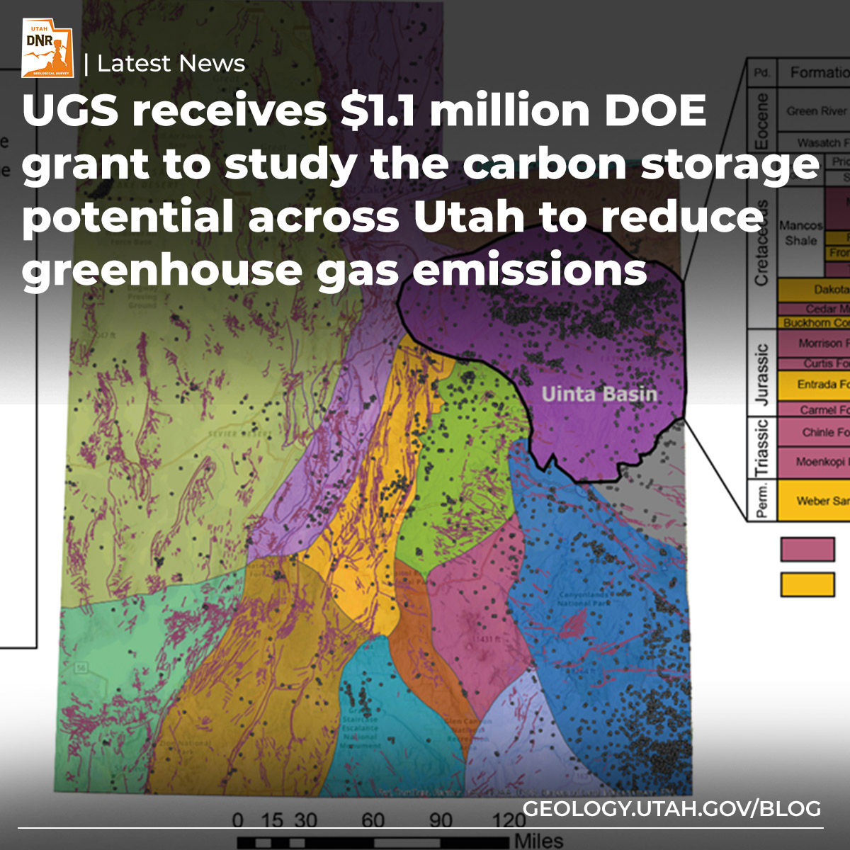
The Utah Geological Survey has received a $1.1M grant from the DOE to study the state's potential for geologic carbon storage, aiming to reduce greenhouse gas emissions. Learn more here–ow.ly/j8I750RzFve

The Utah Geological Survey has received a $1.1M grant from the DOE to study the state's potential for geologic carbon storage, aiming to reduce greenhouse gas emissions. Learn more here–ow.ly/j8I750RzFve #energynews #utahgeology
account_circle
Utah Geological(@utahgeological) 's Twitter Profile Photo

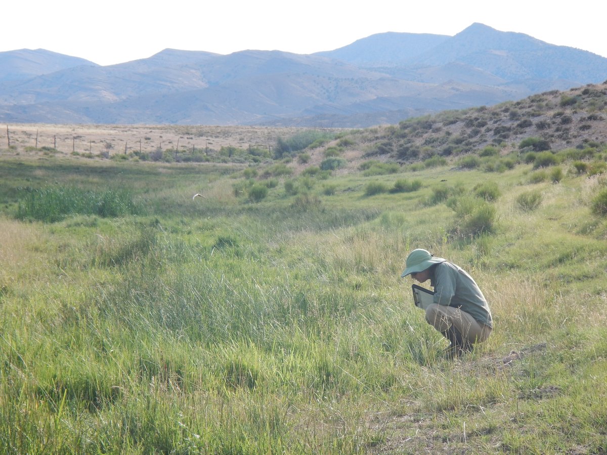
Happy ! Since 2013, our teams have surveyed over 500 sites, focusing on plants, soil, water, and stressors to assess wetland health. Dive into our plant survey data here: ow.ly/O1HS50Rzl89

Happy #WetlandWednesday! Since 2013, our teams have surveyed over 500 sites, focusing on plants, soil, water, and stressors to assess wetland health. Dive into our plant survey data here: ow.ly/O1HS50Rzl89 #utahgeology #wetlandplants
account_circle
Utah Geological(@utahgeological) 's Twitter Profile Photo

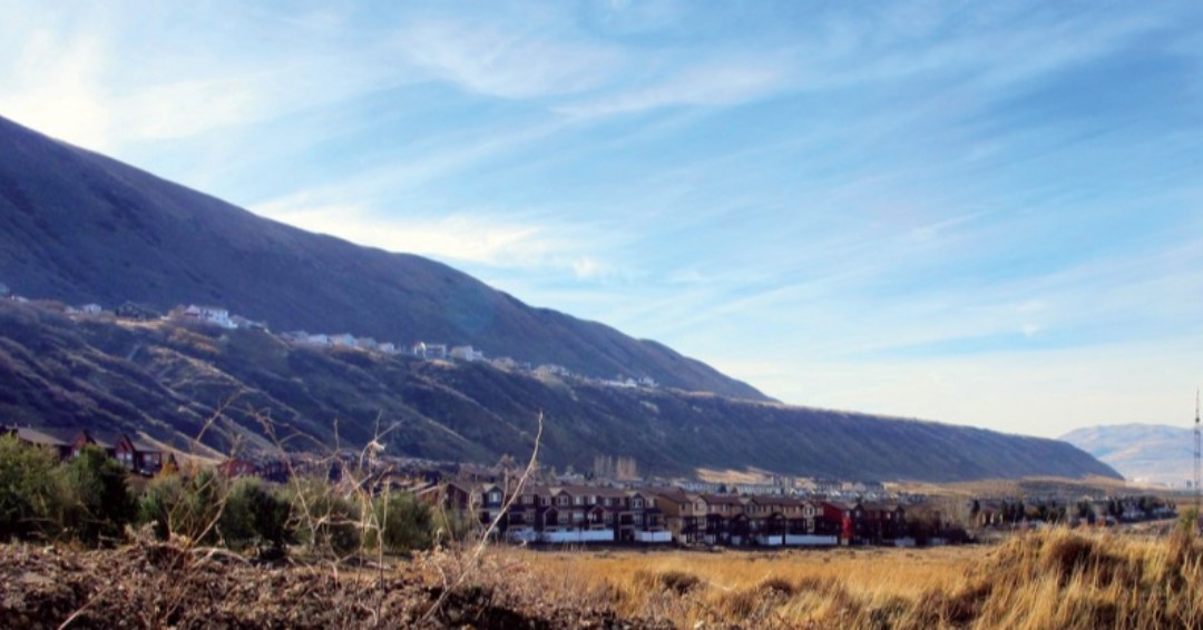
Standing at Point of the Mountain today, you'd see paragliders and hang gliders soaring. But 18,000 years ago? Waves from Lake Bonneville, glacier calving, and even mammoths or saber-toothed cats might have been common sights.
ow.ly/qVGp50CEYhT

Standing at Point of the Mountain today, you'd see paragliders and hang gliders soaring. But 18,000 years ago? Waves from Lake Bonneville, glacier calving, and even mammoths or saber-toothed cats might have been common sights. ow.ly/qVGp50CEYhT #utahgeology #geosight
account_circle
Utah Geological(@utahgeological) 's Twitter Profile Photo

Check out the 75th-anniversary issue of Survey Notes featuring a timeline of important events in the history of the UGS, an article on the evolution within each of the Survey’s programs, employee reflections, and much more. ow.ly/6OoY50RxvLX

Check out the 75th-anniversary issue of Survey Notes featuring a timeline of important events in the history of the UGS, an article on the evolution within each of the Survey’s programs, employee reflections, and much more. ow.ly/6OoY50RxvLX #utahgeology

account_circle
Utah Geological(@utahgeological) 's Twitter Profile Photo

Did you feel it? On Sunday, May 5, 2024, at 5:30 pm, Tremonton experienced a magnitude (M) 4.4 earthquake with an epicenter 16 miles southwest of Tremonton. Learn more about what to do before, during, and after an earthquake and more FAQs at earthquakes.utah.gov.

account_circle
Utah Geological(@utahgeological) 's Twitter Profile Photo

Planning your summer outdoor adventures? Visit the Natural Resources Map & Bookstore! Specializing in maps and guides for hiking, OHV, hunting, fishing, and more. Find over 1,500 USGS maps and on-demand prints for the US. Check us out in SLC, or at utahmapstore.com!

Planning your summer outdoor adventures? Visit the Natural Resources Map & Bookstore! Specializing in maps and guides for hiking, OHV, hunting, fishing, and more. Find over 1,500 USGS maps and on-demand prints for the US. Check us out in SLC, or at utahmapstore.com!
account_circle
Utah Geological(@utahgeological) 's Twitter Profile Photo

Happy Fossil Friday!
Horn coral fossils in the Mississippian-age Great Blue Limestone, Wellsville Mountains, Cache County.
Photographer: Grant Willis

Happy Fossil Friday! Horn coral fossils in the Mississippian-age Great Blue Limestone, Wellsville Mountains, Cache County. Photographer: Grant Willis #fossilfriday #utahgeology
account_circle
Utah Geological(@utahgeological) 's Twitter Profile Photo

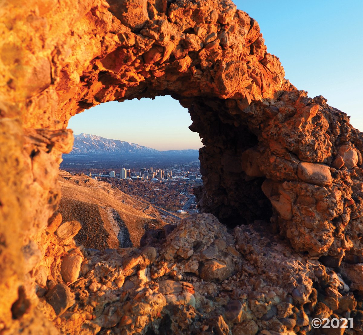
Jones Cnyn, Salt Lake Cty
Photo by Mark Milligan

'Industrial Arch,' just N. of downtown Salt Lake City, is one of two scenic arches in a 45-50 m.y. old conglomerate. Recently shaped by erosion after the Wasatch Fault uplift exposed the rock, forming the Wasatch Range.

Jones Cnyn, Salt Lake Cty Photo by Mark Milligan 'Industrial Arch,' just N. of downtown Salt Lake City, is one of two scenic arches in a 45-50 m.y. old conglomerate. Recently shaped by erosion after the Wasatch Fault uplift exposed the rock, forming the Wasatch Range.
account_circle
Utah Geological(@utahgeological) 's Twitter Profile Photo

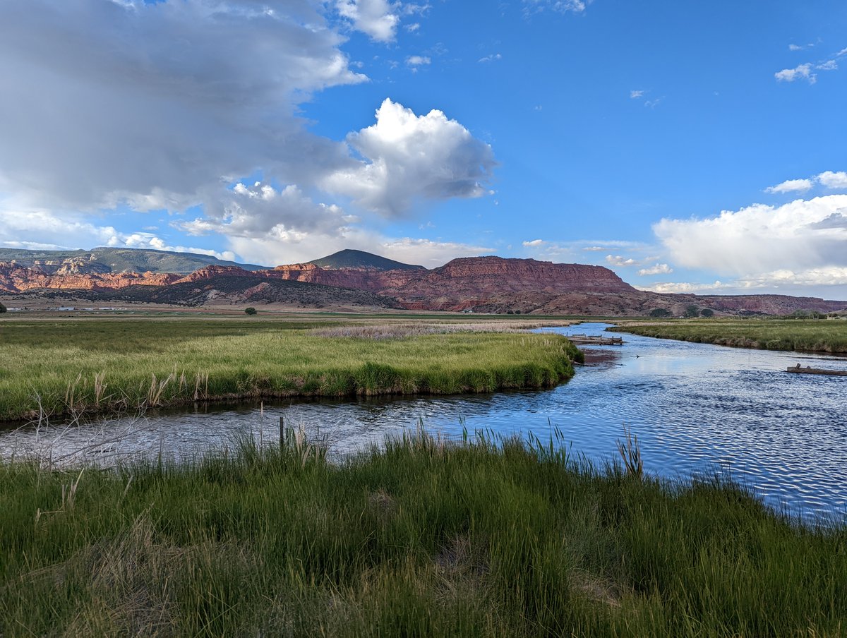
Not quite water, not quite land, a marshy maze, alive and grand! Wetland Wednesday posts are back for American Wetlands Month. Did you know UGS studies wetlands? Check out our webpage to learn more about these vital ecosystems: ow.ly/Ebrj50RtrBX

Not quite water, not quite land, a marshy maze, alive and grand! Wetland Wednesday posts are back for American Wetlands Month. Did you know UGS studies wetlands? Check out our webpage to learn more about these vital ecosystems: ow.ly/Ebrj50RtrBX #wetlandwednesday
account_circle
Utah Geological(@utahgeological) 's Twitter Profile Photo

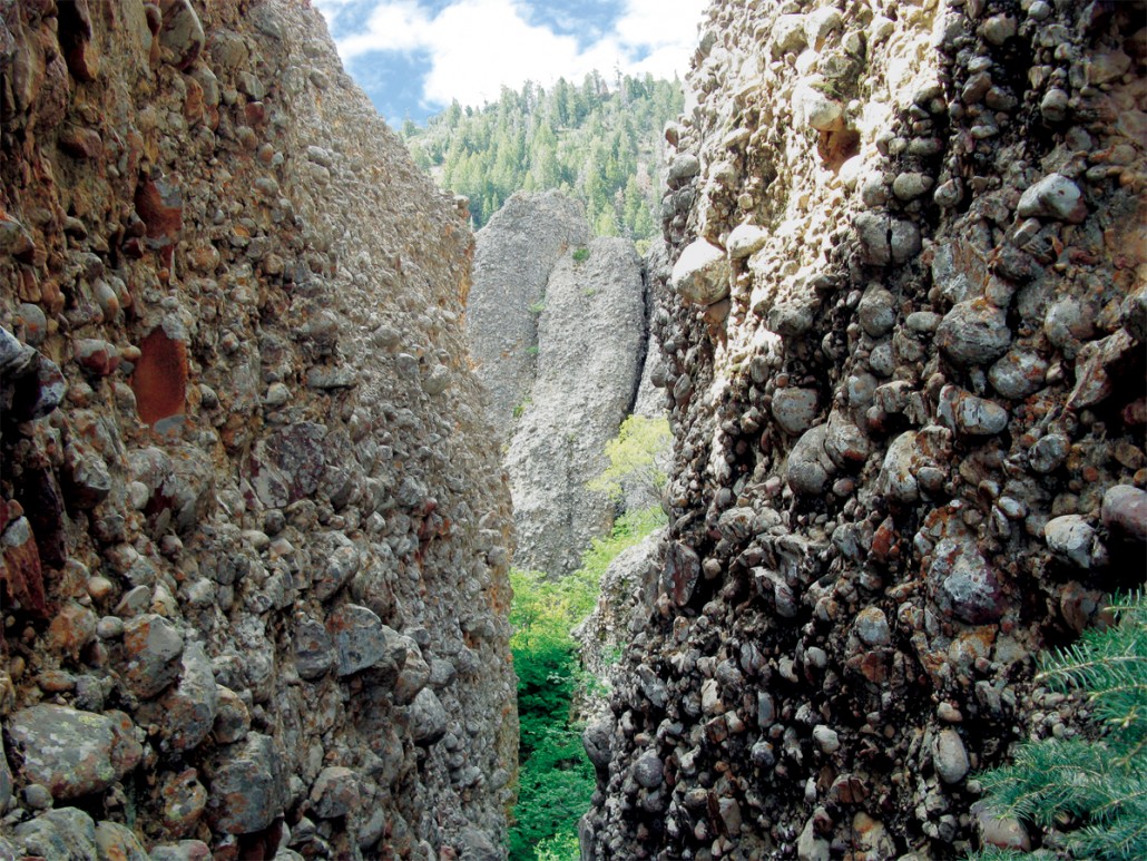
Cretaceous-age conglomerate deposited during a mountain-building episode 75 million years ago.
Maple Canyon, eastern San Pitch Mountains, Sanpete County, Utah.
Photographer: Don Clark

Cretaceous-age conglomerate deposited during a mountain-building episode 75 million years ago. Maple Canyon, eastern San Pitch Mountains, Sanpete County, Utah. Photographer: Don Clark
account_circle
Utah Geological(@utahgeological) 's Twitter Profile Photo

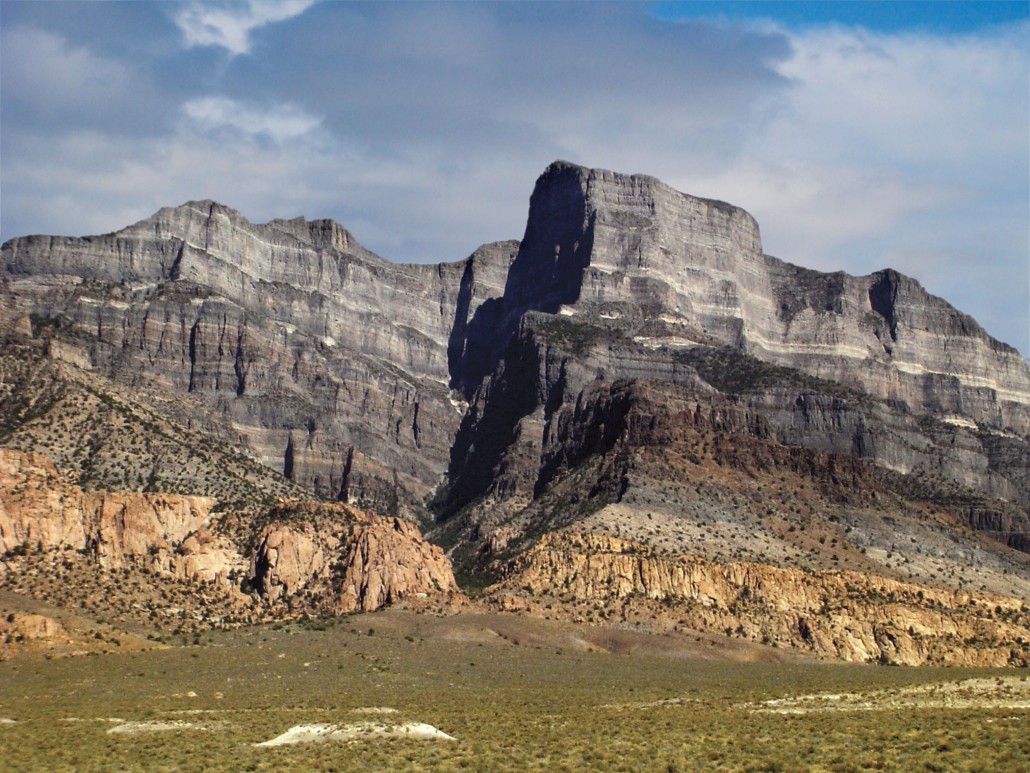
Tucked away in the House Range west of Delta, Notch Peak stands with one of the greatest vertical drops in the contiguous U.S. How does Notch Peak measure up to other tall cliffs? Find out here!–ow.ly/eCFx50EJW0Q

Tucked away in the House Range west of Delta, Notch Peak stands with one of the greatest vertical drops in the contiguous U.S. How does Notch Peak measure up to other tall cliffs? Find out here!–ow.ly/eCFx50EJW0Q #utahgeology
account_circle
Utah Geological(@utahgeological) 's Twitter Profile Photo

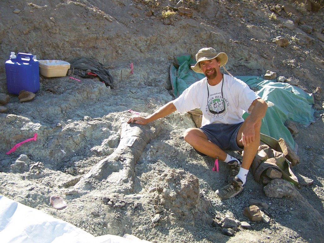
Although most of the fossil bones you see on display in museums might look strong, most of them were not found in that condition. Here, UGS preparator Don DeBlieux is next to a partially excavated dinosaur humerus (upper arm bone) in the field.

Although most of the fossil bones you see on display in museums might look strong, most of them were not found in that condition. Here, UGS preparator Don DeBlieux is next to a partially excavated dinosaur humerus (upper arm bone) in the field. #FossilFriday
account_circle
Utah Geological(@utahgeological) 's Twitter Profile Photo

It's National Parks Week! Celebrate with a visit to one of Utah's five national parks or plan a trip with a hiking and recreation guide from the Natural Resources Map & Bookstore. Stop by if you're in Salt Lake City or visit utahmapstore.com.

It's National Parks Week! Celebrate with a visit to one of Utah's five national parks or plan a trip with a hiking and recreation guide from the Natural Resources Map & Bookstore. Stop by if you're in Salt Lake City or visit utahmapstore.com. #nationalparksweek
account_circle
Utah Geological(@utahgeological) 's Twitter Profile Photo

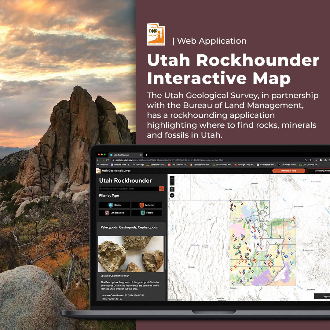
Looking to explore rocks, minerals, fossils, or beautiful landscape rocks? Check out our web app! Tailor your search based on your interests and get detailed information including location descriptions, land ownership, coordinates, directions, and photos. –geology.utah.gov/apps/rockhound…

Looking to explore rocks, minerals, fossils, or beautiful landscape rocks? Check out our web app! Tailor your search based on your interests and get detailed information including location descriptions, land ownership, coordinates, directions, and photos. –geology.utah.gov/apps/rockhound…
account_circle
Utah Geological(@utahgeological) 's Twitter Profile Photo

Paria Canyon-Vermilion Cliffs Wilderness Area, Kane Cty
Photo by Trevor Schlossnagle

A golden palette of Jurassic Navajo Sandstone eolian cross-beds fans out. In the distance, the gray and tan Permian Kaibab Formation is topped by the reddish-orange Triassic Moenkopi Formation.

Paria Canyon-Vermilion Cliffs Wilderness Area, Kane Cty Photo by Trevor Schlossnagle A golden palette of Jurassic Navajo Sandstone eolian cross-beds fans out. In the distance, the gray and tan Permian Kaibab Formation is topped by the reddish-orange Triassic Moenkopi Formation.
account_circle
Utah Geological(@utahgeological) 's Twitter Profile Photo

The rock layers of the Grand Staircase in UT's Colorado Plateau region are a popular destination for tourists and geologists alike. The rock layers are compared to pages of an open book inviting visitors to look back at the area's geologic history. –ow.ly/YBwO50FDFw4

The rock layers of the Grand Staircase in UT's Colorado Plateau region are a popular destination for tourists and geologists alike. The rock layers are compared to pages of an open book inviting visitors to look back at the area's geologic history. –ow.ly/YBwO50FDFw4
account_circle
Utah Geological(@utahgeological) 's Twitter Profile Photo

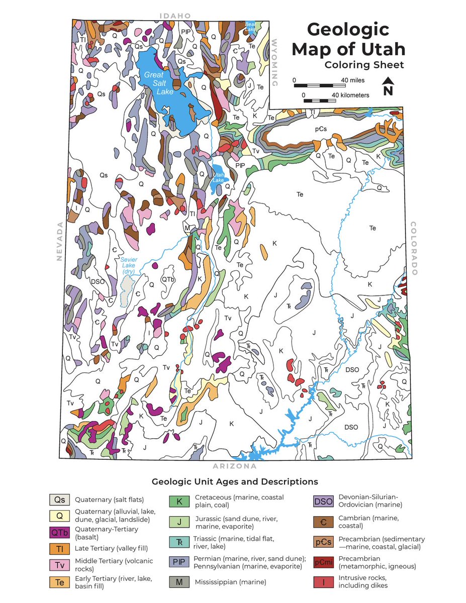
Geologic maps use a combination of colors, lines, and symbols to depict the relative age, composition, and relationships among rocks and sediments at and near the earth’s surface. Click here to download and print the color-by-number activity–ow.ly/RB0U50PMReH

Geologic maps use a combination of colors, lines, and symbols to depict the relative age, composition, and relationships among rocks and sediments at and near the earth’s surface. Click here to download and print the color-by-number activity–ow.ly/RB0U50PMReH #mappingmonday
account_circle
Utah Geological(@utahgeological) 's Twitter Profile Photo

Happy Fossil Friday! One of our most popular publications, 'Exceptional Cambrian Fossils from Utah—A Window Into the Age of Trilobites,' can be purchased at the Natural Resources Map & Bookstore. Find this and other books in Salt Lake City, or utahmapstore.com.

Happy Fossil Friday! One of our most popular publications, 'Exceptional Cambrian Fossils from Utah—A Window Into the Age of Trilobites,' can be purchased at the Natural Resources Map & Bookstore. Find this and other books in Salt Lake City, or utahmapstore.com.
account_circle
Utah Geological(@utahgeological) 's Twitter Profile Photo

Today at 10:15 a.m., DNR employees took 60 seconds to drop, cover, and hold on during the Great Utah ShakeOut as an opportunity to learn what to do before, during, and after an earthquake.
Visit earthquakes.utah.gov/#prepare for more information.

Today at 10:15 a.m., DNR employees took 60 seconds to drop, cover, and hold on during the Great Utah ShakeOut as an opportunity to learn what to do before, during, and after an earthquake. Visit earthquakes.utah.gov/#prepare for more information. #ShakeOut2024
account_circle
Utah Geological(@utahgeological) 's Twitter Profile Photo

Don't forget to drop, cover, and hold on today at 10:15 am because it's the Great Utah Shakeout! Let's ensure we're all prepared for any seismic event. Join us as we participate in the largest earthquake drill in the state. Register here–shakeout.org/utah

Don't forget to drop, cover, and hold on today at 10:15 am because it's the Great Utah Shakeout! Let's ensure we're all prepared for any seismic event. Join us as we participate in the largest earthquake drill in the state. Register here–shakeout.org/utah #ShakeOut2024
account_circle