National Snow and Ice Data Center(@NSIDC) 's Twitter Profileg
National Snow and Ice Data Center

@NSIDC

Advancing knowledge of Earth's frozen regions.

ID:16229491

linkhttp://nsidc.org calendar_today10-09-2008 22:34:31

6,4K Tweets

19,4K Followers

646 Following

National Snow and Ice Data Center(@NSIDC) 's Twitter Profile Photo

QGreenland, a free mapping tool to support interdisciplinary Greenland-focused research, teaching, decision making, and collaboration, combines key datasets into a unified, all-in-one GIS analysis and visualization environment for offline & online use. qgreenland.org

account_circle
National Snow and Ice Data Center(@NSIDC) 's Twitter Profile Photo

Thwaites Glacier in Antarctica is already a major contributor to global sea level rise and a collapse of the glacier could increase sea levels up to 65 centimeters (2 feet) in the coming centuries. Learn more about why scientists are studying the glacier: bit.ly/3YOazaJ

account_circle
National Snow and Ice Data Center(@NSIDC) 's Twitter Profile Photo

Sea ice plays a critical role in regulating Earth’s climate. NSIDC’s Arctic Sea Ice News & Analysis project provides near real-time data and monthly insights & analyses on how Arctic sea ice is changing and what conditions may be playing a role. nsidc.org/our-research/f…

account_circle
National Snow and Ice Data Center(@NSIDC) 's Twitter Profile Photo

When is the Northeast Passage accessible for shipping? A recent study looked at data from 2002 to 2021, analyzing its navigability from July to October. Some NSIDC DAAC data were used in the study. Read the paper to learn more: tandfonline.com/doi/full/10.10…

account_circle
National Snow and Ice Data Center(@NSIDC) 's Twitter Profile Photo

IceBridge ATM Waveform Derived Snow Effective Grain Radius V1, is available at the NSIDC DAAC. This data set contains surface grain size estimates of snow & ice derived from waveform measurements from NASA's Airborne Topographic Mapper instrumentation. bit.ly/3w3wJxk

IceBridge ATM Waveform Derived Snow Effective Grain Radius V1, is available at the NSIDC DAAC. This data set contains surface grain size estimates of snow & ice derived from waveform measurements from NASA's Airborne Topographic Mapper instrumentation. bit.ly/3w3wJxk
account_circle
National Snow and Ice Data Center(@NSIDC) 's Twitter Profile Photo

The SnowEx23 Univ of Wyoming Ground Penetrating Radar data set is now available at the NSIDC DAAC. It contains the results of ground-penetrating radar surveys conducted at the Arctic Coastal Plain & Upper Kuparuk/Toolik sites in Alaska during SnowEx23. bit.ly/3xLl5aT

account_circle
National Snow and Ice Data Center(@NSIDC) 's Twitter Profile Photo

Our NOAA@NSIDC program preserves data over the long term to support current & future research. Data products serve scientists engaged in research, decision makers planning activities affected by snow and ice, and more. Learn more: nsidc.org/data/data-prog…

account_circle
National Snow and Ice Data Center(@NSIDC) 's Twitter Profile Photo

In this photo captured by Ben Holt in 1987, scientist Frank Carsey drills into the sea ice. NOAA@NSIDC holds a collection of sea ice thickness measurements of the Arctic Ocean from 1879, starting with the fated Jeannette Expedition, to 2016. Learn more: nsidc.org/data/g10011/ve…

In this photo captured by Ben Holt in 1987, scientist Frank Carsey drills into the sea ice. NOAA@NSIDC holds a collection of sea ice thickness measurements of the Arctic Ocean from 1879, starting with the fated Jeannette Expedition, to 2016. Learn more: nsidc.org/data/g10011/ve…
account_circle
National Snow and Ice Data Center(@NSIDC) 's Twitter Profile Photo

Daily monitoring of the Greenland Ice Sheet is back! Find these two maps on our Ice Sheets Today page: the Greenland daily melt map and the Greenland cumulative melt days map. Analyses about conditions on the Greenland Ice Sheet will return soon as well. nsidc.org/ice-sheets-tod…

Daily monitoring of the Greenland Ice Sheet is back! Find these two maps on our Ice Sheets Today page: the Greenland daily melt map and the Greenland cumulative melt days map. Analyses about conditions on the Greenland Ice Sheet will return soon as well. nsidc.org/ice-sheets-tod…
account_circle
National Snow and Ice Data Center(@NSIDC) 's Twitter Profile Photo

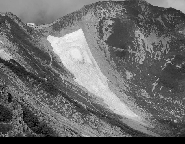
This 2006 image of Hamaguri Yuki Glacier is a part of our Glacier Photograph Collection, an online, searchable collection of more than 25,000 glacier photographs. This is the only photo of a Japanese glacier in the collection. nsidc.org/data/glacier_p…

This 2006 image of Hamaguri Yuki Glacier is a part of our Glacier Photograph Collection, an online, searchable collection of more than 25,000 glacier photographs. This is the only photo of a Japanese glacier in the collection. nsidc.org/data/glacier_p…
account_circle
National Snow and Ice Data Center(@NSIDC) 's Twitter Profile Photo

There are 2 broad categories of glaciers: alpine glaciers and ice sheets. Alpine glaciers are frozen rivers of ice, slowly flowing under their own weight down mountainsides and into valleys. Ice sheets cover entire continents. nsidc.org/learn/parts-cr…

account_circle
National Snow and Ice Data Center(@NSIDC) 's Twitter Profile Photo

In late February & early March, two record melt events for that time of year occurred on the Antarctic Peninsula. Overall, the seasonal melt for the 2023-2024 Antarctic Ice Sheet melt season was slightly below the 45-year average. Read the analysis: bit.ly/4aPkjbQ

account_circle
National Snow and Ice Data Center(@NSIDC) 's Twitter Profile Photo

'Follow what you’re passionate about.' When Ann Windnagel, a project manager at NSIDC, was asked what advice she would give to a student who wants to pursue a career in science, that's what she said! Learn more about the many hats Ann wears at NSIDC: nsidc.org/news-analyses/…

account_circle
National Snow and Ice Data Center(@NSIDC) 's Twitter Profile Photo

The Silalirijiit Project was an innovative effort to engage community members and stakeholders to better monitor and understand the weather of Baffin Island’s Clyde River region. NSIDC's involvement in the project ended in 2023. nsidc.org/news-analyses/…

account_circle
CIRES CEEE(@CiresCEEE) 's Twitter Profile Photo

Our Alyse Thurber and National Snow and Ice Data Center’s Twila Moon wrote a feature in WWF Global Arctic Programme’sCircle issue. Their piece, Mapping Greenland: Free Research Tool Inspires Research and Learning bolsters the power of Greenland's cross-cutting data to understand our climate
❄️arcticwwf.org/magazine-issue…
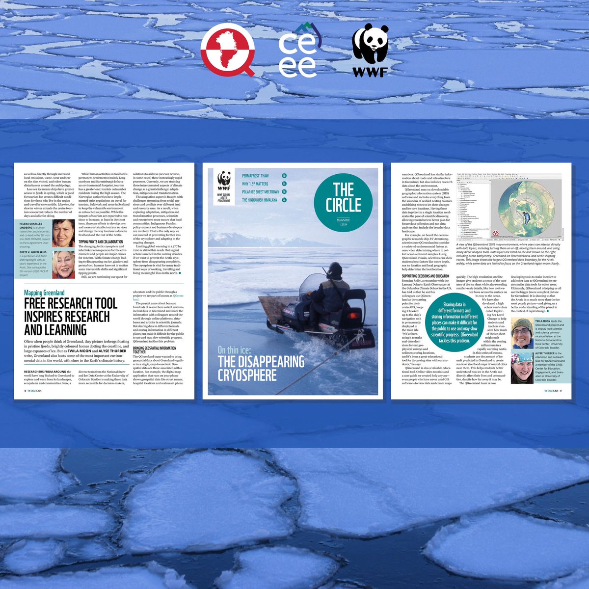
Our Alyse Thurber and @NSIDC’s Twila Moon wrote a feature in @WWF_Arctic’sCircle issue. Their piece, Mapping Greenland: Free Research Tool Inspires Research and Learning bolsters the power of Greenland's cross-cutting data to understand our climate ❄️arcticwwf.org/magazine-issue…
account_circle
CIRES(@CIRESnews) 's Twitter Profile Photo

Happy ! CIRES scientists study a wide range of Earth system science topics, including weather and climate, changes at Earth’s poles, atmospheric chemistry, water resources, and solid Earth sciences. Learn more about our research: cires.colorado.edu/research

Happy #EarthDay! CIRES scientists study a wide range of Earth system science topics, including weather and climate, changes at Earth’s poles, atmospheric chemistry, water resources, and solid Earth sciences. Learn more about our research: cires.colorado.edu/research
account_circle
National Snow and Ice Data Center(@NSIDC) 's Twitter Profile Photo

Have you checked out the Arctic Meltdown Specialization from Coursera yet? This course is run by NSIDC director Mark C. Serreze and has a flexible schedule so students can learn at their own pace. coursera.org/specialization…

account_circle
National Snow and Ice Data Center(@NSIDC) 's Twitter Profile Photo

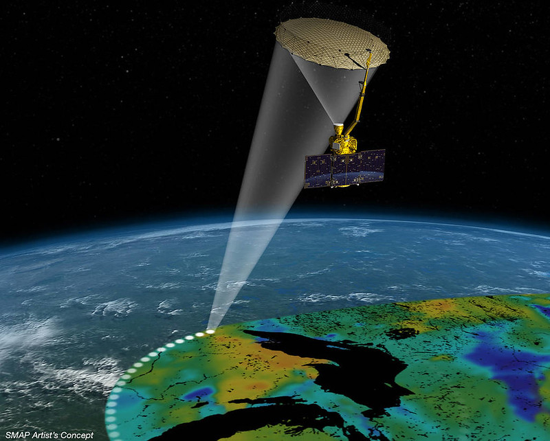
The Soil Moisture Active Passive (SMAP) orbiting observatory measures surface soil conditions everywhere on Earth every 2-3 days, distinguishing between ground that is frozen or thawed. Check out the SMAP data collection at the NSIDC DAAC: nsidc.org/data/smap

The Soil Moisture Active Passive (SMAP) orbiting observatory measures surface soil conditions everywhere on Earth every 2-3 days, distinguishing between ground that is frozen or thawed. Check out the SMAP data collection at the NSIDC DAAC: nsidc.org/data/smap
account_circle
National Snow and Ice Data Center(@NSIDC) 's Twitter Profile Photo

The Library of Congress is acquiring 1,200 prints from James Balog's photographic study of the relationship between humanity & the natural environment. This story will run on CBS Sunday Morning 🌞 4/21. Some photos are from the Extreme Ice Survey collection at NSIDC: nsidc.org/data/nsidc-078…

The @librarycongress is acquiring 1,200 prints from James Balog's photographic study of the relationship between humanity & the natural environment. This story will run on @CBSSunday 4/21. Some photos are from the Extreme Ice Survey collection at NSIDC: nsidc.org/data/nsidc-078…
account_circle
National Snow and Ice Data Center(@NSIDC) 's Twitter Profile Photo

We're hiring! NSIDC is searching for a DAAC Project Manager (bit.ly/3Q27bHQ) and a DAAC Data Product Team Lead (bit.ly/4aUkUbF). Know anyone who might be a good fit? Please share! Photo credit: Carrie Vuyovich, NASA

We're hiring! NSIDC is searching for a DAAC Project Manager (bit.ly/3Q27bHQ) and a DAAC Data Product Team Lead (bit.ly/4aUkUbF). Know anyone who might be a good fit? Please share! Photo credit: Carrie Vuyovich, NASA
account_circle