Steve Templeton(@SteveTempleton) 's Twitter Profileg
Steve Templeton

@SteveTempleton

Chief Meteorologist #KMOV #STL. Love active wx, it's when my job is most important. Love BBQ & most of all family. Two kids keep me smiling & tired

ID:23949947

linkhttps://www.kmov.com/authors/Steve.Templeton/ calendar_today12-03-2009 13:55:54

27,8K Tweets

13,6K Followers

1,4K Following

Steve Templeton(@SteveTempleton) 's Twitter Profile Photo

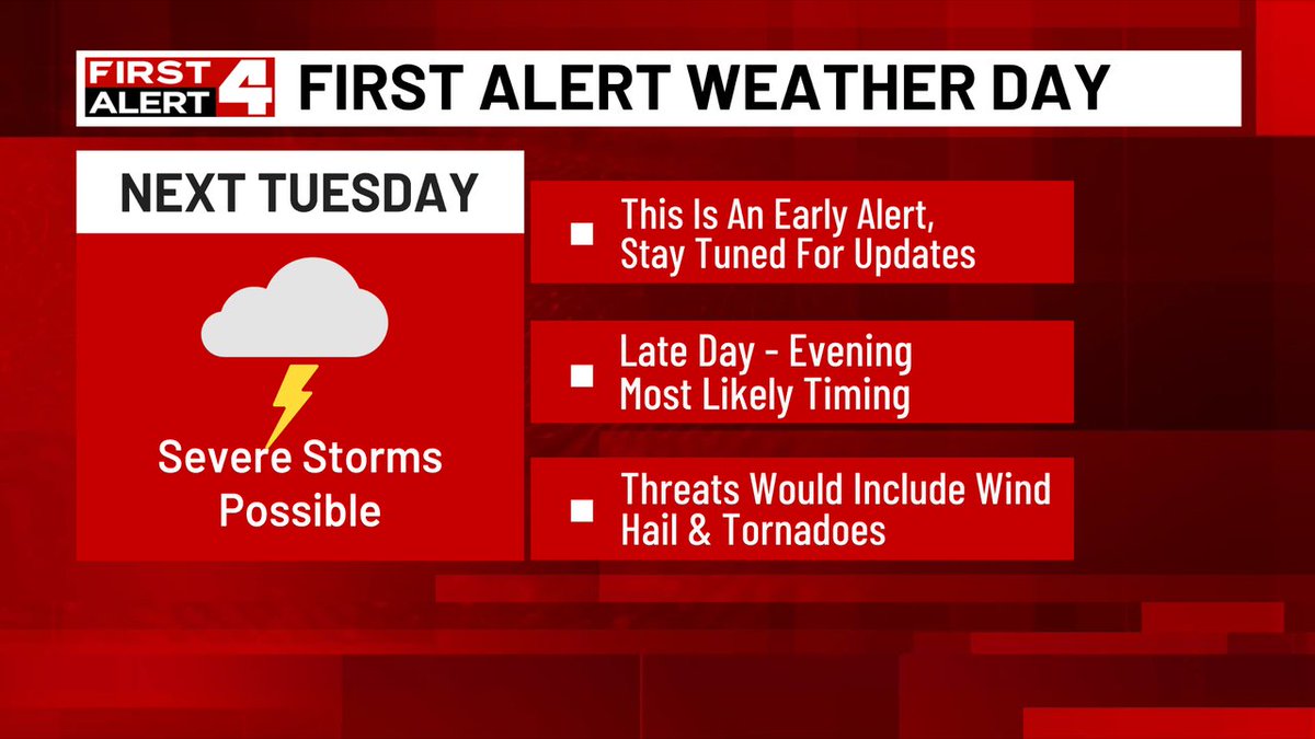
First Alert Weather Day issued for next Tuesday. It's an early alert, but we see potential for the ingredients to come together for severe weather late day or evening next Tuesday. Check in with First Alert 4 for more updates as we get closer to Tuesday

First Alert Weather Day issued for next Tuesday. It's an early alert, but we see potential for the ingredients to come together for severe weather late day or evening next Tuesday. Check in with First Alert 4 for more updates as we get closer to Tuesday #FirstAlert4
account_circle
Steve Templeton(@SteveTempleton) 's Twitter Profile Photo

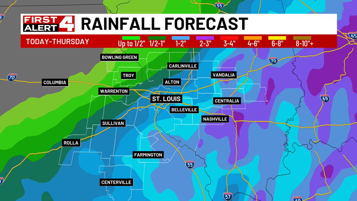
Some more soggy weather ahead as today and Thursday will combine for around 1' in St. Louis and more to the southeast, less to the northwest. Rain will turn steadier and heavier by this evening and continue overnight.

Some more soggy weather ahead as today and Thursday will combine for around 1' in St. Louis and more to the southeast, less to the northwest. Rain will turn steadier and heavier by this evening and continue overnight. #FirstAlert4
account_circle
Steve Templeton(@SteveTempleton) 's Twitter Profile Photo

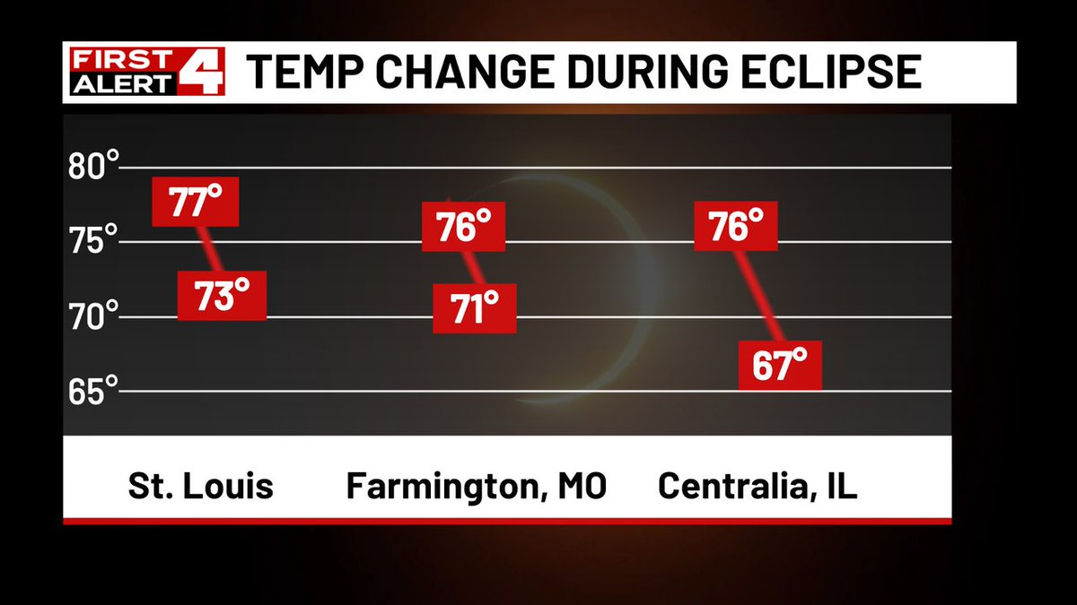
Check out the temperature drop we had during the Eclipse. And wow, how about that great weather! Couldn't order it up any better!

Check out the temperature drop we had during the Eclipse. And wow, how about that great weather! Couldn't order it up any better! #FirstAlert4
account_circle
Steve Templeton(@SteveTempleton) 's Twitter Profile Photo

First First Alert 4 Weather...A new Severe Storm Warning Warning issued for Marion, Clinton, Washington. Track the storms on radar at bit.ly/3v79dLm

account_circle
Steve Templeton(@SteveTempleton) 's Twitter Profile Photo

First First Alert 4 Weather...A new Severe Storm Warning Warning issued for Fayette, Marion. Track the storms on radar at bit.ly/3v79dLm

account_circle
Steve Templeton(@SteveTempleton) 's Twitter Profile Photo

First First Alert 4 Weather...A new Severe Storm Warning Warning issued for Clay, Effingham. Track the storms on radar at bit.ly/3v79dLm

account_circle
Steve Templeton(@SteveTempleton) 's Twitter Profile Photo

First First Alert 4 Weather...A new Severe Storm Warning Warning issued for Marion, Clinton, Washington. Track the storms on radar at bit.ly/3v79dLm

account_circle
Steve Templeton(@SteveTempleton) 's Twitter Profile Photo

First First Alert 4 Weather...A new Severe Storm Warning Warning issued for Marion, Clinton. Track the storms on radar at bit.ly/3v79dLm

account_circle
Steve Templeton(@SteveTempleton) 's Twitter Profile Photo

From First Alert 4 Weather...A new Tornado Warning issued for Fayette, Marion. Track the storms on radar at bit.ly/3v79dLm

account_circle
Steve Templeton(@SteveTempleton) 's Twitter Profile Photo

First First Alert 4 Weather...A new Severe Storm Warning Warning issued for Clinton, Bond, Fayette. Track the storms on radar at bit.ly/3v79dLm

account_circle
Steve Templeton(@SteveTempleton) 's Twitter Profile Photo

We expect high clouds for the Eclipse Monday, but the big question is how thick they'll be. You can see a good visual here of potential outcomes, the thickest (Option 3) would really put a damper on the Eclipse, if they're not quite that thick it will be decent viewing.

We expect high clouds for the Eclipse Monday, but the big question is how thick they'll be. You can see a good visual here of potential outcomes, the thickest (Option 3) would really put a damper on the Eclipse, if they're not quite that thick it will be decent viewing.
account_circle
Steve Templeton(@SteveTempleton) 's Twitter Profile Photo

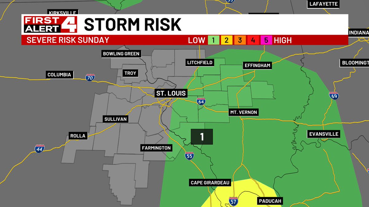
First Alert Weather Day for this area in a lowest level 1 severe threat today. Stay alert in Illinois as isolated storms move east this afternoon, gone by evening.

account_circle
Leah Hill ⚑️ πŸ‘(@leahwx4) 's Twitter Profile Photo

Watch for iso. storms this afternoon, mainly for areas east. Winds up to 60mph and hail up to 1' are the primary threats. Most of us will be missed by the storms, but I want to make sure you're paying attention. Especially if you're in Illinois.

Watch for iso. storms this afternoon, mainly for areas east. Winds up to 60mph and hail up to 1' are the primary threats. Most of us will be missed by the storms, but I want to make sure you're paying attention. Especially if you're in Illinois. #4FirstAlert #mowx #ilwx #stlwx
account_circle
Steve Templeton(@SteveTempleton) 's Twitter Profile Photo

Great visual example of the high clouds we could face on Monday for the Eclipse. The question is how thick they will be. High clouds tend to be thin and could allow for decent viewing, but when they get thick like in the photo on the right, it's a problem.

account_circle
Steve Templeton(@SteveTempleton) 's Twitter Profile Photo

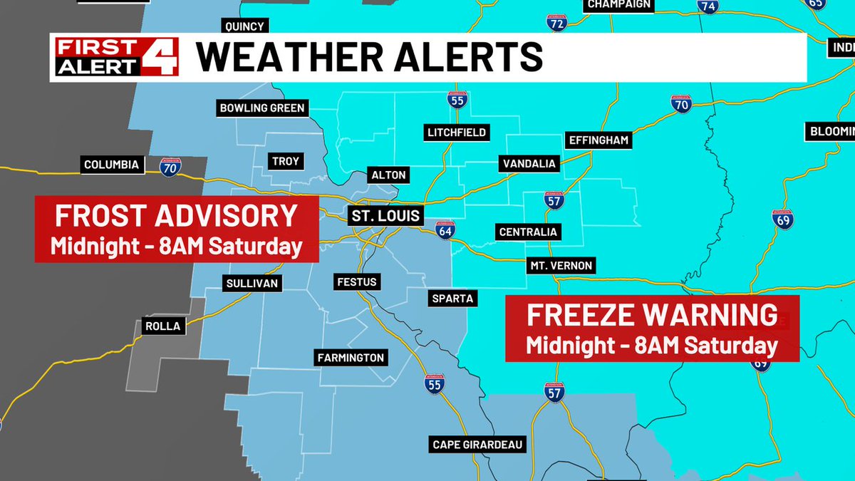
Just a heads up that we have one more chilly night, frosty in STL with a low near 35 but some outlying areas east may have a light freeze with temps slightly below freezing. Then a warmer day and weekend is on tap.

Just a heads up that we have one more chilly night, frosty in STL with a low near 35 but some outlying areas east may have a light freeze with temps slightly below freezing. Then a warmer day and weekend is on tap. #FirstAlert4
account_circle