Weather2020(@Weather2020) 's Twitter Profileg
Weather2020

@Weather2020

Weather2020 is a predictive weather modeling platform, helping leaders anticipate business-impacting weather events months in advance

ID:223613994

linkhttp://www.weather2020.com calendar_today06-12-2010 21:37:46

4,4K Tweets

44,3K Followers

14,2K Following

Follow People
Gary Lezak(@glezak) 's Twitter Profile Photo

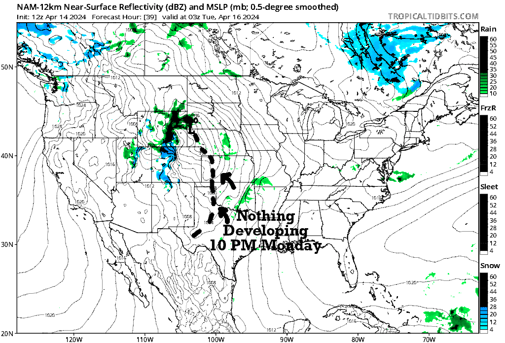
Severe Weather Risk Problems for Monday. Storm Chasers may be waiting until after sunset, or hoping for 'sunset magic' Monday. The energy of the storm, the vorticity, is parallel to the flow, limiting rising motion until after around 10 PM Monday? Something to monitor!

Severe Weather Risk Problems for Monday. Storm Chasers may be waiting until after sunset, or hoping for 'sunset magic' Monday. The energy of the storm, the vorticity, is parallel to the flow, limiting rising motion until after around 10 PM Monday? Something to monitor!
account_circle
Gary Lezak(@glezak) 's Twitter Profile Photo

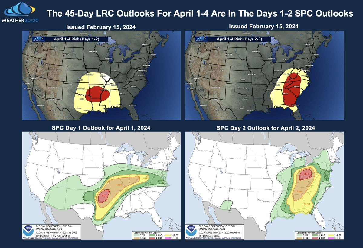
The risk was increased by the SPC to a level 4 out of 5 over Oklahoma. The 45-day prediction allows for long term planning for these risks and not a last second scramble. This part of the is directly related to 11/20/2023 when 16 tornadoes struck Louisiana & Mississippi.

The risk was increased by the SPC to a level 4 out of 5 over Oklahoma. The 45-day prediction allows for long term planning for these risks and not a last second scramble. This part of the #LRC is directly related to 11/20/2023 when 16 tornadoes struck Louisiana & Mississippi.
account_circle
Gary Lezak(@glezak) 's Twitter Profile Photo

Thundersnow! Watch for the flash of lightning, then listen for the thunder. It just dropped from 47 to 32 in 15 minutes! I’m mesmerized! Heavy thunder snow & graupel in Golden, CO!

account_circle
Gary Lezak(@glezak) 's Twitter Profile Photo

Check out my latest article: Long-Range Severe Weather Prediction Using The LRC linkedin.com/pulse/long-ran… via LinkedIn

account_circle
Connor Croff(@ChasingWConnor) 's Twitter Profile Photo

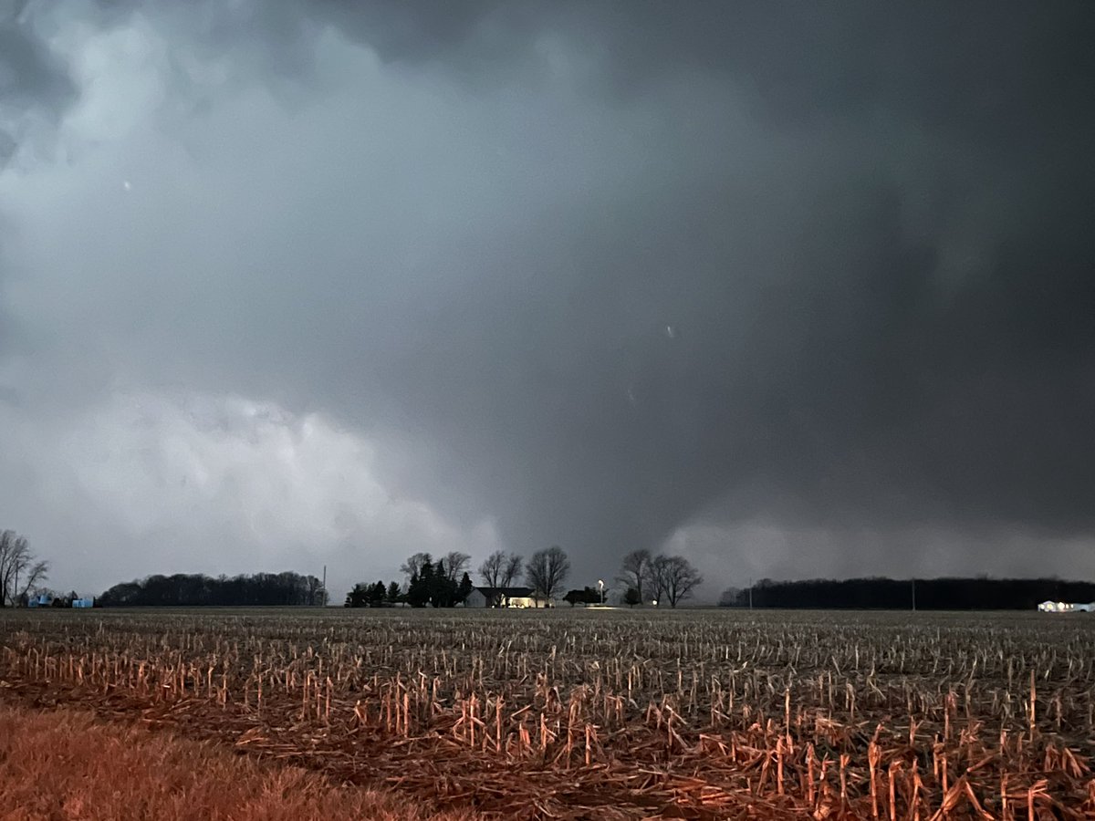
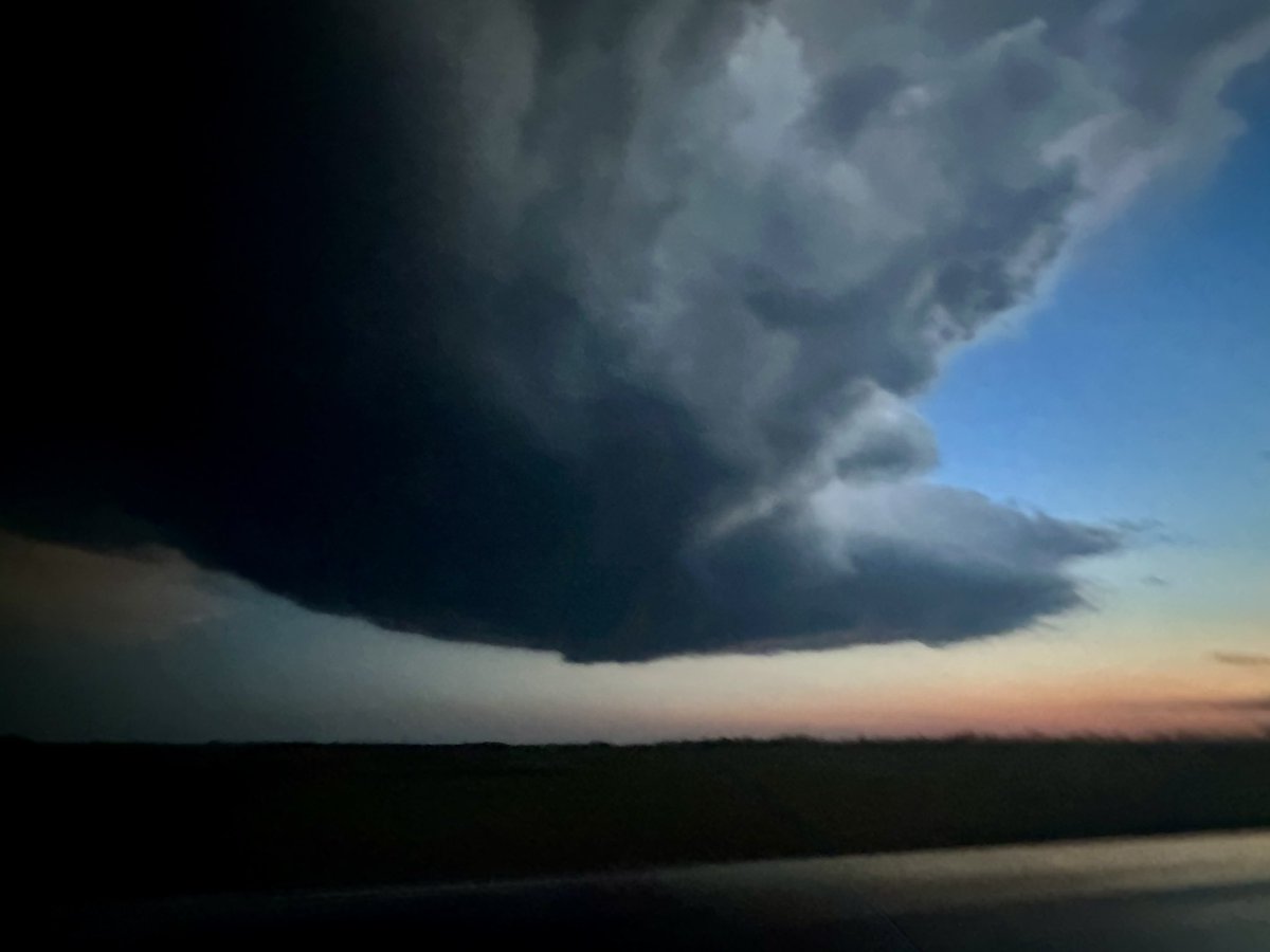
Insane chase today what a day, I will post some footage tomorrow but for now gonna focus on tomorrow! Here is a quick screen grab from the stream. Absolutely crushing 2024 so far. Reed Timmer, PhD Ben Williams
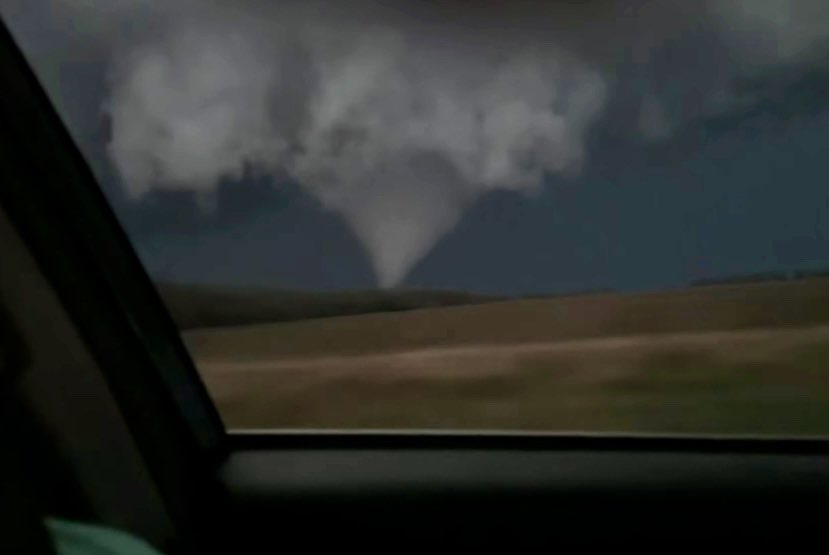
Insane chase today what a day, I will post some footage tomorrow but for now gonna focus on tomorrow! Here is a quick screen grab from the stream. Absolutely crushing 2024 so far. @ReedTimmerUSA @ben_williams_wx
account_circle
FOX Weather(@foxweather) 's Twitter Profile Photo

Denver likely to see plowable snow later this week from incoming Rockies snowstorm
foxweather.com/weather-news/d…

account_circle
Gary Lezak(@glezak) 's Twitter Profile Photo

Last year Weather2020 was 91% accurate on predicting when & where severe weather risks would produce. These predictions are made weeks to months in advance. How? The . Our first prediction of 2024 is spot on; a 3 week forecast. Take a look!

account_circle
Gary Lezak(@glezak) 's Twitter Profile Photo

Facebook is down. OMG-We have to go back to last Century. I am going to get outside, walk the dogs, and workout.

account_circle
Jeff Penner(@JeffPennerKSHB) 's Twitter Profile Photo

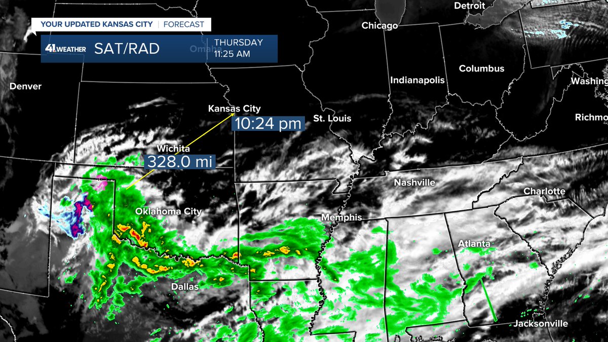
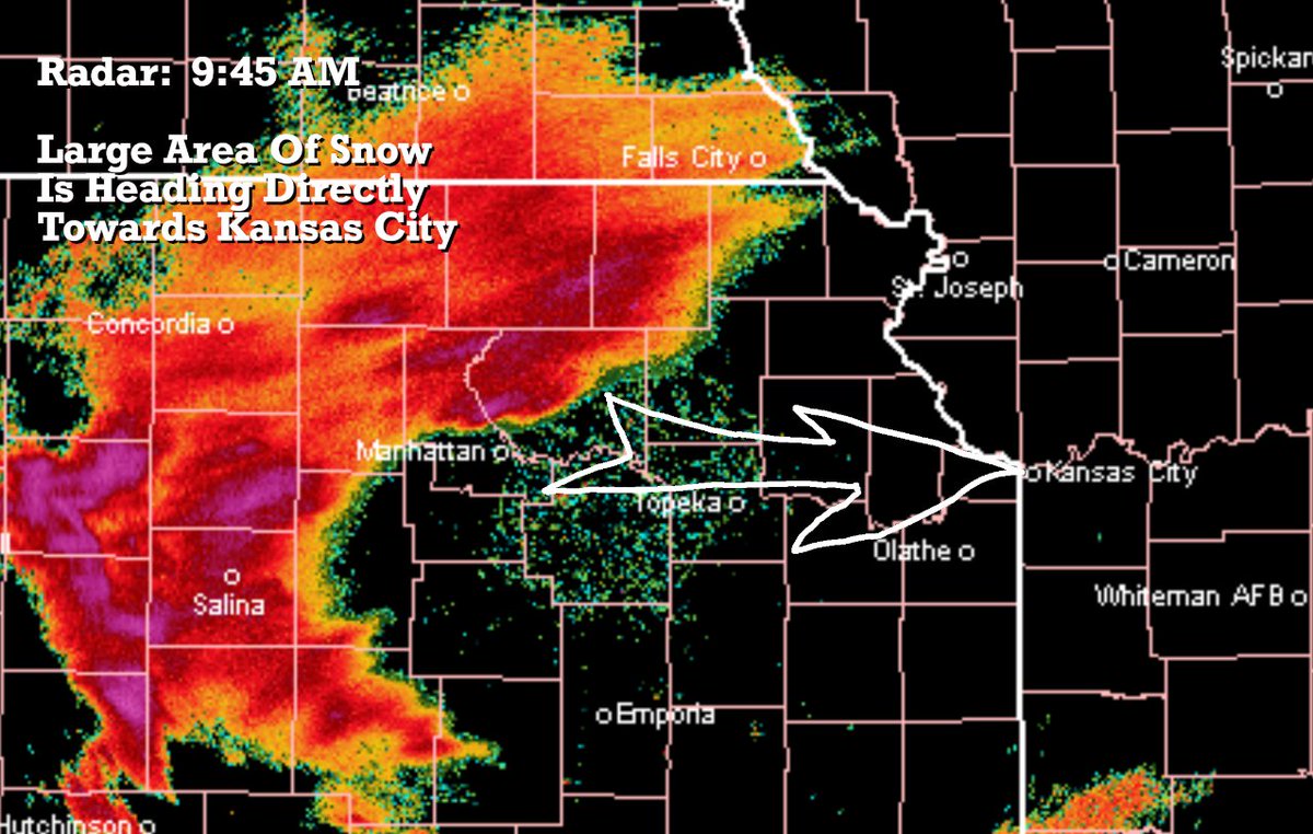
Our high fire danger may be helped a bit by a system now bringing much needed precipitation to the Texas wildfire areas. This system is weakening, but heading right towards KC. It will arrive around 10 PM and exit by 5-6 AM. Rainfall would be a trace-.25'.
@kshb41

Our high fire danger may be helped a bit by a system now bringing much needed precipitation to the Texas wildfire areas. This system is weakening, but heading right towards KC. It will arrive around 10 PM and exit by 5-6 AM. Rainfall would be a trace-.25'. @kshb41
account_circle
Gary Lezak(@glezak) 's Twitter Profile Photo

The dramatic weather day is in progress. Watch from sunrise to Arctic Blast with snow. Look closely and you can see the cold front move through, then everything turns white! This is looking out over Lakewood, CO!

account_circle
Gary Lezak(@glezak) 's Twitter Profile Photo

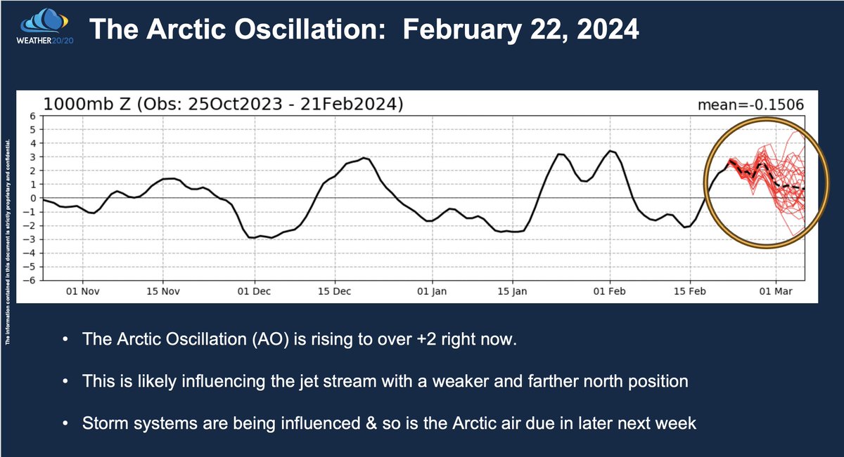
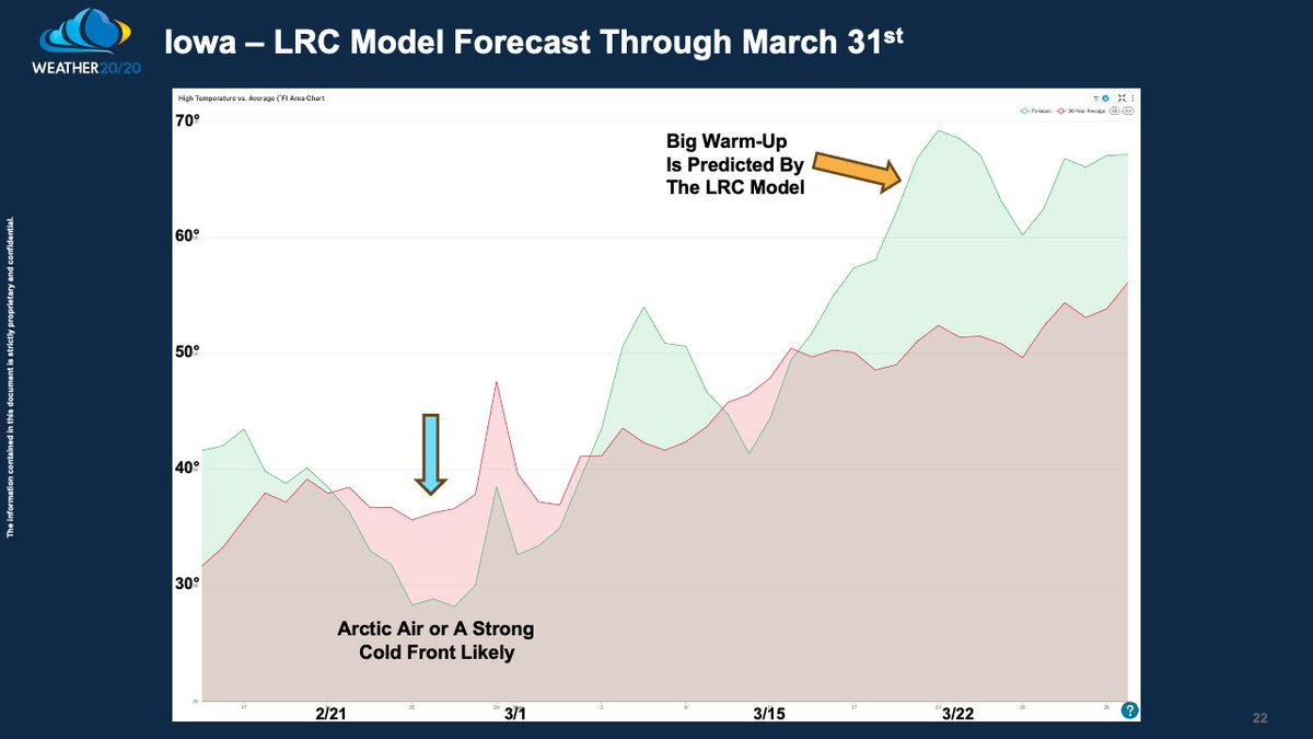
The Arctic Oscillation (AO) is up to near +3. A positive AO will weaken the jet stream & shift it farther north. A warmup ahead of an Arctic front is right on the schedule predicted in the next week. Here is the Weather2020 Intelligence Report: open.substack.com/pub/weather202…

The Arctic Oscillation (AO) is up to near +3. A positive AO will weaken the jet stream & shift it farther north. A warmup ahead of an Arctic front is right on the #LRC schedule predicted in the next week. Here is the @Weather2020 Intelligence Report: open.substack.com/pub/weather202…
account_circle
Gary Lezak(@glezak) 's Twitter Profile Photo

A Year's Worth Of Rain In Two Days In The Los Angeles Region. Weather2020 makes another incredible prediction for this storm. Is an Arctic Blast next in line? El Niño Flexes It's Muscles & Influences The LRC open.substack.com/pub/weather202…
A Year's Worth Of Rain In Two Days In The Los Angeles Region. @Weather2020 makes another incredible prediction for this storm. Is an Arctic Blast next in line? El Niño Flexes It's Muscles & Influences The LRC open.substack.com/pub/weather202…
account_circle
Gary Lezak(@glezak) 's Twitter Profile Photo

Who is ready for some more snow? Did you know it got down to -16° this morning in Kansas City, 7 degrees shy of the all time coldest record? Expect 1' of Arctic snow this afternoon centered near KC. It is snowing here in Colorado too! A big warm up happens within a week!!!

Who is ready for some more snow? Did you know it got down to -16° this morning in Kansas City, 7 degrees shy of the all time coldest record? Expect 1' of Arctic snow this afternoon centered near KC. It is snowing here in Colorado too! A big warm up happens within a week!!!
account_circle
Gary Lezak(@glezak) 's Twitter Profile Photo

Weather Update from Weather2020 using the : If the Kansas City Chiefs win, then they will either play at Arrowhead (Bills lose), or at Buffalo. The weather next weekend looks much calmer and much warmer, which is not that hard to do, at both KC and Buffalo!

account_circle