Paula Moraga 🌍💻📊(@Paula_Moraga_) 's Twitter Profile Photo

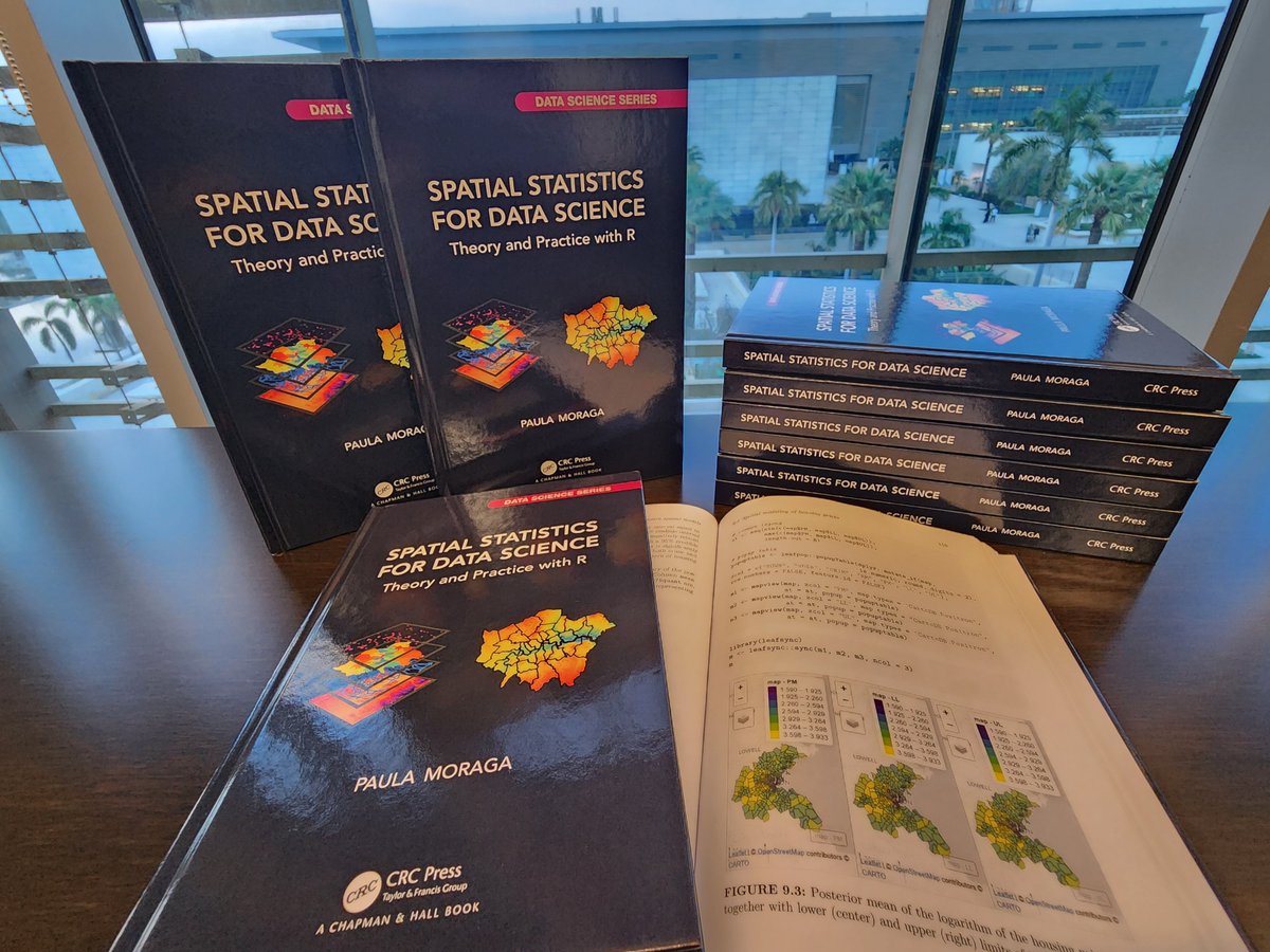
I just received the hardcopies of my book ✨ Spatial Statistics for Data Science ✨

👉 paulamoraga.com/book-spatial/

Many thanks CRC Press Data Science, Stats, and Math Books! They look great! 🤩

💻 🗺️ ⚡️ 📊 📈 🌍 🌈 🌿 📕

I just received the hardcopies of my book ✨ Spatial Statistics for Data Science ✨

👉 paulamoraga.com/book-spatial/

Many thanks @CRC_MathStats! They look great! 🤩

💻#rstats 🗺️#rspatial ⚡️#gischat 📊#RINLA 📈#datascience 🌍#dataviz 🌈#epitwitter 🌿#ecology 📕 #statistics
account_circle
Mohamed Omar(@absiyejunior) 's Twitter Profile Photo

Everyone loves so here are 20 shortcuts to make your work easier and faster.

1. Add Vector Layer: 𝐂𝐭𝐫𝐥 + 𝐒𝐡𝐢𝐟𝐭 + 𝐕
2. Add Raster Layer: 𝐂𝐭𝐫𝐥 + 𝐒𝐡𝐢𝐟𝐭 + 𝐑

account_circle
Mohamed Omar(@absiyejunior) 's Twitter Profile Photo

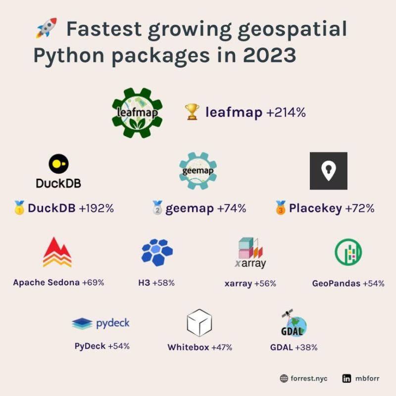
Spatial Python packages play a vital role in Geographic Information Systems especially in spatial data analysis thus enabling users to identify patterns in the data and support decision-making.

Here is a short list of the most used packages in 2023,

Spatial Python packages play a vital role in Geographic Information Systems  #GIS especially in spatial data analysis thus enabling users to identify patterns in the data and support decision-making.

Here is a short list of the most used packages in 2023,
#Geospatial #gischat
account_circle
Isaac Besora(@ibesora) 's Twitter Profile Photo

How many clicks do you think it takes to go from the left image to the right one? Just 5 with our latest release at Felt chat lover

How many clicks do you think it takes to go from the left image to the right one? Just 5 with our latest release at @felt #gis #gischat #gislover #maps
account_circle
Wahome🗺🛰(@ItsWahome) 's Twitter Profile Photo

QGIS vs. ArcGIS Pro is a common debate in the world of GIS. This thread will compare QGIS and ArcGIS Pro in various aspects.

QGIS vs. ArcGIS Pro is a common debate in the world of GIS. This thread will compare QGIS and ArcGIS Pro in various aspects.
#gischat #geospatial
account_circle
Ọmọwọnúọlá A.(@Svelte_mo) 's Twitter Profile Photo

Today, I am really grateful for people who put in time creating free resources (podcasts, newsletters, blogs, documentations, research, conference sessions, posts).

You make learning so much easier and enjoyable.

account_circle
Diana(@GISTdoinmybest) 's Twitter Profile Photo

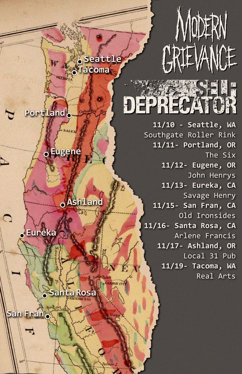
Looking for feedback from map nerds (bonus points if you like metal/mathcore). My partner’s band is going on tour and I made this map for it. Any suggestions for how to improve?

Applications used: Adobe Illustrator
Data source: David Rumsey Map Collection

Looking for feedback from map nerds (bonus points if you like metal/mathcore). My partner’s band is going on tour and I made this map for it.  Any suggestions for how to improve? #gischat #mapfeedback 

Applications used: Adobe Illustrator
Data source: David Rumsey Map Collection
account_circle
Dr. T(@DrTubo) 's Twitter Profile Photo

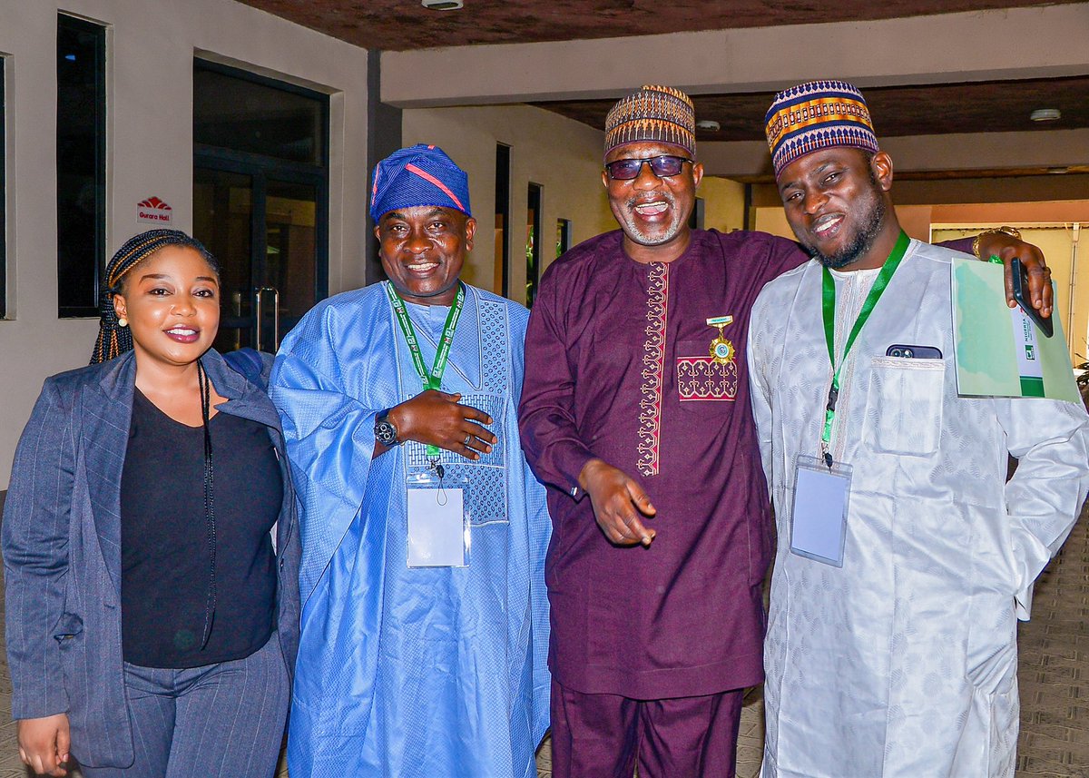
Hey Geospatial Ecosystem, our NGDI is underway!

This week, stakeholders reviewed the draft NGDI policy and the Bill, and the NGDI Committee was inaugurated by the Honorable Minister.

We appreciate His Excellency for his support and unwavering commitment in this.

Hey Geospatial Ecosystem, our NGDI is underway!

This week, stakeholders reviewed the draft NGDI policy and the Bill, and the NGDI Committee was inaugurated by the Honorable Minister.

We appreciate His Excellency for his support and unwavering commitment in this.
#NGDI
#GISChat
account_circle
CaGIS(@cartographyGIS) 's Twitter Profile Photo

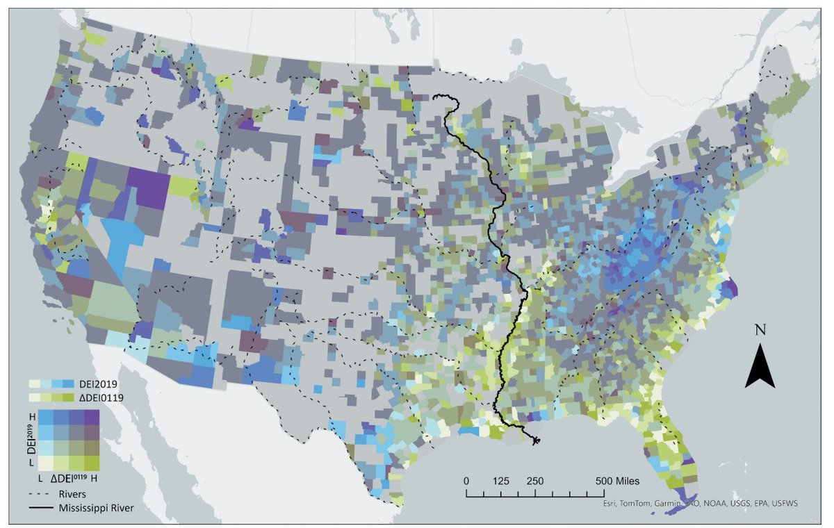
New paper! Jinwen Xu & Yi Qiang present Environmental justice implications of flood risk in the contiguous United States – a spatiotemporal assessment of flood exposure change from 2001 to 2019, doi.org/10.1080/152304…,

New paper! Jinwen Xu & Yi Qiang present Environmental justice implications of flood risk in the contiguous United States – a spatiotemporal assessment of flood exposure change from 2001 to 2019, doi.org/10.1080/152304…, #gisChat
account_circle
Godwin Murithi(@Godwin_Murithi) 's Twitter Profile Photo

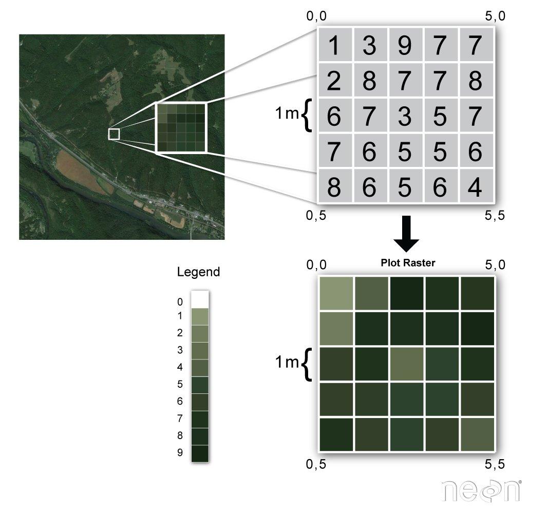
The raster package in R has functions for creating, reading, manipulating, and writing raster data. The package provides, among other things, general raster data manipulation functions that can easily be used to develop more specific functions.

The raster package in R has functions for creating, reading, manipulating, and writing raster data. The package provides, among other things, general raster data manipulation functions that can easily be used to develop more specific functions.  #gischat #rstats #geospatial
account_circle