humo(@hrykyn) 's Twitter Profile Photo

もくもく会。テーマ「QGIS」

去年これ(qiita.com/chizutodesign/…)を見て興味があった「時系列アニメ」を作ってみた。

データは ^^
4月26日の1時間毎のデータ。

7時〜9時ごろに、赤(自転車ない)→ 青(自転車いっぱい)のエリアが変化してるのが分かる。

account_circle
森林組合の人(@ShinkumiNoHito) 's Twitter Profile Photo

で森林クラウドの地図を使う方法について
全部の地図が使える訳ではないですが
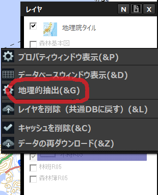
森林クラウドの『レイヤ』の右クリックで『地理的抽出』があれば可能

#QGIS で森林クラウドの地図を使う方法について
全部の地図が使える訳ではないですが
森林クラウドの『レイヤ』の右クリックで『地理的抽出』があれば可能
account_circle
Peter Brodersen(@peterbrodersen) 's Twitter Profile Photo

I går holdt jeg et oplæg til QGIS-brugermødet i Nyborg. Undervejs viste jeg en animation, jeg lavede i QGIS med 3D-bymodel fra Googles Photorealistic 3D tiles. For sjov fandt jeg lyssignaler fra OSM og en 3D-model af gadelamper fra QGIS. Dog ikke clamped korrekt til terrænhøjde.

account_circle
Ujaval Gandhi(@spatialthoughts) 's Twitter Profile Photo

Learn about Cloud Optimized GeoTIFFs (COGs). Learn the concept behind this format and how to create COGs using . Don't miss the demo of streaming and clipping a 8GB raster to without downloading it! youtube.com/watch?v=vHrT9p…

account_circle
h(@hbecerraGIS) 's Twitter Profile Photo

En Guadalajara, los camiones del servicio municipal de recolección de basura tienen navegadores GPS/GNSS. Procesado en QGIS. Aquí en tiempo real:

tequierolimpia.guadalajara.gob.mx

visualization a

account_circle
ぴっかりん(@ra0kley) 's Twitter Profile Photo

衛星画像や航空写真のAI判読サービスであるMapflowのQGISプラグインで建物検出を試してみた。
判読に使用した画像は「ArcGIS World Imagery」なので、背景地図に映している地理院の空中写真と解像度の差や位置ずれなどあるけど、大きな建物は検出できていそう。
戸建てを1棟ずつとかは厳しい感じかな。

account_circle
山崎啓介 / KEISUKE YAMAZAKI(@k2_yamazaki) 's Twitter Profile Photo

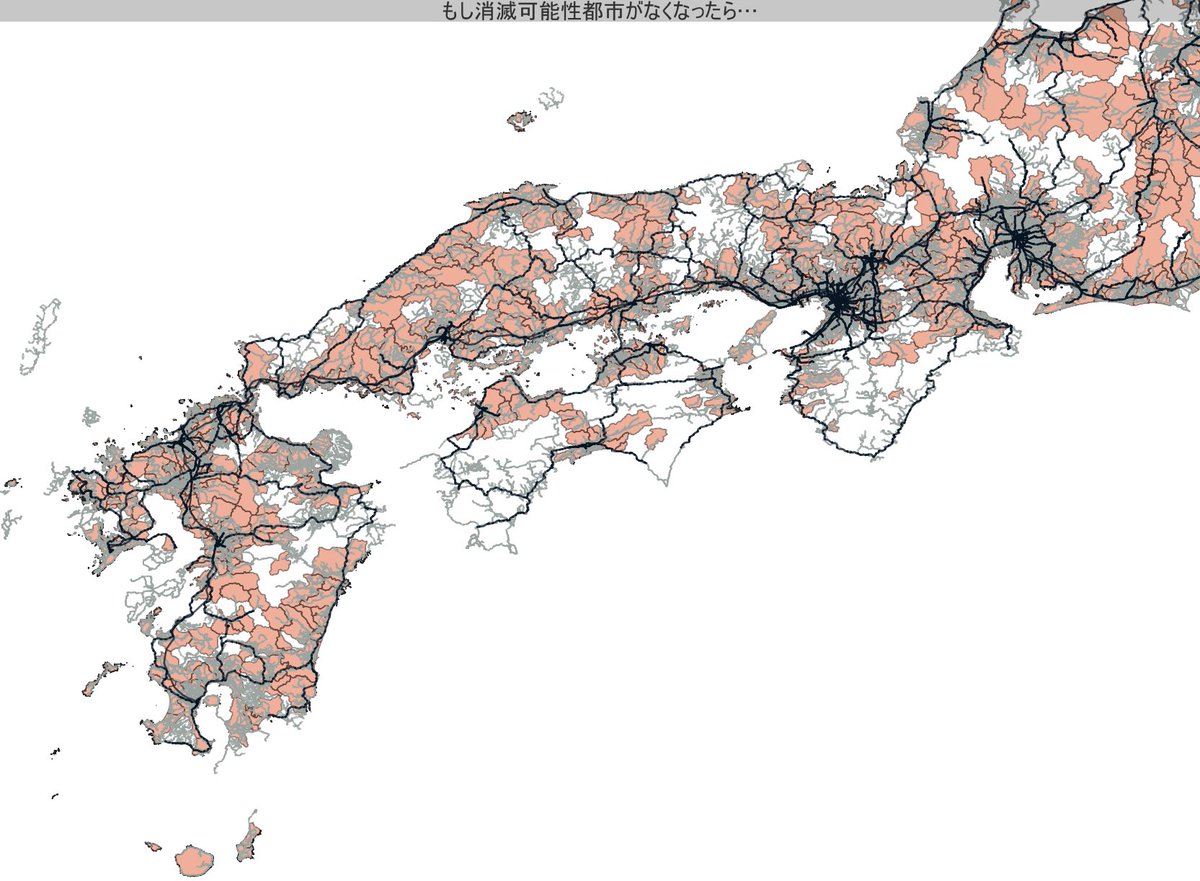
人口戦略会議が発表した「消滅可能性自治体」を日本地図から削って電車とバスの路線を重ねてみると、線路が交差するターミナル的機能のある場所はやっぱり残るし、バス路線の末端から消滅してる気がする(てかバス網って可視化するとほぼ日本地図になるのすごい…)

人口戦略会議が発表した「消滅可能性自治体」を日本地図から削って電車とバスの路線を重ねてみると、線路が交差するターミナル的機能のある場所はやっぱり残るし、バス路線の末端から消滅してる気がする(てかバス網って可視化するとほぼ日本地図になるのすごい…)
#QGIS #国土数値情報
account_circle
INTI_FALCON(@Inti_Falcon) 's Twitter Profile Photo

QGIS, es la herramienta que tiene a disposición los técnicos de campo del Instituto Nacional de Tierras (INTi) proporcionando una gama de capacidades a través de sus funciones básicas, donde se puede visualizar, gestionar y analizar todos los datos de unidades de producción

QGIS, es la herramienta que tiene a disposición los técnicos de campo del @INTi_Venezuela proporcionando una gama de capacidades a través de sus funciones básicas, donde se puede visualizar, gestionar y analizar todos los datos de unidades de producción
#EstaTierraEsNuestroFuturo

account_circle
Pedigo(@Pedro1gor) 's Twitter Profile Photo

Mais um dia que viro a noite em uma batalha contra o QGis Server e novamente perdi, mas não desistirei... já estou aprendendo até a programar e hj apelei aos desenvolvedores... lembro disso n
a madruga toda:

account_circle
Deny Sullivan(@DenySully) 's Twitter Profile Photo

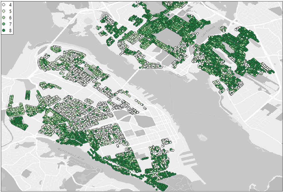
Cooking in QGIS rn, here's what how many units you could build by lot across the ER zones if HAF passes (note: I havent excluded heritage areas yet)

Cooking in QGIS rn, here's what how many units you could build by lot across the ER zones if HAF passes (note: I havent excluded heritage areas yet)
account_circle
Pedigo(@Pedro1gor) 's Twitter Profile Photo

Hj eu venci o QGis Server, consegui fazer uma aplicação gisweb, estava 3x0 pra ele, agora ficou 3x1 e eu venci, pq uma coisa é perder batalha e outra a guerra

Hj eu venci o QGis Server, consegui fazer uma aplicação gisweb,  estava 3x0 pra ele, agora ficou 3x1 e eu venci, pq uma coisa é perder batalha e outra a guerra
account_circle
Linus Anari(@linusanari_) 's Twitter Profile Photo

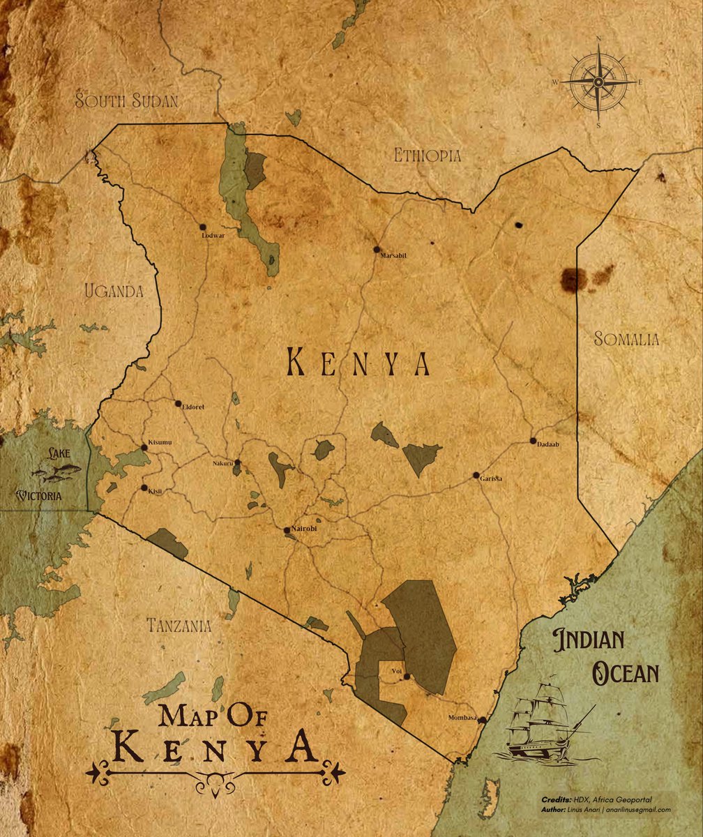
Amusing how, despite all the modern mapping techniques, some touch of retro still remains charming. Here's a nod to simpler times.

Amusing how, despite all the modern mapping techniques, some touch of retro still remains charming. Here's a nod to simpler times.
#QGIS #cartography
account_circle
Ujaval Gandhi(@spatialthoughts) 's Twitter Profile Photo

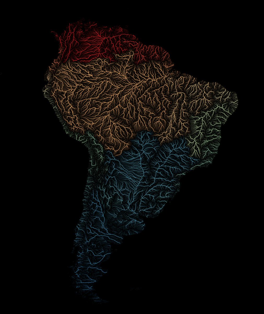
Hot off the presses! A new tutorial in our series focusing on leveraging expressions for cartography. svg unveils his techniques for crafting stunning visualizations of rivers using the HydroRIVERS dataset. Check out the tutorial at qgistutorials.com/en/docs/3/rive…

Hot off the presses! A new tutorial in our series focusing on leveraging #QGIS expressions for cartography. @newgeographer2 unveils his techniques for crafting stunning visualizations of rivers using the HydroRIVERS dataset. Check out the tutorial at qgistutorials.com/en/docs/3/rive…
account_circle