Ahmed(@AhmMoneim) 's Twitter Profile Photo

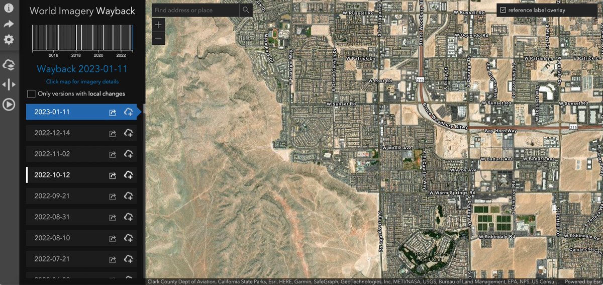
موقع مجاني منزل صور اقمار صناعية للسودان محدثة حتي تاريخ (9/5/2024) ، الناس تخش علي اللينك تتفقد مناطقها و بيوتها ، و تشوف حجم الخراب الخلفتو المليشيا .
الرابط :
livingatlas.arcgis.com/wayback

account_circle
Esri Eastern Africa(@EsriEA) 's Twitter Profile Photo

🗺️ Finding the data you need for your maps isn't always easy. is your go-to for making informed decisions and stunning visuals, with a rich collection of geographic data, maps, and resources. Dive in and explore today! hubs.li/Q02y4F700

🗺️ Finding the data you need for your maps isn't always easy. #ArcGIS #LivingAtlas is your go-to for making informed decisions and stunning visuals, with a rich collection of geographic data, maps, and resources. Dive in and explore today! hubs.li/Q02y4F700
account_circle
Barry Graham(@BarrySGraham) 's Twitter Profile Photo

Scottsdale Fire Chief Shannon shared this live link with Council showing extent & info—Thank you firefighters🧑‍🚒🚒🙏🏜️

livingatlas.arcgis.com/wildfireaware/…
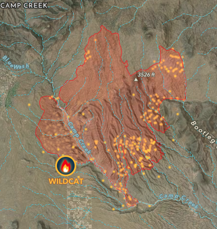
Scottsdale Fire Chief Shannon shared this live link with Council showing #WildcatFire extent & info—Thank you firefighters🧑‍🚒🚒🙏🏜️

livingatlas.arcgis.com/wildfireaware/…
account_circle
Geospatial Equity Tech(@tech_geospatial) 's Twitter Profile Photo

Today we celebrate ! This swipe map exemplifies how tools can be leveraged to help visualize data that empowers with insights into water resources and dynamics.
Source: @LivingAtlas powered by Esri
Keyword:

account_circle
عبدالله الدخيل الله(@aaldakheelalla) 's Twitter Profile Photo

موقع livingatlas.arcgis.com

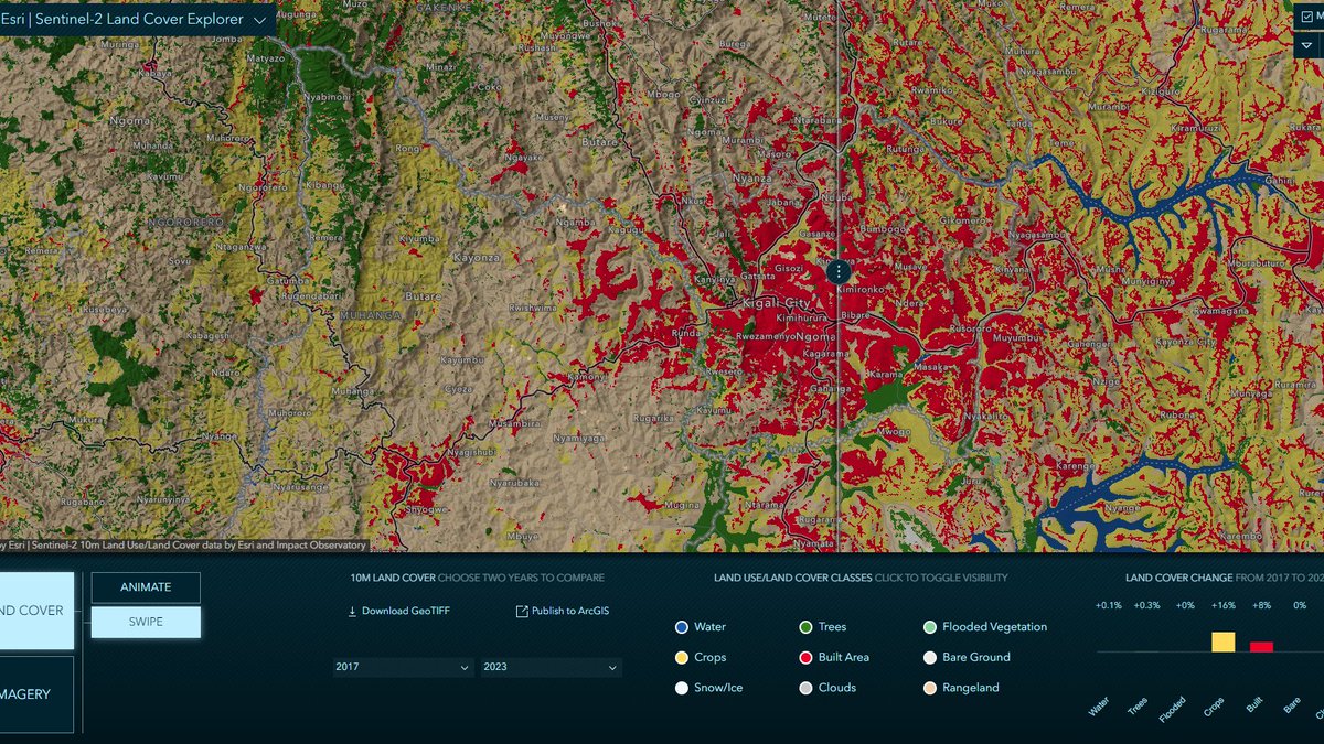
يعطي تفاصيل Land Cover بدقة عالية و تحديث سنوي تستطيع فيه رصد عدة ابعاد، من نمو النسيج و الرطوبة الارض و صحة النباتات و نسب الاراضي الفاضية وغيره،

جميل وسهل المقارنة ، الدقة 10 متر.
تستطيع تحميل اي مدينة حول العالم💁🏻‍♂️

livingatlas.arcgis.com/landcoverexplo…

account_circle
Pratiksha Chalke(@Spatiomaps) 's Twitter Profile Photo

This is how our planet saves us, storing carbon that we release, This animation shows carbon sequestration in potential restoration areas Happy earth day!! Data:
Global Forest Watch

Created in
ArcGIS Pro
@LivingAtlas

account_circle
Saidilivi(@saidilivi) 's Twitter Profile Photo

Geolocation
livingatlas.arcgis.com/wayback/#activ…

Terör örgütü YPG, Türkiye sınırındaki Kamışlı'da tünel kazmaya devam ediyor. Güncel görüntülerde şehrin ortasındaki sanayi bölgesinden geçen tünel çalışmaları görülebiliyor.

account_circle
Africa GeoPortal(@AfricaGeoPortal) 's Twitter Profile Photo

How has your area changed over the last 5 years? Use explorer to search for your location, step through the years to view how each class has changed and get the statistics using the summary chart
Explore > livingatlas.arcgis.com/landcoverexplo…

account_circle
Bert Temme(@berttemme) 's Twitter Profile Photo

World Imagery Wayback App - Explore, compare and start using all different versions of World Imagery Basemap released since 2014 github.com/vannizhang/way… livingatlas.arcgis.com/wayback/

World Imagery Wayback App - Explore, compare and start using all different versions of World Imagery Basemap released since 2014 github.com/vannizhang/way…  livingatlas.arcgis.com/wayback/
account_circle
John Nelson(@John_M_Nelson) 's Twitter Profile Photo

Deforestation in the Brazilian state of Rondônia, around Buritis, since 1985. View these Landsat images in sequence, here: livingatlas.arcgis.com/landsatexplore…

account_circle
ofSi0_2(@ofSi0_2) 's Twitter Profile Photo

Day 21 (Raster) In 2020, the August Complex Fire became California's largest wildfire, at 1,032,648 acres. Check out my before-and-after visual of the land cover using Sentinel-2 Land Cover Explorer @LivingAtlas around the fire boundary. 🌲🔥

account_circle
Renārs(@laysking3) 's Twitter Profile Photo

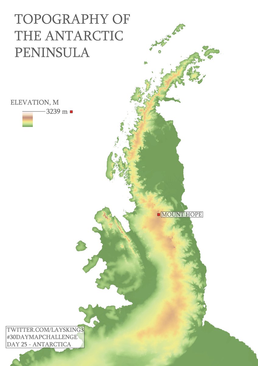
Day 25, Antarctica. Topography of the Antarctic Peninsula with the highest peak Mount Hope at 3239 metres above sea level. Data: @LivingAtlas

Day 25, Antarctica. Topography of the Antarctic Peninsula with the highest peak Mount Hope at 3239 metres above sea level. Data: @LivingAtlas #30DayMapChallenge #livingatlas #esri #polar #antarctica #map
account_circle
Mohamed Ahmed(@MohamedMMAhmed) 's Twitter Profile Photo

🌬️🔥Smoke Forecast for the next 48 hours in Canada. Stay safe, everyone! 🌫️🌍 @LivingAtlas

Data: ncei.noaa.gov/products/weath…

account_circle
Waffentraeger(@waffentraeger) 's Twitter Profile Photo

3/4
There were also, what I believe to be 8 D30 howitzers there, which are gone by 2023 (or have been moved somewhere less visible).
livingatlas.arcgis.com/wayback/#activ…

3/4
There were also, what I believe to be 8 D30 howitzers there, which are gone by 2023 (or have been moved somewhere less visible).
livingatlas.arcgis.com/wayback/#activ…
account_circle
Africa GeoPortal(@AfricaGeoPortal) 's Twitter Profile Photo

Celebrate International Mother of Earth Day today by exploring, visualising and analysing of our beautiful planet through this app: ow.ly/ntqm50RkOKQ

Celebrate International Mother of Earth Day today by exploring, visualising and analysing #imagery of our beautiful planet through this app: ow.ly/ntqm50RkOKQ
#GIS
account_circle
John Nelson(@John_M_Nelson) 's Twitter Profile Photo

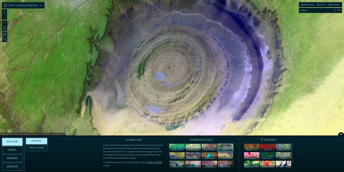
Here's the Buritis area of the Amazon rain forest, 1985 and now. Link to interactive app:
livingatlas.arcgis.com/landsatexplore…

account_circle