The Heritage Council(@HeritageHubIRE) 's Twitter Profile Photo

This week features two of Ireland by Nicolaes Visscher & Mattheus Seutter. Seutter’s map (c.1740) is a closely re-drawn version of Visscher’s (c.1690) – a typical method of informing maps at the time.

High-res at bit.ly/41TAO1O & bit.ly/3LGH1si
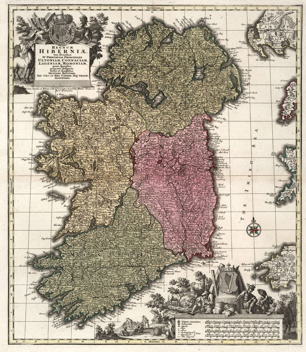
This week #MondayMappery features two of Ireland by Nicolaes Visscher & Mattheus Seutter. Seutter’s map (c.1740) is a closely re-drawn version of Visscher’s (c.1690) – a typical method of informing maps at the time.

High-res at bit.ly/41TAO1O & bit.ly/3LGH1si
account_circle
The Heritage Council(@HeritageHubIRE) 's Twitter Profile Photo

Brought to you by our HeritageMaps.ie programme, our series looks at Ireland as represented on the World’s Oldest maps & follows its Cartographic development through 7 centuries! These maps are the work of Abraham Ortelius creator of the first modern atlas.
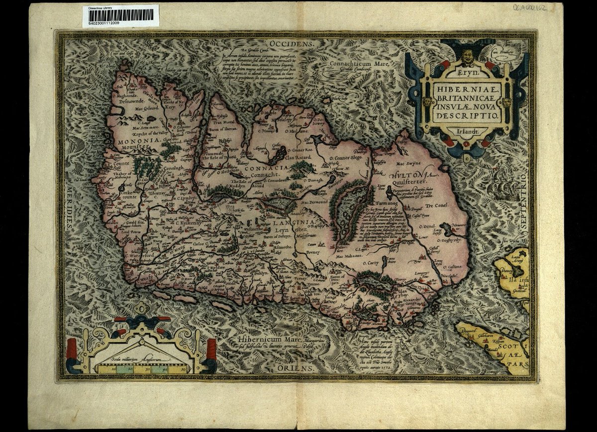
Brought to you by our HeritageMaps.ie programme, our #MondayMappery series looks at Ireland as represented on the World’s Oldest maps & follows its Cartographic development through 7 centuries! These maps are the work of Abraham Ortelius creator of the first modern atlas.
account_circle
The Heritage Council(@HeritageHubIRE) 's Twitter Profile Photo

For this week's we look at a nautical chart of the Irish coast and the ‘Mer D’Irande’. Beautifully drawn, published in Amsterdam in 1693 by Pierre Mortier, it features the work of Alexis Jaillot.

This map appears courtesy of the Rumsey Map Collection, Stanford…
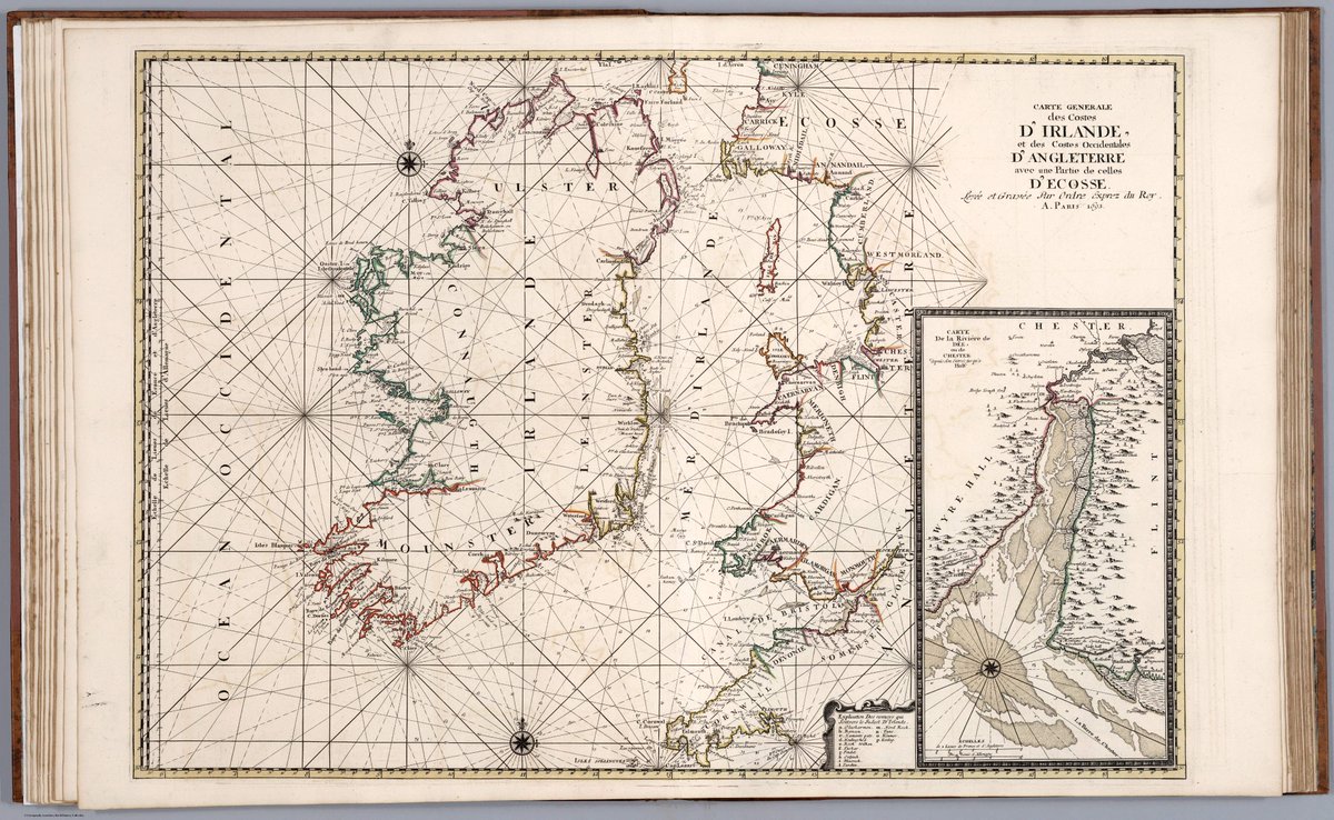
For this week's #MondayMappery we look at a nautical chart of the Irish coast and the ‘Mer D’Irande’. Beautifully drawn, published in Amsterdam in 1693 by Pierre Mortier, it features the work of Alexis Jaillot.

This map appears courtesy of the Rumsey Map Collection, Stanford…
account_circle
The Heritage Council(@HeritageHubIRE) 's Twitter Profile Photo

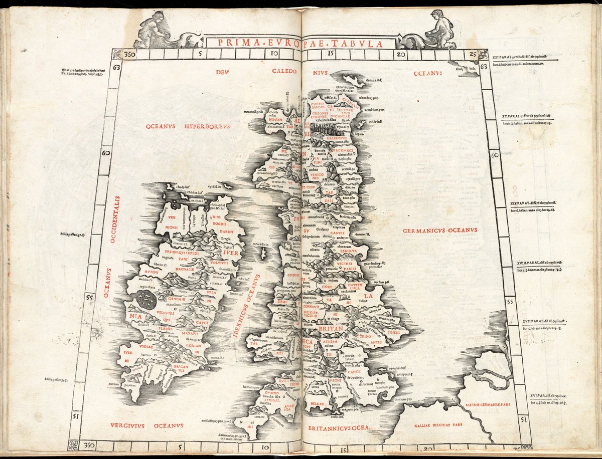
Our series from our Heritagemaps.ie programme, takes a look at on some of the World’s Oldest maps & follows its Cartographic development through 7 centuries!

This week’s map titled ‘Prima Europa Tabula’ is another based on Ptolemy’s 2nd C accts.

Our #MondayMappery series from our Heritagemaps.ie programme, takes a look at #Ireland on some of the World’s Oldest maps & follows its Cartographic development through 7 centuries! 

This week’s map titled ‘Prima Europa Tabula’ is another based on Ptolemy’s 2nd C accts.
account_circle
@ejfox@mastodon.social(@mrejfox) 's Twitter Profile Photo

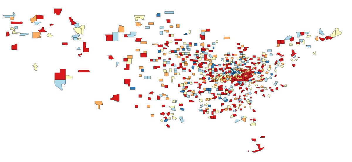
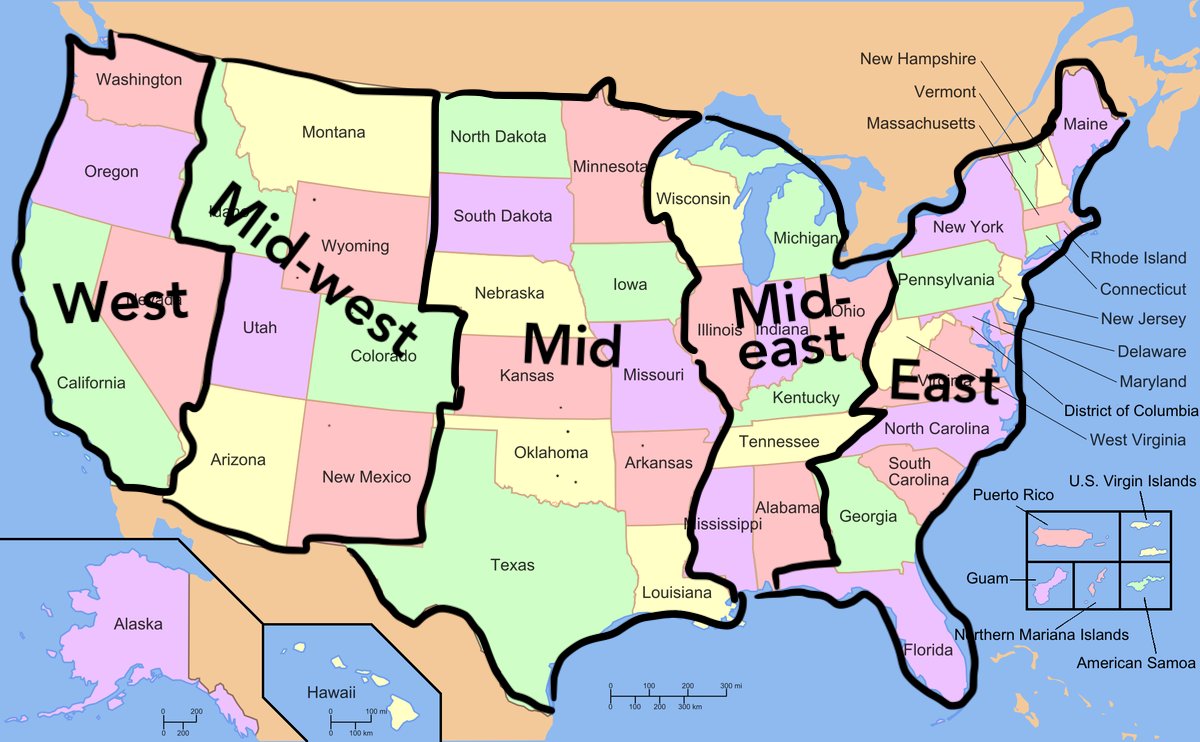
I'm bad at data joins so I accidentally made this map of every county in the US that shares a name with a county in Kentucky

I'm bad at data joins so I accidentally made this map of every county in the US that shares a name with a county in Kentucky
account_circle
The Heritage Council(@HeritageHubIRE) 's Twitter Profile Photo

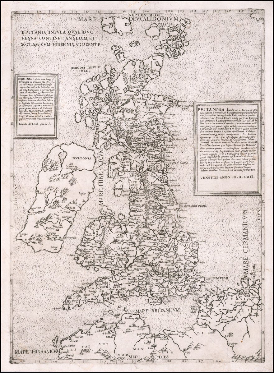
The series from our heritagemaps programme looks at on the world’s oldest maps and follows its cartographic development over 7 centuries! This map features Bertelli's Edition of the first modern map of the British Isle. Check out the familiar place names!

The #MondayMappery series from our heritagemaps programme looks at #Ireland on the world’s oldest maps and follows its cartographic development over 7 centuries! This map features Bertelli's Edition of the first modern map of the British Isle. Check out the familiar place names!
account_circle
The Heritage Council(@HeritageHubIRE) 's Twitter Profile Photo

This week’s features Philip Lea’s 1690 map of Ireland based on Petty’s surveys as featured last week. An interesting map, it shows Ireland separated from Britain by ‘The Ireish Sea’.

Map appears courtesy Leventhal Map & Education Center at the BPL
View in hi-res here: ow.ly/yvlj50Otypi
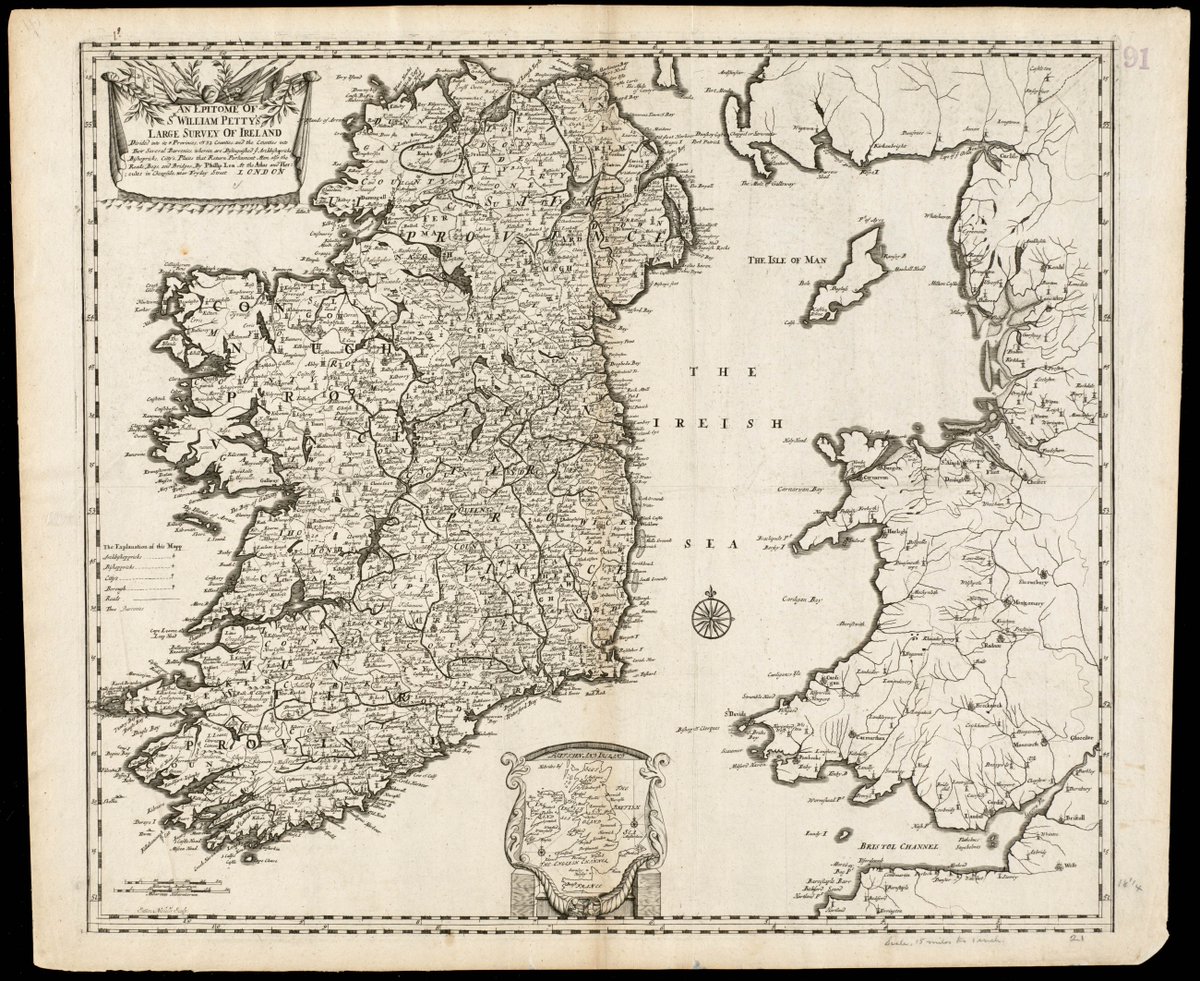
This week’s #MondayMappery features Philip Lea’s 1690 map of Ireland based on Petty’s surveys as featured last week. An interesting map, it shows Ireland separated from Britain by ‘The Ireish Sea’.

Map appears courtesy @bplmaps 
View in hi-res here: ow.ly/yvlj50Otypi
account_circle
The Heritage Council(@HeritageHubIRE) 's Twitter Profile Photo

This week's features two maps by Frederick de Wit dated c. 1682. Ireland’s form appears very differently in both images – yet the two maps featured in the same atlas ‘Tot Amsterdam’.

View in high-res at bit.ly/3VBdu6M and bit.ly/3M9h3y9
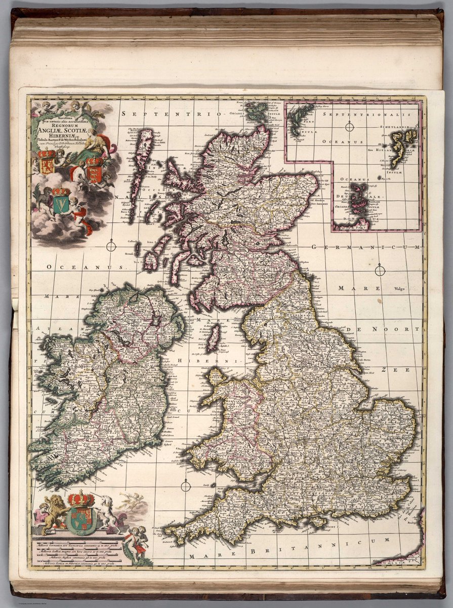
This week's #MondayMappery features two maps by Frederick de Wit dated c. 1682. Ireland’s form appears very differently in both images – yet the two maps featured in the same atlas ‘Tot Amsterdam’.

View in high-res at bit.ly/3VBdu6M and bit.ly/3M9h3y9
account_circle