
My on scene Report from tonight out of #Fritch #Texas
Wildfire still on going 100 + houses are gone.
Talked to a woman who lost her home and her dog
Fire is still burning 3% contained and 90,000 acres
📍 Fritch Texas
#wildfires #WindyDeuceFire
#news #txwx #wxtwitter


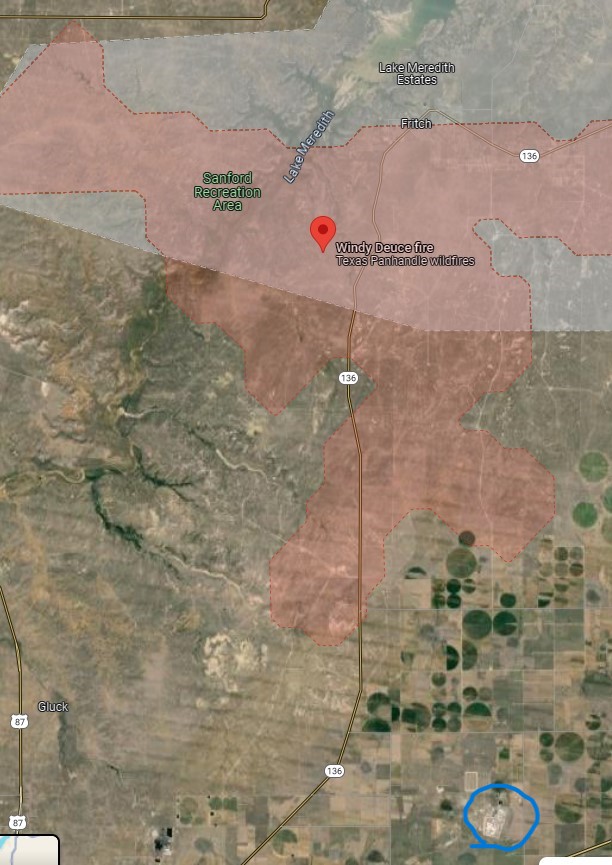
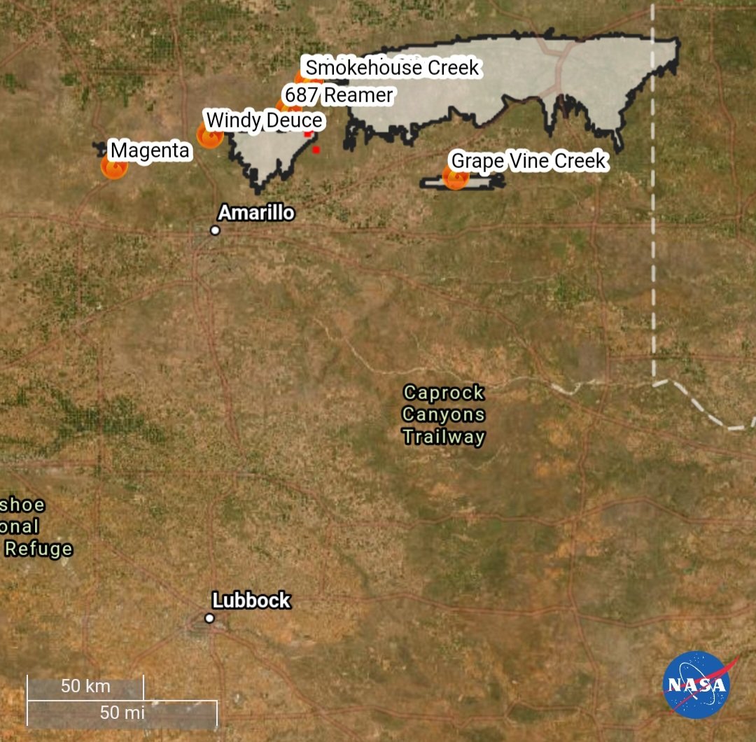
Prayers for all in the area. The Texas PanHandle fires are just North of the Pantex Nuclear plant near Amarillo. Should be of great concern right now. #windydeucefire #smokehousecreekfire #foxnews

Perimeter updates for TX Fires
#SmokehouseCreekFire Info: inciweb.nwcg.gov/incident-infor…
#WindyDeuceFire Info: inciweb.nwcg.gov/incident-infor…
#GrapeVineCreekFire Info: inciweb.nwcg.gov/incident-infor…
Fire Info: x.com/allhazardstfs
#FireMappers Map link: arcg.is/0bLTfn
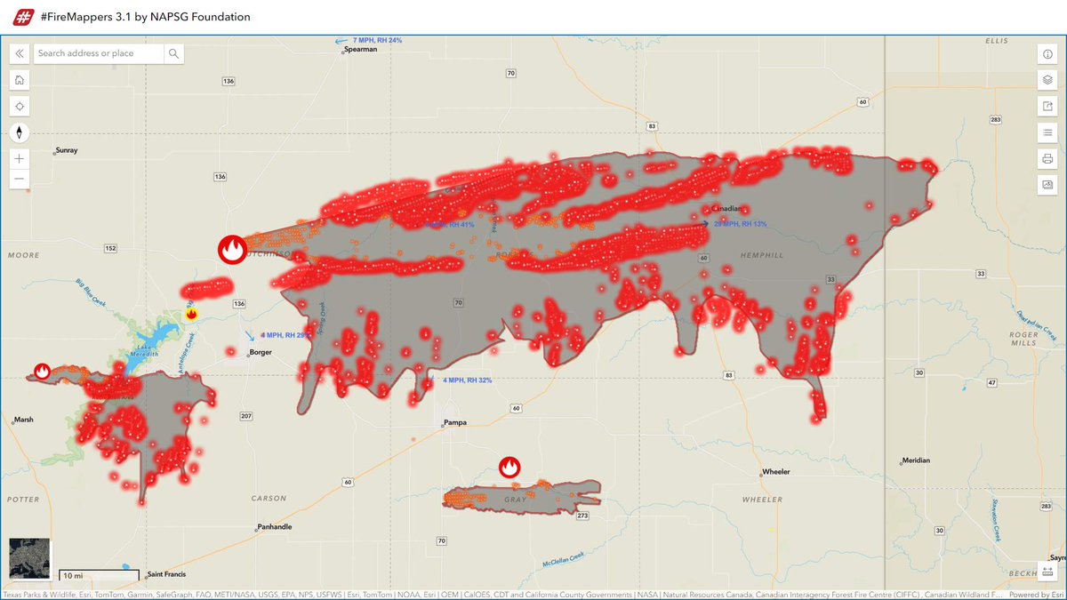

#SmokehouseCreekFire
1,075,000 acres (Incl ~25,000 acres in #Oklahoma )
5% contained
#687ReamerFire & #MAnorthStinnett
merged with Smokehouse Creek
#WindyDeuceFire
142,000 acres
50% contained
#GrapeVineCreekFire
30,000 acres
60% contained
#MagentaFire
3,300 acres
85% contained

#SmokehouseCreekFire
500,000 acres
0% contained
#WindyDeuceFire
38,000 acres
20% contained
#GrapeVineCreekFire
30,000 acres
60% contained
#687ReamerFire
2,000 acres
10% contained
#MagentaFire
2,000 acres
40% contained
#BettysWayFire [North Platte]
71,022 acres
72% contained
![ℹ️MiBaWi🇩🇪🇺🇸🇳🇱🇨🇦🇨🇱🇪🇸🇦🇺🇮🇩🇺🇦🇬🇷🚨 (@Michael45231497) on Twitter photo 2024-02-28 14:14:29 #SmokehouseCreekFire
500,000 acres
0% contained
#WindyDeuceFire
38,000 acres
20% contained
#GrapeVineCreekFire
30,000 acres
60% contained
#687ReamerFire
2,000 acres
10% contained
#MagentaFire
2,000 acres
40% contained
#BettysWayFire [North Platte]
71,022 acres
72% contained #SmokehouseCreekFire
500,000 acres
0% contained
#WindyDeuceFire
38,000 acres
20% contained
#GrapeVineCreekFire
30,000 acres
60% contained
#687ReamerFire
2,000 acres
10% contained
#MagentaFire
2,000 acres
40% contained
#BettysWayFire [North Platte]
71,022 acres
72% contained](https://pbs.twimg.com/media/GHbhBC9X0AEYUjb.jpg)

#texas #Wildfires
#SmokehouseCreekFire
1,058,570 acres, 87% contained
#WindyDeuceFire
144,206 acres, 92% contained
#GrapeVineCreekFire
34,883 acres, 96% contained
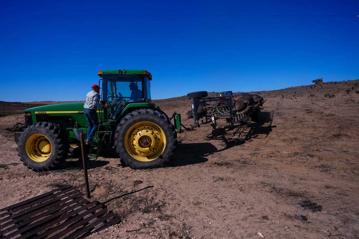
6,650 heads of cattle were reported lost as of Thursday
📸 Julio Cortez/AP

This photo was taken an hour ago.
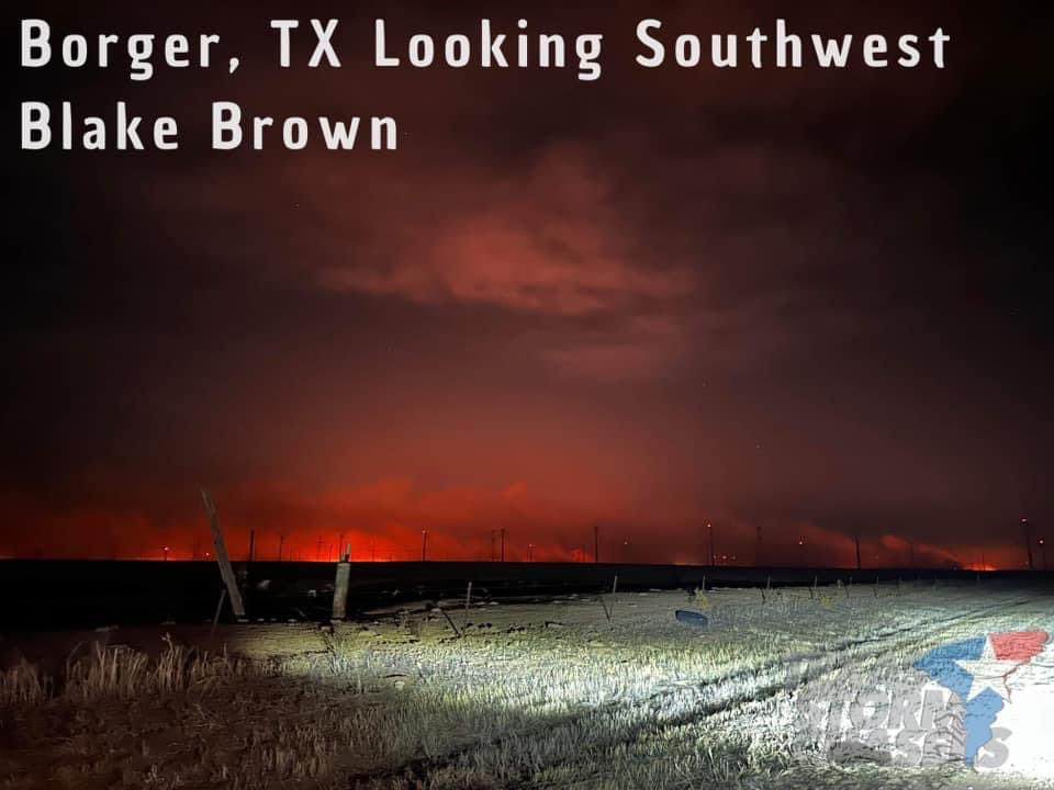
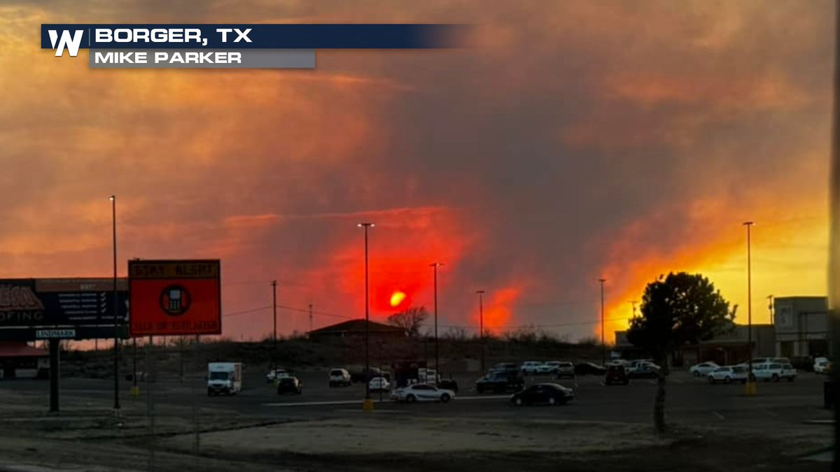
“The mean orange glow of the #WindyDeuceFire north of Amarillo, Texas - As seen looking SW from near Borger via chaser Blake Brown.”
📸- Blake Brown Photography

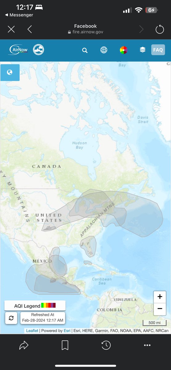
Smoke plume from the fires in the Texas Panhandle have reached the Atlantic Ocean
#txwx #SmokehouseCreek #WindyDeuceFire

Updates are a little old from the #WindyDeuceFire in the #Texas #panhandle
Currently still burning but close to containment at 60% as if last night still critical fire danger present.
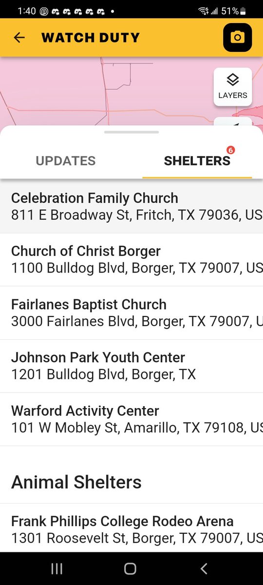
List of locations and shelters for both people and animals
Are in the second photo.

Aviones ' anfibio' sacan agua del lago Meredith antes de ayudar a sofocar el #WindyDeuceFire de #Texas . Además de estos, hay otors 13 aviones en Texas trabajando en incendios forestales activos, incluido el #SmokehouseCreekFire .

Multi-engine Airtankers (Super Scoopers) scoop water out of Lake Meredith before responding to the #WindyDeuceFire . In addition to the scoopers, there are 13 aircraft in Texas working on active wildfires, including the #SmokehouseCreekFire . #txfire

TX Wildfires Perimeter updates & stats per IRWIN
#SmokehouseCreekFire 2/29/2024, 1:56 PM 1,075,000 Ac, 0% Cont
#WindyDeuceFire 2/29/2024, 2:04 PM 142,000 Ac, 0% Cont
#GrapeVineCreekFire 2/28/2024, 3:50 PM 30,000 Ac, 60% Cont
#FireMappers map link: arcg.is/199vHb0

True Color + Nighttime Microphysics RGB images from #GOES18 / #GOESWest & #GOES16 / #GOESEast showed a plume of blowing dust (mixed with some smoke) being lofted from the #SmokehouseCreekFire & #WindyDeuceFire burn scars by strong SW winds: cimss.ssec.wisc.edu/satellite-blog… NWS Amarillo #TXwx

Fires have now burned over 300,000 acres in the Panhandle of Texas.
Winds will back off today, giving firefighters a chance to contain some of these
#WindyDeuceFire
20,000 acres | 20% contained
#SmokehouseCreekFire
250,000 acres | 0% contained
#GrapeVineCreekFire
30,000 acres

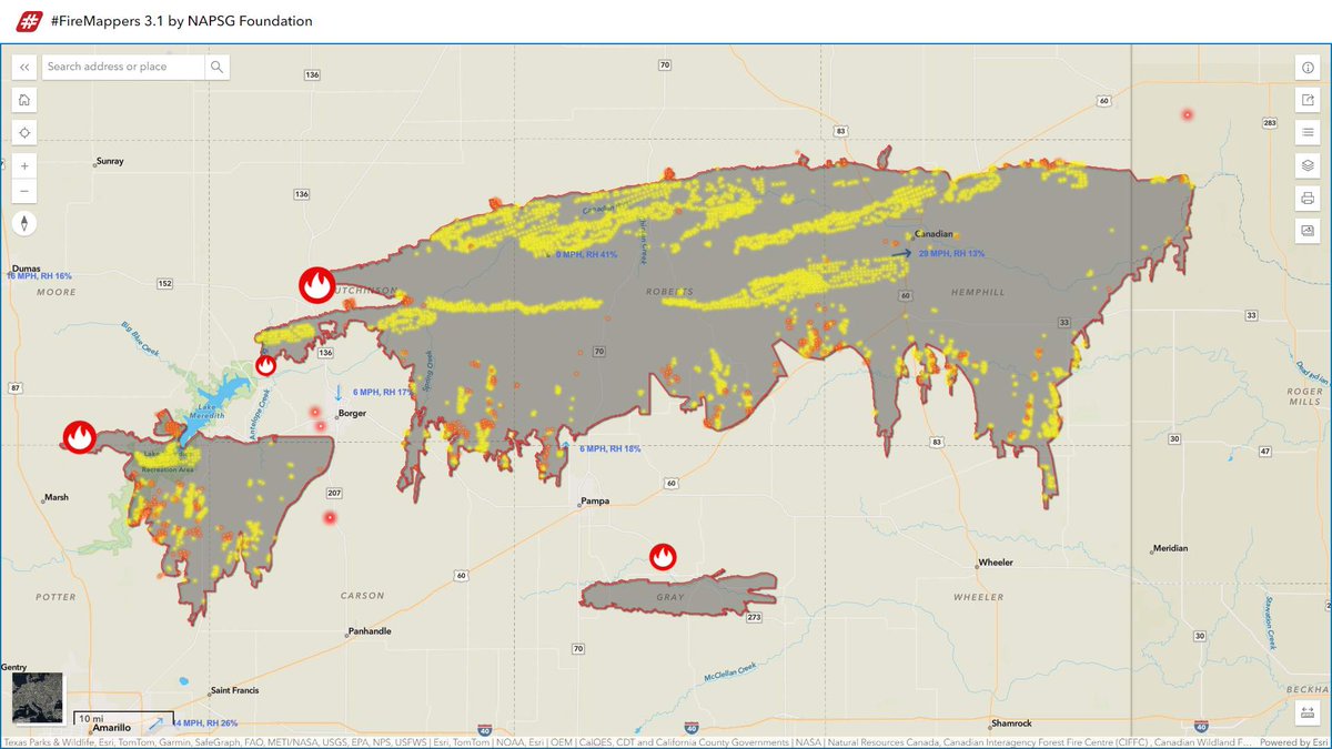
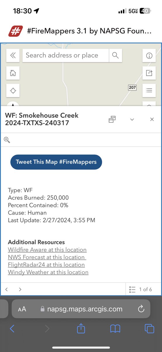
Wildfire Maps for - #SmokehouseCreekFire #WindyDeuceFire and more
Zoom in for more details click on fire points for links. Watch Duty also active in TX now as well.
Map Link: napsg.maps.arcgis.com/apps/instant/m…

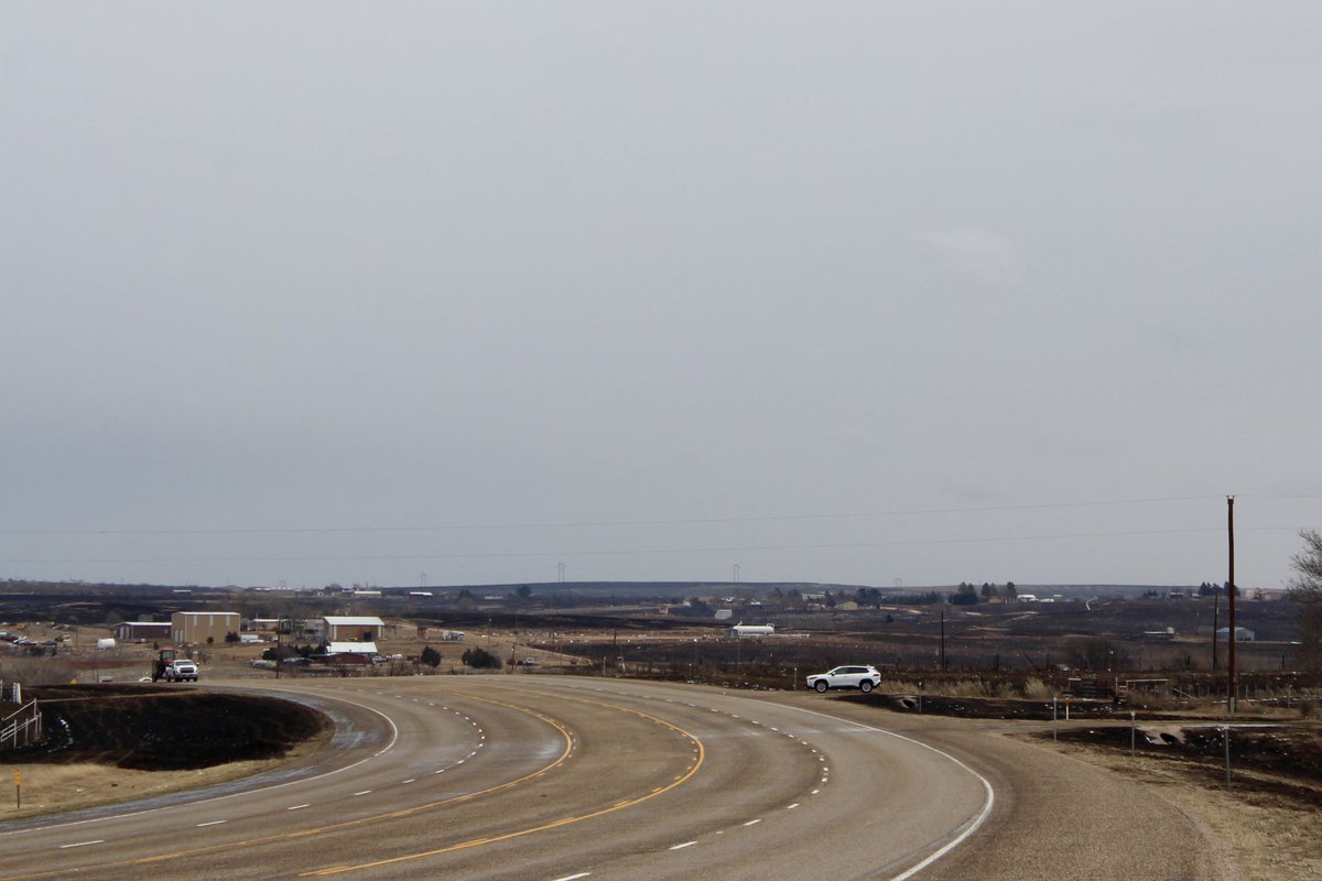
Here’s a quick glimpse at some of the fire damage Jayme Lozano Carver, Mark Rogers and I have seen in Hutchinson County between Borger and Fritch in the Texas Panhandle. #WindyDeuceFire #SmokehouseCreekFire

#SmokehouseCreekFire #Animals #687ReamerFire #MAnorthStinnett
#WindyDeuceFire #GrapeVineCreekFire #MagentaFire
More than six thousands of #livestock have been killed in the #wildfires that've ripped across the #Texas #Panhandle over the last week
>
texasagriculture.gov/News-Events/Ar…


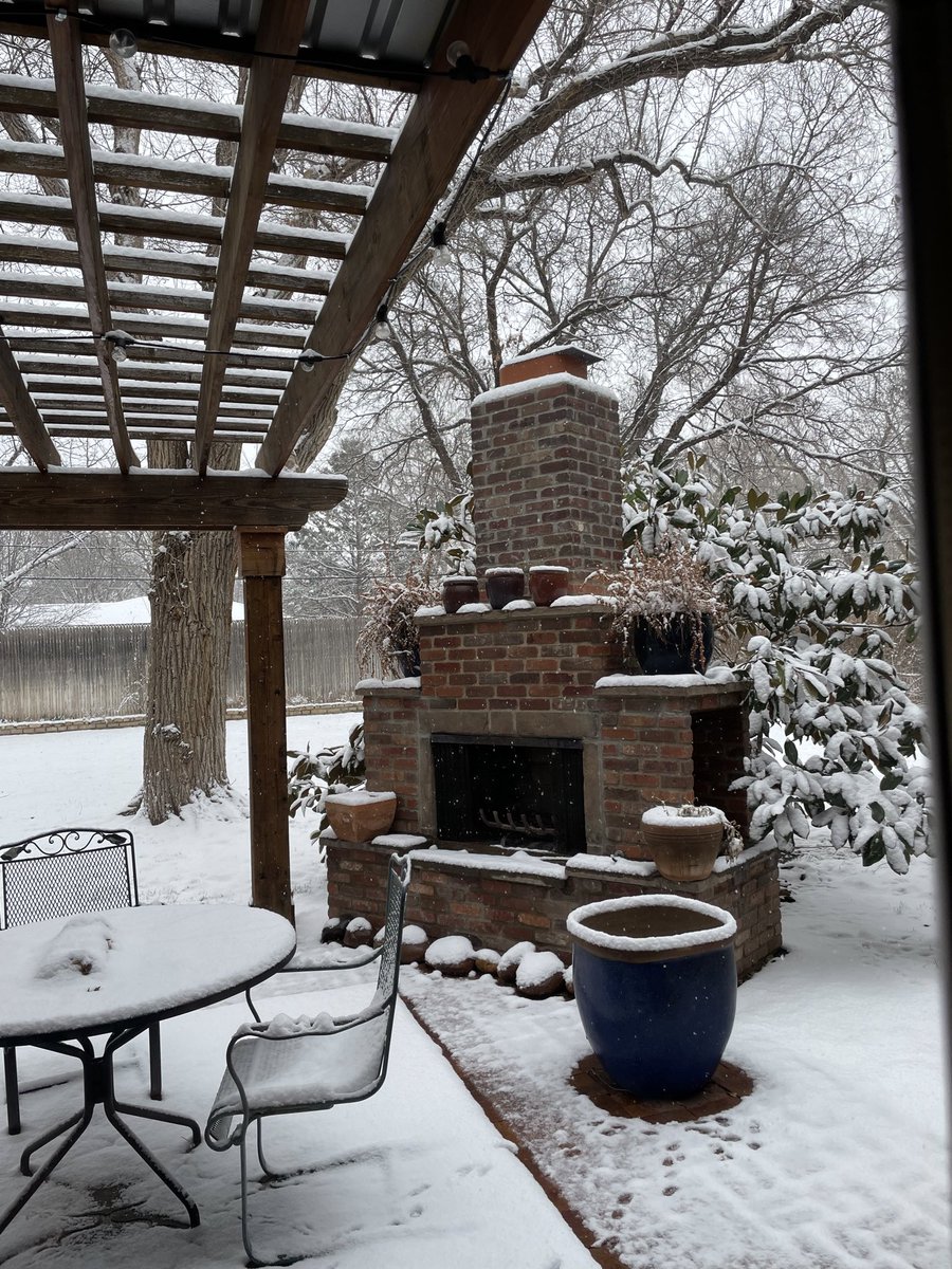
Incident Information - Texas A&M Forest Service #WindyDeuceFire #txfires Thank you Jesus for stellar firefighters and the snow!

True Color + Nighttime Microphysics RGB images from #GOES18 / #GOESWest & #GOES16 / #GOESEast showed a plume of blowing dust (mixed with some smoke) being lofted from the #SmokehouseCreekFire & #WindyDeuceFire burn scars by strong SW winds: cimss.ssec.wisc.edu/satellite-blog… NWS Amarillo #TXwx