D.E.B.T.(@TheDebtBox) 's Twitter Profile Photo

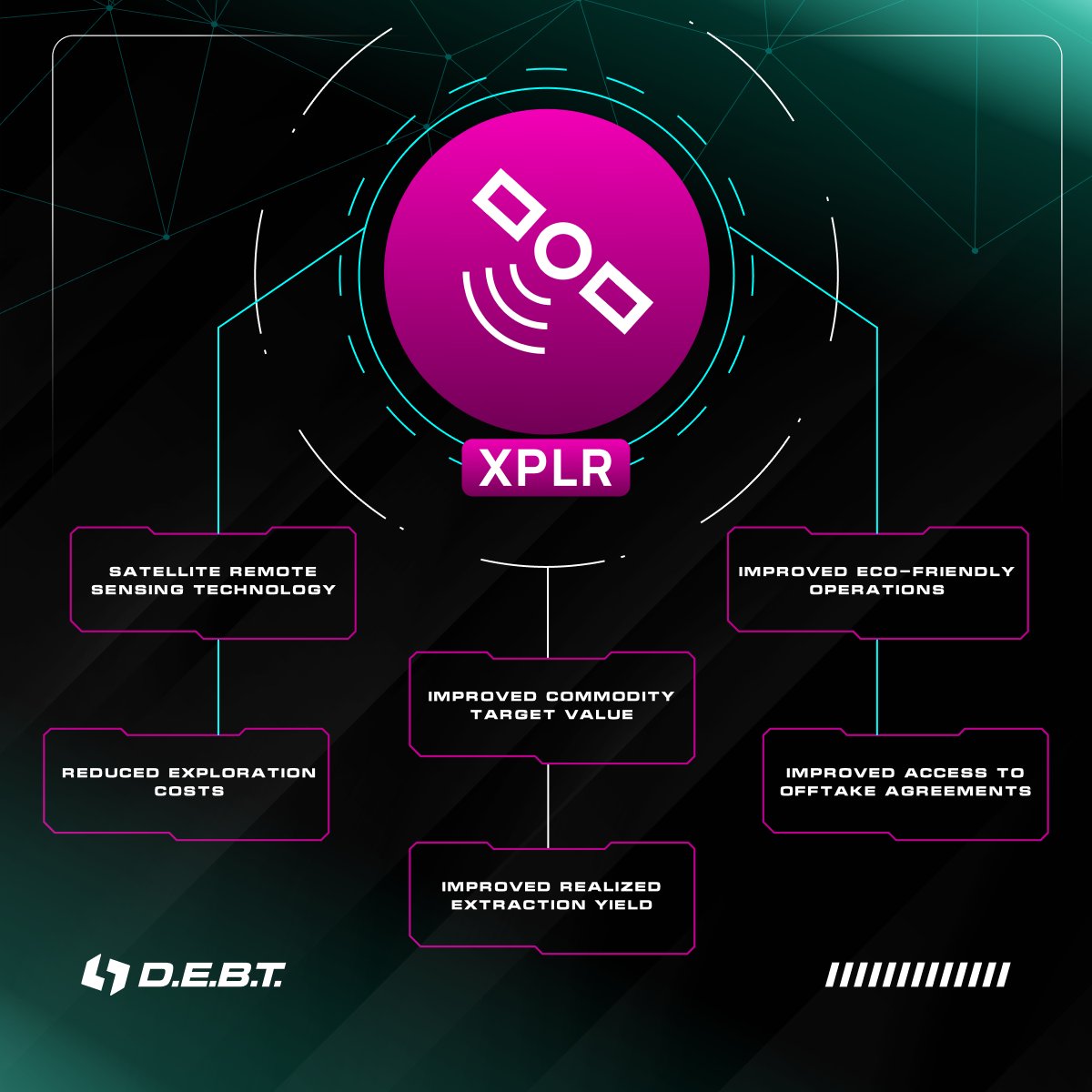
Unlock the potential of commodity markets with XPLR 🛰️🌍

⚡️At D.E.B.T. Box, we introduce the XPLR project – a revolutionary solution that harnesses advanced remote sensing and satellite imagery technologies to transform the exploration, extraction, refining, and production…

Unlock the potential of commodity markets with XPLR 🛰️🌍

⚡️At D.E.B.T. Box, we introduce the XPLR project – a revolutionary solution that harnesses advanced remote sensing and satellite imagery technologies to transform the exploration, extraction, refining, and production…
account_circle
UChicago RCC(@UChicago_RCC) 's Twitter Profile Photo

The RCC and ISAC invite you to attend a talk on the innovative application of Deep Learning in the field of Remote Sensing and Satellite imagery.
RSVP: eventbrite.com/e/deep-learnin…

The RCC and ISAC invite you to attend a talk on the innovative application of Deep Learning in the field of Remote Sensing and Satellite imagery.
RSVP: eventbrite.com/e/deep-learnin…
account_circle
Biplov Bhandari 🇳🇵(@BiplovBhandari) 's Twitter Profile Photo

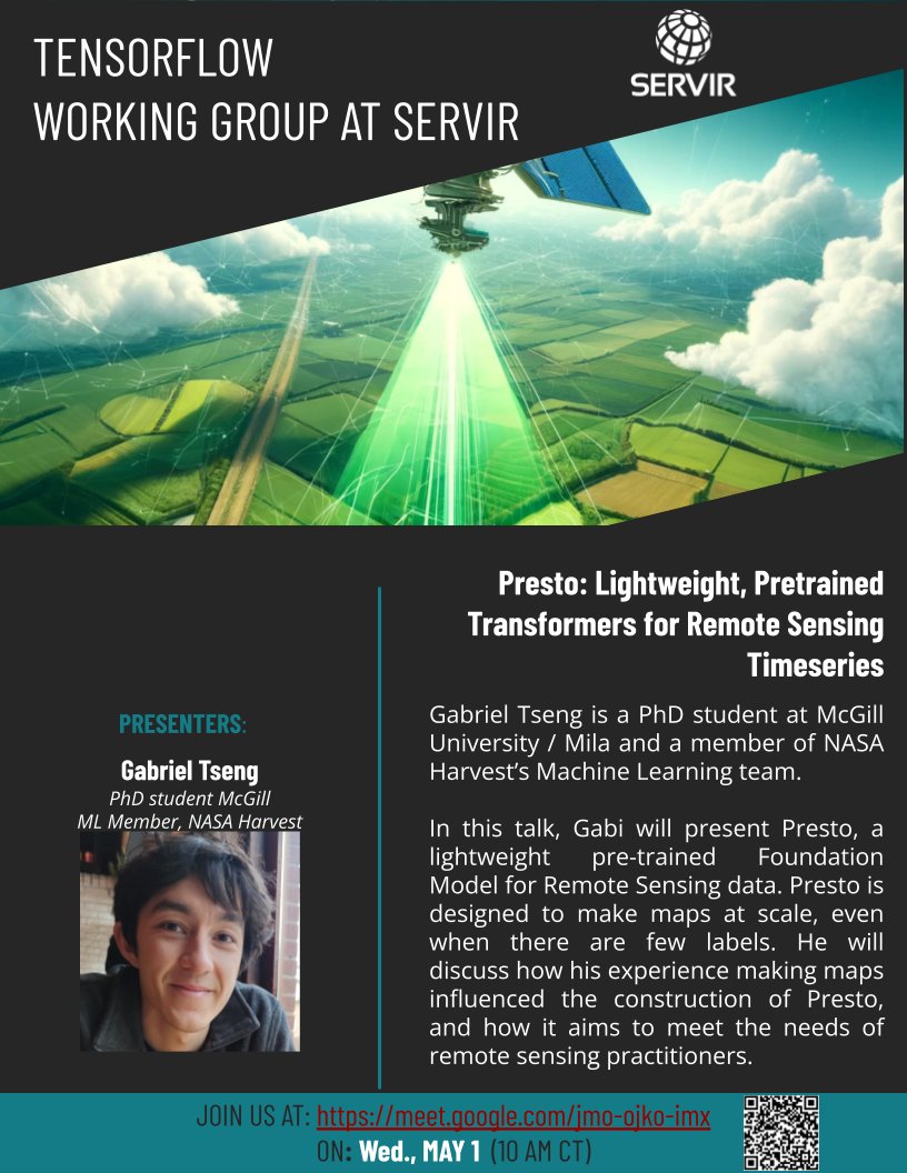
ℹ️ Join us on Wed May 1, for talk by Gabriel Tseng on Presto, a Lightweight, Pretrained Transformers for Remote Sensing Timeseries at the SERVIR's Geo-AI Working Group.
🔗 Link to Call: meet.google.com/jmo-ojko-imx 🌐 tinyurl.com/join-geo-ai-wg
📷 Past videos: tinyurl.com/watch-tfwg

ℹ️ Join us on Wed May 1, for talk by Gabriel Tseng on Presto, a Lightweight, Pretrained Transformers for Remote Sensing Timeseries at the SERVIR's Geo-AI Working Group.
🔗 Link to Call: meet.google.com/jmo-ojko-imx 🌐 tinyurl.com/join-geo-ai-wg
📷 Past videos: tinyurl.com/watch-tfwg
account_circle
UK Centre for Ecology & Hydrology(@UK_CEH) 's Twitter Profile Photo

📢 ! We're seeking an experienced Peatland Remote Sensing Scientist to join our team.

Apply your remote sensing expertise to develop our understanding of peatlands, croplands & coastal habitats such as saltmarshes & sand dunes.

Apply here: ceh.wd3.myworkdayjobs.com/CEH_Careers/jo…
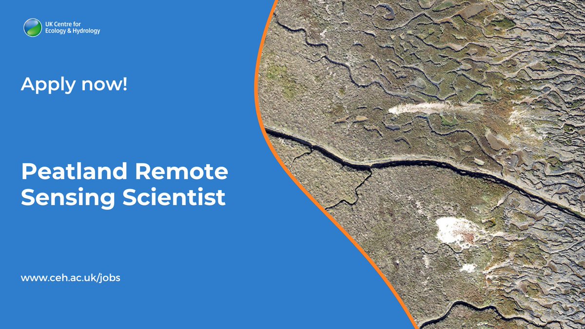
📢#HiringNow! We're seeking an experienced Peatland Remote Sensing Scientist to join our team. 

Apply your remote sensing expertise to develop our understanding of peatlands, croplands & coastal habitats such as saltmarshes & sand dunes.

Apply here: ceh.wd3.myworkdayjobs.com/CEH_Careers/jo…
account_circle
Nina DN ❤️🇨🇳(@ninadn21) 's Twitter Profile Photo

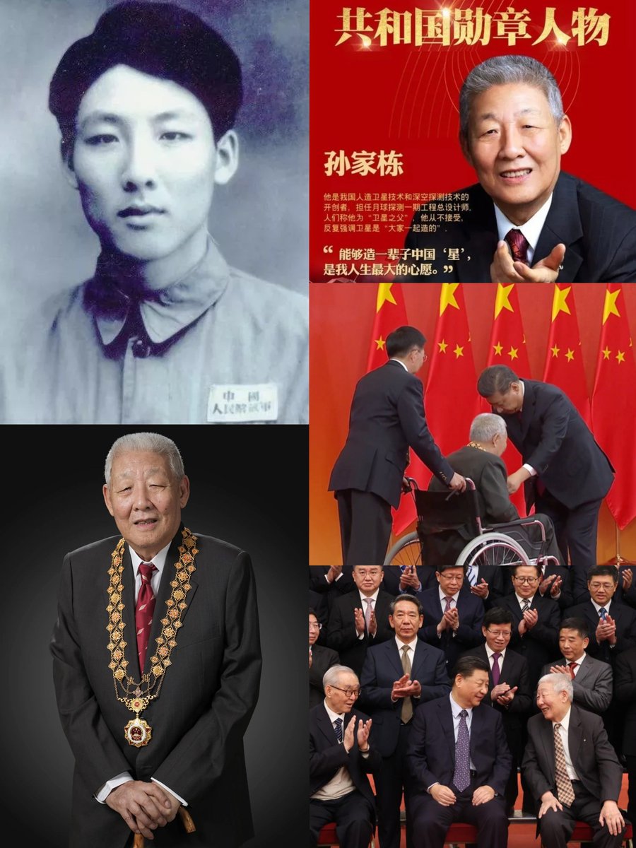
Happy 95th birthday to our esteemed scientist!❤️🫡
Sun Jiadong, CPC member, Chief Designer of China's DF-2 & DF-3 IRBMs, 1st artificial & remote sensing satellites, Beidou Navigation Satellite System, & Chinese Lunar Exploration Program

Happy 95th birthday to our esteemed scientist!❤️🫡
Sun Jiadong, CPC member, Chief Designer of China's DF-2 & DF-3 IRBMs, 1st artificial & remote sensing satellites, Beidou Navigation Satellite System, & Chinese Lunar Exploration Program
account_circle
TN Irrigated Agriculture Modernization Project(@TNIAMProject) 's Twitter Profile Photo

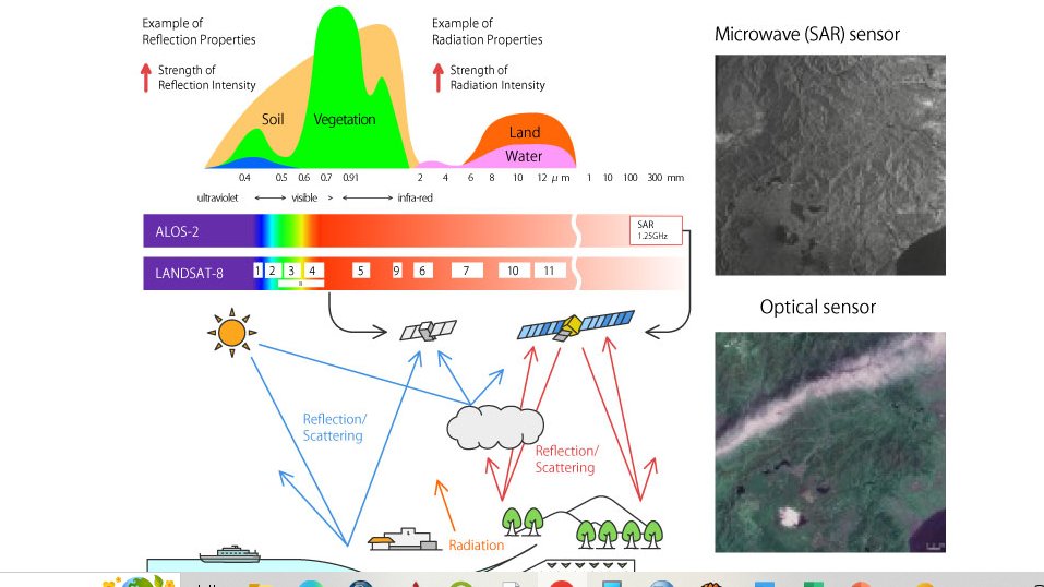
GIS-What is Satellite Remote Sensing?
Earth observation satellites are the satellites equipped with remote sensing technology. Various sensors are equipped on these satellites in accordance with their respective missions.📍

GIS-What is Satellite Remote Sensing?
Earth observation satellites are the satellites equipped with remote sensing technology. Various sensors are equipped on these satellites in accordance with their respective missions.📍
account_circle
EvoLand(@EvoLandEU) 's Twitter Profile Photo

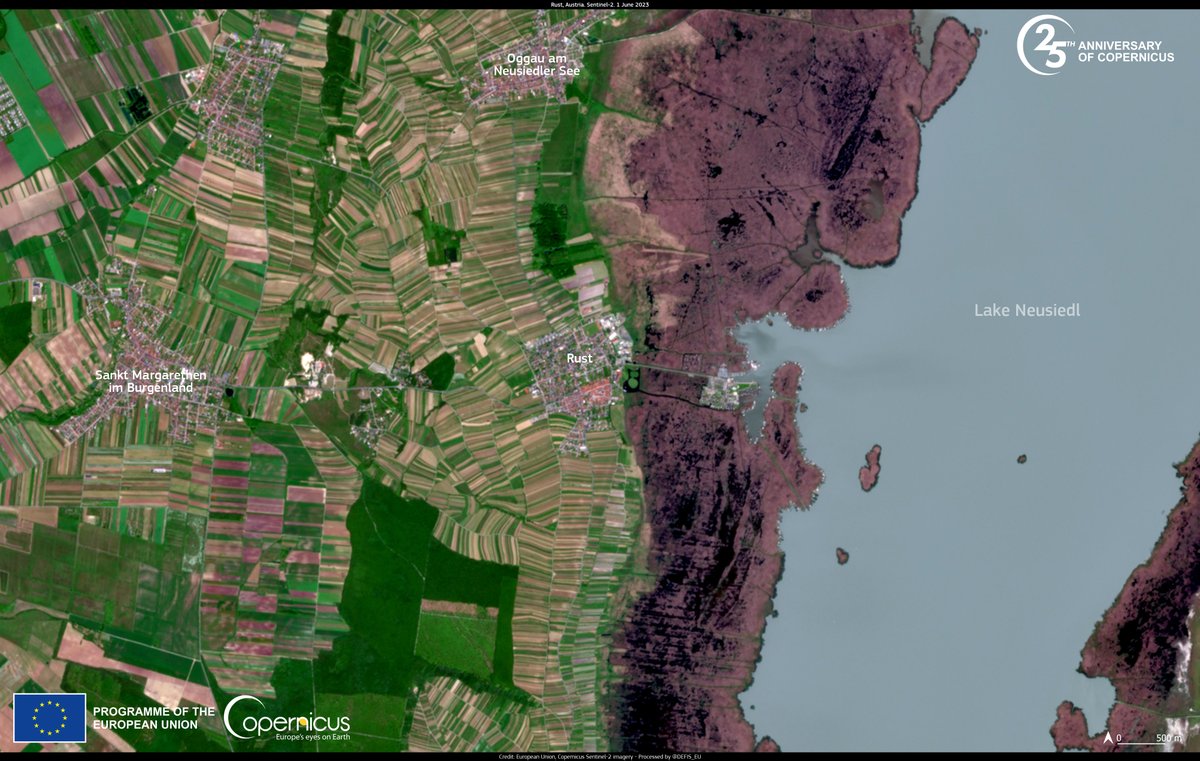
🌍 Big News! 🚀 Our latest article, ' Innovating land cover monitoring by complementing annual land cover maps with near real-time observations' is live!

Read now: evo-land.eu/innovating-lan…

🌍 Big News! 🚀 Our latest article, ' Innovating land cover monitoring by complementing annual land cover maps with near real-time observations' is live! 

Read now: evo-land.eu/innovating-lan…

#LandCover #RemoteSensing #Innovation #EO
account_circle
Colin Wyse(@realColinWyse) 's Twitter Profile Photo

Yep, ALL our asses are connected to the cloud, pervasive remote sensing, polling and ‘heathcare’ [pre-2020]

Yep, ALL our asses are connected to the cloud, pervasive remote sensing, polling and ‘heathcare’ [pre-2020]
account_circle
Emerald(@theemeraldco) 's Twitter Profile Photo

Introducing automated processes such as machine learning in our remote sensing data analysis to track emeralds, besides the physical methods, is also a focus of in considering ESG as a major responsibility.

Introducing automated processes such as machine learning in our remote sensing data analysis to track emeralds, besides the physical methods, is also a focus of #EMERALD in considering ESG as a major responsibility.
account_circle
IEEE Geoscience and Remote Sensing Society(@IEEE_GRSS) 's Twitter Profile Photo

📣 Call for GRSS YP Ambassador
👉Are you an GRSS member who graduated from your first professional degree within the past 15 years – an IEEE GRSS YP ? Then we invite you to apply for our GRSS “YP Ambassador” program!
🗓️ July 1, 2024
🔗 : shorturl.at/ejnQ6

📣 Call for GRSS YP Ambassador
👉Are you an GRSS member who graduated from your first professional degree within the past 15 years – an IEEE GRSS YP ? Then we invite you to apply for our GRSS “YP Ambassador” program!
🗓️ July 1, 2024
🔗 : shorturl.at/ejnQ6
account_circle
VITO Remote Sensing(@VITO_RS_) 's Twitter Profile Photo

🆕 Proud to announce the launch of or Application Propagation Environment(s)!

An innovative service initiated by European Space Agency to:

💡 enhance the reuse of results
💡 optimize collaboration & innovation
💡 facilitate transition to operational services

remotesensing.vito.be/news/new-esa-a…
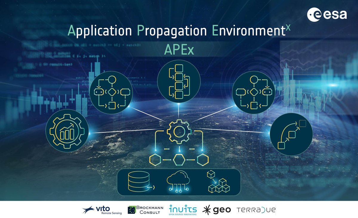
🆕 Proud to announce the launch of #APEx or Application Propagation Environment(s)!

An innovative service initiated by @esa to:
 
💡 enhance the reuse of #EO results
💡 optimize collaboration & innovation
💡 facilitate transition to operational services

remotesensing.vito.be/news/new-esa-a…
account_circle
HUC Secretariat(@HUCSecretariat) 's Twitter Profile Photo

Join us on May 14th for an illuminating webinar on 'Remote Sensing in Risk Management in High Mountain Asia', sponsored by IEEE Geoscience and Remote Sensing Society REACT TC.

Register here: rb.gy/6si1w6
Details: hkh.pub/4a2et5x
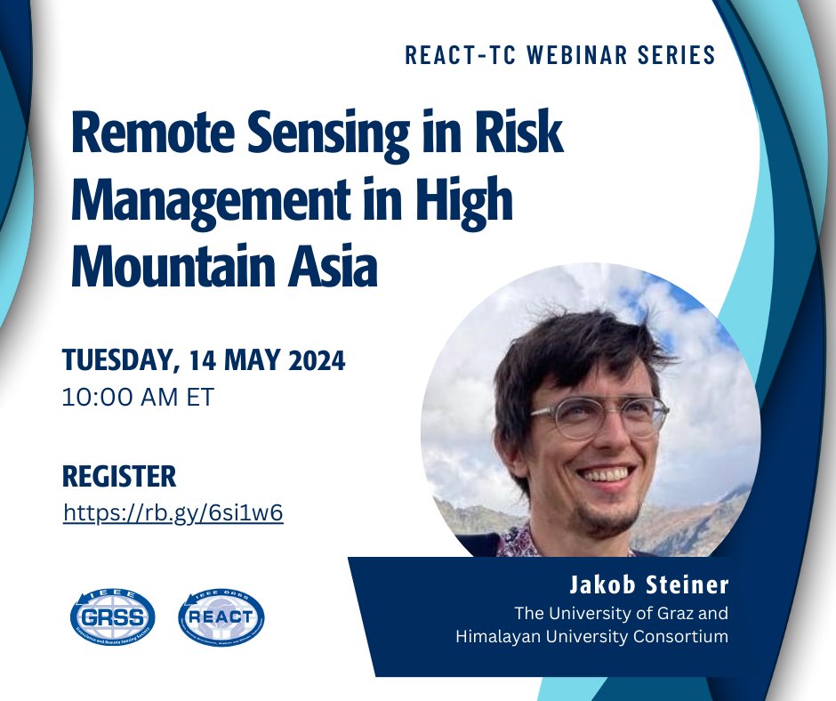
Join us on May 14th for an illuminating webinar on 'Remote Sensing in Risk Management in High Mountain Asia', sponsored by @IEEE_GRSS REACT TC.

Register here: rb.gy/6si1w6
Details: hkh.pub/4a2et5x
account_circle
VITO Remote Sensing(@VITO_RS_) 's Twitter Profile Photo

Spotting tulips from space! 🌷🛰️🇳🇱

Six weeks a year, a range of tulips bloom in , Europe’s largest flower garden!

Discover a rainbow of colors over the years in the image gallery 👇

dataspace.copernicus.eu/gallery/2023-4…

ESA Earth Observation 🇪🇺 DG DEFIS #StrongerTogether Sinergise CloudFerro S.A. T-Systems

account_circle
GIS and Science(@GISandScience) 's Twitter Profile Photo

Picture a world where the hidden becomes visible and our planet’s unseen layers are revealed in a new light. The satellites and their multispectral sensors have become key observers of our planet and are revealing our world like never before: esri.social/akjz50R9ESb

account_circle
Laurent ALFONSO(@LaurentAlfonso) 's Twitter Profile Photo

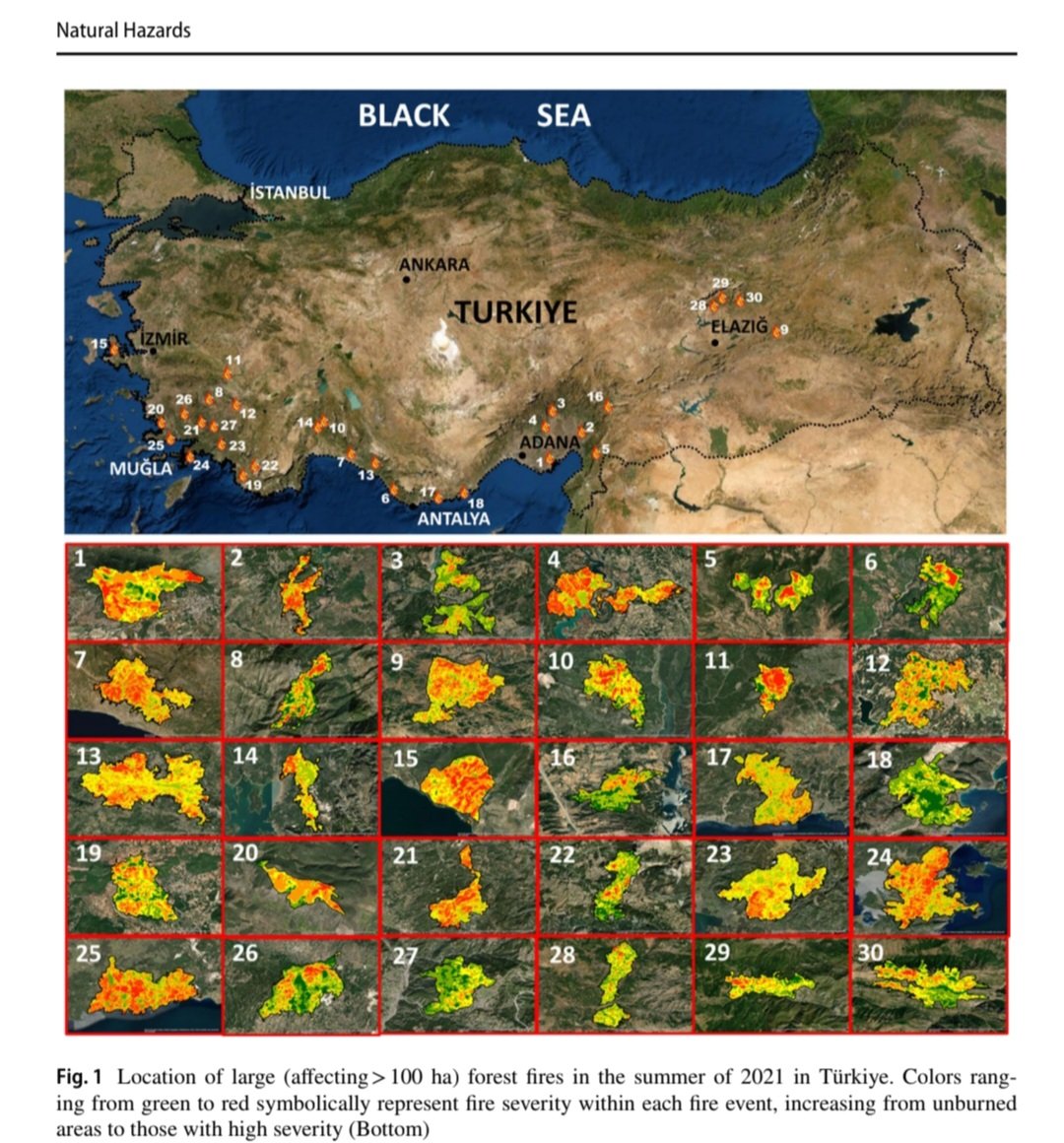
Remote sensing and GIS-based inventory and analysis of the unprecedented 2021 forest fires🔥 in Türkiye’s 🇹🇷 history preventionweb.net/quick/84838

Remote sensing and GIS-based inventory and analysis of the unprecedented 2021 forest fires🔥 in Türkiye’s 🇹🇷 history  preventionweb.net/quick/84838
account_circle