Amazon Conservation Team(@AmazonTeamOrg) 's Twitter Profile Photo

šŸŒŽšŸŒ“šŸŒ Through the ā€œLiving Territoriesā€ storymap, join us for stories about how our work to advance is helping to indigenous and local communities in Colombia to manage and preserve some of the worldā€™s most critical ecosystems: storymaps.arcgis.com/stories/6fa6d4ā€¦ā€¦

šŸŒŽšŸŒ“šŸŒ Through the ā€œLiving Territoriesā€ storymap, join us for stories about how our work to advance #territorialrights is helping to #empower indigenous and local communities in Colombia to manage and preserve some of the worldā€™s most critical ecosystems: storymaps.arcgis.com/stories/6fa6d4ā€¦ā€¦
account_circle
Orla-Peach(@orlapeach) 's Twitter Profile Photo

The first of our Source to Seas - Zero Pollution 2030 is now complete! Thanks to the stakeholders who participated and our partners at Wageningen U&R for organising and facilitating the event!

You can learn more about the issue of PFAS in our Storymap below:
storymaps.arcgis.com/stories/dc9f7dā€¦

account_circle
USGS Landsat(@USGSLandsat) 's Twitter Profile Photo

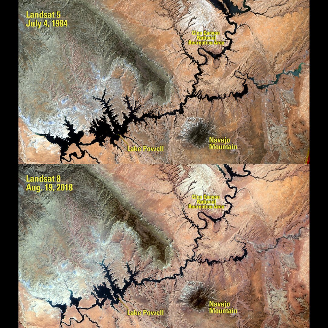
LANDSAT. The longest continuously running Earth-observing satellite program offers unique views of Earthā€™s land each day. We celebrate our planet every day from the vantage point of 438 miles above the surface! Check out the Landsat Science Storymap: ow.ly/JxuV50RlpPQ.

LANDSAT. The longest continuously running Earth-observing satellite program offers unique views of Earthā€™s land each day. We celebrate our planet every day from the vantage point of 438 miles above the surface! Check out the Landsat Science Storymap: ow.ly/JxuV50RlpPQ.
account_circle
UW Environmental & Occupational Health Sciences(@UWDEOHS) 's Twitter Profile Photo

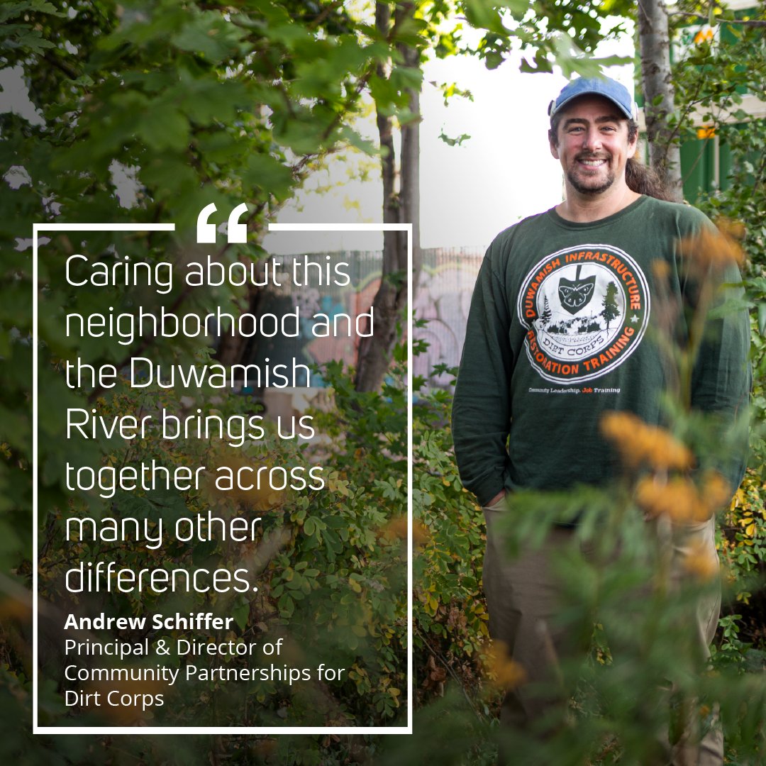
Happy ! Check out this storymap featuring Duwamish Valley community members who are prioritizing environmental health, green space and community perspectives to build climate resilience: deohs.washington.edu/edge/blog/resiā€¦

Happy #EarthDay! Check out this storymap featuring Duwamish Valley community members who are prioritizing environmental health, green space and community perspectives to build climate resilience: deohs.washington.edu/edge/blog/resiā€¦
account_circle
AlcisGeo(@AlcisGeo) 's Twitter Profile Photo

Our most recent , with David Mansfield for XCEPT Research, explores two Taliban-ruled provinces, Nimroz and Samangan, to explore how they differ economically and politically.

To learn more, explore our interactive StoryMap here:
storymaps.arcgis.com/stories/b35734ā€¦

Our most recent #StoryMap, with @mansfieldintinc for @XCEPT_Research, explores two Taliban-ruled provinces, Nimroz and Samangan, to explore how they differ economically and politically.

To learn more, explore our interactive StoryMap here:
storymaps.arcgis.com/stories/b35734ā€¦
account_circle
Melissa Data India(@melissadataind) 's Twitter Profile Photo

Check out Melissa's team's StoryMap on the recent 4.8 magnitude earthquake in New Jersey on April 5th. Discover the impact on states, counties, zip codes, land parcels, and addresses near the epicenter. Powered by
Esri - view here: i.melissa.com/4b8rUSt

Check out Melissa's #GIS team's StoryMap on the recent 4.8 magnitude earthquake in New Jersey on April 5th. Discover the impact on states, counties, zip codes, land parcels, and addresses near the epicenter. Powered by 
@Esri - view here: i.melissa.com/4b8rUSt #EsriPartner
account_circle
AlcisGeo(@AlcisGeo) 's Twitter Profile Photo

Our latest with David Mansfield for XCEPT Research has been published!

If you're interested in the current political and economic landscape of Afghanistan's provinces Nimroz and Samangan, read our storymap linked below ā¬‡ļø
storymaps.arcgis.com/stories/b35734ā€¦

Our latest #StoryMap with @mansfieldintinc for @XCEPT_Research has been published!

If you're interested in the current political and economic landscape of Afghanistan's provinces Nimroz and Samangan, read our storymap linked below ā¬‡ļø
storymaps.arcgis.com/stories/b35734ā€¦
account_circle
Copernicus ECMWF(@CopernicusECMWF) 's Twitter Profile Photo

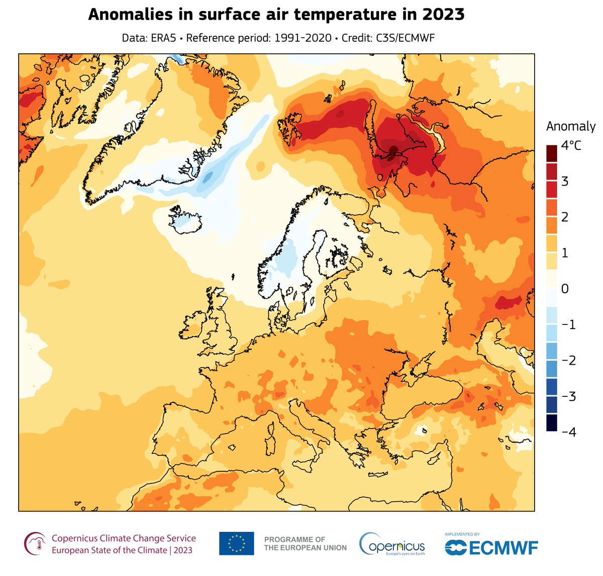
The first report produced jointly with World Meteorological Organization provides data and insights about WMOā€™s Regional Association VI members and a focus on Policy & Action.

See WMOā€™s storymap summary of the report: storymaps.arcgis.com/stories/58d385ā€¦

The first #ESOTC report produced jointly with @WMO provides data and insights about WMOā€™s Regional Association VI members and a focus on Policy & Action.

See WMOā€™s storymap summary of the report: storymaps.arcgis.com/stories/58d385ā€¦
account_circle
VBCPS Environmental Studies Program(@VBEnvStudies) 's Twitter Profile Photo

Two of our amazing students presented at the North Landing River & Albemarle Sound Estuarine Symposium! First high school students to ever present at this event! They were inspiring and this is the Storymap they made: storymaps.arcgis.com/stories/f66876ā€¦

account_circle
Scott Meinhardt(@scottmeinhardt) 's Twitter Profile Photo

Roof reflectivity and topology can help with heat . The City of Cambridge, MA, USA used in generalā€”and in particularā€”to understand the scope and distribution of community roof types and inform their citizens using a . ow.ly/LTHX30sBbXS

Roof reflectivity and topology can help with heat #adaptation. The City of Cambridge, MA, USA used #GIS in generalā€”and #ArcGIS in particularā€”to understand the scope and distribution of community roof types and inform their citizens using a #Storymap. ow.ly/LTHX30sBbXS
account_circle
Noam Raydan(@NoamRaydan) 's Twitter Profile Photo

All the details on the Houthi-led attacks can be found in our Washington Institute ArcGIS StoryMap which tracks maritime attacks in the Middle East since 2019. Today's attack will be added once all details have been confirmed: storymaps.arcgis.com/stories/756ca7ā€¦

All the details on the Houthi-led attacks can be found in our @WashInstitute ArcGIS StoryMap which tracks maritime attacks in the Middle East since 2019. Today's attack will be added once all details have been confirmed: storymaps.arcgis.com/stories/756ca7ā€¦
account_circle
Scott Meinhardt(@scottmeinhardt) 's Twitter Profile Photo

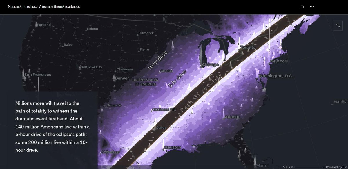
Excellent blog by Cooper Thomas from the Esri StoryMaps team on using Map Viewer-based workflows for the story, Mapping the eclipse: A journey through darkness. Follow along to see how you can use these workflows. ow.ly/uYy850R5GvS

StoryMap: ow.ly/xeqj30sBeZR

Excellent blog by Cooper Thomas from the @Esri StoryMaps team on using Map Viewer-based workflows for the story, Mapping the eclipse: A journey through darkness. Follow along to see how you can use these workflows. ow.ly/uYy850R5GvS

StoryMap: ow.ly/xeqj30sBeZR
account_circle
State of Global Air(@HEISoGA) 's Twitter Profile Photo

This we want to focus on the ways air pollution, climate change, & health are intertwined. fossil fuels contributed to over 1 million deaths from air pollution in 2019?

Fossil fuels StoryMap: bit.ly/476U8eH
Climate & health video: bit.ly/3Uxih7w

account_circle
AllieCatails(@AllieCatails) 's Twitter Profile Photo

The NU Knight Lab has a couple cool design timeline type-beat resources that might work re: your dan cant tweet convo on stream today, Destiny. See Storymap, Timeline, Storyline, etc. knightlab.northwestern.edu/projects/

account_circle
Otonabee Conservation(@OtonabeeC) 's Twitter Profile Photo

Our 2023 Annual Report to the Watershed Community StoryMap is now available for viewing online! It highlights our accomplishments, thanks donors for their contributions, and gives supporters a better understanding of our impact.

storymaps.arcgis.com/stories/fba99eā€¦

Our 2023 Annual Report to the Watershed Community StoryMap is now available for viewing online! It highlights our accomplishments, thanks donors for their contributions, and gives supporters a better understanding of our impact.

storymaps.arcgis.com/stories/fba99eā€¦
account_circle
John Steffenson(@jsteffenson) 's Twitter Profile Photo

Happy Arbor Day! šŸŒ³šŸ’š

Another beautiful StoryMap by the StoryMap team, Thanks Ross and team! - Celebrate the contribution of trees to our health and planet ā€” with .
ow.ly/REPk50Rp6yB

account_circle
Scott Meinhardt(@scottmeinhardt) 's Twitter Profile Photo

Supercharge your ArcGIS StoryMap stories with media actions that help enrich your stories with optional media behavior and map interactions in sidecar slides. ow.ly/gS6O50R6b9J

Supercharge your ArcGIS StoryMap stories with media actions that help enrich your stories with optional media behavior and map interactions in sidecar slides. ow.ly/gS6O50R6b9J
account_circle
Prince George's County Planning Department(@PGPlanningMD) 's Twitter Profile Photo

While traffic congestion is rated by studies as moderate in the area, the number of fatal accidents along Central Avenue is concerning. See StoryMap for details at pgplan.org/blueline

While traffic congestion is rated by studies as moderate in the #BlueLinePlan area, the number of fatal accidents along Central Avenue is concerning. See StoryMap for details at pgplan.org/blueline
account_circle