USGS South Atlantic Water Science Center(@USGS_SAWSC) 's Twitter Profile Photo

Kendra Smith & Dale Skipper visited Coosawhatchie River Near Hampton, SC - 02176500 today to make measurements in the wake of Idalia. They captured this video while out in the field. This gage is part of the USGS Federal Priority Streamgage Network: ow.ly/isj550PGYJr

account_circle
USGS StreamStats(@USGSStreamStats) 's Twitter Profile Photo

Happy Maryland Statehood Day to our friends at @usgs_md_de_dc !

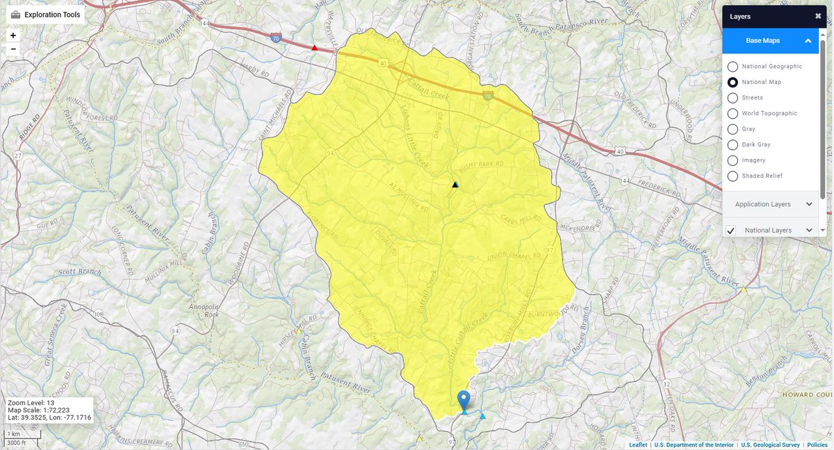
Pictured here is the watershed of streamgage # 01591400, Cattail Creek near Glenwood, MD. Our Maryland application has water use functionality, 5 types of flow statistics, and 14 basin characteristics.

Happy Maryland Statehood Day to our friends at @usgs_md_de_dc ! 

Pictured here is the watershed of streamgage # 01591400, Cattail Creek near Glenwood, MD. Our Maryland application has water use functionality, 5 types of flow statistics, and 14 basin characteristics.
account_circle
USGS StreamStats(@USGSStreamStats) 's Twitter Profile Photo

It's Watershed Wednesday again! Today we feature the watershed of USGS in Oklahoma streamgage # 07324400 , Washita River near Foss, OK.

Our Oklahoma application features 18 types of flow statistics and 20 different basin characteristics.
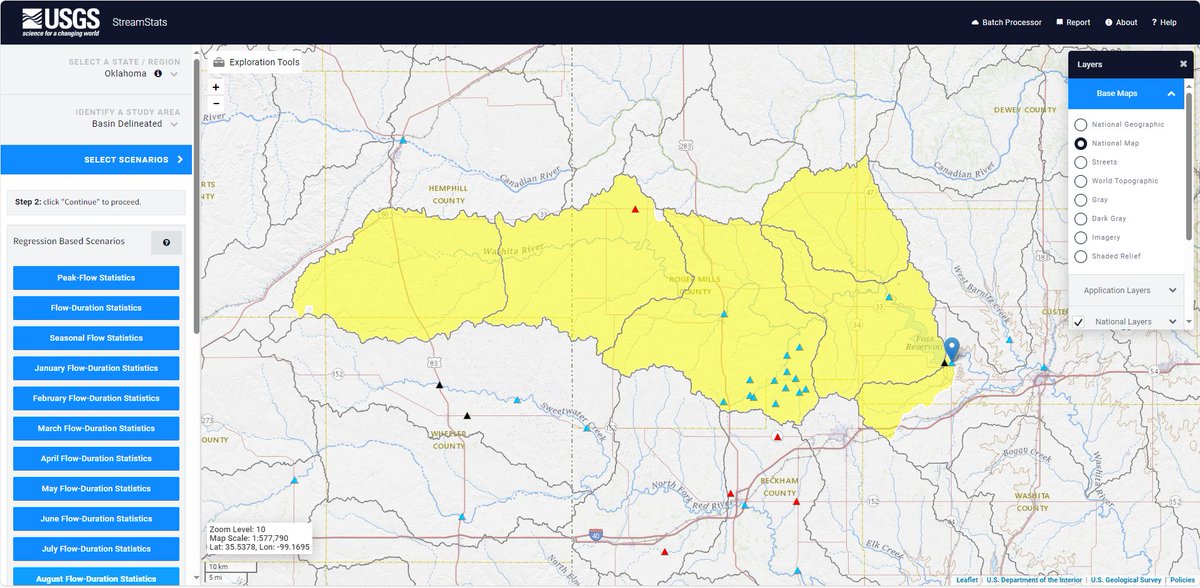
It's Watershed Wednesday again! Today we feature the watershed of @USGS_Oklahoma streamgage # 07324400 , Washita River near Foss, OK. 

Our Oklahoma application features 18 types of flow statistics and 20 different basin characteristics.
account_circle
USGS Data Science(@USGS_DataSci) 's Twitter Profile Photo

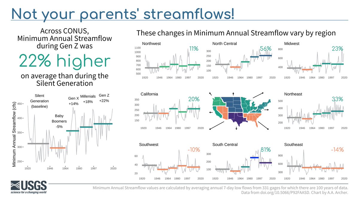
Not your parents’... streamflow 💧

Using 100 years of USGS data, we show minimum annual streamflow across generations. How does today compare to the “Silent Generation' across ?

| Historic 📅 | by Althea Archer

Not your parents’... streamflow 💧

Using 100 years of @USGS #streamgage data, we show minimum annual streamflow across generations. How does today compare to the “Silent Generation' across #CONUS?

#Day4 | #30DayChartChallenge Historic 📅 | #DataViz by Althea Archer
account_circle
USGS in Idaho(@USGS_Idaho) 's Twitter Profile Photo

You can literally keep an eye on this situation thanks the at our Portneuf River at : waterdata.usgs.gov/monitoring-loc….

account_circle
USGS Water Resources(@USGS_Water) 's Twitter Profile Photo

This uses our streamgage network to check conditions before heading out for an adventure in the Mt. Hood National Forest area. 🤳🛶🏔

This #FollowerInTheField uses our streamgage network to check conditions before heading out for an adventure in the Mt. Hood National Forest area. #GageGreatness #MtHood  🤳🛶🏔
account_circle
DNR, Nebraska(@NebraskaDNR) 's Twitter Profile Photo

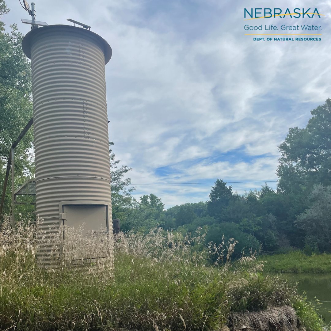
Have you seen one of these structures by a canal or stream and wondered what the heck it was? It's a streamgage house! It stores the equipment DNR and local NRDs use to record streamflow!

Have you seen one of these structures by a canal or stream and wondered what the heck it was? It's a streamgage house! It stores the equipment DNR and local NRDs use to record streamflow!

#WaterWednesday #Streamgaging #NeDNR
account_circle
Annalise (she/her)(@annalisemporter) 's Twitter Profile Photo

Also, I saw a streamgage on the map and went to find it because I can't help myself. This is Kings Canyon Creek and it was running at 2.7 cfs.

Also, I saw a streamgage on the map and went to find it because I can't help myself. This is Kings Canyon Creek and it was running at 2.7 cfs.
account_circle
USGS in Idaho(@USGS_Idaho) 's Twitter Profile Photo

We just installed this information sign at our Portneuf River streamgage in City of Pocatello. This is the second in a proposed series of flood information signs developed by the Silver Jackets team, of which we are a member: ow.ly/KSb750Rof6U.

We just installed this #flood information sign at our Portneuf River streamgage in @cityofpocatello. This is the second in a proposed series of flood information signs developed by the #Idaho Silver Jackets team, of which we are a member: ow.ly/KSb750Rof6U. #USGS
account_circle
USGS in Idaho(@USGS_Idaho) 's Twitter Profile Photo

Our streamgage downstream of Wolverine Creek is reporting a new record high streamflow for May 1: 2,290 cfs. Previous record of 1,830 cfs set in 1986. waterdata.usgs.gov/monitoring-loc…

account_circle
Joseph Elfelt https://m.ai6yr.org/@mappingsupport(@MappingSupport) 's Twitter Profile Photo

Red area has 40-69% chance of excessive rain today. Click any dot and follow the link to see streamgage data. Click “Map tips” upper left corner for more info.

Open map: bit.ly/3FKkx6o

Red area has 40-69% chance of excessive rain today.  Click any dot and follow the link to see streamgage data.  Click “Map tips” upper left corner for more info.  #ARwx #TNwx #MOwx #ILwx #INwx #KYwx

Open #GISsurfer map:  bit.ly/3FKkx6o
account_circle
DNR, Nebraska(@NebraskaDNR) 's Twitter Profile Photo

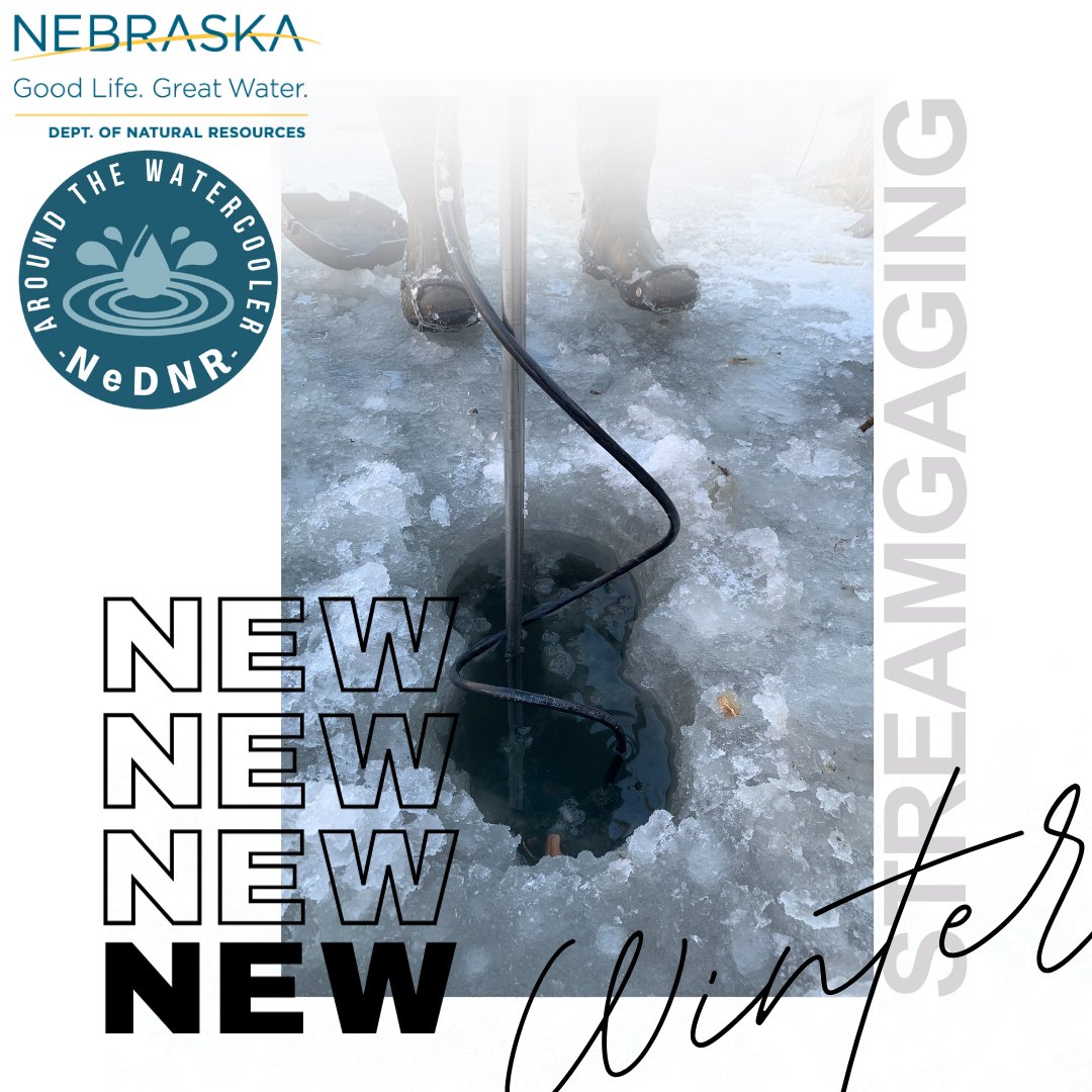
How do we streamgage when there's ice on the rivers and streams?😮

Watch our video! youtu.be/3TSHK0njlOs?si…

Or, listen here:
Podbean: bit.ly/42Doeog

DNR.Nebraska.gov

How do we streamgage when there's ice on the rivers and streams?😮 

Watch our video! youtu.be/3TSHK0njlOs?si…

Or, listen here:
Podbean: bit.ly/42Doeog

DNR.Nebraska.gov
account_circle
USGS South Atlantic Water Science Center(@USGS_SAWSC) 's Twitter Profile Photo

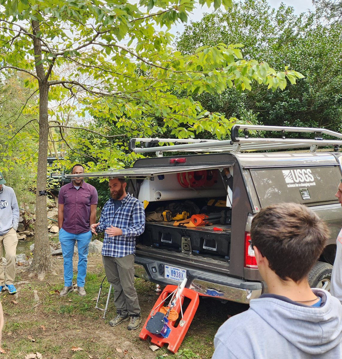
SAWSC Hydrologic Technician Adam Gray discussed streamflow data collection with an Environmental Technology class at NC State University. The students also got a field tour of the streamgage and groundwater monitoring sites at Rocky Branch in Raleigh, NC.

SAWSC Hydrologic Technician Adam Gray discussed streamflow data collection with an Environmental Technology class at NC State University. The students also got a field tour of the streamgage and groundwater monitoring sites at Rocky Branch in Raleigh, NC. #TechTuesday
account_circle
USGS MD-DE-DC(@USGS_MD_DE_DC) 's Twitter Profile Photo

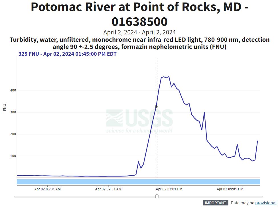
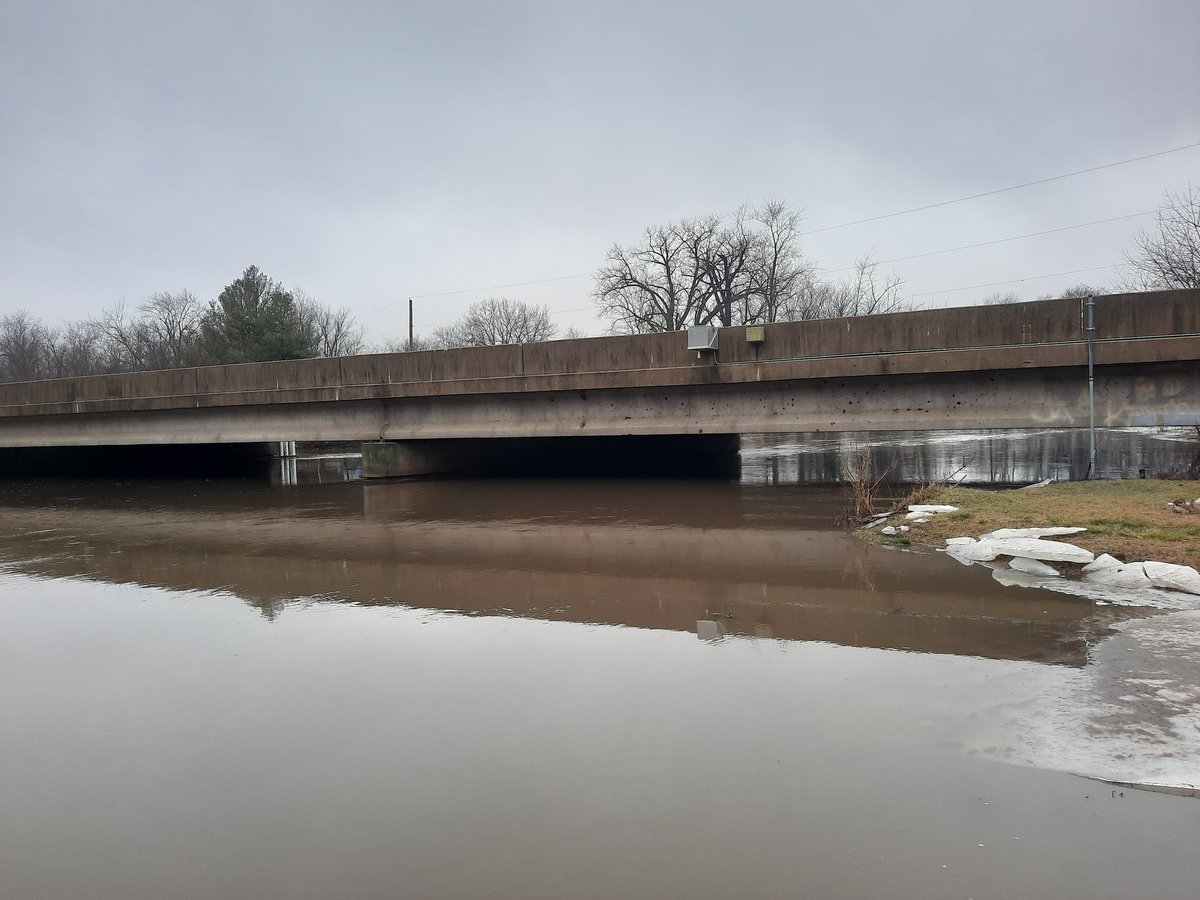
This photo shows the Potomac River at Point of Rocks, MD (01638500) on April 2 when the river turned a muddy color due to suspended sediment. Our streamgage registered the spike in turbidity as seen in the hydrograph. waterdata.usgs.gov/monitoring-loc…

Photo credit: Lauren Kurtz

This photo shows the Potomac River at Point of Rocks, MD (01638500) on April 2 when the river turned a muddy color due to suspended sediment. Our streamgage registered the spike in turbidity as seen in the hydrograph. waterdata.usgs.gov/monitoring-loc…

Photo credit: Lauren Kurtz
account_circle
USGS Science in Utah(@USGS_UT) 's Twitter Profile Photo

Field Office has been hard at work. New streamgage, Colorado River at Gypsum Canyon near Hite, UT, quantifies flow directly entering from the Upper Colorado and Green Rivers allowing water managers to improve estimates of inflow volumes and TDS loads to the lake

#Moab Field Office has been hard at work. New streamgage, Colorado River at Gypsum Canyon near Hite, UT, quantifies flow directly entering #LakePowell from the Upper Colorado and Green Rivers allowing water managers to improve estimates of inflow volumes and TDS loads to the lake
account_circle
USGS in Idaho(@USGS_Idaho) 's Twitter Profile Photo

A hydrographer's-eye view of measuring peak streamflow on the Willow Creek Floodway Channel near Idaho Falls: waterdata.usgs.gov/monitoring-loc…. We operate this streamgage station in cooperation with 's Water District 1.

A hydrographer's-eye view of measuring peak streamflow on the Willow Creek Floodway Channel near Idaho Falls: waterdata.usgs.gov/monitoring-loc…. We operate this streamgage station in cooperation with #Idaho's Water District 1. #USGS #streamflow #streamgage #irrigation
account_circle
USGS StreamStats(@USGSStreamStats) 's Twitter Profile Photo

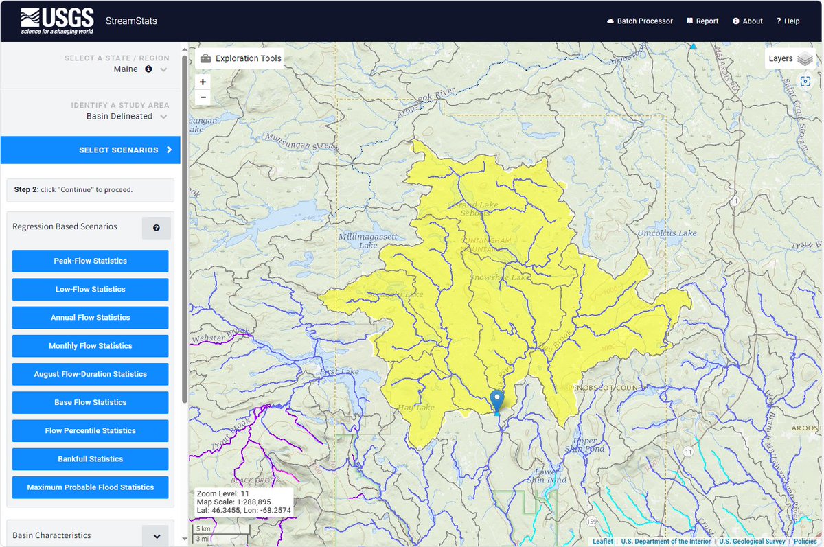
Happy Statehood Day to Maine! Pictured here is the watershed of USGS streamgage #01029200, Seboeis River near Shin Pond, ME.

Maine users can calculate 9 types of flow statistics and over 25 basin characteristics. Learn more at ow.ly/HkE350QJZnk

Happy Statehood Day to Maine! Pictured here is the watershed of USGS streamgage #01029200, Seboeis River near Shin Pond, ME. 

Maine users can calculate 9 types of flow statistics and over 25 basin characteristics. Learn more at ow.ly/HkE350QJZnk
account_circle