TxDOT(@TxDOT) 's Twitter Profile Photo

Roads are closed for a reason, you never know what dangers may be out of sight. Rain and floods have affected multiple roads across the state, please check drivetexas.org for the latest on closures and conditions.

Roads are closed for a reason, you never know what dangers may be out of sight. Rain and floods have affected multiple roads across the state, please check drivetexas.org for the latest on closures and conditions. #TurnAroundDontDrown
account_circle
TxDOT- HOU District(@TxDOTHouston) 's Twitter Profile Photo

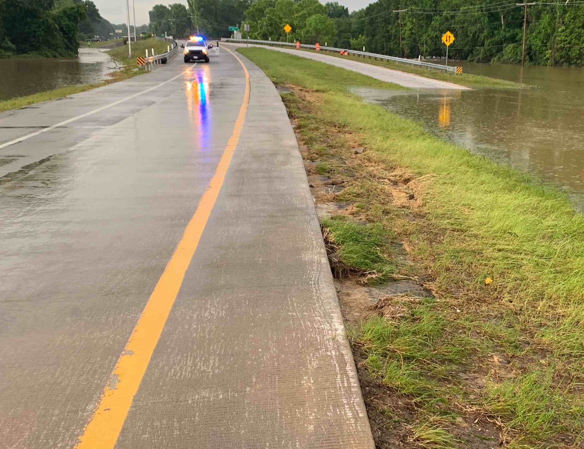
Some state roads are still experiencing high water issues. and get a full list of impacted roadways at traffic.houstontranstar.org/roadclosures/#…. Remember to never drive through high water!

Some state roads are still experiencing high water issues. #KnowBeforeYouGo and get a full list of impacted roadways at traffic.houstontranstar.org/roadclosures/#…. Remember to never drive through high water! #TurnAroundDontDrown
account_circle
NWS Houston(@NWSHouston) 's Twitter Profile Photo

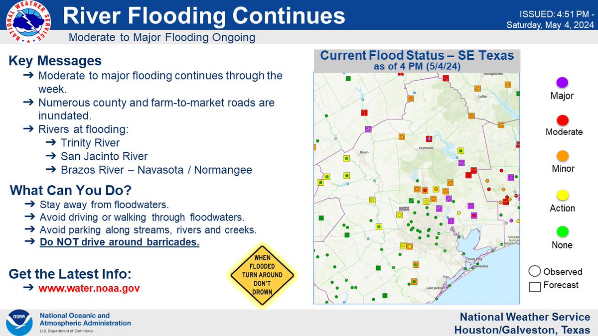
The next round of showers & storms will begin late tonight into Sunday afternoon. Flood Watch continues with rainfall of 1-3' with isolated amounts of 4-8' will be possible over the areas still dealing with ongoing flooding issues.

Remember

The next round of showers & storms will begin late tonight into Sunday afternoon. Flood Watch continues with rainfall of 1-3' with isolated amounts of 4-8' will be possible over the areas still dealing with ongoing flooding issues.

Remember #TurnAroundDontDrown

#TXwx #HOUwx
account_circle
TxDOT Austin(@TxDOTAustin) 's Twitter Profile Photo

Storms moving through Central Texas with lots of rain. Slow down and drive to conditions. Remember, never drive through rushing or pooling water.

Storms moving through Central Texas with lots of rain. Slow down and drive to conditions. Remember, never drive through rushing or pooling water. #TurnAroundDontDrown #BeSafeDriveSmart #ATXtraffic
account_circle
KPRC 2 Houston(@KPRC2) 's Twitter Profile Photo

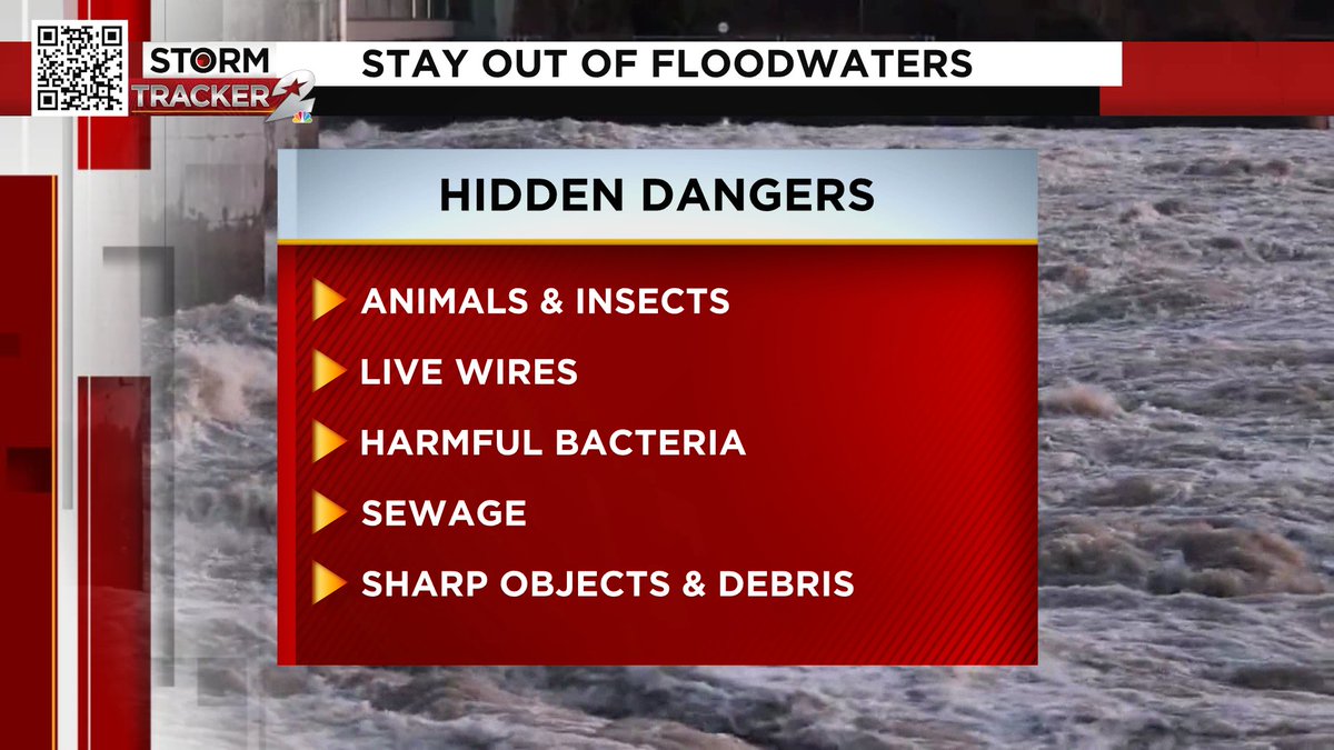
Not only can you be swept away, but floodwaters can also hide dangers that can cause sickness, injury or even death! Do not let children play in floodwaters!

Not only can you be swept away, but floodwaters can also hide dangers that can cause sickness, injury or even death! Do not let children play in floodwaters! #TurnAroundDontDrown
account_circle
Atascocita Fire Department(@AVFDOEM) 's Twitter Profile Photo

TRAFFIC ALERT: Be advised that there are high 🌊water spots on roadways throughout the Atascocita area. Please avoid being out on the roads if you can do so. Never drive into water that is higher than the curbside.

TRAFFIC ALERT:  Be advised that there are high 🌊water spots on roadways throughout the Atascocita area.  Please avoid being out on the roads if you can do so.  Never drive into water that is higher than the curbside.  #TurnAroundDontDrown
account_circle
PHI Med One Conroe Texas(@MedOneConroeTX) 's Twitter Profile Photo

Heavy rainfall has caused large areas of flooding in our County and surrounding counties. They continue to release water from lakes as well. Everyone stay safe out there, and if you come across water while driving, Turn around don’t drown!

Heavy rainfall has caused large areas of flooding in our County and surrounding counties. They continue to release water from lakes as well. Everyone stay safe out there, and if you come across water while driving, Turn around don’t drown!

#Safety #Turnarounddontdrown
account_circle
Atascocita Fire Department(@AVFDOEM) 's Twitter Profile Photo

WEATHER ALERT: Tonight into tomorrow there is a potential for heavy rains and flooding in areas already saturated. Pay very close to weather updates tonight and through the next 48 hours.

account_circle
NWS Raleigh(@NWSRaleigh) 's Twitter Profile Photo

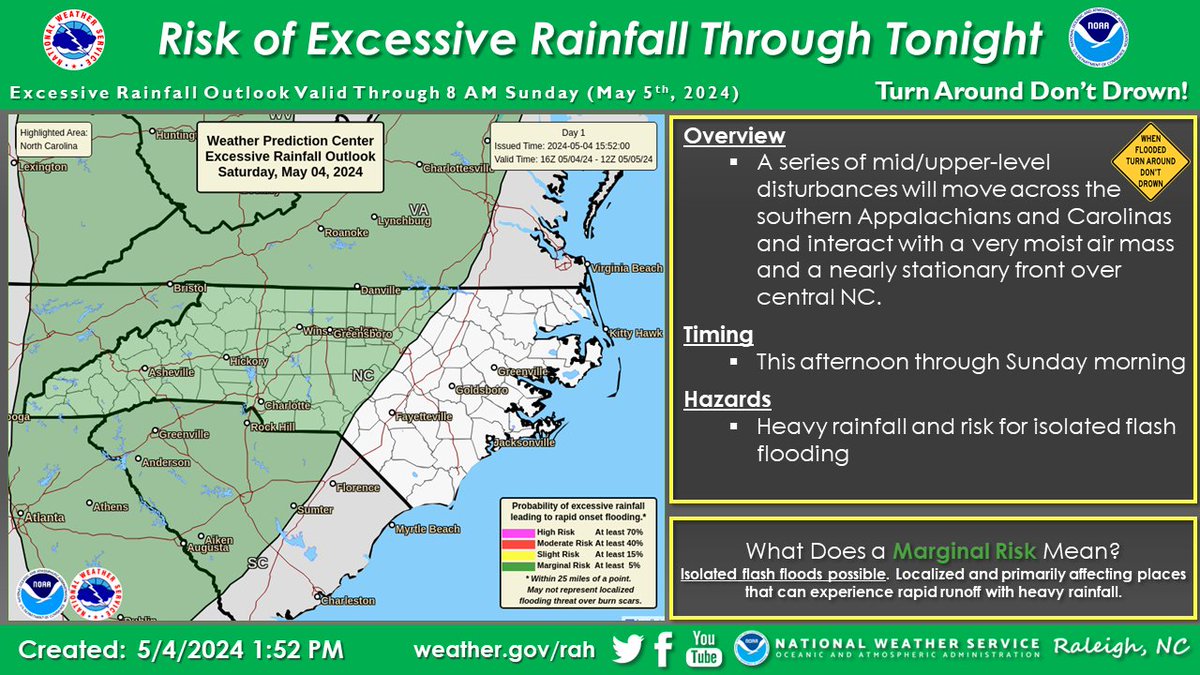
There will be a risk of heavy rainfall and isolated instances of flash flooding over mainly the western half of central NC through Sunday morning. Urban locations will be particularly vulnerable to excessive runoff and risk of flooding.

There will be a risk of heavy rainfall and isolated instances of flash flooding over mainly the western half of central NC through Sunday morning. Urban locations will be particularly vulnerable to excessive runoff and risk of flooding. #ncwx #TurnAroundDontDrown
account_circle
Klein Fire Department(@Kleinfiredept) 's Twitter Profile Photo

WEATHER ADVISORY: FLASH FLOOD UPDATE
Thursday, May 2 2024
Source: Jeff Lindner, Harris County Flood Control District

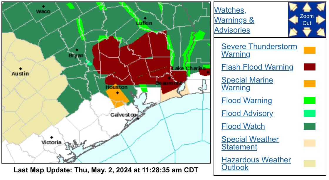
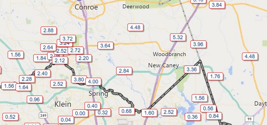
Significant flash flooding ongoing across southern Montgomery and extreme northern portions of Harris County.

WEATHER ADVISORY: FLASH FLOOD UPDATE
Thursday, May 2 2024
Source: Jeff Lindner, Harris County Flood Control District

Significant flash flooding ongoing across southern Montgomery and extreme northern portions of Harris County. #TurnAroundDontDrown #KleinFirDept #hcesd16
account_circle
New Waverly News(@newwaverlynews) 's Twitter Profile Photo

This is why you don’t drive into floodwaters across a road!

Crabb’s Prairie VFD reports that FM 2989 is washed out West of Falba Cemetery. There is a 30 ft drop off in the wash out that’s at least 20 ft wide.

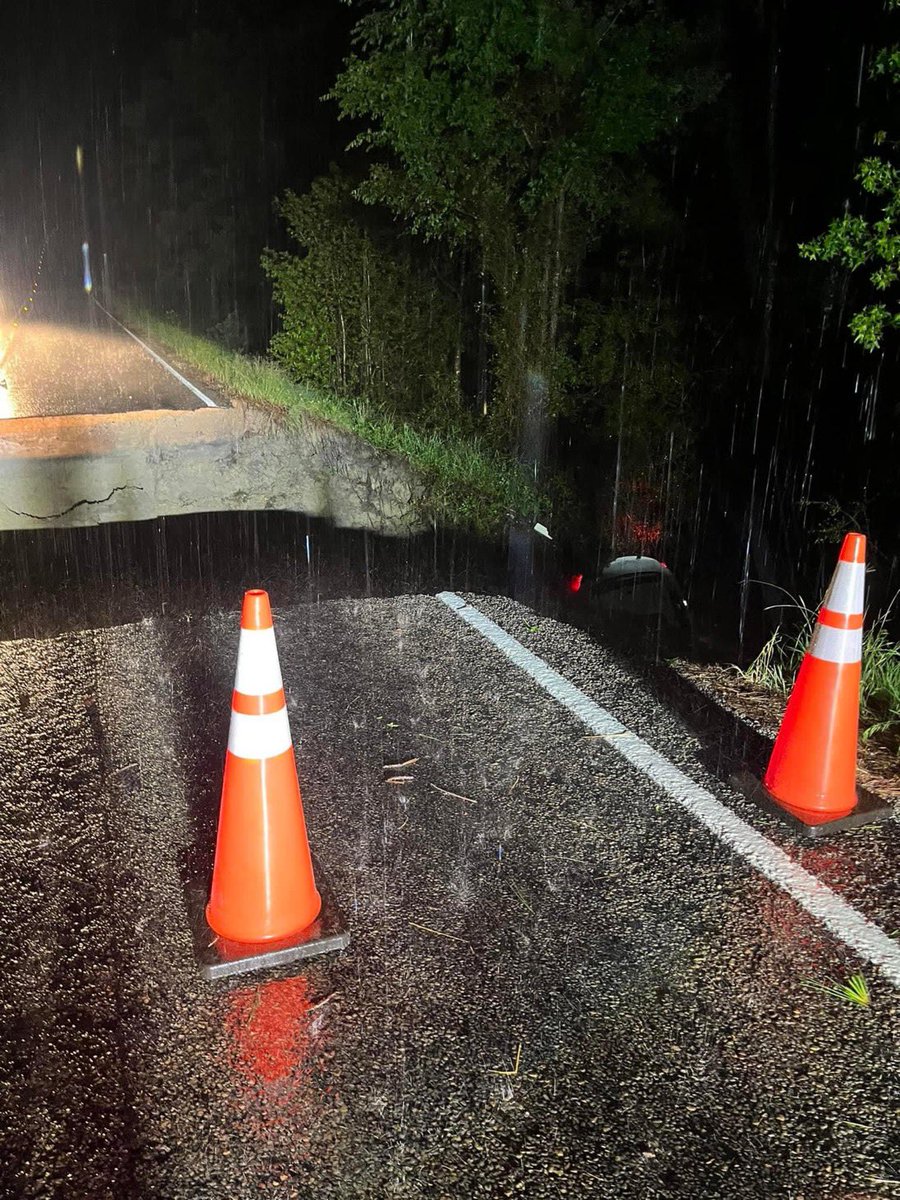
This is why you don’t drive into floodwaters across a road!  

Crabb’s Prairie VFD reports that FM 2989 is washed out West of Falba Cemetery. There is a 30 ft drop off in the wash out that’s at least 20 ft wide. 

#TurnAroundDontDrown
account_circle
TxDPS - Southeast Texas Region(@TxDPSSoutheast) 's Twitter Profile Photo

SETX is on high alert due to the heavy flooding in a lot our areas.

Please be cautious when traveling as some areas have flooded roadways.

account_circle
TxDOT Brownwood(@TxDOTBWD) 's Twitter Profile Photo

Mills County Traffic Alert: FM 218 is closed, from SH 16 to FM 572, due to water over the road. Remember never go around barricades or drive into water over the roadway.

Mills County Traffic Alert: FM 218 is closed, from SH 16 to FM 572, due to water over the road. Remember never go around barricades or drive into water over the roadway.  #TurnAroundDontDrown
account_circle
Ponca Tribe of NE(@PoncaTribeofNE) 's Twitter Profile Photo

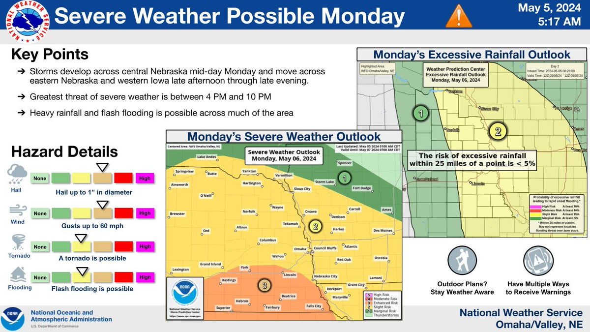
Severe weather chances for Lincoln have increased and could begin as early as 11 am on Monday, May 6, 2024. Tune into your favorite weather station or weather radio for more information, and remember and

Severe weather chances for Lincoln have increased and could begin as early as 11 am on Monday, May 6, 2024. Tune into your favorite weather station or weather radio for more information, and remember #WhenThunderRoarsGoIndoors and #TurnAroundDontDrown
account_circle
Klein Fire Department(@Kleinfiredept) 's Twitter Profile Photo

Think you know a road? Think again. It's better to be safe than sorry. Don't drive or walk in a flooded area. Hidden dangers - displaced manhole covers, gutters, live wires, hidden ditches & streams - are everywhere.

Think you know a road? Think again. It's better to be safe than sorry. Don't drive or walk in a flooded area. Hidden dangers - displaced manhole covers, gutters, live wires, hidden ditches & streams - are everywhere. #houtx #flashflood #TurnAroundDontDrown #KleinFireDept #hcesd16
account_circle
Dr. V(@ChaliceGarden) 's Twitter Profile Photo

Hundreds rescued from flooding in as waters continue to rise. Please don’t drive through even shallow floodwaters. A few inches can dislodge a vehicle and carry it away.
apnews.com/article/floodi…

account_circle