panic 🗡️(@PoseidonCourt) 's Twitter Profile Photo

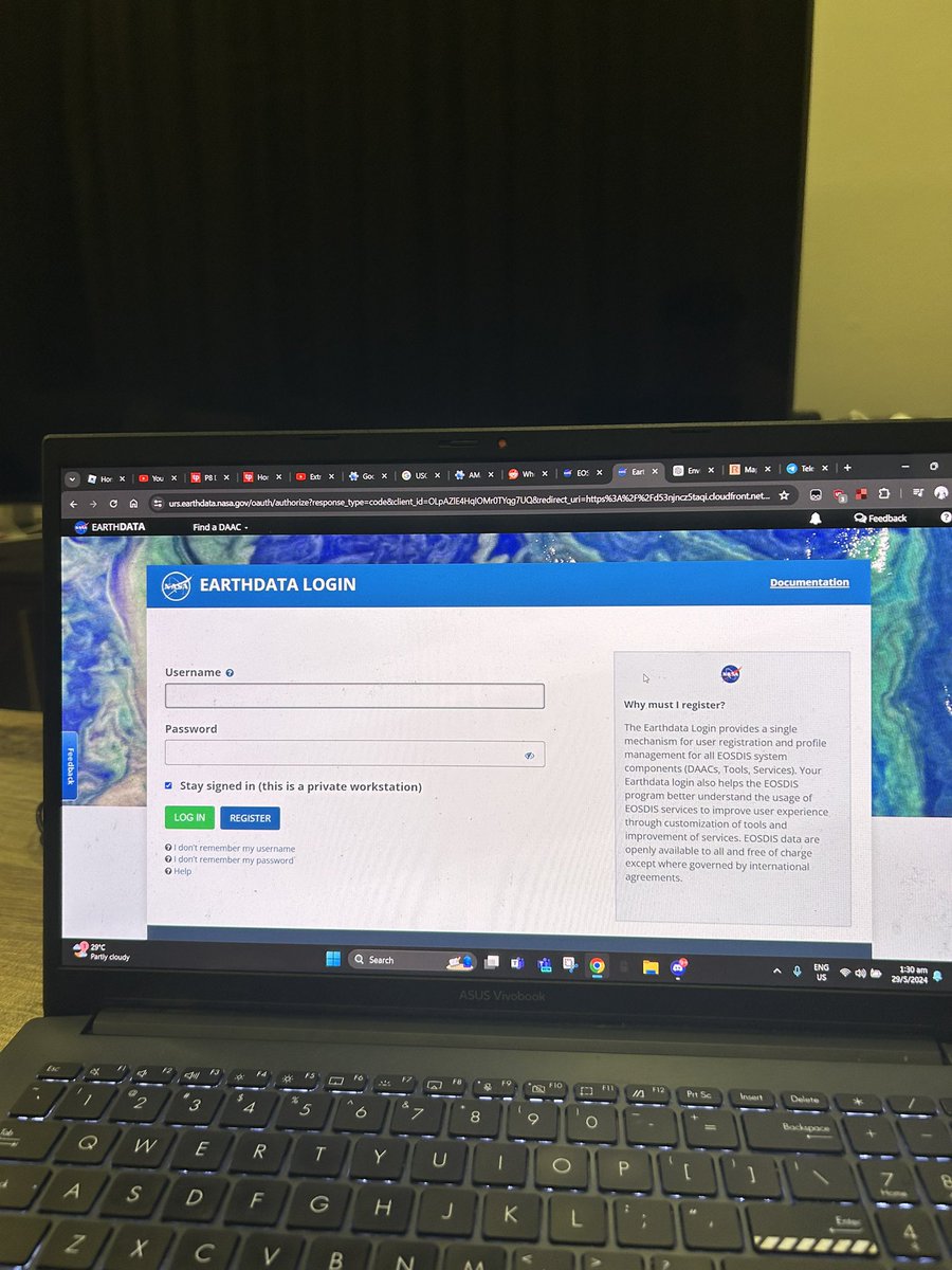
okay bro tell me why did my NASA earthdata account magically delete itself the MOMENT i wanted to start downloading the data i spent a whole DAY to filter and collect

okay bro tell me why did my NASA earthdata account magically delete itself the MOMENT i wanted to start downloading the data i spent a whole DAY to filter and collect
account_circle
NASAEarthdata(@NASAEarthData) 's Twitter Profile Photo

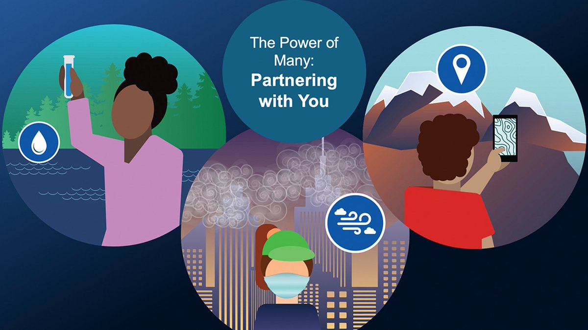
Calling all citizen scientists! Join the NASA Earth Science Data Systems Community Coordinator for a presentation about NASA’s Citizen Science for Earth Systems Program (CSESP) on June 4 at the Virtual Conference.

Learn more about CSESP: go.nasa.gov/3wKZi30

Calling all citizen scientists! Join the NASA Earth Science Data Systems Community Coordinator for a presentation about NASA’s Citizen Science for Earth Systems Program (CSESP) on June 4 at the #CAPS2024 Virtual Conference. 

Learn more about CSESP: go.nasa.gov/3wKZi30
account_circle
NASAEarthdata(@NASAEarthData) 's Twitter Profile Photo

In a new NASA Earthdata video tutorial playlist, learn how to use NASA POWER tools and services to explore solar and meteorological datasets that support the renewable energy, sustainable building, and agroclimatology user communities.

Access tutorials: go.nasa.gov/3wOZD4N

In a new NASA Earthdata video tutorial playlist, learn how to use NASA POWER tools and services to explore solar and meteorological datasets that support the renewable energy, sustainable building, and agroclimatology user communities.

Access tutorials: go.nasa.gov/3wOZD4N
account_circle
NASAEarthdata(@NASAEarthData) 's Twitter Profile Photo

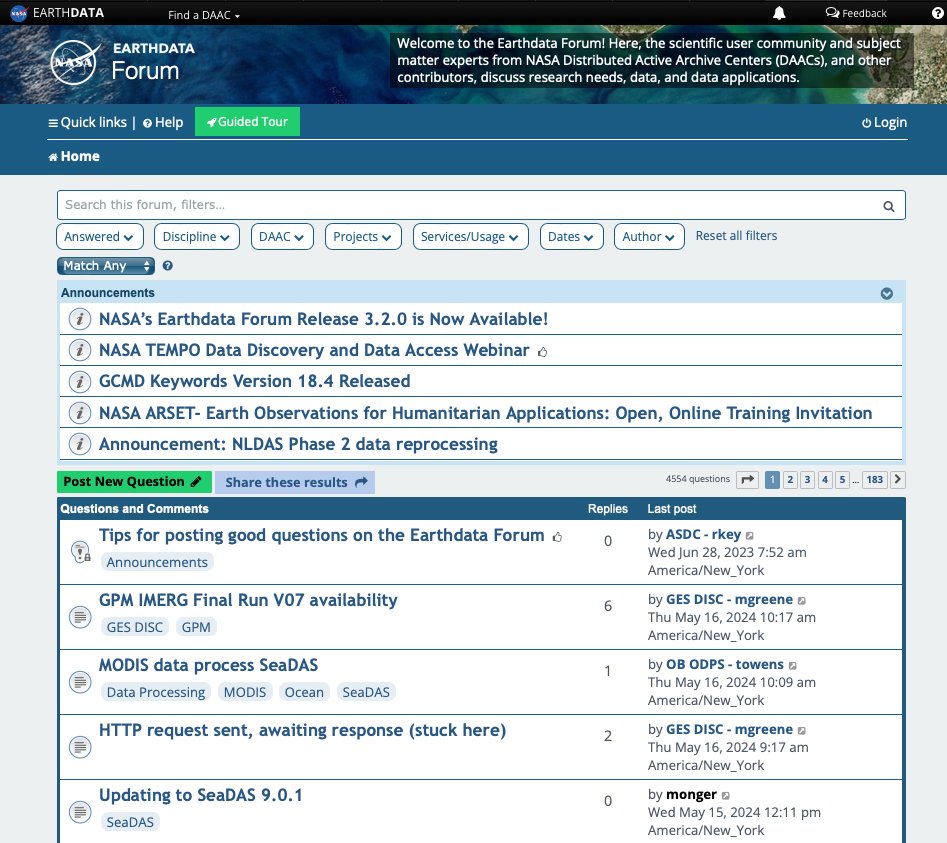
NASA's Earthdata Forum has a new look and feel! Updates include a new Guided Tour highlighting the Forum's major features, an expanded search, condensed filters at the top, and more—making it easier than ever for data users to get the answers they need. go.nasa.gov/3wwqym0

NASA's Earthdata Forum has a new look and feel! Updates include a new Guided Tour highlighting the Forum's major features, an expanded search, condensed filters at the top, and more—making it easier than ever for data users to get the answers they need.  go.nasa.gov/3wwqym0
account_circle
NASAEarthdata(@NASAEarthData) 's Twitter Profile Photo

Learn how a new Geostationary Earth Orbit – Low-Earth Orbit (GEO-LEO) Dark Target Aerosol product suite at NASA's can provide more frequent aerosol measurements for studying aerosol plumes from dust storms and wildfires.

Webinar registration: go.nasa.gov/4bqXsDy
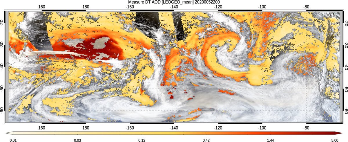
Learn how a new Geostationary Earth Orbit – Low-Earth Orbit (GEO-LEO) Dark Target Aerosol product suite at NASA's #LAADSDAAC can provide more frequent aerosol measurements for studying aerosol plumes from dust storms and wildfires. 

Webinar registration: go.nasa.gov/4bqXsDy
account_circle
NASAEarthdata(@NASAEarthData) 's Twitter Profile Photo

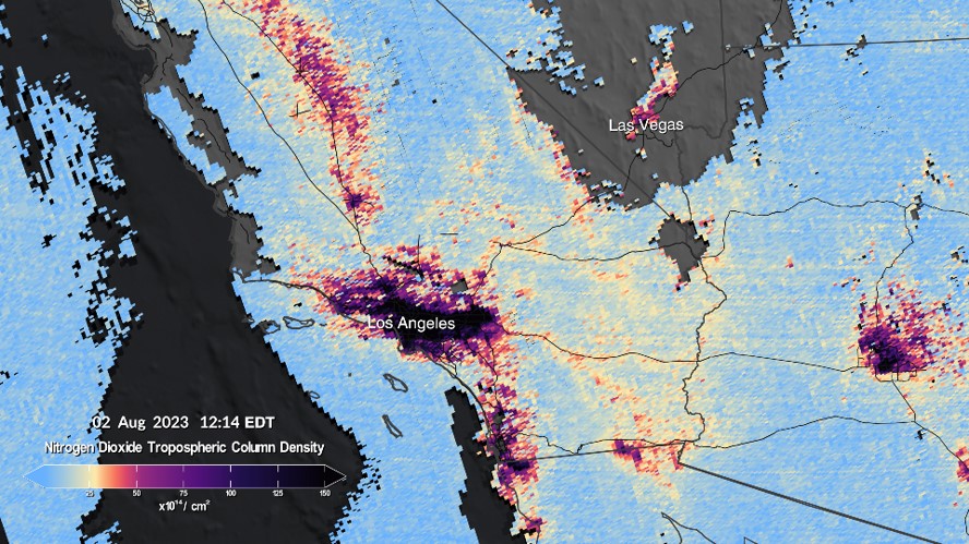
Join us at our next NASA Earthdata webinar on May 29 at 2PM EDT (UTC-4) for an introduction to NASA's Tropospheric Emissions: Monitoring of Pollution ( ) mission, its datasets, services, and tools.

➡️To register: go.nasa.gov/3UtzjFh

Join us at our next NASA Earthdata webinar on May 29 at 2PM EDT (UTC-4) for an introduction to NASA's Tropospheric Emissions: Monitoring of Pollution (#TEMPO) mission, its datasets, services, and tools. #airquality #ozone #aerosols

➡️To register: go.nasa.gov/3UtzjFh
account_circle
Space News(@Automation404) 's Twitter Profile Photo

Search engine focused on Earth data gets new investors

Danti’s $5 million seed round led by defense tech VC firm Shield Capital

Search engine focused on Earth data gets new investors

Danti’s $5 million seed round led by defense tech VC firm Shield Capital
#Space #AI #Earthdata
account_circle
NASAEarthdata(@NASAEarthData) 's Twitter Profile Photo

Read all about it! The next Earthdata Discovery newsletter will be emailed around May 10. This is your chance to learn about new data resources, open science events, and more.

➡️Subscribe today: go.nasa.gov/3NdirQK

Read all about it! The next Earthdata Discovery newsletter will be emailed around May 10. This is your chance to learn about new data resources, open science events, and more. 

➡️Subscribe today: go.nasa.gov/3NdirQK
account_circle
NASAEarthdata(@NASAEarthData) 's Twitter Profile Photo

📢New TEMPO data!  A new suite of beta Level 1, 2, and 3 Version 03 data products from the Tropospheric Emissions: Monitoring of Pollution (TEMPO) mission is available at NASA's Atmospheric Science Data Center (ASDC).

Learn more: go.nasa.gov/3Kr81uB

account_circle
NASAEarthdata(@NASAEarthData) 's Twitter Profile Photo

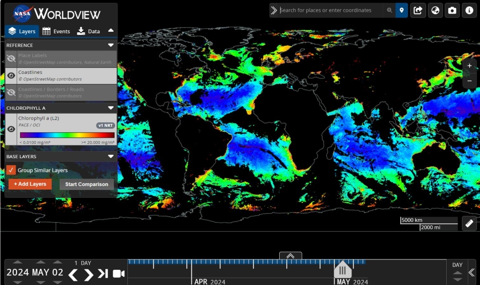
Get excited! PACE ocean color data imagery layers have been added to NASA’s Worldview. Also find new nighttime lights, corrected reflectance, and other data layers— expanding the ways you can visualize Earth as it is 'right now'!

➡️Learn more: go.nasa.gov/4biRVil

Get excited! PACE ocean color data imagery layers have been added to NASA’s Worldview. Also find new nighttime lights, corrected reflectance, and other data layers— expanding the ways you can visualize Earth as it is 'right now'!

➡️Learn more: go.nasa.gov/4biRVil
account_circle
Dr. Sparkle Malone(@SparkleLM85) 's Twitter Profile Photo

Postdoc Alert for remote sensing experts interested in a exploring the capacity of natural ecosystems to capture and sequester carbon Yale School of the Environment MexFlux AmeriFlux FLUXNET_Coop Ama Bemma is writing a book @EarthData
Apply by February 28th: forms.gle/hv6C3f3eFZ9Pfp…

Postdoc Alert for remote sensing experts interested in a exploring the capacity of natural ecosystems to capture and sequester carbon @YaleEnvironment @MexFlux @AmeriFlux @FLUXNET_Coop @AmaBemma @EarthData
Apply by February 28th: forms.gle/hv6C3f3eFZ9Pfp…
account_circle
Dennis Kao(@professorkao) 's Twitter Profile Photo

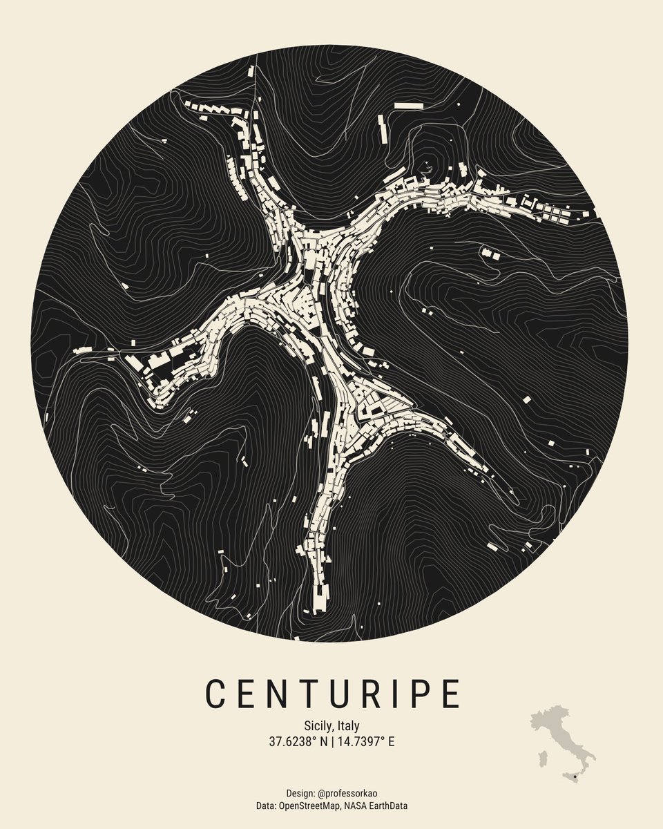
Map of Centuripe in Sicily, Italy 😍

Link: tabsoft.co/44QraPMMap

Map designed in @TableauPublic
Data: @OpenStreetMap, NASA EarthData, prepped w/
@QGIS
Inspired by Saverio Rocchetti

Map of Centuripe in Sicily, Italy 😍 

Link: tabsoft.co/44QraPMMap   

Map designed in @TableauPublic
Data: @OpenStreetMap, @NASA EarthData, prepped w/
@QGIS
Inspired by @Saveriorocc
account_circle
OSINTech(@OSINTech_) 's Twitter Profile Photo

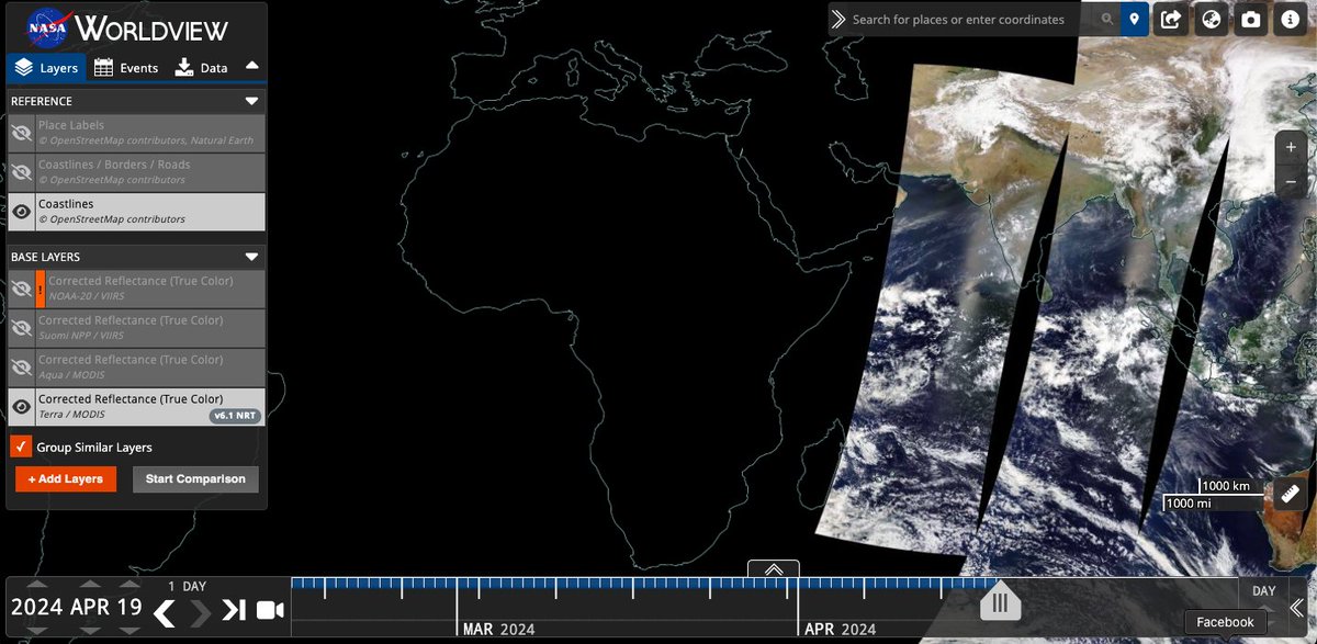
NASA's Earthdata Search provides user-friendly access to EOSDIS services, facilitating the discovery, filtering, visualization, and retrieval of Earth science data: worldview.earthdata.nasa.gov

NASA's Earthdata Search provides user-friendly access to EOSDIS services, facilitating the discovery, filtering, visualization, and retrieval of Earth science data: worldview.earthdata.nasa.gov
account_circle
Lionel(@meteo_reunion) 's Twitter Profile Photo

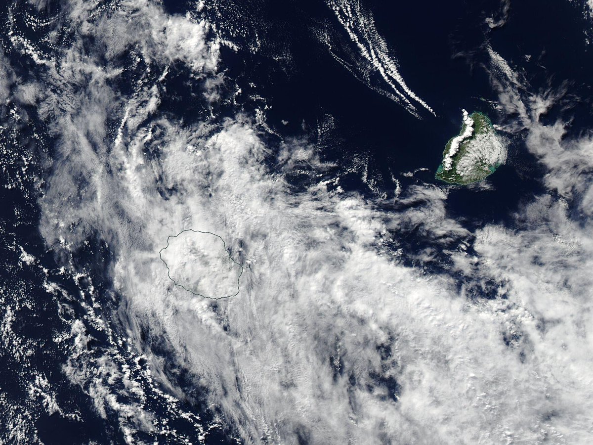
La Réunion 🇷🇪 et Maurice 🇲🇺 vue du ciel... l'image visible du jour depuis le satellite 🛰️ AQUA... le mercredi 29 mai 2024 à 14h25 lors de son passage à environ 810 km à l'est de la Réunion... worldview.earthdata.nasa.gov/?v=52.8,-22.5,…

La Réunion 🇷🇪 et Maurice 🇲🇺 vue du ciel... l'image visible du jour depuis le satellite 🛰️ AQUA... le mercredi 29 mai 2024 à 14h25 lors de son passage à environ 810 km à l'est de la Réunion... worldview.earthdata.nasa.gov/?v=52.8,-22.5,…
account_circle
Lionel(@meteo_reunion) 's Twitter Profile Photo

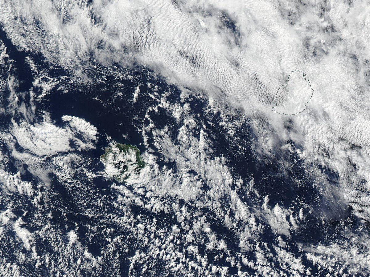
La Réunion 🇷🇪 et Maurice 🇲🇺 vue du ciel... l'image visible du jour depuis le satellite 🛰️ AQUA... le lundi 27 mai 2024 à 14h41 lors de son passage à environ 706 km à l'ouest-sud-ouest de la Réunion... worldview.earthdata.nasa.gov/?v=52.8,-22.5,…

La Réunion 🇷🇪 et Maurice 🇲🇺 vue du ciel... l'image visible du jour depuis le satellite 🛰️ AQUA... le lundi 27 mai 2024 à 14h41 lors de son passage à environ 706 km à l'ouest-sud-ouest de la Réunion... worldview.earthdata.nasa.gov/?v=52.8,-22.5,…
account_circle
NASAEarthdata(@NASAEarthData) 's Twitter Profile Photo

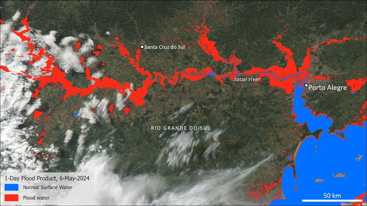
NASA’s Global Flood Product shows extensive flooding in Rio Grande do Sul, Brazil on May 6, after the devastating heavy rains in the region. The 1-day product is shown here, with in red, and normal surface water in blue.

Learn about the data:  go.nasa.gov/3wteBxd

NASA’s Global Flood Product shows extensive flooding in Rio Grande do Sul, Brazil on May 6, after the devastating heavy rains in the region. The 1-day product is shown here, with #flooding in red, and normal surface water in blue.

Learn about the data:  go.nasa.gov/3wteBxd
account_circle
NASAEarthdata(@NASAEarthData) 's Twitter Profile Photo

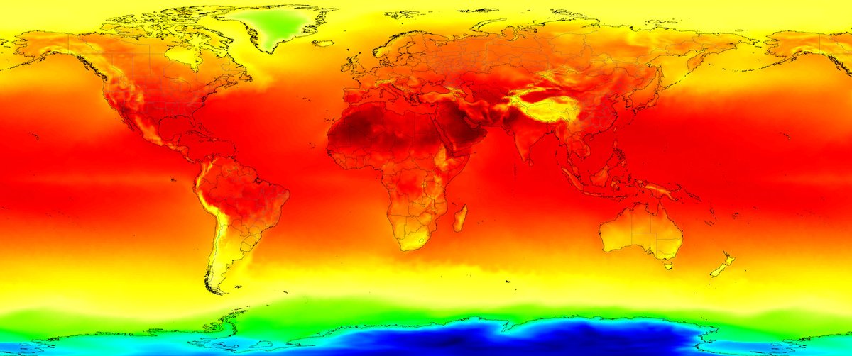
A collaboration involving NASA and IBM Research has led to the development of a new open-source foundation model for and . Read more about Prithvi-weather-climate in an Earthdata blog post: go.nasa.gov/3V5Z9Rg Image: NASA GMAO/MERRA-2.

A collaboration involving NASA and IBM Research has led to the development of a new open-source foundation model for #weather and #climate. Read more about Prithvi-weather-climate in an Earthdata blog post: go.nasa.gov/3V5Z9Rg Image: NASA GMAO/MERRA-2. #MachineLearning #AI
account_circle