Ever wondered how we're able to design our fourplex developments with only 15ft of property width?
We achieve this by providing main street access to 4 units without the need for a common space.
#urbandesign
#spatialanalysis
#infilldevelopment
#multiplexdevelopment

📌📙With the advent of powerful computational tools like R, spatial data analysis has become more accessible to a wider audience. 🔗Download free pdf: pyoflife.com/applied-spatia…
#DataScience #rstats #DataAnalytics #Datavisualization #spatialanalysis #dataengineering


1/n Proud to have finally published this 2018 MSc. thesis by Lila Geis: #PLOSONE : Multiproxy analysis of Upper Palaeolithic lustrous gravels supports their anthropogenic use dx.plos.org/10.1371/journa…
#spatialanalysis #roughness #Experimenting #morphology #colorimetry #Xcultural

#AlluvialFan Surfaces & #Age -Related Stability For #CulturalResource Preservation: #NTTR , #Nellis #AirForce Base, #Nevada , #USA
-
doi.org/10.1016/j.jasr…
-
#GIS #spatial #mapping #military #archaeology #spatial analysis #geomorphology #alluvialfans #desert #desert varnish #dating


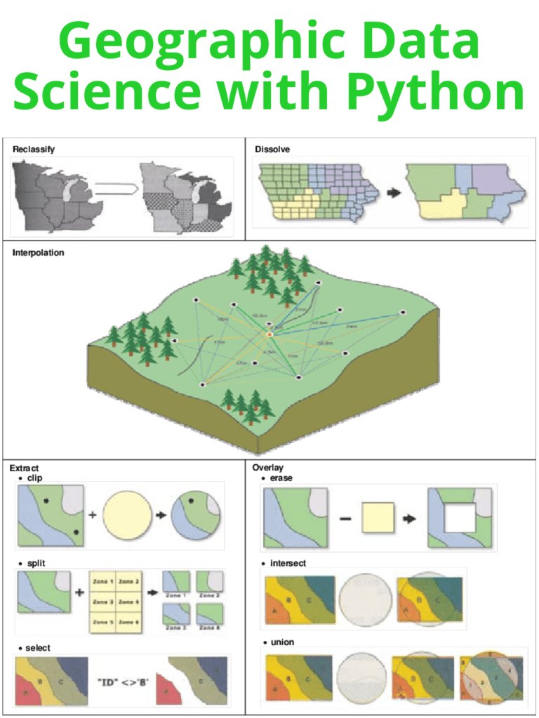
Python is a popular programming language for Geographic Data Science due to its versatility, ease of use, and wide range of powerful libraries such as geopandas, matplotlib, and seaborn. pyoflife.com/geographic-dat…
#DataScience #python #dataviz #spatialanalysis #DataScientists

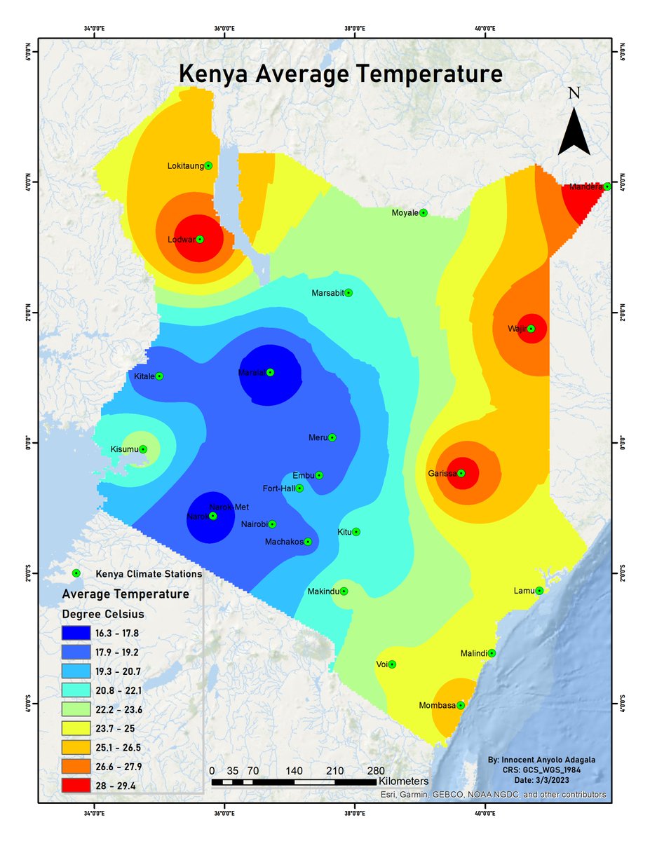
Images obtained by satellites orbiting the earth make them valuable sources for climate data. By using GIS software, one can extract climate data, and map out such data averages over time. Here’s how to go about it:
#SatelliteImagery #GIS #Interpolation #SpatialAnalysis

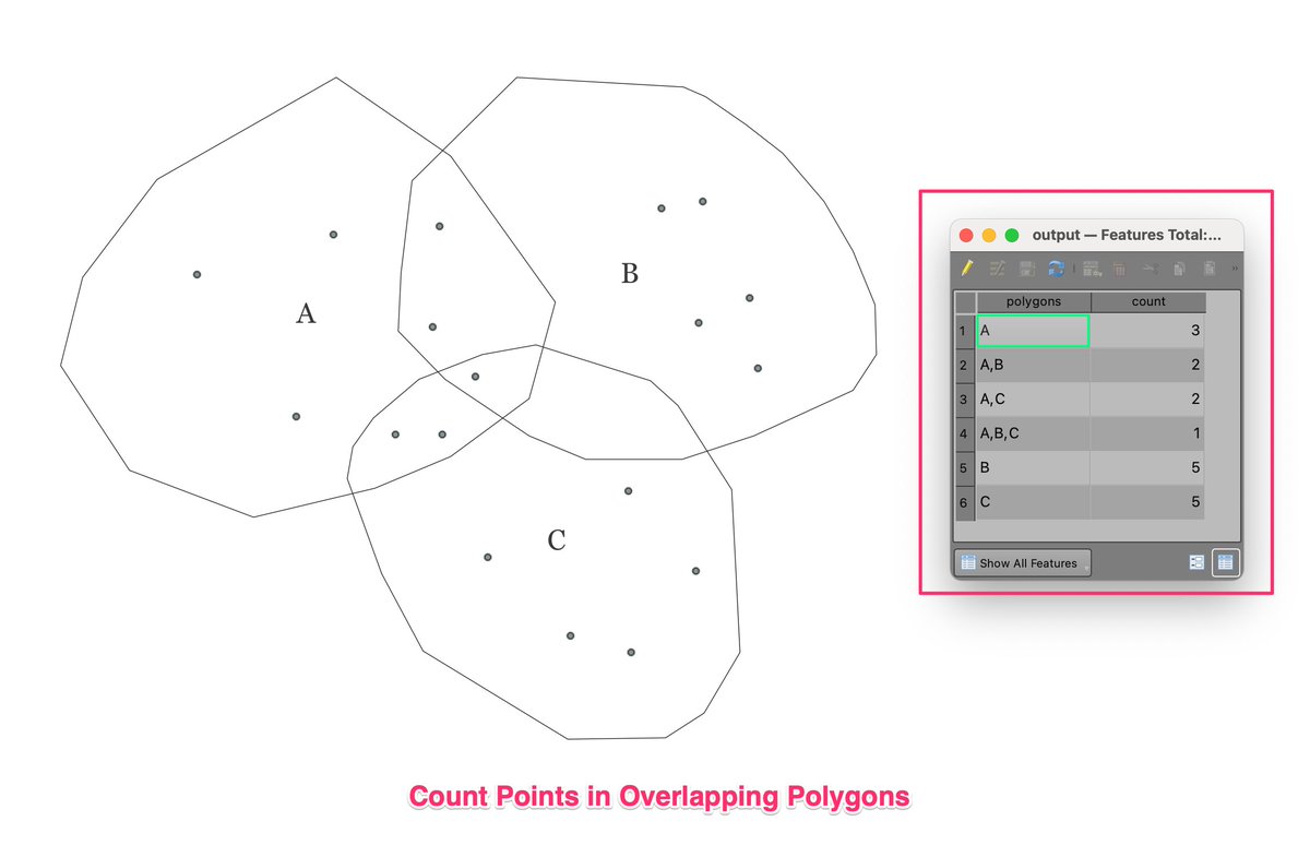
New #SpatialAnalysis Challenge: Count points in overlapping polygons and assign counts to each part. See the attached picture for desired output. See the thread below for more details

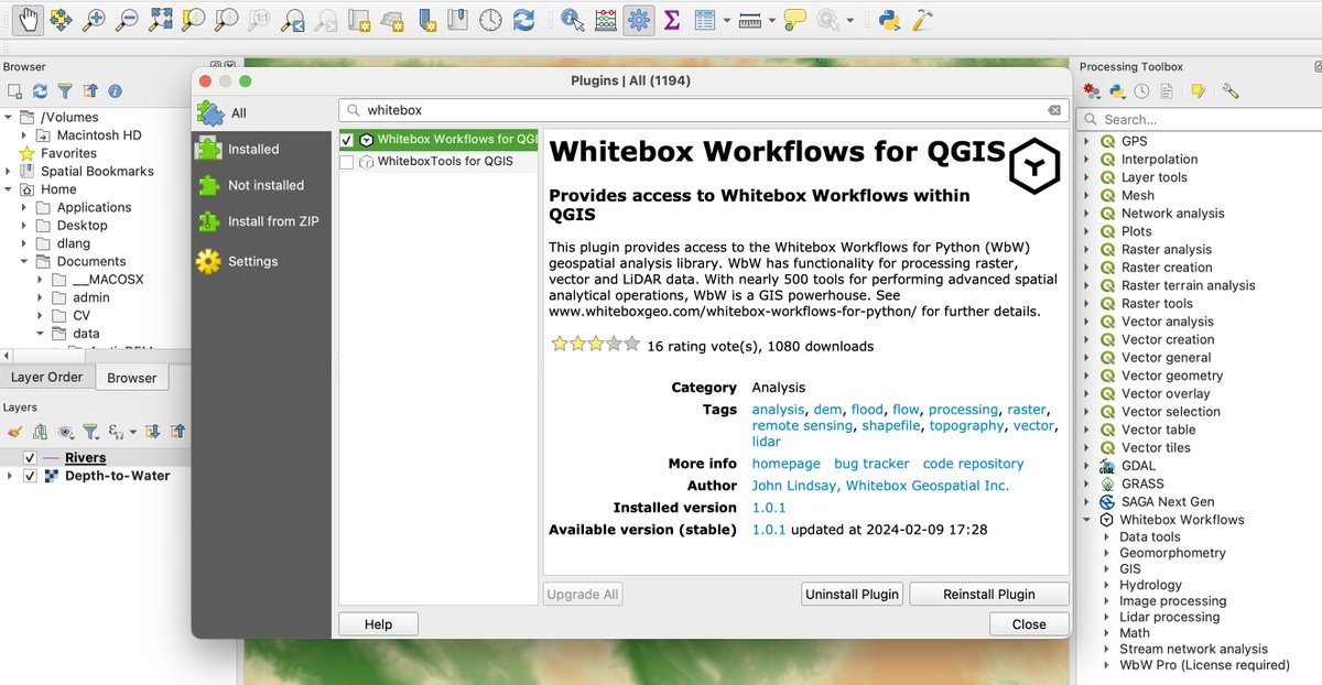
We've recently released a #QGIS plugin for Whitebox Workflows for Python (WbW). Now you can access this powerful #python #geoprocessing library from an easy-to-use GUI. #GIS #gischat #geospatial #mapping #spatialanalysis #geopython
QGIS plugin: plugins.qgis.org/plugins/whiteb…
WbW:…

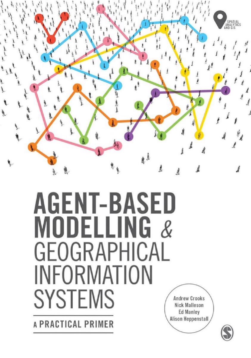
'Agent-Based Modelling and Geographical Information Systems: A Practical Primer ( #GeoSpatial Analytics and #GIS )' amzn.to/3b26CK9
———
#BigData #DataScience #AI #ComputationalScience #SocialScience #AgentBasedModeling #NetworkScience #SpatialAnalysis

ATTEND SPATIAL ANALYSIS COURSE BY #ESRI
#SpatialAnalysis #MOOC kicks off TOMORROW! Register now and enhance your spatial analysis skills for FREE.👇
hubs.li/Q02hmxQK0
#tanzania #gistanzania #tanzania onlinetraining #onlinecourses #onlineearning #esri #esri esternafrica


Learning advanced GIS from MapAction and OpenMap Development Tanzania
SoTM_Tanzania #sotmtanzania #gischat #spatialAnalysis #QGIS


خريجين ال GIS عندهم ميزة مش موجودة عند التخصصات التاني.
#GIS #gisgraduates #SpatialAnalysis #GeographicInformationSystems #نظم_المعلومات_الجغرافية #خريجي_الGIS

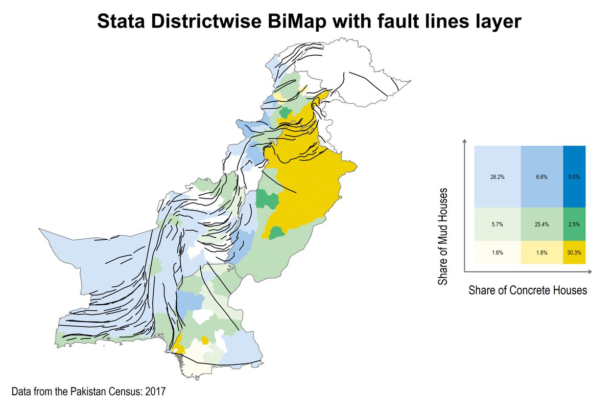
My latest bimap of Pakistan's housing infrastructure, now with fault lines layer and improved color scheme! Using Stata's updated bimap command by Asjad Naqvi, I explored the spatial relationships between housing patterns and earthquake risk. #spatialanalysis #earthquakerisk

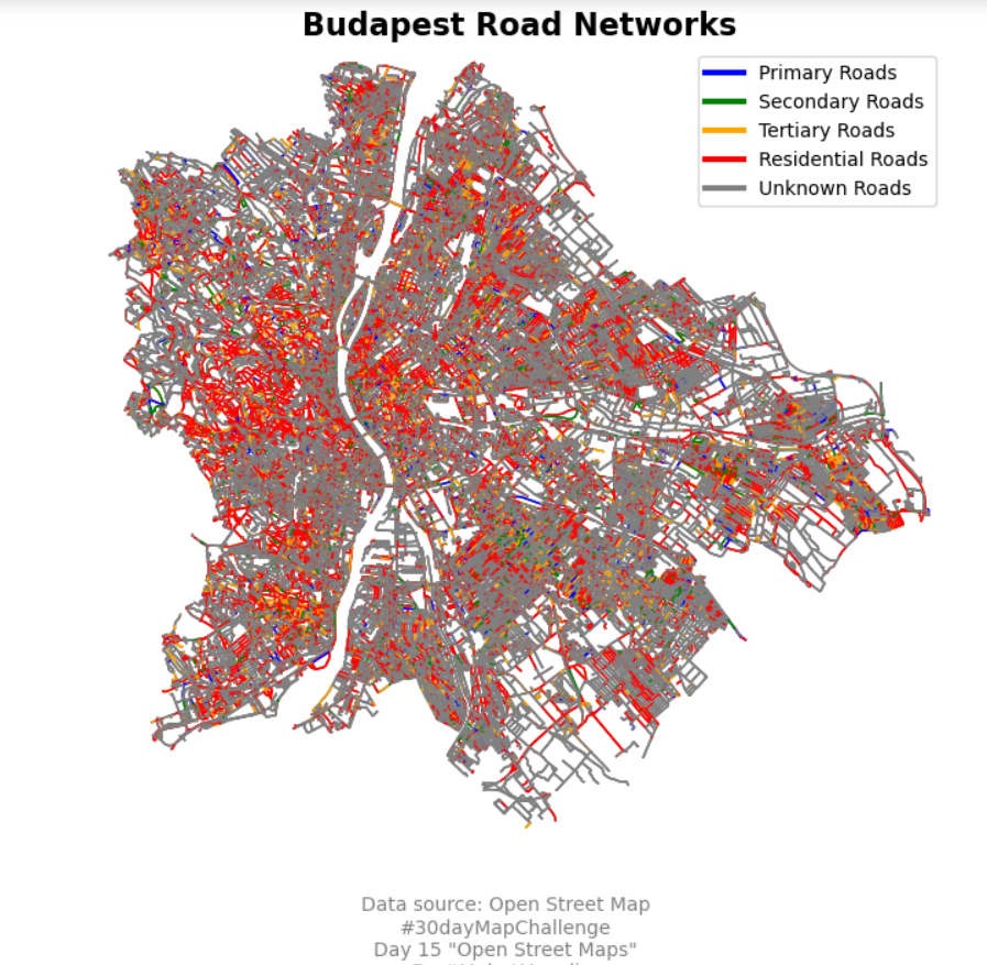
Day 15 of the #30daymapchallenge 'Open Street Map'. This is the Road netwoks of the Budapest, Hungary.
Milos Makes Maps.
#30daymapchallenge , #mapping , #spatialanalysis , #geospatial , #geography #rstats , #python , #osmnx .

🌐🏢 Optimize Your Space with SpatialUse.com! 🚀 Unlock the potential of spatial resources. DM to secure it now! #DomainForSale #SpatialAnalysis #UrbanPlanning #Architecture #RealEstate #Innovation


#Python for #Geospatial Data Analysis:
amzn.to/3DNT2bC by bonny mcclain, human geographer, speaker, author🌏
—————
#BigData #Analytics #DataScience #Geoscience #LocationIntelligence #GIS #Geoinformatics #AI #MachineLearning #DataScientists #SpatialAnalysis #Coding


#Palaeodemographic #Modeling Supports A #Population Bottleneck During The #Pleistocene - #Holocene Transition In #Iberia
-
doi.org/10.1038/s41467…
-
#GIS #spatial #mapping #demography #spain #prehistoric #huntergatherers #spatial analysis #spatiotemporal #climatechange #genetics
