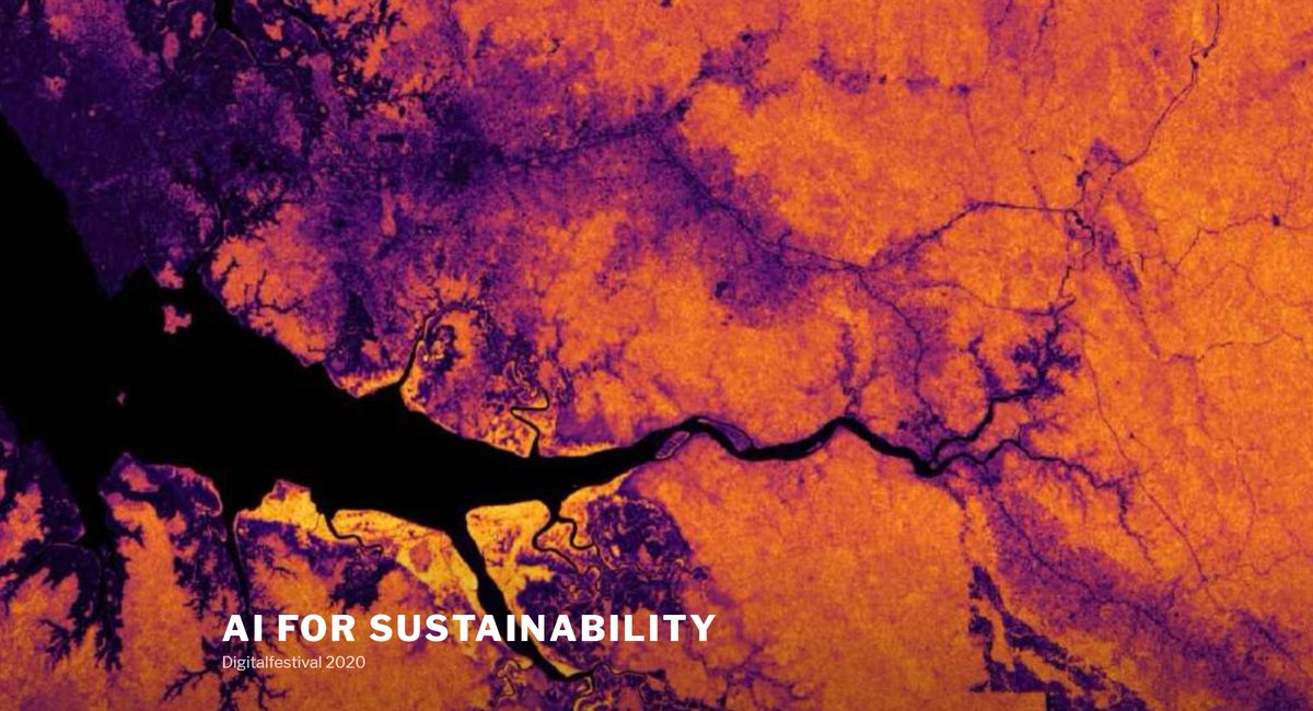
How can #AI be used for global sustainable development? Discuss with experts from academia and industry during a special #AI in #Sustainability session at Digital Festival & HackZurich hosted by ETH Zurich, ETH for Development, the EcoVision and World Food System Center. ai-for-sustainability.ethz.ch

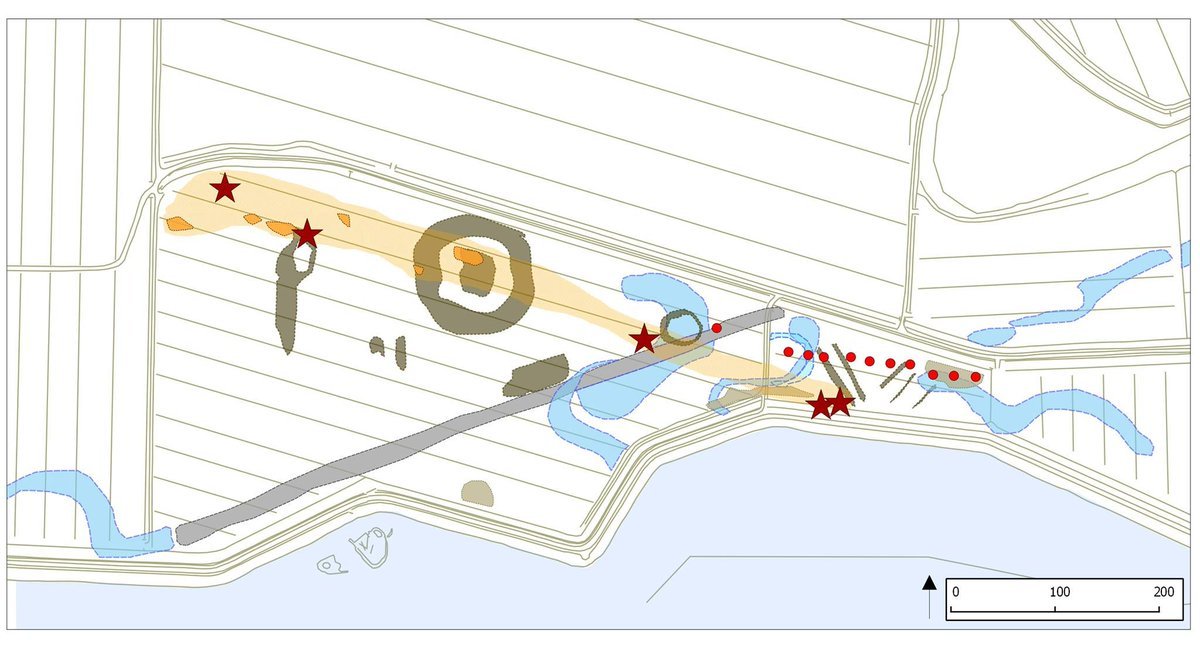
. #archink , day 2, #below .
#Drawings help #archaeologists in the interpretation of #satelliteimages to better understand what lies #below the surface
(images from VEiL Project research)
#Inktober #inktober2020 #archaeology #illustration

'this place does not exist' #generativeart #gan #stylegan2 trained on @planetlabs 190k #satelliteimages #artistinresidence

Hot from the press! #LAI Estimation in #rice crops from in-field #spectroscopy and #satelliteimages in #Panama . Kudos to the team Centro Investigaciones Hidráulicas e Hidrotécnicas Facultad de Ingeniería de Sistemas Computacionales CEPIA UTP IDIAP Panamá Facultad de Ingeniería Mecánica UTP Funds: Sistema Nacional de Investigación de Panamá Senacyt Panamá info: mdpi.com/2624-7402/5/2/… #ML #agriculture #remotesensing

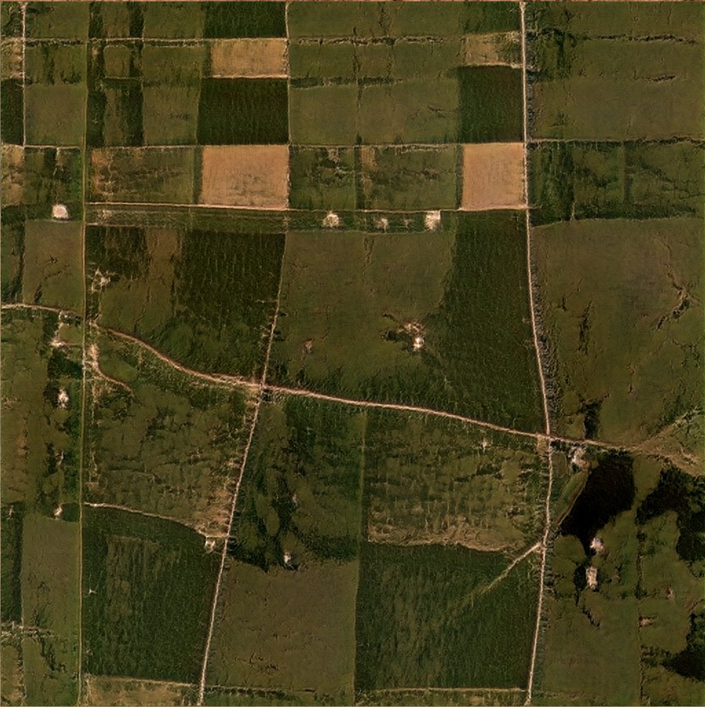
BREAKING! Monthly high-resolution satellite imagery of the world's tropical forests will be made free and accessible to everyone through Norway’s International Climate and Forest Initiative (NICFI).
#SatelliteImages #Rainforest #Tropics #PlanetLabs
[Image from Planet]
![BNHR.XYZ (@BNHRdotXYZ) on Twitter photo 2020-09-25 10:22:40 BREAKING! Monthly high-resolution satellite imagery of the world's tropical forests will be made free and accessible to everyone through Norway’s International Climate and Forest Initiative (NICFI).
#SatelliteImages #Rainforest #Tropics #PlanetLabs
[Image from Planet] BREAKING! Monthly high-resolution satellite imagery of the world's tropical forests will be made free and accessible to everyone through Norway’s International Climate and Forest Initiative (NICFI).
#SatelliteImages #Rainforest #Tropics #PlanetLabs
[Image from Planet]](https://pbs.twimg.com/media/EiwOecsUwAApec_.jpg)

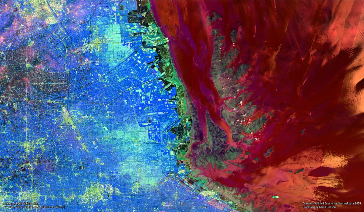
Dafeng, Dongtai, Hai'an; #China 🇨🇳 May 09th, 2019; #Sentinel -2 🛰️ #Copernicus , True & False Color Composites #EarthfromSpace #RemoteSensing #EarthObservation #SatelliteImages

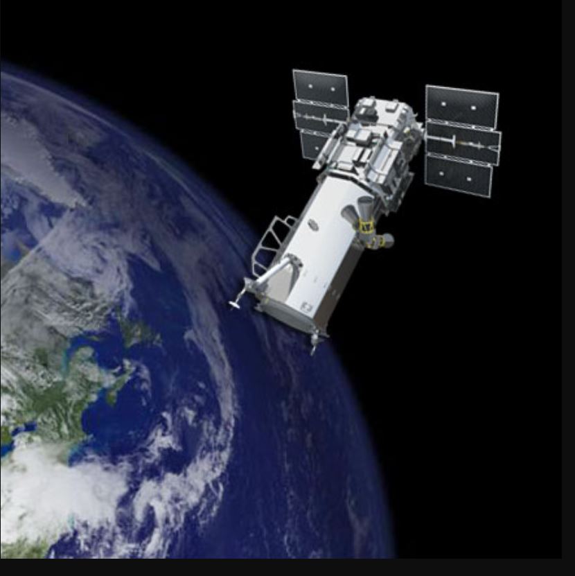
Neither #Ethiopia or #Eritrea can complain against #humanrightsmonitoring of #TigrayGenocide via #satelliteimages because #UN membership means agreement to #OuterSpaceTreaty1967 and #1966UNResolution2222 banning claims of sovereignty


Nueva publicación! sobre teledetección del índice de área foliar en cultivos de arroz #rice crops #spectroscopy and #satelliteimages in #Panama gracias al equipo Centro Investigaciones Hidráulicas e Hidrotécnicas Facultad de Ingeniería de Sistemas Computacionales CEPIA UTP IDIAP Panamá Facultad de Ingeniería Mecánica UTP UTPInvestigación Funds: Sistema Nacional de Investigación de Panamá Senacyt Panamá mdpi.com/2624-7402/5/2/…

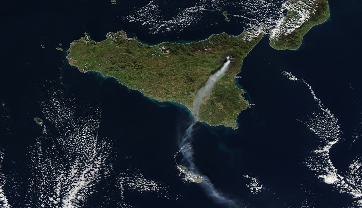
#Etna 🌋, #Sicily , #Italy 🇮🇹 Dec 26th, 2018; #Sentinel -2 🛰️ #Copernicus #ESA multispectral imagery (SWIR, CIR, RGB composite) #MountEtna #Vulcano #eruption #remotesensing #satelliteimages #eo #MODIS #NASA #wulkan #erupcja #teledetekcja


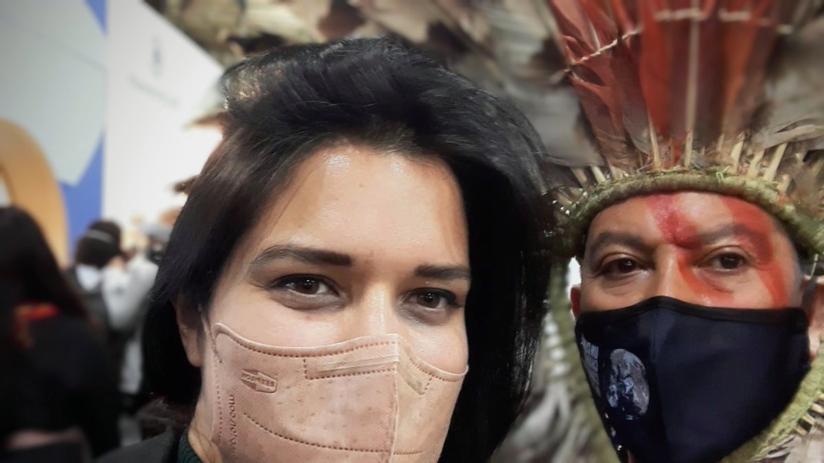
Discussing the role of #SatelliteImages & #mapping for #Indigenous Peoples for #ClimateAction
👉Kretã Kaingang
#Brazilian #Indigenous leader from the #Kaingang People #COP26
cc: Apib Oficial GEO Indigenous Alliance

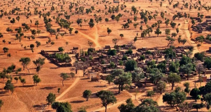
AI discovers over 1.8 billion trees in Sahara Desert
University of Copenhagen NASA WWF @nature
#SaharaDesert #trees #ArtificialIntelligence #satelliteimages #largesthotdesert #Africa
READ| newsvibesofindia.com/ai-discovers-o…
The Kyiv Independent Capture and add the #SatelliteImages to the evidence. you CAN see from satellite, smoke from crematorium OR burning bodies in piles or mass graves, you can geolocate and ID length of time of burning, air temp AND contents of the air. Ukraine / Україна

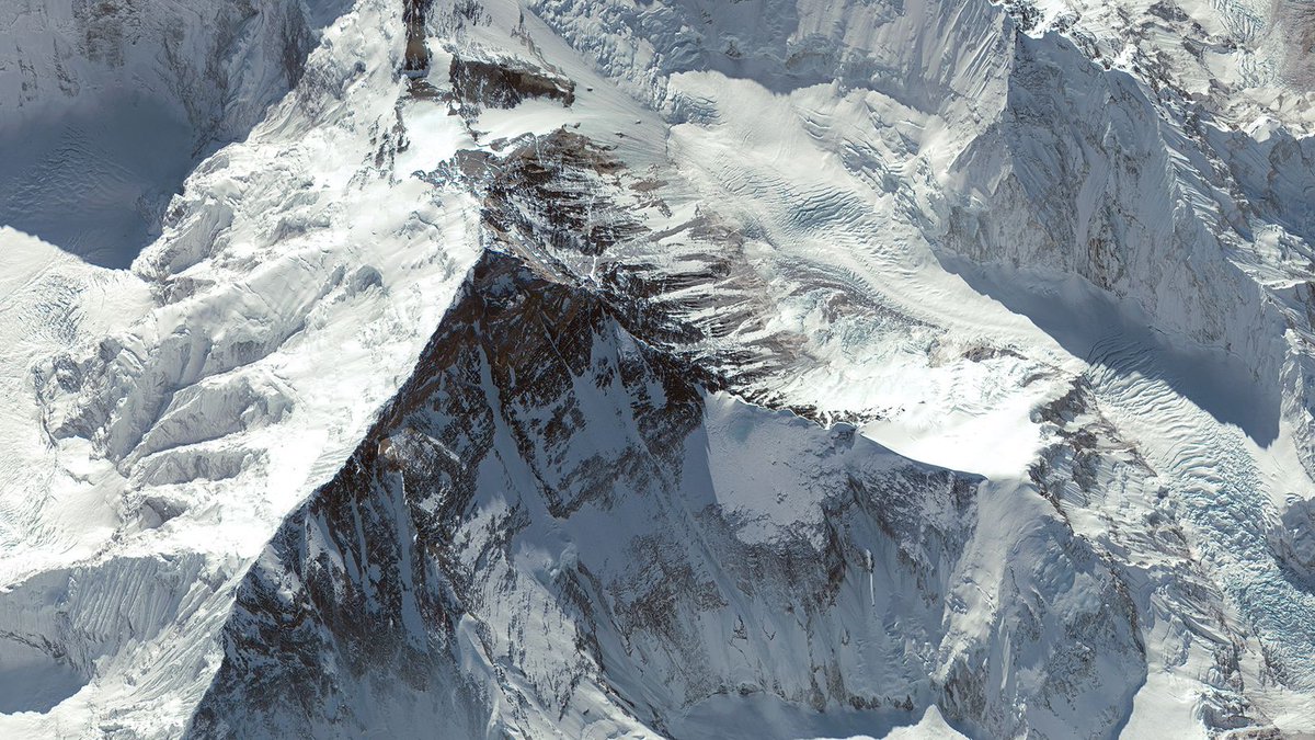
Images of the Earth taken by GeoEye satellites Ikonos and GeoEye-1.
Giza Necropolis
Ayers Rock, Australia
Venice, Italy
Mt. Everest
#satelliteimages #earth #photography

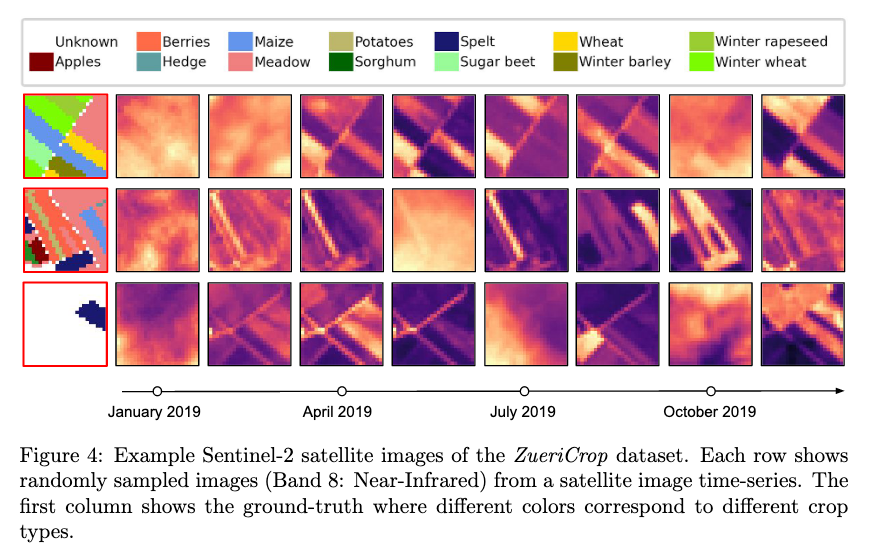
interested in crop mapping with #DeepLearning from #SatelliteImages ? Check our new paper where we exploit expert’s knowledge on label taxonomy to improve the classification of rare crop types.
#MachineLearning #RNN #TimeSeries arxiv.org/abs/2102.08820


Shoghi provides high-resolution satellite imagery for a wide range of industries and applications. (1/1)
bit.ly/3UYdhcs
#shoghicom #satelliteimages #defenceindustry
#bordersecurity #innovation #military


The program maps the #Earth by superimposing #satelliteimages , aerial #photography and GIS data on #3D globe.
Let's take tour Regional Science Centre (RSC)Bhavanagar on google earth.
#google earth #rscbhavnagar #ThankYou #google
Gujarat Council on Science & Technology 🇮🇳 Dept of Science & Technology, Gujarat Narottam Sahoo Dr Girish K Goswami

Precision #AgServices are essential to increase #yield production and reduce #inputs and #costs
#SmartFarmingTechnologies
#drones
#soilsensors
#satelliteimages

first snow ❄️❄️❄️ in (northern) Poland 🇵🇱, 2020-01-05, 🛰️ #Sentinel -3 [RGB] #Copernicus & Terra/MODIS [B:3,6,7] #EarthData #NASA #RemoteSensing #EarthObservation #SatelliteImages
![Kamil Onoszko 🇵🇱 (@Onosz) on Twitter photo 2020-01-05 18:22:36 first snow ❄️❄️❄️ in (northern) Poland 🇵🇱, 2020-01-05, 🛰️ #Sentinel-3 [RGB] #Copernicus & Terra/MODIS [B:3,6,7] #EarthData #NASA #RemoteSensing #EarthObservation #SatelliteImages first snow ❄️❄️❄️ in (northern) Poland 🇵🇱, 2020-01-05, 🛰️ #Sentinel-3 [RGB] #Copernicus & Terra/MODIS [B:3,6,7] #EarthData #NASA #RemoteSensing #EarthObservation #SatelliteImages](https://pbs.twimg.com/media/ENiZKFaXsAAUeKp.jpg)

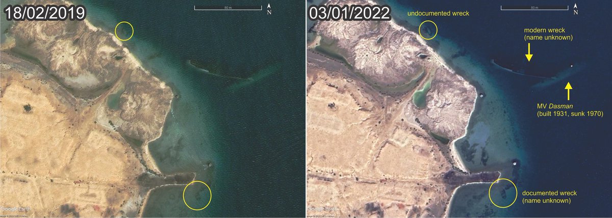
Always nice when new #GoogleEarth #satelliteimages come out. Especially when they show us clearer images of previously documented #shipwrecks and even better when they reveal undocumented wrecks like this example from #Suakin , #Sudan !

📌🎙️ “La agricultura de precisión es la fórmula para ser cada vez más competitivos” - Miguel Córdoba (Miguel Cordoba Perez), CEO de Greenfield Technologies by #Agrodrone en #AGRARIA2019 🛰️🌾
📲 Por CampoCyL

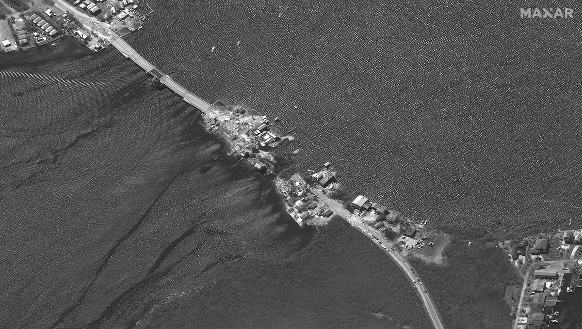
Before (Dec 18, 2021) and after (Sept 30, 2022) #satelliteimages of the Matlacha Pass Bridge area (lat/lon: 26.63463, -82.06592) in #Matlacha , #Florida , showing the severe damage cause by #HurricaneIan .
