GINA(@uafgina) 's Twitter Profileg
GINA

@uafgina

Geographic Information Network of Alaska. At the Geophysical Institute of UAF, we process and distribute remote-sensing data on weather and wildland fires to AK

ID:55004039

linkhttps://gina.alaska.edu/ calendar_today08-07-2009 19:41:16

1,1K Tweets

499 Followers

84 Following

GINA(@uafgina) 's Twitter Profile Photo

Remnants of old fires from 2023 are getting active again in northeast British Columbia. Called “zombie fires” for how they overwinter under snow, the infrared bands of this satellite image make one of these fires visible as hot spots on the edge of last year's burn scars.

Remnants of old fires from 2023 are getting active again in northeast British Columbia. Called “zombie fires” for how they overwinter under snow, the infrared bands of this satellite image make one of these fires visible as hot spots on the edge of last year's burn scars. #bcwx
account_circle
GINA(@uafgina) 's Twitter Profile Photo

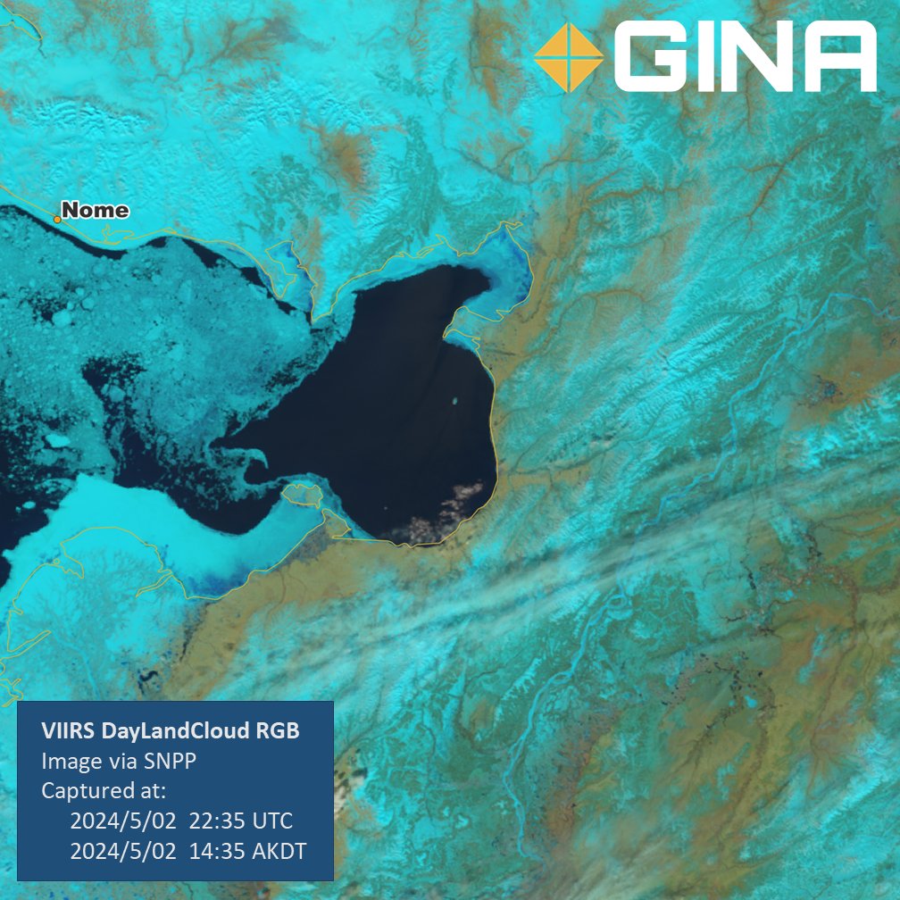
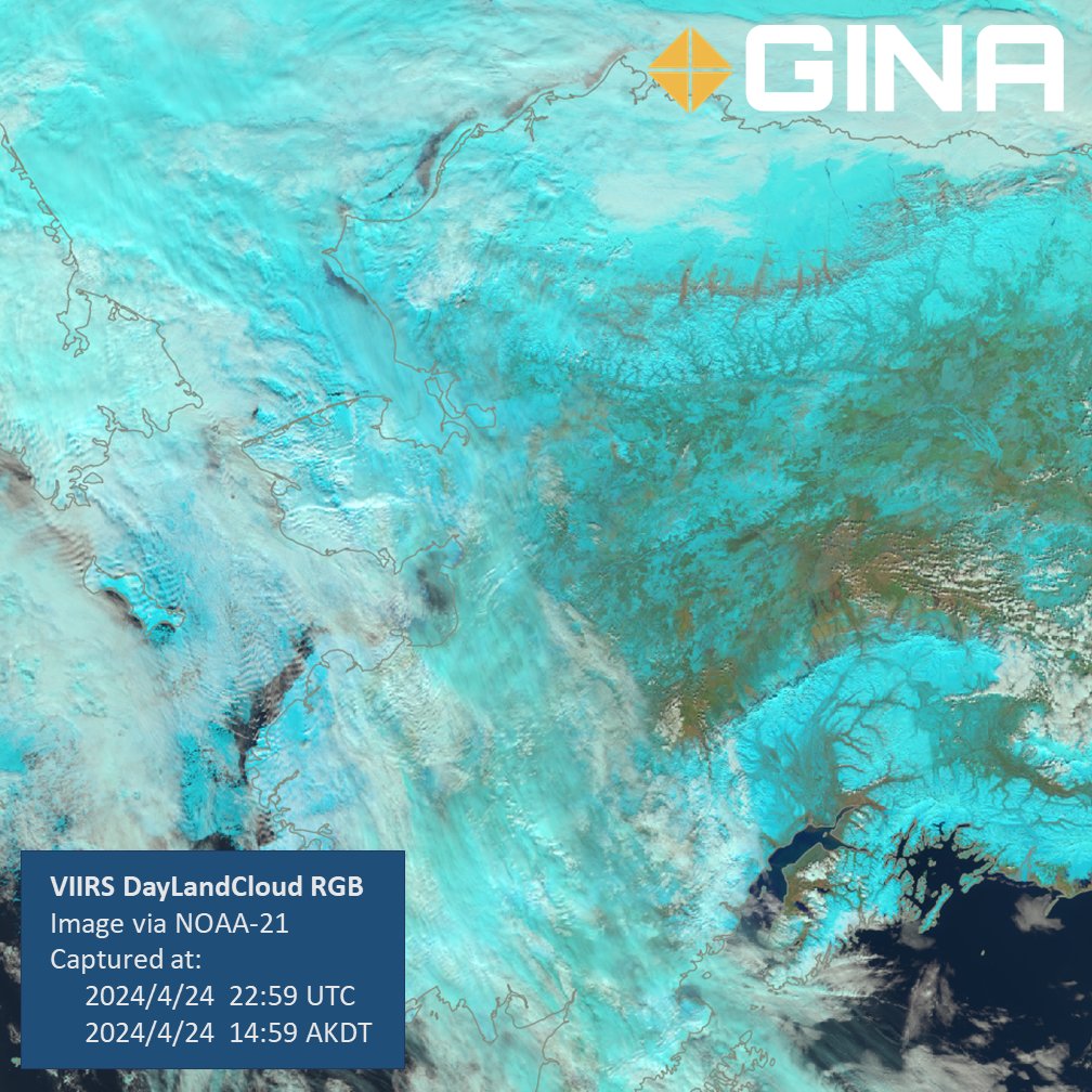
Breakup is upon us! This DayLandCloud image of Norton Sound uses exaggerated colors for better visibility of different features. For example, the snow and ice is colored cyan and the emerging vegetation is in browns and greens. You can even glimpse the Yukon at right.

Breakup is upon us! This DayLandCloud image of Norton Sound uses exaggerated colors for better visibility of different features. For example, the snow and ice is colored cyan and the emerging vegetation is in browns and greens. You can even glimpse the Yukon at right. #akwx
account_circle
NWS APRFC(@NWSAPRFC) 's Twitter Profile Photo

An ice jam has recently developed on the Nushagak River above Dillingham, as captured by satellite imagery. The jam has caused water levels to rise upstream, yet floodwaters remain contained within the floodplain, posing no immediate threat to upstream communities.

An ice jam has recently developed on the Nushagak River above Dillingham, as captured by satellite imagery. The jam has caused water levels to rise upstream, yet floodwaters remain contained within the floodplain, posing no immediate threat to upstream communities. #akwx
account_circle
GINA(@uafgina) 's Twitter Profile Photo

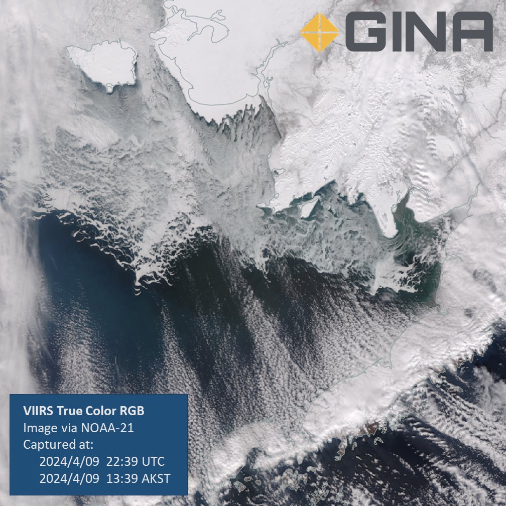
GINA’s new satellite antenna is up and running! Atop the UA Fairbanks ELIF building, it will receive data from future satellites to advance the science of remote sensing and ensure redundancy in our operations. Here's a NOAA-21 DayLandCloud from our antenna! @noaasatellites

GINA’s new satellite antenna is up and running! Atop the @uafairbanks ELIF building, it will receive data from future satellites to advance the science of remote sensing and ensure redundancy in our operations. Here's a NOAA-21 DayLandCloud from our antenna! @noaasatellites #akwx
account_circle
GINA(@uafgina) 's Twitter Profile Photo

Want to learn more about the amazing universe of space exploration, science and technology? The UA Fairbanks Science Potpourri happening tomorrow - Saturday, April 13 - is part of @noaasatellites “Find Your Place in Space Week!” Stop by for activities and learning for all ages!
Want to learn more about the amazing universe of space exploration, science and technology? The @uafairbanks Science Potpourri happening tomorrow - Saturday, April 13 - is part of @noaasatellites “Find Your Place in Space Week!” Stop by for activities and learning for all ages!
account_circle
UAF Geophysical Institute(@UAFGI) 's Twitter Profile Photo

What's up at the UA Fairbanks Geophysical Institute? A new rooftop antenna for our GINA, the Geographic Information Network of Alaska, that's what.

Joint Polar Satellite System (JPSS) NOAA

gi.alaska.edu/news/new-rooft…
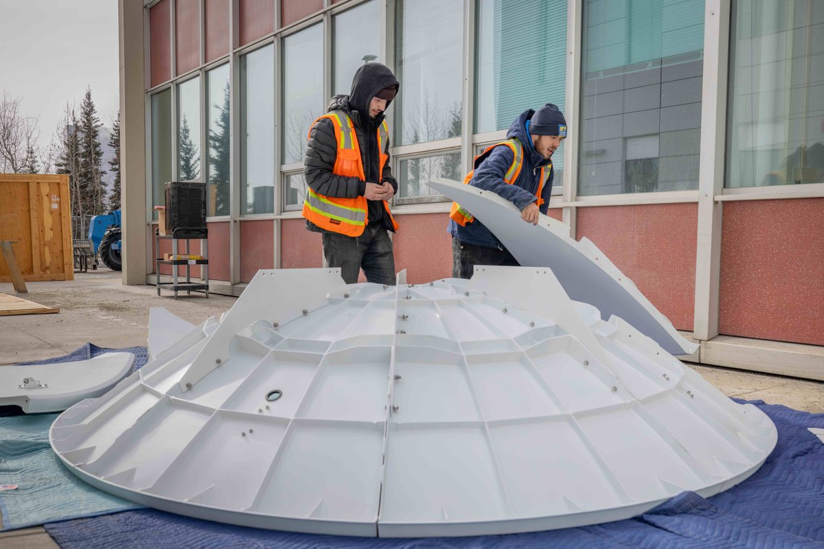
What's up at the @uafairbanks Geophysical Institute? A new rooftop antenna for our @uafgina, the Geographic Information Network of Alaska, that's what. @JPSSProgram @NOAA gi.alaska.edu/news/new-rooft…
account_circle
GINA(@uafgina) 's Twitter Profile Photo

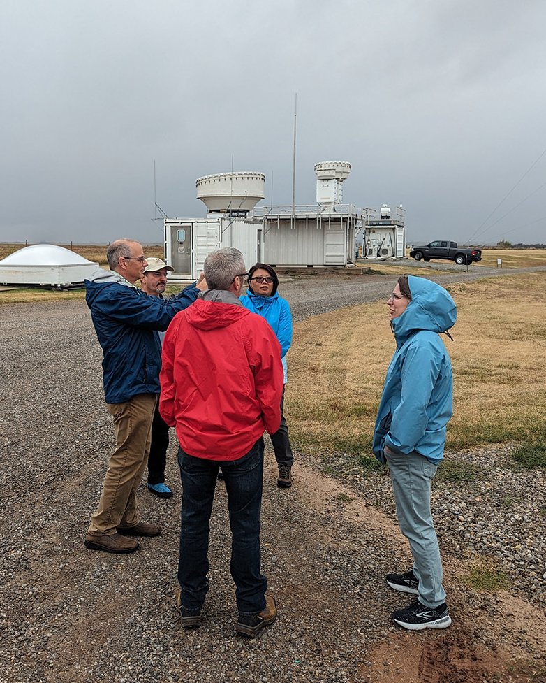
GINA’s director, Jen Delamere, who also daylights as the chair of ARM’s user executive committee, recently wrote about the committee’s meeting in October where she reflects on the people of ARM and the committee itself. Read it below! ARM News

arm.gov/news/blog/post…

GINA’s director, Jen Delamere, who also daylights as the chair of ARM’s user executive committee, recently wrote about the committee’s meeting in October where she reflects on the people of ARM and the committee itself. Read it below! @armnewsteam arm.gov/news/blog/post…
account_circle
GINA(@uafgina) 's Twitter Profile Photo

In this Spring '24 Aurora, GINA's own Grace Veenstra discusses spring breakup, and its affect on communities like Circle and Sleetmute.

Click to read about how ice jams can cause flooding, and how satellite imagery and citizen science help!

uaf.edu/aurora/archive…

account_circle
GINA(@uafgina) 's Twitter Profile Photo

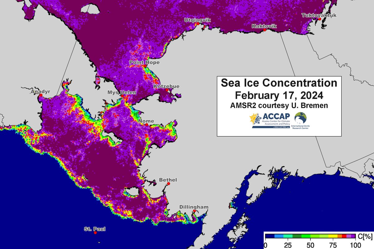
Rick Thoman's Arctic Report Card is focused on Sea Ice this Week. He Reports:

While extent nears seasonal maximum, thickness remains low, with ominous implications for summer melt. Barents Sea sees significant loss, with Alaska experiencing mixed ice conditions. @AlaskaWx

Rick Thoman's Arctic Report Card is focused on Sea Ice this Week. He Reports: While extent nears seasonal maximum, thickness remains low, with ominous implications for summer melt. Barents Sea sees significant loss, with Alaska experiencing mixed ice conditions. @AlaskaWx
account_circle
NWS Juneau(@NWSJuneau) 's Twitter Profile Photo

On this Valentine's Day, we'd like to share with you one of our Alaskan loves, polar satellites! These are satellites that do not stay in place (relative to earth) but orbit the earth by going over the poles. NOAA Satellites

account_circle
GINA(@uafgina) 's Twitter Profile Photo

Want to live and work in Alaska?

Have a passion for Environmental Monitoring, Coding, and GIS?

Want to work on projects that directly benefit Alaskans?

If you answered yes, Apply to work at GINA, the Geographic Information Network of Alaska, as a Geospatial Data Analyst!

Want to live and work in Alaska? Have a passion for Environmental Monitoring, Coding, and GIS? Want to work on projects that directly benefit Alaskans? If you answered yes, Apply to work at GINA, the Geographic Information Network of Alaska, as a Geospatial Data Analyst!
account_circle
GINA(@uafgina) 's Twitter Profile Photo

Did you miss this week's VAWS Webinar? Not to Worry!

Access ' Decision Support in the High Arctic: five weeks of embedded deployment aboard the R/V Sikuliaq' below, to learn about life on the only ice-capable vessel in the US Academic Research Fleet

uaf-accap.org/event/decision…

account_circle
GINA(@uafgina) 's Twitter Profile Photo

Reminder! This Wednesday, Feb 14th, tune into the next VAWS Webinar about UAF's very own ice breaker, the R/V Sikuliaq!

account_circle
UAF Geophysical Institute(@UAFGI) 's Twitter Profile Photo

Want to be involved in environmental monitoring and assessment to benefit the public? GINA is seeking a geospatial data analyst to support projects such as wildland fire risk assessment, air quality monitoring and more. Info: careers.alaska.edu/en-us/job/5276…

Want to be involved in environmental monitoring and assessment to benefit the public? @uafgina is seeking a geospatial data analyst to support projects such as wildland fire risk assessment, air quality monitoring and more. Info: careers.alaska.edu/en-us/job/5276…
account_circle
GINA(@uafgina) 's Twitter Profile Photo

Tune in Wednesday, Feb. 14 at 11-12 AKST for a webinar from Michael Lawson of the NWS Alaska Sea Ice Program! Lawson will discuss decision support work conducted on the UAF research vessel R/V Sikuliaq, and his five week deployment onboard as an ice analyst.

uaf-accap.org/event/decision…

account_circle
GINA(@uafgina) 's Twitter Profile Photo

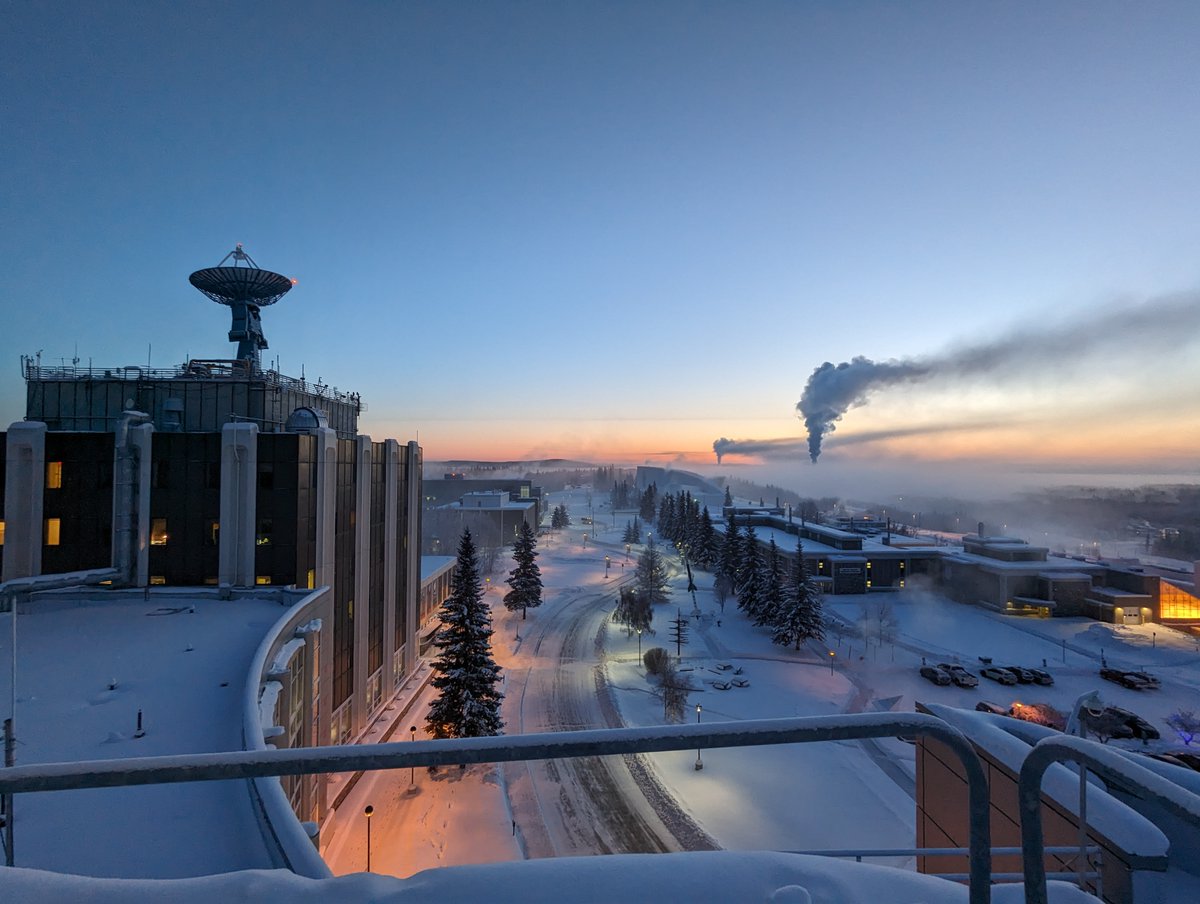
It’s fifty below zero here in Fairbanks. In Fahrenheit, that’s not just freezing, that’s 80 degrees below freezing! These pictures from GINA’s Jay Cable show his bike by the UA Fairbanks sign, and the thick inversion layer over Fairbanks caused by the dense cold air.

It’s fifty below zero here in Fairbanks. In Fahrenheit, that’s not just freezing, that’s 80 degrees below freezing! These pictures from GINA’s Jay Cable show his bike by the @uafairbanks sign, and the thick inversion layer over Fairbanks caused by the dense cold air. #akwx
account_circle
GINA(@uafgina) 's Twitter Profile Photo

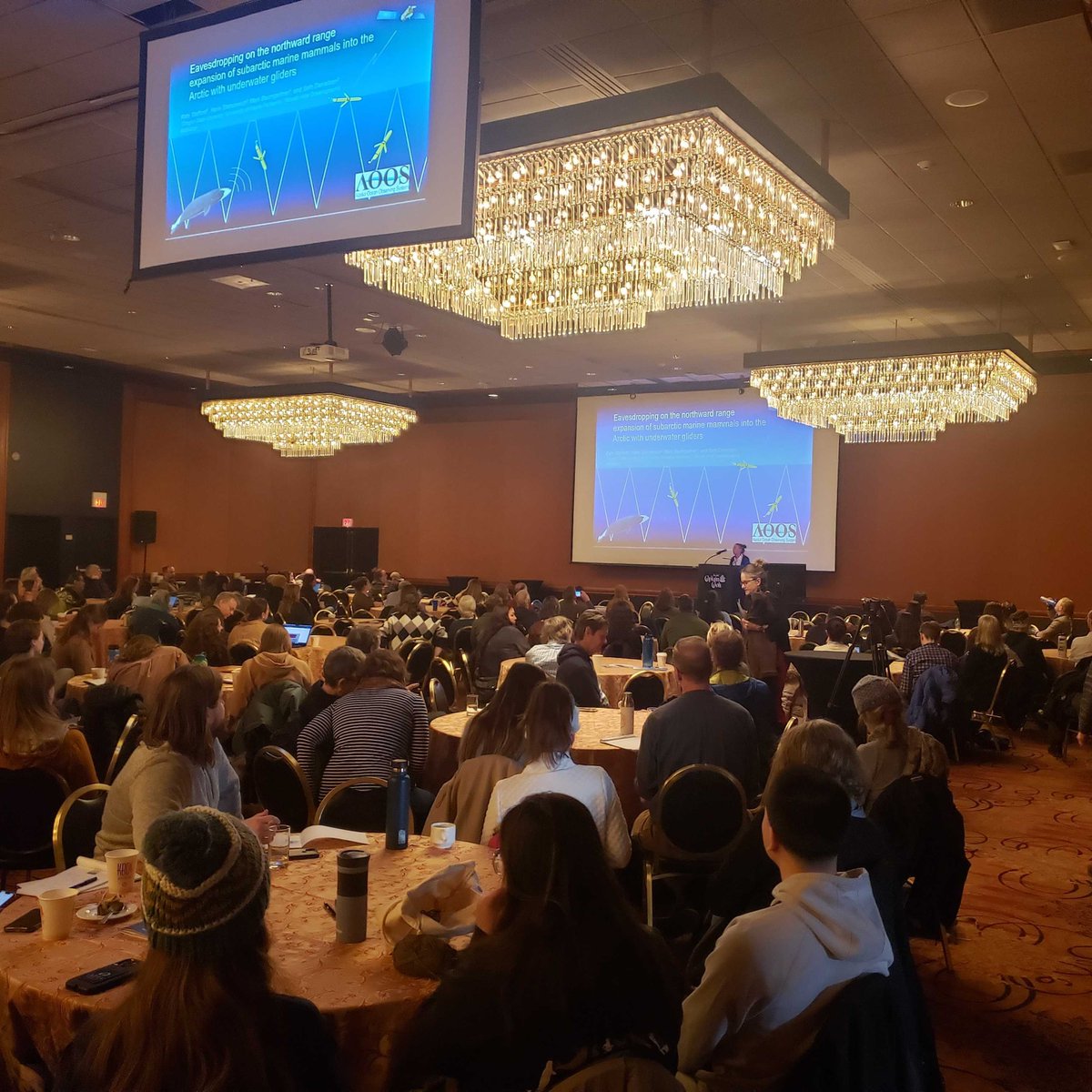
It’s been a busy week of conferences for GINA’s amazing employees! Owen and Carl can be seen chatting with curious attendees at the American Meteorological Society, and Hunter snapped some pictures at the Alaska Marine Science Symposium!

It’s been a busy week of conferences for GINA’s amazing employees! Owen and Carl can be seen chatting with curious attendees at the American Meteorological Society, and Hunter snapped some pictures at the Alaska Marine Science Symposium! #AMSS2024 #AMS2024
account_circle
NWS Fairbanks(@NWSFairbanks) 's Twitter Profile Photo

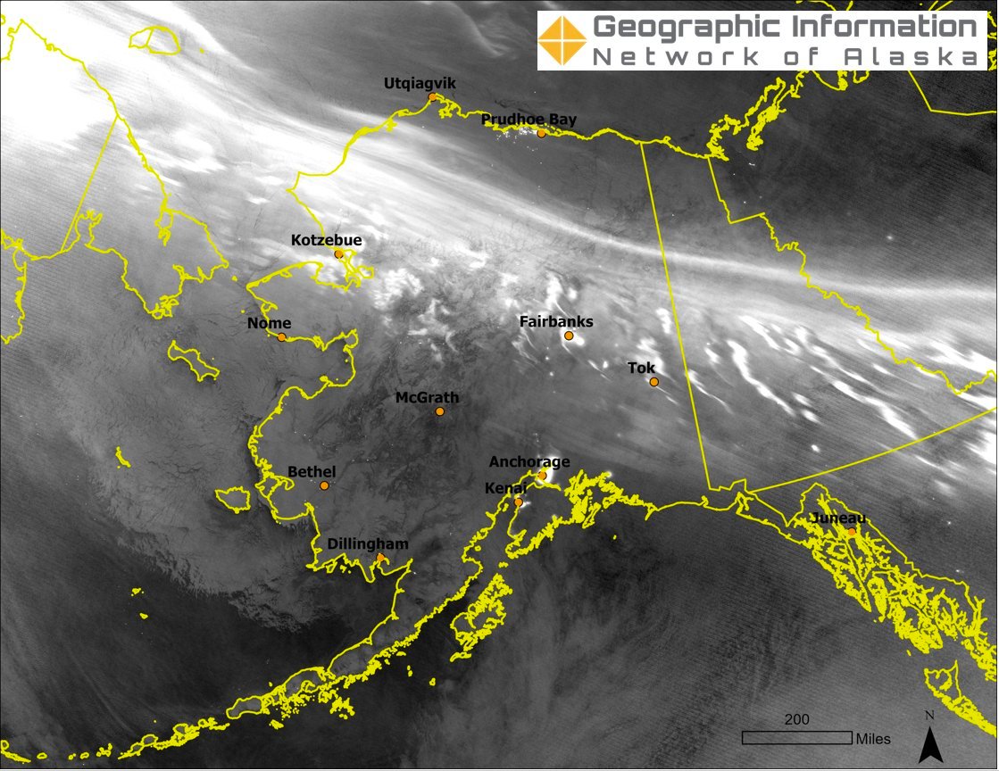
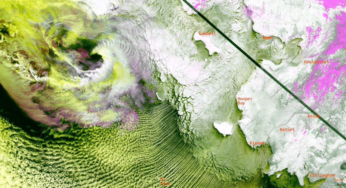
😍Check out this stunning example of a forming along the ice edge, behind the arctic front. These lows are classified based on how they form. But they tend to be small (mesoscale), but can be very strong. GINA

😍Check out this stunning example of a #polar #low forming along the ice edge, behind the arctic front. These lows are classified based on how they form. But they tend to be small (mesoscale), but can be very strong. #akwx @uafgina
account_circle
Joint Polar Satellite System (JPSS)(@JPSSProgram) 's Twitter Profile Photo

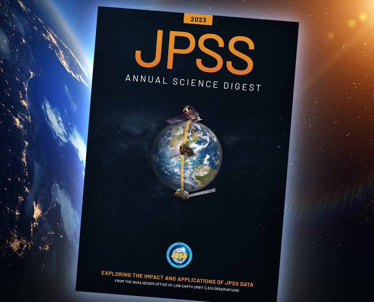
Dive into the 2023 and see how JPSS satellite data is enhancing weather forecasting and environmental monitoring. 📖

Gain valuable insights into practical applications. Download your copy: nesdis.noaa.gov/jpss-digest

Dive into the 2023 #JPSS #ScienceDigest and see how JPSS satellite data is enhancing weather forecasting and environmental monitoring. 📖 Gain valuable insights into practical applications. Download your copy: nesdis.noaa.gov/jpss-digest
account_circle