
Home IPO(@officialhomeipo) 's Twitter Profile Photo

So your home's value just skyrocketed, but you're still low on cash?

You (probably) qualify to get $30k-$400k WITHOUT a loan.

Companies like Unlock will buy 'shares' of your house in exchange for cash.

See how much/little you qualify for: homeipo.net/unlock

account_circle
NOAA Satellites(@NOAASatellites) 's Twitter Profile Photo

Happy Wednesday!

Yesterday, the 🛰️ had a striking view of Mogote Corralitos in South America. The mountain rests in the Atacama Plateau, an arid region within the Andes that is also home to the Atacama Desert, the driest nonpolar desert in the world.

Happy #WhereInTheWorld Wednesday!

Yesterday, the #NOAA20 🛰️ had a striking view of Mogote Corralitos in South America. The mountain rests in the Atacama Plateau, an arid region within the Andes that is also home to the Atacama Desert, the driest nonpolar desert in the world.
account_circle
Joint Polar Satellite System (JPSS)(@JPSSProgram) 's Twitter Profile Photo

This captivating visual predicts how intense Canadian wildfire smoke will travel from June 7 to 9, and includes data from NOAA/NASA’s & NOAA’s satellites.

Green, yellow and red represent dense smoke, seen swirling across the United States.

account_circle
NOAA Satellites(@NOAASatellites) 's Twitter Profile Photo

It's Wednesday!

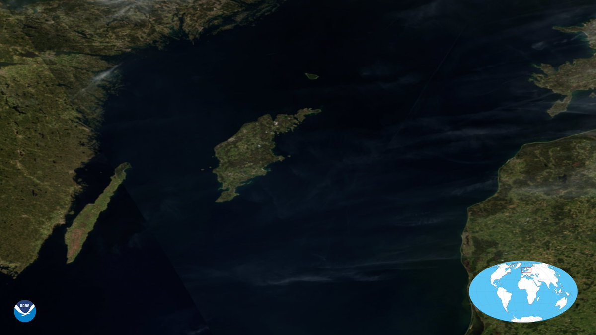
Yesterday, the 🛰️ had a view of Sweden's largest island, which is located in the center of the Baltic Sea. The county formed by the archipelago is the second smallest by area and is the least populated in Sweden.

It's #WhereInTheWorld Wednesday!

Yesterday, the #NOAA20 🛰️ had a view of Sweden's largest island, which is located in the center of the Baltic Sea. The county formed by the archipelago is the second smallest by area and is the least populated in Sweden.
account_circle
LiVEARTH(@livearthjp) 's Twitter Profile Photo

[Earthview Wonders] No.1749: satellite captured the in winter. In this image, ice cover on the lake was 7% which is the lowest ice cover measured on this date of any year since 1973 when satellite-based record keeping began.

[Earthview Wonders] No.1749: #NOAA20 satellite captured the #GreatLakes in winter. In this image, ice cover on the lake was 7% which is the lowest ice cover measured on this date of any year since 1973 when satellite-based record keeping began.
account_circle
NOAA Satellites(@NOAASatellites) 's Twitter Profile Photo

Imagery captured yesterday via NOAA's satellite continues to show wispy grayish wildfire smoke (circled in red) over Canada.

Learn more about the Canadian wildfires:
bit.ly/3O1DZQU

Imagery captured yesterday via @NOAA's #NOAA20 satellite continues to show wispy grayish wildfire smoke (circled in red) over Canada. 

Learn more about the Canadian wildfires: 
bit.ly/3O1DZQU
account_circle
Joint Polar Satellite System (JPSS)(@JPSSProgram) 's Twitter Profile Photo

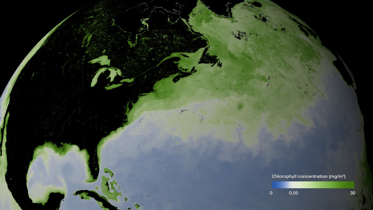
This image shows chlorophyll (shown in green) measured by NOAA/NASA’s & NOAA’s satellite from May 2023.

Algae are made up of chlorophyll, and whales are often present in these areas, since the small critters they consume eat algae. 🐋

This image shows chlorophyll (shown in green) measured by @NOAA/@NASA’s #SuomiNPP & NOAA’s #NOAA20 satellite from May 2023.

Algae are made up of chlorophyll, and whales are often present in these areas, since the small critters they consume eat algae. 🐋 #NationalOceanMonth
account_circle
NOAA Satellites(@NOAASatellites) 's Twitter Profile Photo

On March 24, 2023, the 🛰️ saw some beautiful auroras over the Northern Hemisphere via its Day/Night band (note the lighter haziness in this imagery). It also captured this clear view of oil fields in North Dakota’s Bakken region.

On March 24, 2023, the #NOAA20 🛰️ saw some beautiful auroras over the Northern Hemisphere via its Day/Night band (note the lighter haziness in this imagery). It also captured this clear view of oil fields in North Dakota’s Bakken region.
account_circle
Scott Longmore(@ScottLongmore) 's Twitter Profile Photo

Thanks to all of those who talked to us at NASA Goddard LAADS DAAC at the American Meteorological Society ( ) EIPT conference about our dataset migration to the AWS cloud platform. Very productive conversations from Terra/Aqua MODIS and SNPP/NOAA20/NOAA21 VIIRS dataset users. NASAEarthdata

account_circle
Scott Longmore(@ScottLongmore) 's Twitter Profile Photo

It's happening! NASA Goddard LAADS DAAC satellite datasets (Terra/Aqua MODIS, S-NPP/NOAA20/NOAA21 VIIRS, etc) are migrating to the Amazon Web Services (AWS) cloud enterprise. Phase 1 dataset transition is complete, Phase 2 is starting this year. ams.confex.com/ams/103ANNUAL/…

account_circle
Peter the Great Space Science☀️(@Space_PHD) 's Twitter Profile Photo

This captivating visual predicts how intense Canadian wildfire smoke will travel from June 7 to 9, and includes data from NOAA/NASA’s Suomi NPP & NOAA’s satellites.

account_circle
suhail khan ❄️🏔️🌡️🌨️🌋🧭🌪️📡🌊(@suhailk49329508) 's Twitter Profile Photo

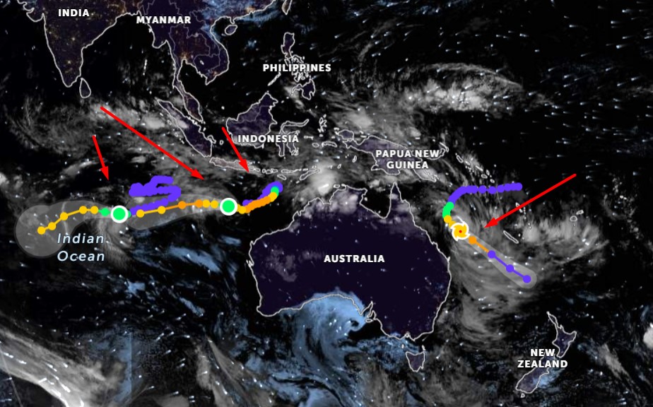
OVER AUSTRALIA DATE - 10/02/2023
Two tropical cyclones have formed on either side of Australia. Off the coast of Queensland is , and off the coast of Western Australia is Freddy.+ .

#sentinal3OLI #NOAA20  OVER AUSTRALIA DATE - 10/02/2023
Two tropical cyclones have formed on either side of Australia. Off the coast of Queensland is #Gabrielle, and off the coast of Western Australia is Freddy.+#Dingani .
account_circle
JM. 📡(@g5juergenm) 's Twitter Profile Photo

Recordings are ziq s8 and u8 (HDSDR). Recordings from NOAA20 and SUOMI are decodable without problems. I get Aqua decoding in Satdump when I change the pll_bw in the EOS.json file from 0.006 to 0.003. But that is only a work around. Any ideas?

account_circle
Joint Polar Satellite System (JPSS)(@JPSSProgram) 's Twitter Profile Photo

This , view a full disk image of “Mother Earth,” captured by the satellite on May 11, 2023. 🌎

JPSS satellites watch over Earth and keep the public aware of its weather, as well as environmental hazards like wildfires, droughts, and harmful coastal waters.

This #MothersDay, view a full disk image of “Mother Earth,” captured by the #NOAA20 satellite on May 11, 2023. 🌎

JPSS satellites watch over Earth and keep the public aware of its weather, as well as environmental hazards like wildfires, droughts, and harmful coastal waters.
account_circle
Joint Polar Satellite System (JPSS)(@JPSSProgram) 's Twitter Profile Photo

Smoke from fires in Canada has blanketed parts of northeastern North America in smog, affecting air quality.

This view, captured by NOAA’s satellite on June 3, shows multiple smoke plumes from the fires in Quebec, Canada, which also caused a haze over Ontario.

Smoke from fires in Canada has blanketed parts of northeastern North America in smog, affecting air quality.

This view, captured by @NOAA’s #NOAA20 satellite on June 3, shows multiple smoke plumes from the fires in Quebec, Canada, which also caused a haze over Ontario.
account_circle